Castrum Altinum: A Late Roman Fort at Alzey, Germany
Site at a Glance
- Popularity
- Medium
- Country
- Germany
- Primary era
- Classical
- Eras represented
- Classical
- Civilizations
- Roman
- Site type
- Military
- Remains
- Fort
On this page19 sections
History
Castrum Altinum was a late Roman fort at Alzey, Germany, built by the Romans around 367–370 as part of the final strengthening of the Rhine frontier. It belonged to the Danube–Iller–Rhine frontier system, the Roman defenses along those rivers, and may have accommodated mobile troops as well as helped guard a river crossing and a junction of regional roads.
Settlement and foundation
The fort occupied part of Altiaia, a civilian settlement whose history began before its construction. A Celtic settlement in the area around 400 BC is possible. After Roman occupation around 50 BC, a civilian settlement, or vicus, developed there around the middle of the first century BC. Its inhabitants may have included people from the Celtic peoples known as the Treveri and Mediomatrici.
An altar inscription from AD 223 identifies the inhabitants as the people of Altiaia. Late Roman records use forms including Alteium and Altinum, apparently derived from the settlement’s name, whose meaning is unknown. The Alamanni, a confederation of Germanic peoples, burned Altiaia in AD 352–353 during an attack attributed to their leader Chnodomar. The fort was subsequently built over the settlement’s ruins. Coins associated with its construction place the work no earlier than 367, and it was probably completed between 367 and 370.
Frontier service and military upheaval
Before Roman provincial reforms, the civilian settlement had been administered from Mogontiacum in Germania Superior. Under the reorganization associated with Emperor Diocletian, the fort fell within Germania Prima. It probably guarded a crossing of the Selz and roads connecting Mainz, Metz, Bingen, Kreuznach, Alzey and Worms. The surrounding region offered few facilities for housing large troop concentrations, so the fort may have served chiefly as temporary accommodation for mobile field-army units. Tents could also be pitched in its courtyard.
The western Roman emperor Valentinian I was at Alteium in 370 and 373, when laws or imperial decisions were issued there. Despite its substantial defenses, the fort may have held Roman troops for only a few years. Its garrison may have left as early as 383, when the western emperor Gratian gathered troops near Paris to oppose Magnus Maximus, a usurper challenging his rule. The garrison may later have joined Maximus’s forces in 388, when he fought the eastern emperor Theodosius I.
After 400, the senior Roman commander Stilicho withdrew frontier and field troops from many forts along the Rhine. The western emperor Honorius had shifted his residence from Trier to Arles, while Italy faced increasing threats. In the winter of 406–407, Germanic groups, including the Vandals, crossed the poorly guarded frontier between Mainz and Worms and devastated the Rhine provinces and Gaul. Castrum Altinum was badly damaged in the early fifth century, possibly after it had already been abandoned.
Fifth-century occupation and abandonment
Under an agreement made in 413–414, Burgundians and other Germanic groups settled as Roman allies in frontier forts around Worms. They were expected to help defend the Rhine alongside other allied groups and remaining Roman troops. East Germanic inhabitants were present at Castrum Altinum from about 407; they were probably Burgundian warriors and their families. Mobile Roman troops may also have used the fort from time to time until about 425.
A fire layer dating to after 425 marks the end of this second occupation phase. Around 436–437, Hunnic auxiliary troops acting on the orders of the Roman general Aëtius devastated the Burgundian kingdom under King Gundahar. Survivors were transferred to Sapaudia, a region broadly corresponding to present-day Savoy and the Rhône Valley. The fort ceased to serve as a Roman military base during this period. Its defenses may have been deliberately disabled by Burgundians resisting deportation, possibly with help from groups east of the Rhine.
Alamannic troops serving as Roman allies occupied the fort again around 450, during a period when its use was mainly civilian. In 454, the western emperor Valentinian III killed Aëtius, an event that marked the end of Roman rule in the region. After Valentinian’s own death in 455, Franks and Alamanni took control of the Rhine provinces. The fort was burned again after the Alamanni came under Frankish rule following the Battle of Tolbiac in 496. Later sixth-century occupation left sparse traces; a small hoard of metal objects dates to approximately 480–510.
Frankish rule and later use
After the Frankish king Clovis I died in 511, Alzey belonged to Austrasia, the eastern Frankish kingdom with its capital at Metz. The settlement became part of the East Frankish realm after the Treaty of Verdun in 843 and was first recorded as an East Frankish fief in 897.
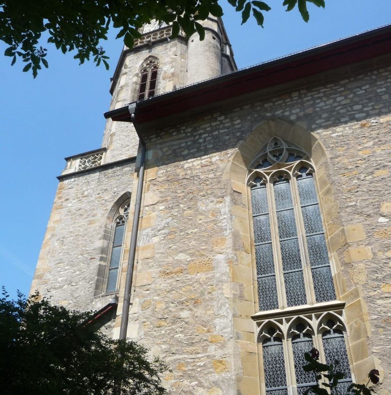
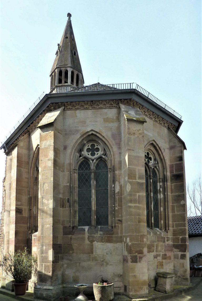
The fort’s command building was converted into a simple church, either in the 440s or perhaps in the sixth century. It preceded St George’s Church, which served as Alzey’s parish church until the fifteenth century and remained standing until about 1800. Views of the town made around 1620 still depicted the fort’s ruins. In later years, residents removed nearly all of the remains for building stone.
Excavation and interpretation
Roman finds first came to wider attention in 1783, when Johann Philipp Walther, a pastor in Dautenheim, excavated old foundations, probably part of the fort’s east wall, and found three inscriptions. In 1902, Karl Schuhmacher of the Imperial Limes Commission and local historian Jakob Curschmann identified part of the fort wall and the foundation of a round tower at the southwest corner. Jean Braun, who owned the site, continued investigations on its western side. In 1904, the monument conservator Soltan excavated much of the east wall, and foundations were found and partly restored in 1906.
Eduard Anthes took over supervision of excavations in 1909. Braun identified the west gate and excavated parts of a barracks and the southeast corner tower. In 1925, Wilhelm Unverzagt found the layer of burning that marks the end of the fort’s second occupation phase. The ceramics recovered from it, mostly dated to the late fourth century, became a reference for dating finds from other sites. Further excavation campaigns were carried out by the University of Mainz’s Institute of Prehistory and Early History.
Remains
The fort occupied a roughly square, slightly skewed site on a south-running spur of Mehlberg, beside a steep slope down to the Selz. Its defenses enclosed about 2.6 hectares, with east and west gates linked by the main road. Buildings stood against much of the perimeter, while the principal courtyard remained open during the first building phase. The fort’s construction combined thick rubble-masonry walls, projecting towers and buildings adapted to the sharply sloping ground.
Site plan and defenses
Position and layout
The fort lay in the southwestern part of the earlier civilian settlement and measured approximately 163.5 by 159 metres. The ground dropped sharply toward the north, so builders levelled the site in layers and included a northern terrace within the plan. Its position gave a view over the surrounding area, especially to the north. Rounded corners and towers projecting from the walls formed the outline of the fort.
Walls and towers
The perimeter wall was up to 3 metres thick at its base and narrowed to about 2.4–2.8 metres above ground. Its foundations were generally 3 metres wide and reached about 1.8 metres below the surface. A smooth stone base projected 0.25–0.30 metres beyond the wall. Builders used mainly rubble masonry, probably including stone from the demolished civilian settlement. The facing on both sides consisted of hand-dressed local limestone, and timber formwork helped bind it to the rubble core. Reused architectural fragments occurred in the north wall. Flat-stone or brick courses levelled the rising masonry; the junction between facing and core was a structural weakness because the materials differed in weight and expansion.
About fourteen towers, probably around 12 metres high, stood at regular intervals, including at the corners. The hollow corner towers were roughly three-quarter-round, rested on rectangular foundations and could be entered from inside the fort. Their walls were 2.4–2.6 metres thick. Hollow intermediate towers stood on square foundations and projected in semicircular form beyond the wall. One tower examined between the west gate and southwest corner had a diameter of 6.3 metres. Four courses of its above-ground masonry survived, about 0.6 metres high; its square foundation was bonded to the wall.
Gates and ditches
The east and west gates opened onto the main road through the fort. Each was built as a single tower on a rectangular foundation that projected both inward and outward. The west gate’s foundation was 1.5 metres thick. Its passage was about 2.5 metres wide, while the rectangular tower measured 4.8 metres across and projected 3.2 metres outward and 3.1 metres inward. Stone paving covered the passage and part of the road leading west, where cartwheel marks were found. The slightly wider east gate served as the main entrance and had a raised footway. It was poorly preserved when excavated in 1904.
In the first building phase, a V-shaped ditch ran about 11 metres in front of the wall. It measured 7.8 metres across and approximately 3.2 metres deep. A second ditch may also have existed. In a later phase, the defensive ditch was partly reshaped into a simpler, flat-bottomed channel up to 8 metres wide.
Buildings within the fort
Barracks and storage buildings
During the first phase, multi-storey barracks and storage buildings stood directly against the west, south and east walls. Their rooms followed a regular arrangement and averaged about 8 by 5 metres, with partitions 0.60–0.73 metres thick. The barracks walls were plastered. Some rooms had flat-stone floors; entrance areas had a hard floor layer over what were probably wooden boards. One room in the western barracks had a basic underfloor heating system that circulated hot air beneath the floor. The building blocks may have contained 234 rooms and housed up to 2,000 people.
Traces along the south wall indicate a roofed walkway around the courtyard, supported by simple wooden posts. Excavations in 1909 uncovered two barrack rooms against that wall, reaching a depth of 11.5 metres. Animal bones in the eastern room suggest possible use as a slaughterhouse. Iron fragments, tools and two stones that may have served as anvils came from the western room. A well shaft in front of the building was covered with sandstone slabs.
Command headquarters
A large detached building in the northeast corner served as the fort’s command headquarters, known by the Latin term principia. It was built and altered in several phases. The long rectangular building had a central corridor 3 metres wide and two hall-like rooms, each measuring 13.35 by 16.50 metres. Its front faced south.
Buildings of later occupation
In the second occupation phase, usable barracks were given new wooden floors, while badly damaged sections, including part of the northwest barracks, were demolished. Irregularly arranged houses occupied the courtyard. They had upper storeys and were mostly built with timber framing on threshold beams set over rubble-stone foundations; their floors were rammed earth. Thatch or wooden shingles may have covered them. The command building was remodelled as a three-aisled hall with wall paintings.
During the later, mainly civilian phase, long rectangular timber-framed buildings followed Roman-style plans and had tiled roofs; smaller buildings also stood within the fort. A tile-roofed workshop occupied the remains of a barracks at the northwest wall, where glass fragments and scrap metal were melted for reuse. The former command building ultimately became a simple church with a single main space. Sandstone slabs and fragments of sarcophagi were also found at the cemetery of the former St George’s Church.
Water, altars and archaeological finds
Drainage and wells
An extensive drainage system carried water from the courtyard into the defensive ditch. Several wells supplied the fort. One well in the courtyard, about 14 metres deep, had two phases of use. Its first phase included a protective structure around the opening, and gravel laid around it helped keep the ground dry.
Altars and reused stone
A votive altar dedicated to Sulis, a Romano-Celtic goddess, was found beside the north wall in 1871–1872. An altar dedicated to the Nymphs, divine female beings associated with nature, had been reused in the fort wall. Its inscription, dated to AD 223, calls the inhabitants the vicani Altiaienses, meaning the people of Altiaia. Fragments of a gateway found in the foundations of the later church may have come from a sanctuary of Apollo-Grannus, a deity associated with springs. The sanctuary may have stood near a sulphur spring close to the present-day tax office.
Objects and occupation evidence
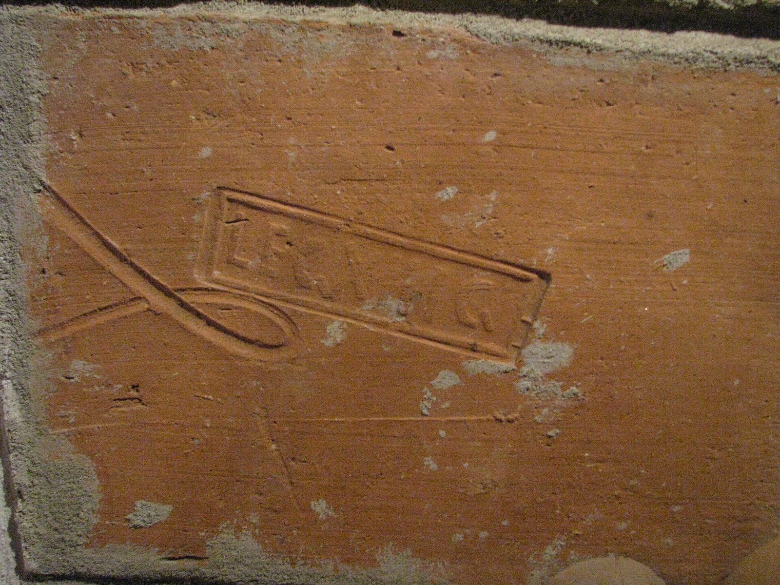
Coins and a brick stamped with the name of Legio XXII Primigenia, a Roman legion, contribute to the fort’s dating. Excavated materials also include Roman glass and ceramics. A comb with a bell-shaped handle is associated with East Germanic contexts, while other combs have parallels in Elbe Germanic regions. Belt-buckle plates with chip-carved decoration belong to the Muthmannsdorf type, an archaeological classification; provincial Roman buckle types were also found. Spiral brooches of the Mildenberg type, which were made no earlier than about 440, relate to the Alamannic occupation.
A small hoard of brooches, earrings and other metal objects dates to approximately 480–510. A limestone slab found in the southeast corner in 1929 measures 5 by 11.5 centimetres and bears three engraved busts and two Christian monograms. It has traditionally been interpreted as a fourth-century stamp for bread used in the Eucharist, the Christian rite commemorating the Last Supper, but it may be a modern forgery.
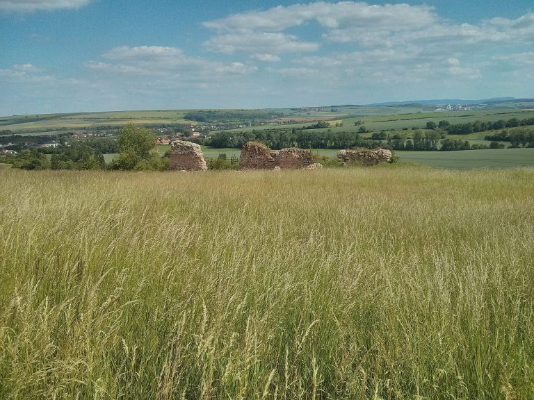
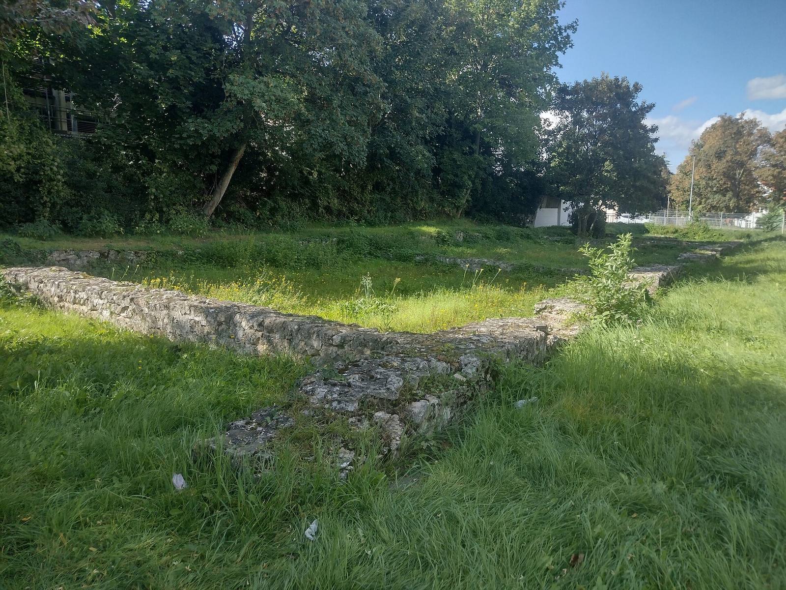
The foundations of rooms along the west wall remain visible above ground. Excavations had exposed about 62 metres of perimeter wall by 1909. In the excavated areas, the wall lay 20–30 centimetres below the surface, with above-ground masonry surviving in places to a height of 50–60 centimetres.