Vicus Wareswald: A Roman Roadside Settlement in Saarland, Germany
Site at a Glance
- Popularity
- Medium
- Country
- Germany
- Primary era
- Classical
- Eras represented
- Classical
- Civilizations
- Roman
- Site type
- City
On this page18 sections
History
Vicus Wareswald was a small Roman settlement in the Wareswald forest, within the present-day areas of Oberthal, Marpingen, and Tholey in Saarland, Germany. It developed around the middle of the first century AD at the meeting of two important roads, and its growth was closely tied to the movement of travelers through the region.
Roadside settlement and Roman prosperity
One road connected Strasbourg, Schwarzenacker, and Trier. The other ran from Metz through Dillingen-Pachten and Wareswald toward Mainz. The settlement lay in the Roman province of Gallia Belgica, later Belgica I, within the territory of the Treveri and near the boundary with the Mediomatrici. Both were peoples of northeastern Gaul under Roman rule. The flow of travelers probably created demand for goods and services, drawing merchants and craftspeople to the junction.
Activity before the Roman settlement is possible but uncertain. Finds from the late La Tène period, an era of later Iron Age Celtic culture, include Celtic coins, and an earlier trade route has been proposed. The area’s earliest Roman object is a coin dated to 83/82 BC, but isolated early coins do not establish that a settlement existed at the time. A larger group of finds belongs to the first half of the first century AD, supporting a foundation around mid-century.
The settlement’s core grew rapidly from the late first century. Wareswald prospered during the second century and much of the third, when the quality of its buildings reflected its economic strength. Economic disruption affecting parts of the Roman Empire during the third century also reached the settlement.
Late Roman revival and abandonment
Activity revived in the early fourth century. This recovery may have been connected with Trier’s elevation to the status of an imperial residence, which helped renew the surrounding region. Settlement activity continued into the later fourth century, after which Wareswald was abandoned. The reason is uncertain; Trier’s later loss of political and economic importance may have weakened the settlement’s livelihood.
Forest, local traditions, and rediscovery
In the Middle Ages, the former settlement lay beneath forest and was no longer in use. As stone became a more common building material, local inhabitants took blocks from the Roman ruins for reuse. The name Wareswald became associated in local tradition with “Varus Forest,” linked either to Publius Quinctilius Varus, a Roman commander defeated at the Battle of the Teutoburg Forest, or to Rictius Varus, a legendary persecutor of Christians in Trier said to haunt the woods after being cursed. The name is more likely derived from an Old High German word meaning “keep” or “preserve,” perhaps reflecting medieval restrictions on forest use or hunting. Another proposal connects it to the nearby Warsberg family, whose name has been linked to the personal name Warin.
A record from 1755 describes Roman structures still visible in the forest and mentions a bronze box bearing two pagan images and a Latin dedication to Mercurius Iovantucarus, a Treverian protective deity associated with youth. In the 1820s, stone quarrying for a district road exposed a Roman circular temple. Investigations by a local antiquities society began in 1836 and uncovered a cellar beneath the debris of a collapsed building. Finds and remains continued to attract attention in the following decades. Legends, including a story of a golden carriage buried near the surface, heightened interest, while looting repeatedly damaged the ruins.
In the late nineteenth century, local historian Max Müller proposed that Wareswald was the civilian settlement serving a legionary camp on the Schaumberg, an interpretation that was not confirmed. Systematic investigation gained new impetus in 1984, when local historian Jürgen Gerhard discovered the furnace of a Roman underfloor heating system. The TERREX project began work at Wareswald and the nearby Celtic ring wall at Otzenhausen in 2001. Since 2018, its investigations at Wareswald have included collaboration with Kennesaw State University and archaeologist Philip Kiernan.
Remains
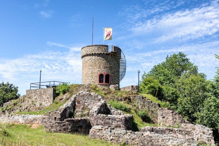
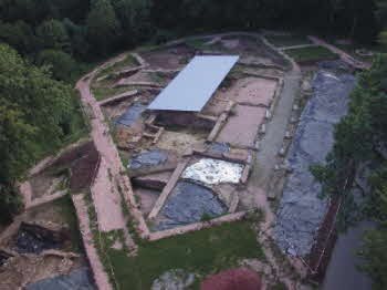
Survey and excavation reveal a settlement extending for about 1,000 metres along a Roman road that crossed a ridge at the foot of the Schaumberg. It covered an estimated 20 hectares, with buildings reaching as far as 200 metres from either side of the road. Artificial terraces followed both the buildings and the contours of the slope. In the excavated core, buildings stood beside the road, a parallel drainage channel, and a covered walkway, or portico. About 2,500 square metres of the core have been excavated, and three building complexes with different phases have been identified.
Settlement core
Building D
In an early phase, Building D included a cellar measuring about 12.5 by 7.5 metres. A cross-wall later divided it, and the cellar was eventually abandoned and filled with clay. Above it, a representative residential room was built with underfloor heating, wall paintings, and glazed windows. The heating system, called a hypocaust, warmed rooms from beneath the floor.
Two bathrooms to the southwest measured about 3.5 metres square each. Their tubs were made from waterproof terrazzo, a mixture of white lime mortar and brick rubble. A southeastern annex, about 2 metres square, also had underfloor heating and is interpreted as a heated bathing room. In this phase, Building D served as a residence. Fine pottery and agricultural tools came from the fill of cellar D13.
Residential and commercial buildings
Buildings southwest and northeast of Building D probably combined living areas with premises for merchants or craftspeople. Finds include unfinished bronze statuettes and a stone weight for a heavy beam balance. The weight is equivalent to 99 Roman pounds, or about 30 kilograms.
House of Fortuna
Building G, also called the House of Fortuna, was discovered in 2019 southwest of Buildings A–D. It had several cellars, and one building phase included a heated room. A sandstone figure of Fortuna, the Roman goddess associated with fortune and fate, was found there. The approximately 35-centimetre figure has lost its head. A separate female statue head lay about two metres away and is not the missing head of the Fortuna figure.
The ground falls away from the road toward a stream valley on the other side of the building. A garden probably occupied this area; surviving features include terrace walls, an outdoor staircase, and other architectural elements.
Craft production and ring deposit
In late antiquity, a workshop in the settlement area made red-ochre drawing sticks for sale from pigment mined nearby. Extraction of the pigment continued into the twentieth century. A ring deposit discovered in 2018 is interpreted as a craftworker’s stock. It contained 24 bronze rings threaded onto a delicate bronze bracelet. Seven had glass inserts imitating gemstones and could be used as seal rings; six had flat, circular glass inserts. Three openwork rings had spaces for glass inserts that were never fitted, while six others retained the channels through which molten metal had entered their moulds, showing that they were unfinished.
Sanctuaries
Earlier sanctuary
Beside the Mars temple, excavated wall remains outline an earlier sanctuary. Its walls survived as a single course of stone, and its upper structure was probably timber, with woven branches coated in clay. The building was later demolished and the ground levelled. The Mars temple was built slightly to its east, on the same alignment, with its corners set diagonally toward the north.
Mars temple
The Mars temple, about 200 metres southwest of the excavated settlement core, was probably built around AD 100. Its construction partly disturbed a grave of a Celtic warrior dating to the middle La Tène period, around 250–150 BC. The temple had a central, tower-like chamber surrounded by a covered passage and an outer wall. The outer wall was plastered red at least around its base. Two pilasters, shallow projections resembling columns, extended from the southwest and southeast sides of the central chamber and may have supported its tall structure.
An additional room was added at the temple’s northwest corner during renovation in the early fourth century. Sherds from jugs, pots, and a large storage jar found there may indicate that food for religious use was kept in the annex. Four statuettes of Mars and 85 iron spearheads were found at the sanctuary, and many of the excavated objects were probably offerings to the deity. A visualization erected in 2021 conveys important features and the approximate dimensions of the temple.
Circular temple
The circular temple exposed during road construction in the 1820s had an entrance stair of stone. Eight column stumps remained when it was found. The interior walls may have been dark red, and painted fragments included images of hares. Finds included three stone statues, about 50 to 60 bronze statuettes of deities, and roughly 100 bronze spearheads and arrowheads. The hares and projectile points have prompted an uncertain association with Diana, the Roman goddess of hunting.
Roadside burial monuments
Pillar tomb
Hewn sandstone blocks found during construction of a parking area within the protected archaeological zone led to the identification of a pillar tomb beside an ancient road. About 700 relief fragments and a pine-cone finial, approximately 40 centimetres high, came from the monument. The reliefs include nude mythological figures, clothed figures thought to represent the family who commissioned the tomb, and scenes involving the sea and vineyards.
The tomb’s base measured 4.2 by 3.8 metres, and recovered architectural elements indicate a total height of about 10 to 12 metres. Only two fragments of its inscription survive, bearing three relatively large letters. An abstract representation in steel and concrete conveys the monument’s dimensions.
Other funerary remains
At least three other foundations and rubble deposits containing carved sandstone funerary elements have been found along an ancient road. Investigations also examined an ancient circular shaft to a depth of five metres and identified an unusual Roman drainage system. Two additional stone grave inscriptions have long been associated with the Wareswald area. Roman gravestones reused in nearby buildings may also have come from the settlement’s burial ground or grounds.
Inscriptions and other finds
Latin inscriptions from the settlement include dedications to Mercury and Visucius; dedications to Jupiter Optimus Maximus, Mars Cnabetius, and the protective spirit of a place; and another dedication to Jupiter Optimus Maximus alone. One inscription names no deity. Grave inscriptions commemorate Ingenuus and Gabrilla, and Utilius and Secundina. A dedication to Jupiter Optimus Maximus, Mars Cnabetius, and the protective spirit of a place, found before 1826, is known through a modern copy. A gold woman’s ring found in the area bears a Greek-language inscription.