Oppidum des Châteliers: A Gallic Fortified Settlement at Amboise
Site at a Glance
- Popularity
- Medium
- Country
- France
- Primary era
- Iron Age
- Eras represented
- Stone Age, Bronze Age, Iron Age, Classical, Medieval
- Civilizations
- Celtic, Roman
- Site type
- City
On this page21 sections
History
Early occupation and Iron Age growth
The Oppidum des Châteliers, an oppidum or fortified settlement, occupies a limestone spur at Amboise, France. Human activity on the plateau began in the Paleolithic, while permanent settlement dates to the Neolithic. The area remained occupied, though the nature and intensity of activity changed, until the fourth century AD.
A local tradition written down by Étienne Cartier in 1842 attributed the foundation of a settlement on the heights of Amboise around 300 BC to druids from the Chartres region. Another story placed Julius Caesar on the plateau after his siege of Avaricum in 52 BC, but archaeology does not confirm that he camped there.
From about 100 BC, during La Tène, the later Iron Age, the settlement expanded eastward to cover more than 50 hectares. It may have been the principal town of the Turones, a Gallic people whose territory included the area around modern Tours, and may have been known as Ambacia. The settlement became a major commercial and religious centre and probably had a political role as well. At least three temples were built there between the Iron Age and antiquity.
Trade first linked the settlement with nearby regions, including Morvan and the Massif Central. From about 50 BC, its connections extended to Franche-Comté, the Atlantic coast, Tuscany, Campania, and Tarraconensis in the Iberian Peninsula. Imported goods included Sicilian alum used in tanning, Egyptian natron used in glassmaking, tableware, and wine from Italy or Spain. Local production remained important: pottery made at the settlement adopted forms and decoration associated with luxury wares from Campania.
Roman rule and gradual decline
During the reign of Augustus, Rome’s first emperor, the settlement lost political importance as Caesarodunum, the Roman predecessor of Tours, developed about 25 kilometres to the west as the Turones’ administrative centre. Authority and some inhabitants may have shifted there under Roman rule or local elites. The Châteliers settlement took on a more secondary, economically focused role, but was not abandoned at once.
Activity revived by the late first century AD, especially in craft production. Workshops may have supplied the growing settlement at Caesarodunum, while residential and religious activity also continued. Occupation weakened by the late second century, and the plateau was gradually deserted from the early third century through the end of the Roman Empire.
Late antiquity and medieval use
Between 372 and 397, Martin, then bishop of Tours and a Christian missionary, is said to have destroyed a pagan temple at the site. His biographer, the late fourth-century Christian writer Sulpicius Severus, also described a fortified structure on the plateau. The temple he referred to cannot be securely identified with any excavated building. The settlement also appears in the writings of the sixth-century bishop and historian Gregory of Tours and the twelfth-century chronicler Jean of Marmoutier.
A small fortified place may have occupied the summit of the spur in the Late Roman period. A keep was built there around the year 1000, followed by a medieval castle. By the twelfth century, much of the plateau had been turned over to farming, and cultivation partly levelled the eastern rampart and ditch. Grape growing is recorded there from the sixteenth century.
The mound near the plateau’s centre acquired the name Caesar’s mound in the nineteenth century. Seventeenth-century maps instead called it a rabbit mound, referring to its burrows. Proposed explanations of its original purpose have included a feudal mound, a rabbit warren, and a base for a telegraph pole, but these do not provide a credible account of its origin. The mound served as a military observation post in the eighteenth century and was used again for surveillance during the Second World War.
Rediscovery and protection
Archaeological remains came to light by chance when vineyards were removed during the nineteenth-century phylloxera crisis, an outbreak of a vine-destroying insect pest. Investigations followed in the early twentieth century, during construction work in 1954, and in the 1960s. Although a proposed holiday village was reduced in size in 1969 to protect archaeological remains, urban development still destroyed many structures, possibly several hundred.
Rescue excavations directed by André Peyrard took place annually from 1977 to 1986, with further investigations from 1991 to 1997. Since the 2000s, building plots have been systematically surveyed and excavated where needed, resulting in about 70 archaeological operations. Since the early 2010s, Jean-Marie Laruaz has overseen investigations, including work near Caesar’s mound and in the southern residential area. Those two areas of work became geographically connected in 2018.
The site was listed as a historic monument in 1985, followed by the eastern rampart and ditch in 1986 and the remains of the first excavated temple in 1987. Construction in the temple area was halted in 1994, and the Ministry of Culture acquired the land as an archaeological reserve. The plateau also received protection through Amboise’s local urban plan. In the second half of the twentieth century, part of the southeastern side of Caesar’s mound was cut away to enlarge a vineyard plot.
Remains
Setting and layout
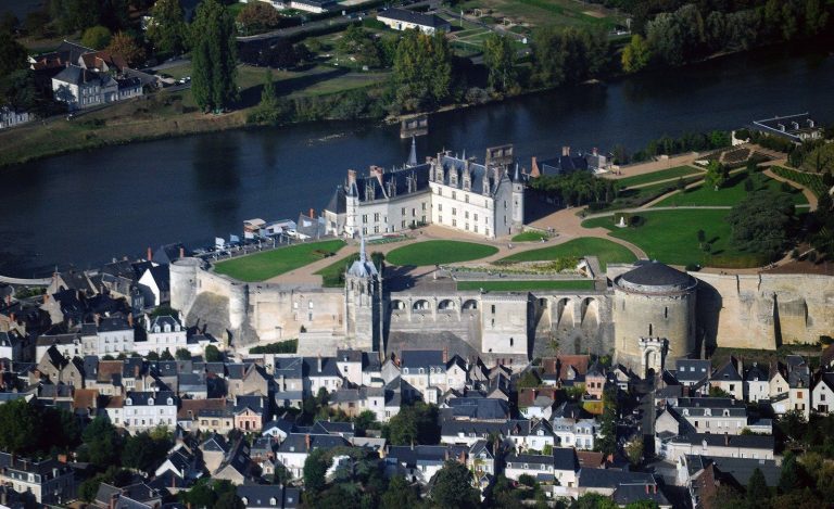
The settlement occupies a limestone spur about 50 metres above the meeting of the Loire and Amasse rivers. The plateau rises from roughly 95 metres above sea level in the west to more than 105 metres in the east; Caesar’s mound marks its highest point, at 112 metres. At its greatest extent the oppidum covered about 50 hectares, with a recorded area of 52 hectares. The medieval castle of Amboise stands at the tip of the spur.
Wind-blown silt covers much of the plateau’s centre, while flint-rich clay is exposed near its edges. Erosion on the steep valley sides reveals local limestone, including the soft stone known as Touraine tuffeau; recent river deposits cover the valley floors. A soil layer about 30 to 80 centimetres thick covers the plateau and may have been added in the medieval period to support cultivation or soften changes in level near the edges. Agricultural use kept later deposits relatively limited, leaving many archaeological remains close to the surface.
Enclosures and earthworks
Early enclosure
The earliest enclosure surrounded about eight hectares at the spur’s tip, where the castle now stands. Its earthen rampart was about 230 metres long, with a ditch to the east. A Neolithic or Bronze Age date has been proposed, but the enclosure’s chronology remains uncertain. At its southern end, an investigated settlement of the Chasséen Neolithic culture yielded decorated pottery fragments, stone tools, and stone projectile points.
Eastern rampart and ditch
A clay bank beneath the eastern rampart is about ten metres wide and contains charcoal, as well as possible traces of a wooden framework. It may date to around 400 BC, although its original purpose is unresolved. During the later Iron Age, successive additions raised the rampart substantially. In its later form, it reached about ten metres high and 25 to 30 metres wide.
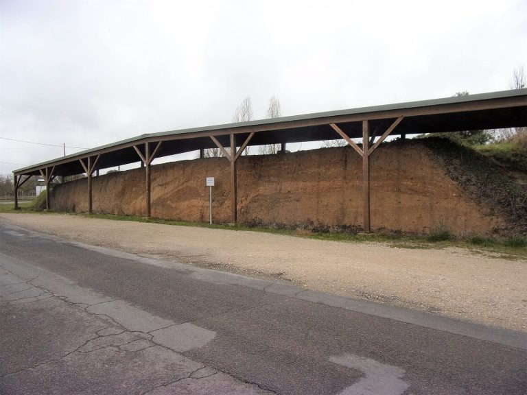
The rampart runs roughly north to south for about 800 metres, some 900 metres from the spur’s tip, and nearly divides the plateau. It defended the side of the settlement not naturally protected by the landscape. A flat-bottomed ditch about 40 metres wide follows its eastern side; to the north, the ditch continues the natural dry valley of Malvau. A road cut through the rampart in 1978 exposed its internal structure. Arable soil now covers the earthwork, which remains visible on the plateau.
Central mound
Caesar’s mound lies near the centre of the plateau, well east of the earliest enclosure. Its earth differs from the surrounding natural soil. The mound is about six metres high and 65 to 70 metres across, and may be the burial mound of a high-status person. A date in either the Bronze Age or the Hallstatt period, an earlier Iron Age cultural period, has been suggested, but both its function and chronology remain uncertain.
Religious and public centre
Main temple
The central high ground, covering at least three hectares, appears to have been used for religious and public activity. Excavation in 1980 revealed a monumental temple of the fanum type, a Gallo-Roman temple with an inner chamber surrounded by a gallery. This temple faced east. Its square inner chamber stood within the gallery, at the centre of an enclosure about 45 metres in diameter.
The enclosure’s northern wall stood on a terrace and included arches that redirected the weight of the surrounding earth. Whole vases placed there may have had a ritual purpose. The temple was probably rebuilt, perhaps as late as the second century AD, from an earlier structure dating to the last third of the first century BC. Its decoration included painted geometric designs and a fragment of mosaic.
Other buildings and ritual deposits
North of the main temple enclosure, across a possible road, a rectangular structure may have served as a ritual basin. Two smaller temples of the same general type were found northeast of the main temple in 1995. A large public building, distinct from the temples, occupied part of the same zone, within an area of at least three hectares.
Pits across the settlement, particularly around the temples, contained coins, small objects, food, wine, and fragments of amphorae, some of which may have been deliberately broken. These deposits are interpreted as possible ritual offerings. A vase dating to the first decades AD may have held a medicinal preparation described by Pliny the Elder about fifty years later. Perforations and graffiti on the vessel may reflect ritual alterations intended to prevent its reuse as a container.
Routes, workshops, and homes
Streets and connections
Excavated traces suggest an urban plan with ditched routes running both east to west and north to south. Sections of two roads have been investigated, one on each alignment. Aerial surveys have identified two possible east-to-west routes: one may follow a rural path through the centre, while the other may be a street along the southern edge. Roof-tile fragments found along their courses support these interpretations. A passage through the rampart at its southern end is one possible entrance.
The plateau lay near routes that followed the Loire valley. An ancient east-to-west route between Cenabum, now Orléans, and Caesarodunum passed through Amboise on the Loire’s right bank, although its precise course is uncertain. A parallel route may have followed a ridge south of the settlement, while a proposed north-to-south route between Port-de-Piles and Amboise is also uncertain near the town. The Malvau valley may have offered a natural approach to the plateau.
Craft production
Activities such as butchery, pottery making, ironworking, and possibly tanning were concentrated around the plateau’s edges. Precious-metal working and glassmaking took place in central areas near housing. Production remains include loom weights, a bronze-worker’s mould, metal and glass debris, butchered animal bones, and woodworking tools.
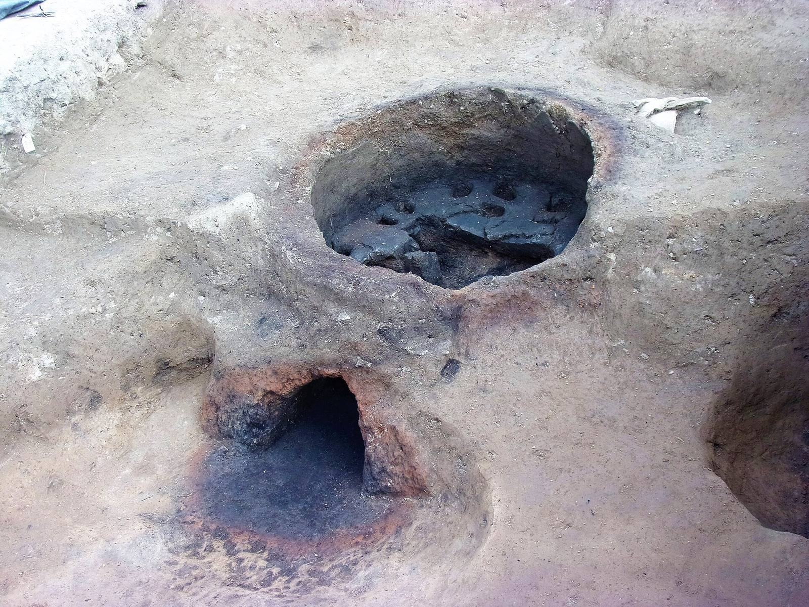
Several pottery kilns have been identified. A kiln found at the foot of Caesar’s mound in 2018 was probably used briefly between 30 BC and AD 20; its products included plates, goblets, and vases. The kiln’s heating chamber measured just over a metre across. Nearly ten other kilns attest to the production of common pottery and dark, smoked Roman-period pottery known as terra nigra, from the latter half of the first century into the second century AD.
Housing and storage
One excavated dwelling measured 37 square metres and stood on supporting posts. Other evidence of homes includes pits, household objects such as fire dogs used to support logs in a fireplace, keys, furniture-door hinges, and impressions left by wooden posts. Stone querns used to grind flour came from workshops at Saint-Christophe-le-Chaudry, about 150 kilometres away, showing that flour could be prepared within family homes.
Numerous shaft-like structures, some with traces of wooden lining, descend as much as six metres. They are thought more likely to have collected rainwater than to have drawn groundwater. Other partly or wholly buried structures are interpreted as small cellars or larger storage chambers. A shift toward masonry in both craft and domestic buildings took place during the Roman period, as stone increasingly replaced wood and wattle-and-daub. Building materials were later removed and may have been reused in the first castle.
Finds and burials
Bronze Age objects and statuettes
Several hundred Bronze Age objects, including weapons, jewellery, tools, and parts of ceremonial chariots, were found in 1861 near the northern end of the earliest rampart. Their burial directly in the ground is consistent with a possible ritual purpose. Ceramic fragments of the same period were recovered in probes in the castle garden in 1995.
Six statuettes made from tuffeau, between 15 and 35 centimetres high, were found at the site in varying condition. Most are attributed to the first century BC. One depicts a figure with an apparently mutilated face beside a horned animal, interpreted as either a goat or a stag and associated with Cernunnos, a horned deity in ancient Celtic religious imagery. Another figure wears a torque, a rigid neck ring, and holds a second torque. The surviving head of a third statuette has features compared with Epona, a Celtic goddess associated with horses. A finely made, mutilated torso, the only surviving part of its statuette, wears bracelets above the elbows.
Burials, coins, and other objects
A probable inhumation in an earthen grave, dated between 176 and 50 BC, lay south of the site within the settlement’s limits, in an area that was not then densely built up. Later urban development respected the burial, which may have marked a person of particular status. Human bone fragments, mostly skulls, have also been found outside burial contexts. They appear to have been cleaned and stripped of flesh soon after death.
Of 1,267 coins collected at the site, 1,258 predate the Middle Ages and 1,071 are Gallic potin coins, cast from a copper-based alloy. Coins with a design known as the diabolic head predominate. A bronze coin of the Turones, stamped TVRONOS/TRICCOS and dated to around 40 BC, was found at the site in the nineteenth century. Other coins came mainly from neighbouring Gallic territories or trading partners. Perforated plates found in 1982 and 1983 may resemble coin-making moulds, but are more likely to relate to the casting of bronze ingots.
Animal bones indicate that inhabitants ate chiefly beef and pork, with sheep, goat, and possibly dog also represented. The proportions varied between inhabited areas, and some slaughter may have had a ritual context. Fish and hunted deer were comparatively uncommon. Numerous wine-amphora fragments show that at least some residents had access to this costly imported product. An openwork handle made of enamelled metal alloy, found near a metalworking area, may have belonged to a strainer. It probably dates to the end of the La Tène period or the reign of Augustus and appears to have been locally made, though its precise domestic use is uncertain.