Nagao-yama Kofun: An Early Burial Mound in Takarazuka, Japan
Site at a Glance
- Popularity
- Medium
- Country
- Japan
- Primary era
- Classical
- Eras represented
- Classical
- Civilizations
- Unclassified
- Site type
- Burial
- Remains
- Burial Mound
On this page15 sections
History
Nagao-yama Kofun is a burial mound in Takarazuka, Hyogo, Japan, built around AD 300 during the first half of the early Kofun period. Its keyhole plan joins a rounded rear section to a projecting rectangular front. The Kofun period takes its name from the large burial mounds built for powerful leaders. Nagao-yama’s occupant is unknown, and its status as the earliest mound in the Inagawa River basin remains a strong possibility rather than a certainty.
The mound’s early date and burial practices have been interpreted as evidence that a local chief adopted customs associated with the Yamato polity, an early Japanese political power centered in the Yamato region, and probably formed relations with it. Later changes in where burial mounds were built in the basin have also been proposed as evidence of shifts in regional authority and in the locations of the polity’s royal burial grounds.
Discovery and changing interpretations
An archaeological society survey led by Hironobu Ishino discovered the mound in the winter of 1957. The initial interpretation identified it as an early Kofun-period keyhole mound about 35 metres long. A survey in December 1969 and January 1970 proposed a different plan, with square front and rear sections, and an estimated length of about 36 metres. The surveyors regarded their evidence as inconclusive and recommended further investigation.
Housing development was planned for the hills north of Yamamoto Station in the 1960s and advanced from the 1980s. In 1992, the ridge containing the tomb was set aside for an urban park so the mound could be preserved in place.
Research and historical interpretation
Research into the ancient history of the Inagawa basin began to focus on Nagao-yama in 2000, as its form and date remained unsettled. Earlier interpretations had placed it at different points within the Kofun period, from its early phase to the end of that phase or the beginning of the middle period. In September 2006, archaeologist Shinya Fukunaga observed stonework and haniwa fragments at the mound, prompting plans for excavation. Haniwa are clay objects placed on and around burial mounds.
Osaka University’s 2007 investigation found many examples of stone facing and haniwa fragments. The forms of the haniwa pointed to the first half of the early Kofun period. From 2008 to 2011, Takarazuka City and Osaka University carried out complementary excavations, examining the mound’s dimensions and arrangement as well as its burial facility. The work established its full length and clarified the two-tier form of both sections. Takarazuka City designated Nagao-yama a historic site on 24 February 2010.
The date around AD 300 rests chiefly on the haniwa forms. Similarities between Nagao-yama’s clay burial structure and that of Nishi-Motomezuka Kofun, among other regional comparisons, caution against dating it later simply because it has a clay enclosure. Its place as the basin’s earliest burial mound is therefore plausible, but not certain.
Remains
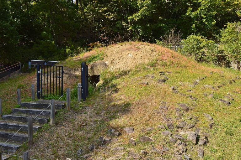
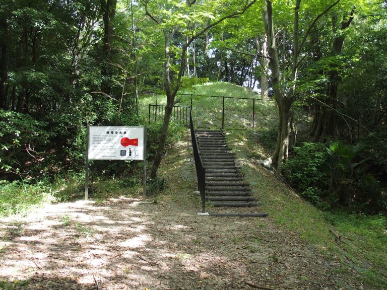
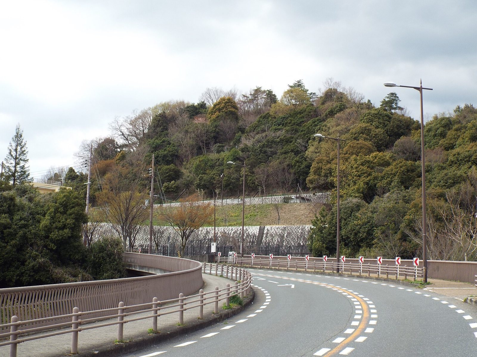
The 41-metre mound occupies a narrow ridge in the Nagao Hills, where a ridge descending south turns east. It was formed mainly by cutting and shaping the natural ground, with additional fill probably used at the northern junction of its two sections. Its front and rear sections create a keyhole-shaped plan, and both were built in two tiers.
Mound form and surface features
Setting and plan
The summit stands 121.37 metres above sea level and 43.5 metres above the plain. The mound lies within the Yamatedai residential area and overlooks the western Settsu Plain. The Saimeiji River, a tributary of the Inagawa, runs east of the ridge, while the Tenjin River, a tributary of the Muko, runs west. The front section is about 14 metres long and points east-southeast. The rear section points east-northeast and measures 26.8 to 27.2 metres across. Its irregular circular form bulges northward, while the front flares about 10 degrees north of the mound’s axis. The narrow ridge is thought to have constrained the plan and contributed to this asymmetry.
Stone facing
Stone facing covered the mound’s steep tiers. On the first tier, flat stones about the size of a person’s head formed a base, with one or two smaller stones above them. The second tier used similar base stones, topped by stones about 20 centimetres across. Backfill supported the facing in many places. The rear section’s stonework appears to have been laid in a counterclockwise direction. The lower tier is about 0.3 metres high, and the upper tier of the rear still reaches 3.4 metres. Erosion has affected parts of the surface, including the southeast front and the southern side of the rear.
Haniwa
Haniwa stood on the first-tier terrace. Near the junction between the two sections, cylindrical examples were generally spaced about one metre apart. Fragments from the front suggest that they also lined its first-tier terrace, while eroded soil leaves open the possibility that some stood higher on the mound. Their bases were set upright and covered with about five centimetres of soil.
The fragments represent ordinary cylindrical haniwa and morning-glory-shaped cylindrical haniwa, with the latter predominating. These have collar-like ridges and four openings, and retain features of an earlier form combining a stand and a jar. Some were thinned on the inside with a spatula. The range of manufacturing methods suggests production before a fully standardized system had developed.
Burial complex
Grave pit and stone floor
A two-level grave pit was cut into the summit with its long axis roughly north to south, set at an angle to the mound’s axis. The upper level has sloping sides, rounded corners and a top measuring 8.9 by 5.0 metres. It was cut 0.2 to 0.4 metres deep. A ledge about 0.3 metres wide separates it from the lower level, which measures 7.6 by 3.4 metres across the top and has nearly vertical walls. The distance from the ledge to the stone floor is 0.9 to 1.2 metres. Rectangular indentations in the lower walls are thought to be tool marks.
River cobbles just over 10 centimetres across formed the floor, with smaller stones packed between them. This layer, also laid beneath the clay burial structure, is estimated to be at least 20 to 30 centimetres thick. Its surface slopes toward the southeast corner, the lowest part of the pit.
Clay burial enclosure
A large enclosure of fine grey-white clay was built around a wooden coffin. Its base measures about 6.8 metres long and 2.6 to 2.7 metres wide, and a well-preserved section stands about one metre high. The space between the enclosure and the pit walls is narrow. A shallow depression measuring about 5.8 by 1.2 metres marks its upper surface, while the ends retain much of their original form.
The construction is thought to have involved placing a clay bed on the stone floor, setting the coffin on it, and covering it with clay, possibly in layers about 10 centimetres thick. The deceased’s head is thought to have been toward the north. The enclosure was covered with an iron plate and reburied without being opened, to protect it from disturbance.
Drainage and archaeological traces
Drainage channel
A drainage channel ran from the southeast corner of the grave pit toward the northern junction of the mound’s sections. That junction occupied a natural valley before construction, and the channel followed ground suited to carrying water. It was V-shaped, 1.3 to 1.4 metres deep and 1.1 to 1.6 metres wide at the top. Stones about 10 centimetres across lined its bottom to a thickness of 0.4 to 0.5 metres. Backfill was added in at least four horizontal stages. The outlet has not been exposed; because the channel narrows toward the junction, it is thought to have ended within the mound, allowing water to seep into the fill.
Summit finds and disturbances
Near the summit, a cluster of rounded stones about the size of a fist extended 3.8 metres north to south and 1.2 metres across. Three or four stones were stacked at its centre, while those at the northern end were more scattered. Fragments of Haji ware, an unglazed earthenware, lay among the central stones. The cluster overlies a subsided part of the burial enclosure and is thought to include stones that fell inward as the wooden coffin decayed.
Most Haji ware fragments are very small, but better-preserved pieces indicate small jars, cooking pots, bowls and stands. Sue ware, a high-fired stoneware, is also among the finds. A possible disturbance pit on the summit was oval, about 1.6 metres long and up to 1.4 metres wide, with its base about 0.6 metres below the surface. It may have been made by grave robbers, but it did not reach the burial structure. A concrete post and frame on the summit extended 0.66 metres below ground and likewise stopped short of the burial structure; their date and purpose are undetermined.
Northern junction
A disturbed area at the northern junction contained scattered stones about 20 centimetres across, some burned, along with burned earth, charcoal and haniwa fragments. The mound had been cut into there by about 0.6 metres. The disturbance lies beneath soil washed down from the mound surface and is thought to have occurred not long after construction, although its cause is undetermined.