Bois des Géantes Dolmens: A Prehistoric Burial Necropolis in France
Site at a Glance
- Popularity
- Low
- Country
- France
- Primary era
- Bronze Age
- Eras represented
- Stone Age, Bronze Age
- Civilizations
- Unclassified
- Site type
- Burial
- Remains
- Necropolis
On this page15 sections
History
The Bois des Géantes dolmens are a prehistoric funerary necropolis in Bourg-Saint-Andéol, France, comprising six identified megalithic burial structures. Used from the Final Neolithic through the Bronze Age, the cemetery served successive prehistoric communities.
Prehistoric use and local tradition
Some dolmens are assigned to Final Neolithic 2a, a subdivision of the late Neolithic, and the Chalcolithic, or Copper Age, which falls between the Neolithic and Bronze Age. Their dates span roughly 3000–2900 to 2200 BCE; other structures are assigned to the Early Bronze Age. Burial use continued through the Early, Middle, and Late Bronze Age, successive phases of that period, without a substantial break in cemetery activity. The site later ceased to be used for burials.
The necropolis has also been called Bois des Joyandes and Bois des Jayandes. Its name has been interpreted as a reference to giants or their dwellings, and local tradition told of giants living in the Ardèche mountains. A possible association with the name Gargantua has been proposed, but remains speculative.
Early surveys and nineteenth-century protection
Local surveyor Bonnefont probably made the earliest record of the dolmens in the late 1830s, describing four structures as caves or druids’ tombs. A. Paradis and Thibon carried out the first excavations in the early 1850s. In September 1867, Jules Ollier de Marichard began surveying about 20 dolmens in Bourg-Saint-Andéol and neighboring Bidon. Earlier looting had left little material to collect.
Léopold Chiron began investigating the group in the 1870s and published reports from 1895. He recorded seven dolmens, including their measurements and orientations, and prepared drawings, plans, and photographs. The necropolis was left out of a French megalith inventory published in 1880, but appeared in a revised regional inventory in 1900. On 31 December that year, seven structures were protected as historic monuments, a category under France’s national heritage system, under the name Dolmens des Joyandes. The listing relied on Chiron’s work; later investigations identified six of the listed structures.
Twentieth-century research
Paul Raymond may have conducted research at the site in the early twentieth century. Around that time, Louis Germain studied mollusk remains recovered by Chiron, and the fallen east upright stone of dolmen 1 was raised again.
Surveys and excavations took place sporadically in the 1950s, 1960s, and 1970s. Construction of a high-voltage line through Laoul Forest around 1970, followed by brush clearing, prompted renewed efforts to locate and describe the six dolmens. Excavations in 1972 and 1979 recovered artifacts and highly fragmented human remains. A 1976–77 study added depictions of dolmens 1, 2, and 4 and inventoried some nineteenth-century finds. Plans were made for five of the six structures.
A Franco-German archaeological program initiated in 2001, under archaeologist Wolfgang Pape, carried out work from 2002 to 2005. Further excavations and surveys took place from 2004 to 2007, with research continuing under the regional archaeological service through 2013. A municipal restoration project was planned and begun in the first half of the 2010s.
Remains
The six dolmens extend for about 750 m within Laoul Forest, between the valleys of Verre and Journées. They stand on Lower Cretaceous limestone of the Urgonian formation, where natural depressions lie beside rocky outcrops and accumulations of stone. Builders enlarged some depressions, using stable ground and nearby building material.
Each dolmen has a burial chamber and a burial mound. Dolmen 1 has a small entry chamber, or antechamber; the other five have an entrance space, or vestibule. The chamber of dolmen 1 exceeds 10 m³, while the other chambers measure between 3 and 6 m³.
Chamber forms
Dolmen 1
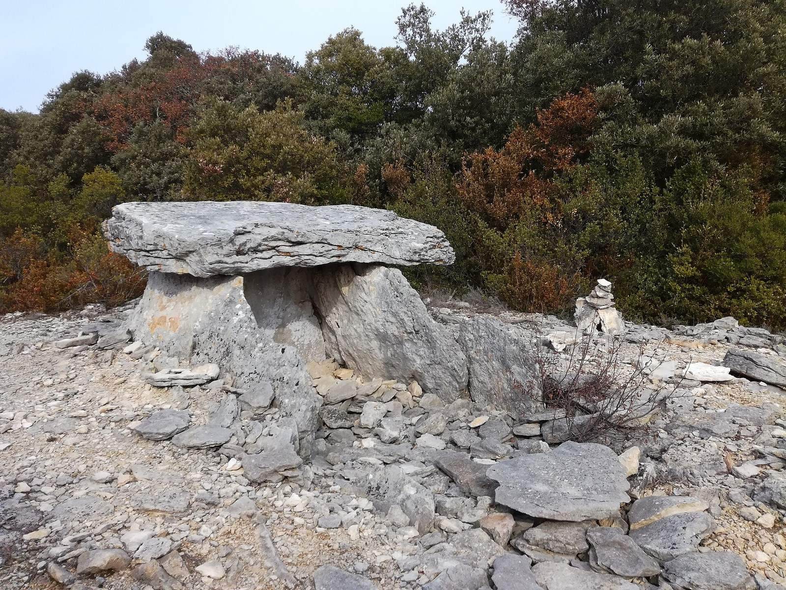
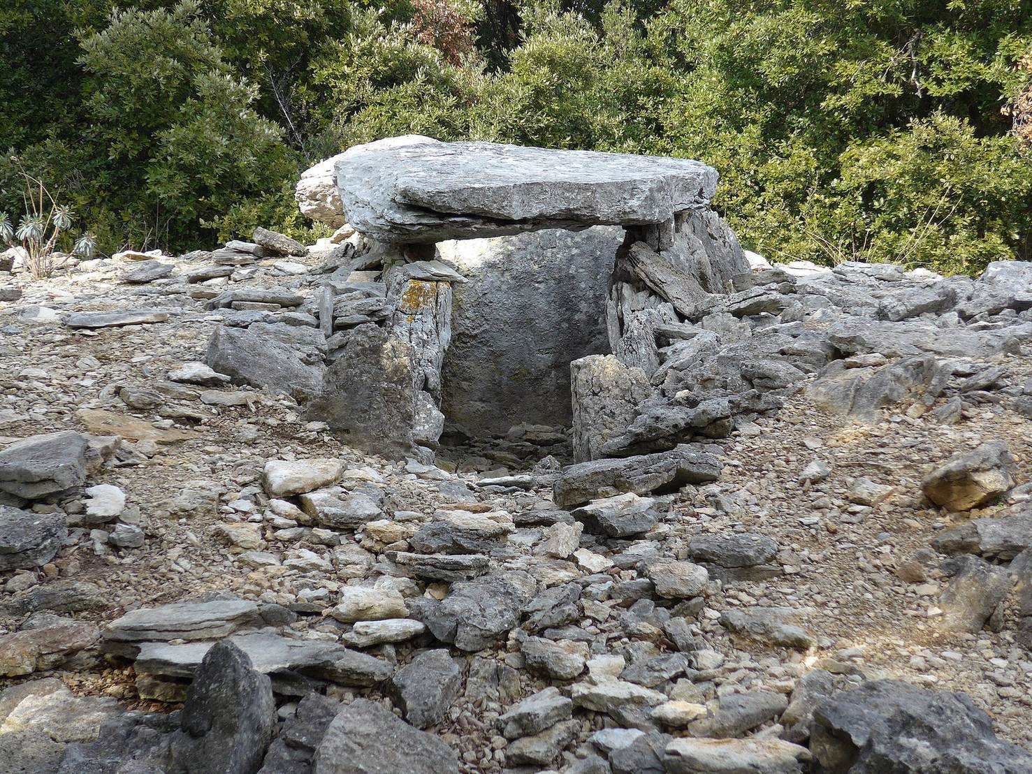
Dolmen 1 belongs to the Languedocien form, one of three regional classifications of dolmen architecture. Its quadrangular chamber has roughly parallel upright slabs, called orthostats, and a passage opening into the chamber through the antechamber. The entrance faces south-southwest. The chamber measures 2.25 m long by 1.65 m wide; its floor is the local bedrock, covered by slabs set on edge. The northwest corner fits into a bedrock recess, though the west orthostat does not rest on it.
The back slab is an irregular trapezoid measuring 1.62 m wide, 1.58 m high, and 60 cm thick, and weighs more than a tonne. Its lower left corner is eroded. A pointed, lance-shaped stone fills the uneven space beside the left orthostat. The blocks are compact limestone, with an estimated average density of 2.5 g/cm³. Chiron described a 40 cm layer of dark, clayey material mixed with stones inside the chamber; this fill may be related to greater erosion higher on the back slab.
Dolmen 4
Dolmen 4 is of the Bas-Rhodanien type. Its capstone, which covers the chamber, and its endstone, which closes one end, are taller and longer than the upright slabs. Stones laid without mortar form the sides. The capstone rests on the upright slabs rather than on the endstone.
Caussenard dolmens
Dolmens 2, 3, 5, and 6 belong to the Caussenard form. Their chambers are generally trapezoidal, bounded by stone blocks and upright slabs, and have an entrance vestibule incorporated into the mound. Dolmen 3 has sloping side walls. An image from the early 1880s shows it in ruins; Ollier de Marichard suggested that shepherds may have used it as shelter.
Mounds and buried soil
Burial mounds
The mounds range in surface dimensions from 9 × 6 m at dolmen 6 to 13 × 10 m at dolmen 1. Some remain largely intact, while others are nearly levelled. On undisturbed mounds, sloping limestone slabs overlap like roof tiles. Excavations also revealed alternating layers of slabs, earth, and small stones. The builders incorporated natural rises in the ground into the stone mounds.
Soil beneath dolmen 1
Excavation beneath the mound above dolmen 1 revealed a relatively well-preserved topsoil layer about 5,000 years old, contemporary with construction of the dolmen. It contained humus mixed with pottery fragments, bones, and flint tools. Its preservation under the mound shows that the soil predated later limestone dissolution and erosion. The ancient environment also offered opportunities for cultivation.
Finds and burial evidence
Objects from earlier investigations
A group of roughly ten objects may be associated with Ollier de Marichard’s investigations, but the connection is uncertain because the name Jayande could refer to dolmens at several nearby sites. The objects include leaf-shaped arrowheads, axes, a double-cone copper bead, and other ornaments. They were placed in the collections of the Natural History Museum–Guimet in Lyon, the Crozatier Museum in Le Puy-en-Velay, and the Moulages Museum in Montpellier. Chiron also recorded a necklace made from mollusk shells.
Finds from the 1972 and 1979 excavations
Sieving recovered a diamond-shaped bronze awl, two limestone buttons pierced with V-shaped holes known as Durfort buttons, four white beads 5–10 mm long, an 8 mm triangular bone pendant, a perforated tooth, a flint blade, and unusual pottery fragments. The awl and one Durfort button date to the Early Bronze Age. Finds came from excavated debris in dolmen 1’s antechamber and from the chamber and vestibule of dolmen 5. Another Durfort button was recovered in 1972 from dolmen 1’s vestibule. The excavations also yielded highly fragmented human remains.