Vijayanagara: Capital of the Vijayanagara Empire
Site at a Glance
- Popularity
- Very High
- Country
- India
- Primary era
- Medieval
- Eras represented
- Medieval, Early Modern
- Civilizations
- Hoysala
- Site type
- City
On this page26 sections
History
Before the imperial capital
Vijayanagara was the capital of the Vijayanagara Empire, founded around 1336 near Hampi in present-day Karnataka, India, by the Sangama brothers Harihara I and Bukka Raya. Hampi was already a settlement and pilgrimage center. By the tenth century, worshippers visited to honor Shiva, and Hoysala rulers supported the pilgrimage site before the fourteenth century. Local traditions connect the area with Kishkindha, the forest kingdom in the Hindu epic Ramayana, and with Pampa, associated with the goddess Parvati, and Shiva.
Foundation and expansion
In the early fourteenth century, armies of the Khalji and Tughlaq dynasties of the Delhi Sultanate invaded and plundered Deccan kingdoms, including the Kakatiyas, Seuna Yadavas, Hoysalas, and Kampili. Harihara and Bukka had served as soldiers in Kampili before founding their own kingdom. Harihara led its establishment, while Bukka later extended its power. Vijayanagara means City of Victory.
The dynasty first ruled from Anegondi, on the north bank of the Tungabhadra River. The capital was subsequently moved across the river to the more defensible south bank, where it developed under the guidance of Vidyaranya, a Hindu religious leader. The new capital grew around the area’s existing sacred center.
Imperial capital
From the fourteenth through the sixteenth centuries, Vijayanagara was a major political and urban center in South India and the Deccan. The empire fought repeatedly against the Bahmani Sultanate and the Deccan sultanates that followed it. It also maintained friendly relations with the Portuguese, who were allowed to take control of Goa and western territories formerly held by the Bahmani Sultanate. Traders arrived from Persia and Portugal, while Hindu migrants came from northern India. Hindu, Jain, and Muslim communities contributed to the empire’s religious diversity and artistic exchange.
Around 1500, the city was described as exceptionally wealthy and among the largest in the world, second only to Beijing. Estimates put the population of the city and its suburbs at 500,000 to 600,000; the Portuguese visitor Domingo Paes counted 100,000 houses. The Persian traveler Abdur Razzak praised the city’s beauty. Nicolo Conti visited in 1420, and Paes, writing of his visit in 1522, likened its appearance to Rome. Cesare Federici visited two years after the 1565 defeat and described houses that still stood, though they were empty.
Religious and royal practices were woven into the capital’s life. The Virupaksha-Pampa temple complex predated the empire, and worship there continued after the city’s destruction. Offerings continued at Kodandarama Temple, while the Vitthala Temple hosted observances honoring the devotional poet Purandara Dasa. On special occasions, the ruler used the royal balance to weigh gifts of gold, jewels, and precious stones for Brahmins, members of the Hindu priestly class, and ascetics. Worship at Hazara Rama Temple was reserved for the royal family and its representatives.
Local traditions associate the Kodandarama Temple site with the story of Rama crowning Sugriva. They also connect Sugriva’s Cave with his refuge and its colored rock markings with Sita’s clothing. The wider area is linked with Pampa Sarovar, a sacred pilgrimage lake, and with a shrine to Hanuman and a cave associated with his parents.
Defeat and later history
The long conflict with the Deccan sultanates culminated in the Battle of Talikota in 1565, fought about 175 kilometers north of Vijayanagara. Aliya Rama Raya, the city’s leader, was captured and killed. The capital was then looted, burned, and destroyed over several months. The empire persisted for a time, but its capital was abandoned and never recovered. Some rural settlements in the wider metropolitan region continued to be occupied.
Colonel Colin Mackenzie’s work in the early nineteenth century brought the ruins to wider attention. In 1986, the Group of Monuments at Hampi became a UNESCO World Heritage Site. It was listed as a World Heritage Site in Danger from 1999 to 2006, then removed after corrective measures. Concerns about heavy traffic and nearby road and bridge construction also prompted steps to limit damage.
Remains
Landscape and urban plan
Terrain and city layout
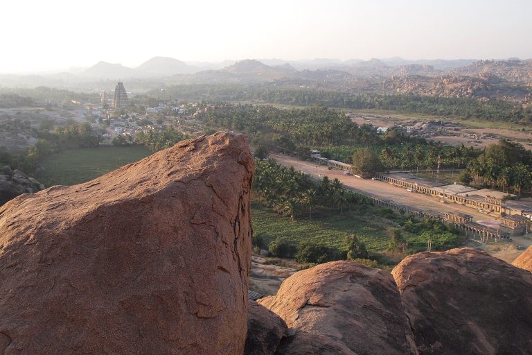
Vijayanagara occupied a broad area of hills and large granite boulders on the Tungabhadra’s south bank. The river and a ravine formed a natural defense to the north; beyond the southern hills and boulders stretched a broad plain. The sacred center extended east from Hampi village toward Matanga Hill and, in places, southeast toward the Vitthala Temple. The royal center began about two kilometers southeast of Hampi and reached toward Kamalapura.
Walls, streets, and water
By the early sixteenth century, the metropolitan area has been estimated at about 650 square kilometers. Nicolo Conti gave the city’s circumference as 60 miles in 1420, while the traceable defensive walls are described as enclosing more than 60 square miles. The walls included fields and gardens irrigated by canals from the river. Descriptions of the urban area also note wide streets, arcaded bazaars, gardens, waterways, and streams carried through cut-stone channels. Agricultural land, irrigation channels, and streams occupied the valley between the sacred and royal centers. Charcoal, heat-cracked basement remains, and burned architectural fragments provide physical evidence of the 1565 destruction.
Sacred center
Virupaksha Temple
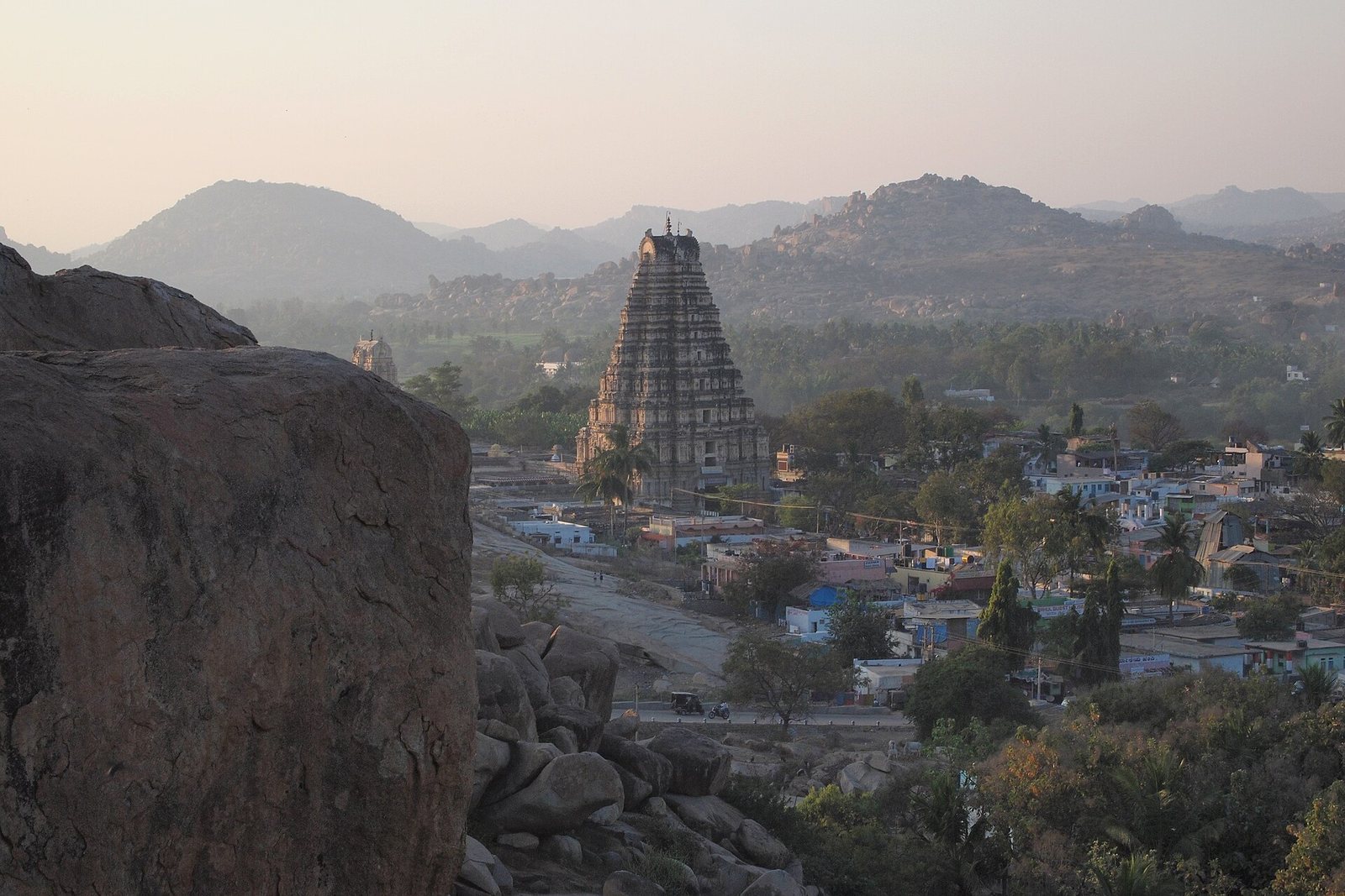
At the western end of Hampi’s main street, Virupaksha Temple is dedicated to Virupaksha, a form of Shiva, and includes shrines to Pampa and Bhuvaneshwari. Its eastern gateway tower rises about 50 meters and has nine tiers, with two lower tiers of stone and seven upper tiers of brick. Three enclosures organize the complex: an open outer area, a roofed pillared cloister with smaller shrines, and an inner enclosure leading to the principal shrine. A small channel from the Tungabhadra supplies the temple kitchen before passing out through the outer enclosure. A large Nandi, the bull associated with Shiva, is carved from a single block of stone in the outer area.
Hemakuta Hill and Krishna Temple
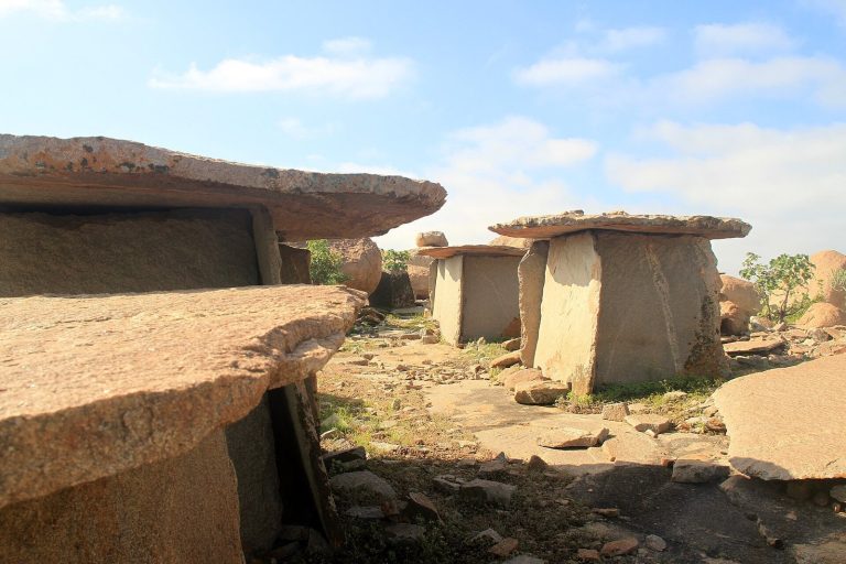
Hemakuta Hill, south of Hampi village, holds small temples dating to the tenth century, along with gateways and water tanks. Some temples remain unfinished, and these early structures were preserved as the city grew. The ruined Krishna Temple stands on or near the hill. It has two enclosures, and part of the outer enclosure has collapsed; restoration work has also been carried out.
Ugra Narasimha
Near Hampi’s main street stands a statue of Ugra Narasimha, Vishnu in his man-lion form. About 6.7 meters high and dated to 1528, it is attributed to the ruler Krishnadevaraya. Narasimha sits on the coils of Adishesha, the serpent associated with Vishnu, beneath a canopy of seven serpent hoods. A separate Lakshmi figure connected with the sculpture is now held at the museum in Kamalapura. The statue has been restored, and a granite brace between its knees stabilizes it.
Sugriva’s Cave
Near the river, Sugriva’s Cave is a natural formation of large boulders resting one above another. Colored markings and pilgrims’ inscriptions can be seen on the rocks.
Kodandarama Temple
Kodandarama Temple stands east of Hampi on the Tungabhadra’s bank, facing the river. Its innermost shrine contains Rama, Sita, and Lakshmana carved from a single stone, and the temple also has an image of Hanuman. A sacred bathing place and long, ancient pillared halls stand beside the temple.
Vitthala Temple complex
Northeast of Hampi and opposite Anegondi, the Vitthala Temple complex is enclosed by a compound wall and gateway towers. It contains halls, pillared buildings, and smaller temples. Granite pillars in its large halls carry extensive sculpture, and seven are noted for producing musical tones. One large hall has an ornamented base and a roof supported by black-stone pillars about 15 feet high. Their branching forms were carved from single blocks, and many are badly damaged, especially around their middle sections. Ruins of the surrounding town of Vitthalapura also survive.
Stone chariot
A stone chariot stands at the eastern side of the Vitthala complex. It is carved as a single stone, and its wheels are said to turn.
Star Well
East of the Vitthala complex, near a ruined temple pavilion and the Vitthala Bazaar, a broad stepped tank is identified as a sacred bathing place. It is also called the Star Well. It may have been covered with canopies when the city was inhabited.
Royal center
Fortifications and palace precinct
A fortification wall beginning about two kilometers southeast of Hampi encloses a small plateau and extends southwest toward Kamalapura. The royal center contains remains of palaces, administrative buildings, and temples associated with the royal family. Palace areas survive chiefly as foundations, alongside stone temples and portions of the surrounding walls. A large black-stone platform overlooks the royal residence. A moat linked to a large agricultural tank could be filled with water for special occasions; broad steps at the tank include geometric designs in green stone.
Hazara Rama Temple
Hazara Rama Temple stands within a rectangular courtyard in the royal center and faces east. Its outer courtyard depicts ordinary and special temple services, while images on the inner walls illustrate the Ramayana and episodes from Krishna’s childhood. Numerous images of Rama give the temple its name, meaning Temple of a Thousand Ramas.
Underground Virupaksha Temple
A separate, excavated temple dedicated to Virupaksha lies underground in the royal center. It is extensive and exposed. Flooding sometimes affects access to its interior, where bats and insects are present.
Lotus Mahal
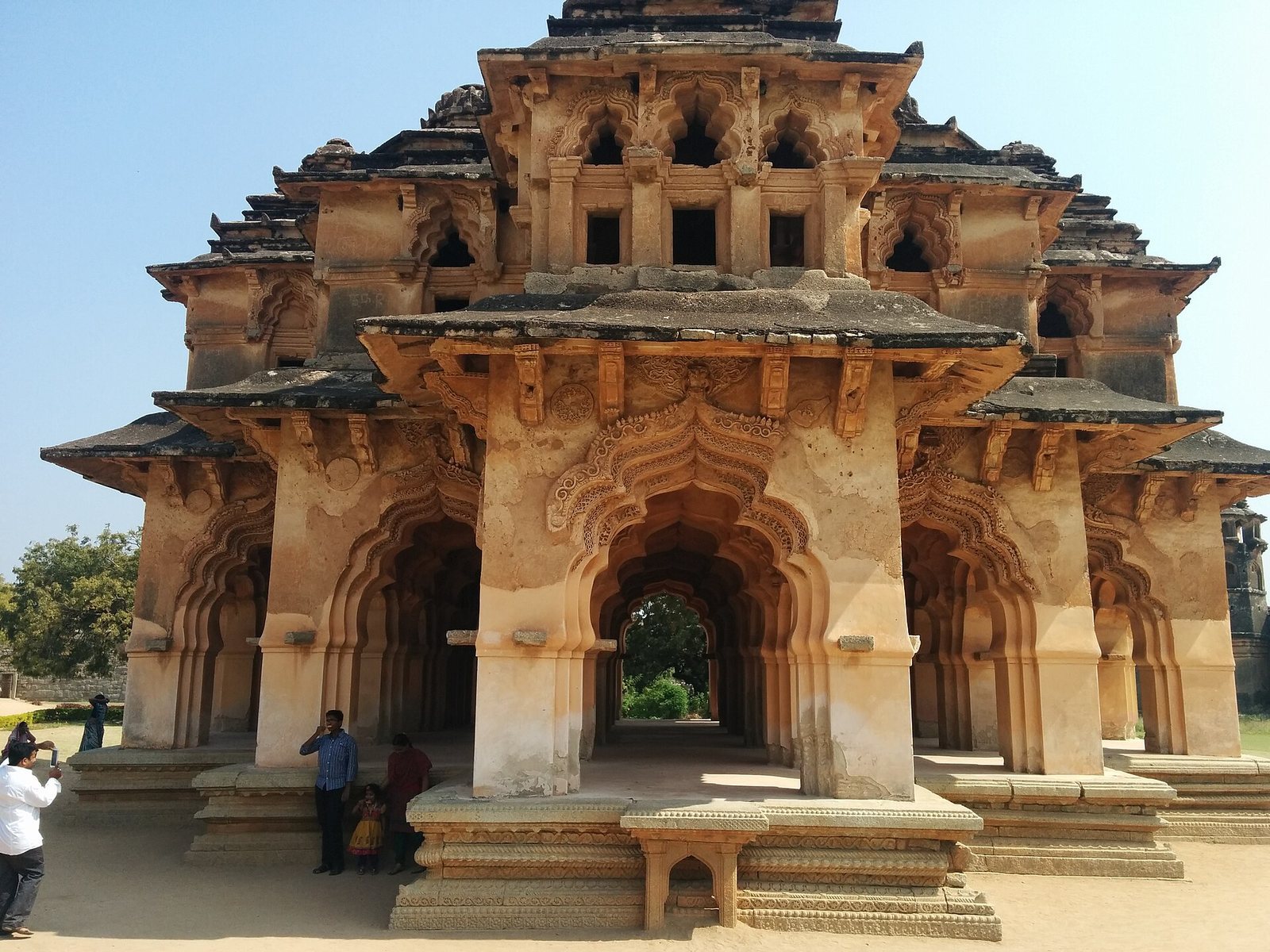
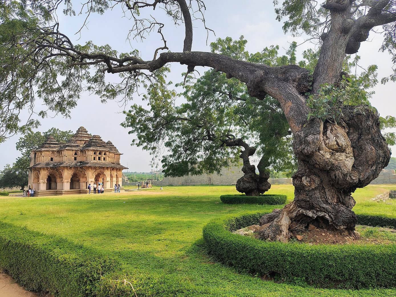
The two-storey Lotus Mahal was built as a residence for the chief queen. Its design combines Indian and Islamic architectural features, including a layered roof, high arches, and balconies on the upper floor. The ground floor is open, and hook-like fittings beside the windows could hold curtains. Water pipes and timber platforms are also noted. The building survived the city’s siege without major damage, although some exterior sculptures show signs of defacement.
Royal bathing tank
A stepped bathing structure in the royal area is associated with the chief queen and was later converted into a tank. Its steps provided access for bathing and, like comparable stepped reservoirs, relief from the heat.
Elephant stables
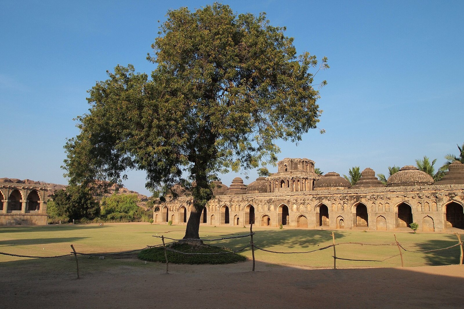
Near the royal residence, the elephant stables served the royal elephants and their daily needs. The structure has domed, arched openings, and military quarters for soldiers and elephant handlers stood beside it. An open area opposite was used for processions of elephants and soldiers.
Royal balance
Southwest of the Vitthala Temple, the royal balance consists of two granite pillars joined by a horizontal granite beam.