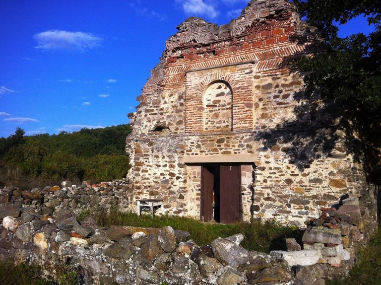
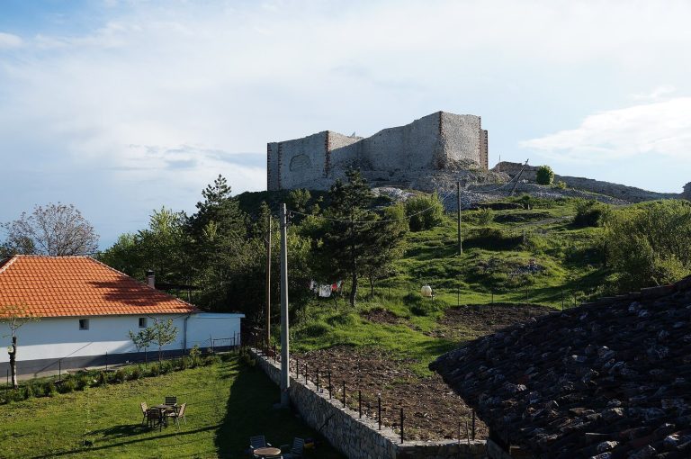
Justiniana Prima: A Byzantine City Founded by Justinian I
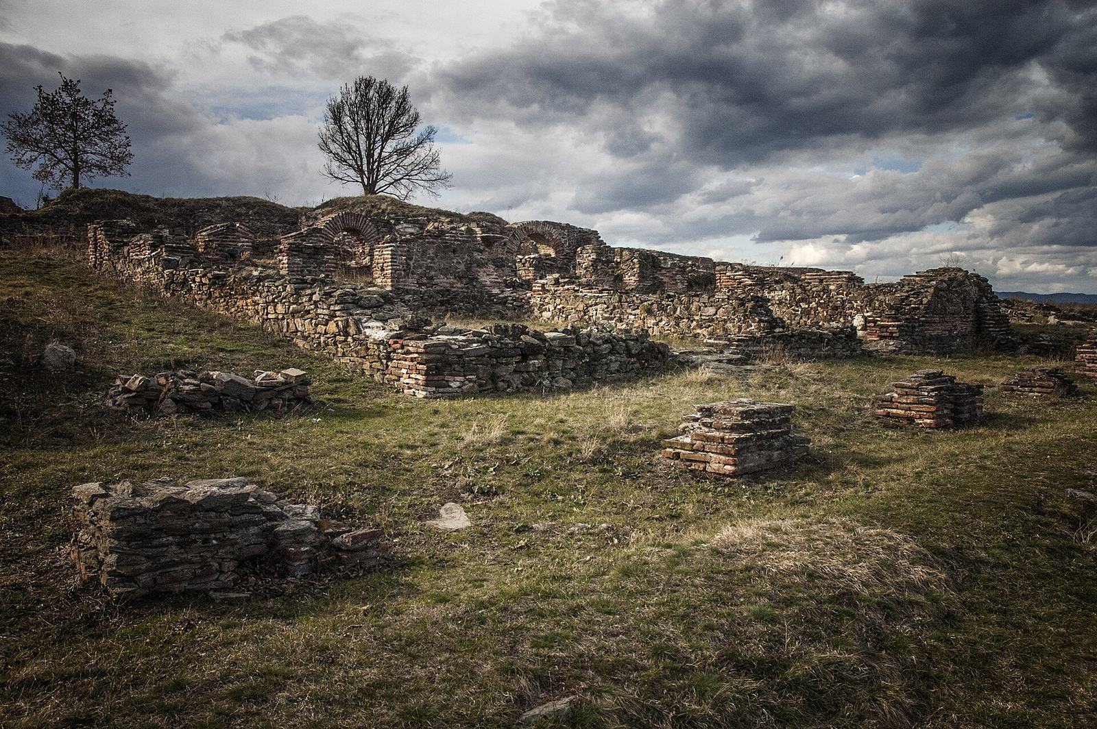
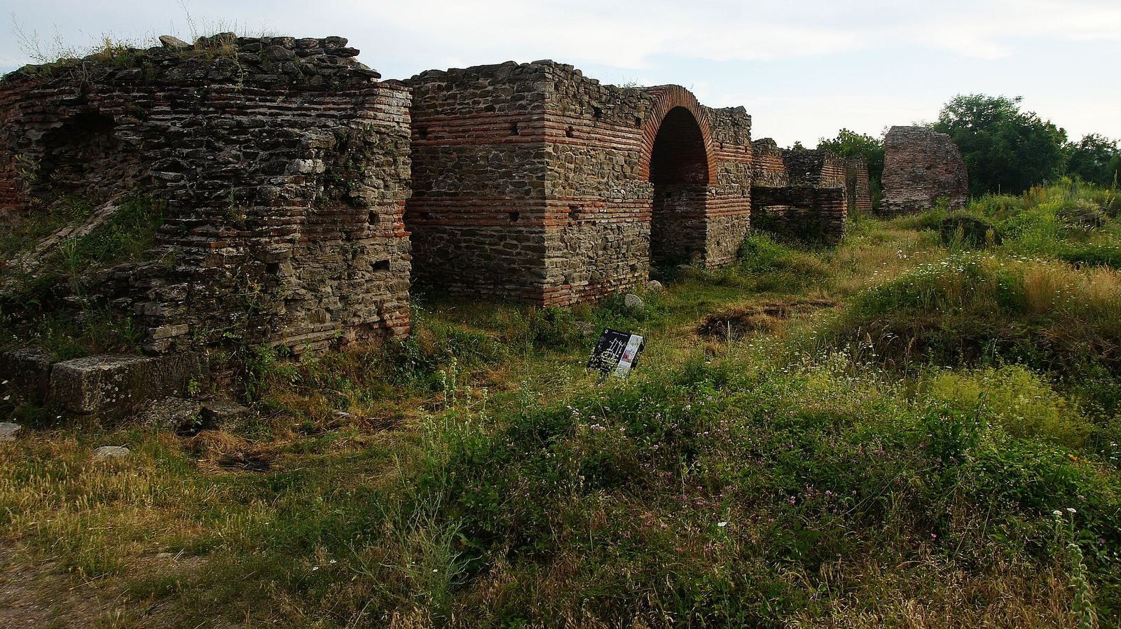
Site at a Glance
- Popularity
- High
- Country
- Serbia
- Primary era
- Medieval
- Eras represented
- Classical, Medieval
- Civilizations
- Byzantine, Roman
- Site type
- City
On this page25 sections
History
Justiniana Prima was a Byzantine city founded by Emperor Justinian I in 535 at Prekopčelica, Serbia. Justinian, the Eastern Roman emperor from 527 to 565, established it in his native region, where his birthplace was identified as Taurisium, near the fortress of Bederiana. The city was intended to become a major urban center and to commemorate this connection. It was first planned as the capital of the prefecture of Illyricum, a Byzantine administrative region in the Balkans, but Thessaloniki was chosen instead, probably because Justiniana Prima lay close to the frontier. The city may also have been meant to strengthen defenses against incursions toward Constantinople.
Foundation and church authority
In 535, Justinian established an archbishopric at Justiniana Prima. The city’s metropolitan bishop, a senior bishop overseeing a church province, was elevated to archbishop, creating a jurisdiction independent of the Archbishop of Thessalonica. It held authority across northern and eastern Illyricum, including Dacia Ripensis, Dacia Mediterranea, northern Moesia Superior, Dardania, Macedonia, Praevalitana, and the territory of Bassianae in Pannonia Secunda. Macedonia Salutaris was excluded in 545.
A law issued by Justinian in 545 reaffirmed the archbishop’s rights and gave him the office of exarch, a senior church authority with power over other bishops. This included authority to ordain bishops in seven provinces. In 549, a synod at Justiniana Prima supported the Three Chapters controversy, a dispute over the condemnation of writings by three theologians. The archbishopric later lost its independence. Avar and Slavic invasions disrupted the Diocese of Dacia, and the archbishopric’s primacy is last visible by 602. Justiniana Prima was also intended as a center of Christian administration and may have helped promote Christianity among non-Christian populations. A role as a pilgrimage destination remains uncertain.
Regional conditions and urban life
Justiniana Prima grew in a region already affected by urban decline following Hun attacks in 441–443 and the settlement of Goths. From the mid-sixth century, the city faced economic and practical constraints, including regional poverty, distance from communications routes, and difficulties with water supply. Incursions by Kutrigurs and by Avar and Slavic forces, along with plague and climatic changes, also contributed to population and economic decline.
The city attracted potters, smiths, goldsmiths, and glassworkers, whose activities are indicated by craft tools. Mining in the region involved gold, lead, copper, and silver, as well as amethyst, opal, and agate. Local cultivation included cereals, fruits, and beans, and the region supplied nearby communities as well as more distant areas.
Conquest and abandonment
Two brooches and handmade pottery point to a Slavic presence before the Avar incursion of 584. By about 615, during the reign of Emperor Heraclius (610–641), Avars and Slavs captured and plundered Justiniana Prima. The city was abandoned in the first half of the seventh century. A local legend about a waterless city ruled by an empress is associated with the name Caričin Grad.
Rediscovery and investigation
Mita Rakić published the first description of the ruins in 1880. Excavations began in 1912 under archaeologist Vladimir Petković, who proposed that the site was Justiniana Prima on the basis of its scale, mosaics, and architectural sculpture. War soon interrupted the work. Excavations resumed in 1936 under the Serbian Royal Academy and the University of Belgrade, but stopped again in 1940. Work restarted in 1947 under the Archaeological Institute of the Serbian Academy of Sciences and continued through 1970, expanding to the Lower City and buildings beyond the urban core.
Research resumed in 1975. Work through 1977 examined the Upper City’s southern wall and a reservoir tower, and uncovered a single-nave basilica on the southern plateau. A French–Serbian collaboration began in 1978 to investigate religious and non-religious buildings. A programme focused on a residential quarter ran from 1984 until 1990, when work stopped amid Yugoslavia’s international isolation. Research restarted in 1997 under Bernard Bavant and Vujadin Ivanišević. From 2010, additional survey methods helped refine the city plan; ground-penetrating radar revealed remains of four more churches in 2015, and a project to excavate a four-conch building began in 2019.
The identification of Justiniana Prima rests on the close correspondence between the remains and the sixth-century historian Procopius’s description, as well as seals associated with the city’s archbishops. Four seals of Justinian I and five of Archbishop John attest to the city’s importance in the sixth and early seventh centuries. Serbia protects the site as an Archaeological Site of Exceptional Importance, and it is included on UNESCO’s Tentative List of World Heritage Sites.
Remains
The archaeological area occupies an elevated plateau of about 42,000 square metres on the slopes descending from Mount Radan toward the Leskovac basin. The city’s building tradition combined classical and Christian forms with features characteristic of the eastern Mediterranean. Construction did not reach the extent envisioned in Justinian’s original plans.
Plan and fortifications
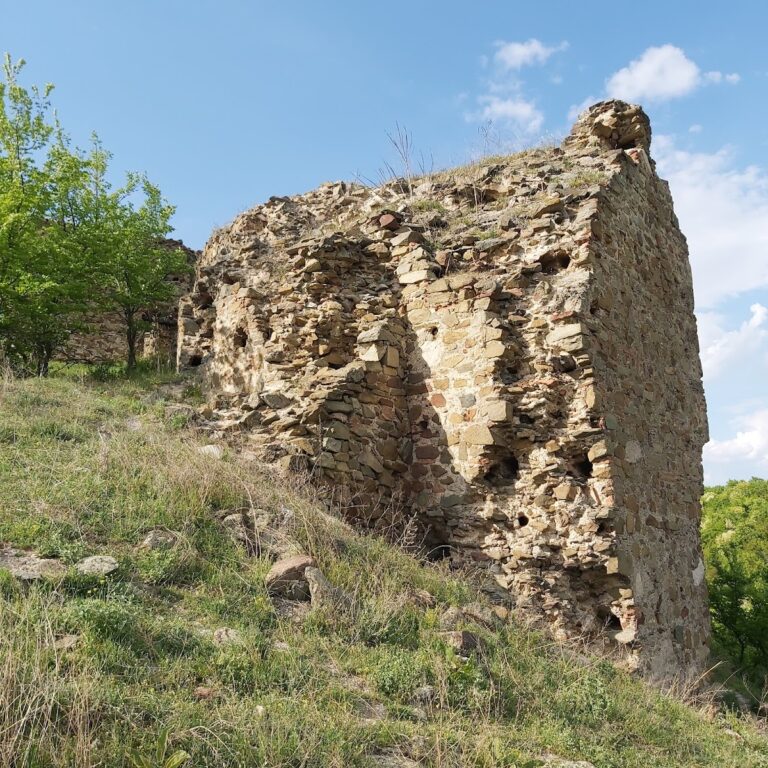
The plateau lies between the Svinjarička River to the west and the Caričinska River to the east. Outer defenses enclosed the city, while inner walls divided it into Upper, Middle, and Lower cities. The Acropolis occupied the highest ground, and a circular public square formed a focus of civic life. Several circuits of walls, palisades, and a broad ditch near the city limits strengthened the defenses. The walls used mixed masonry combining stone and brick. Around 40 towers of different forms are known, while a later plan based on accumulated surveys identified about 60 fortified works dated from the fourth to the sixth centuries. Procopius also described a separate small square enclosure near the city, with a tower at each corner, called the Tetrapyrgia.
The Acropolis
Episcopal palace
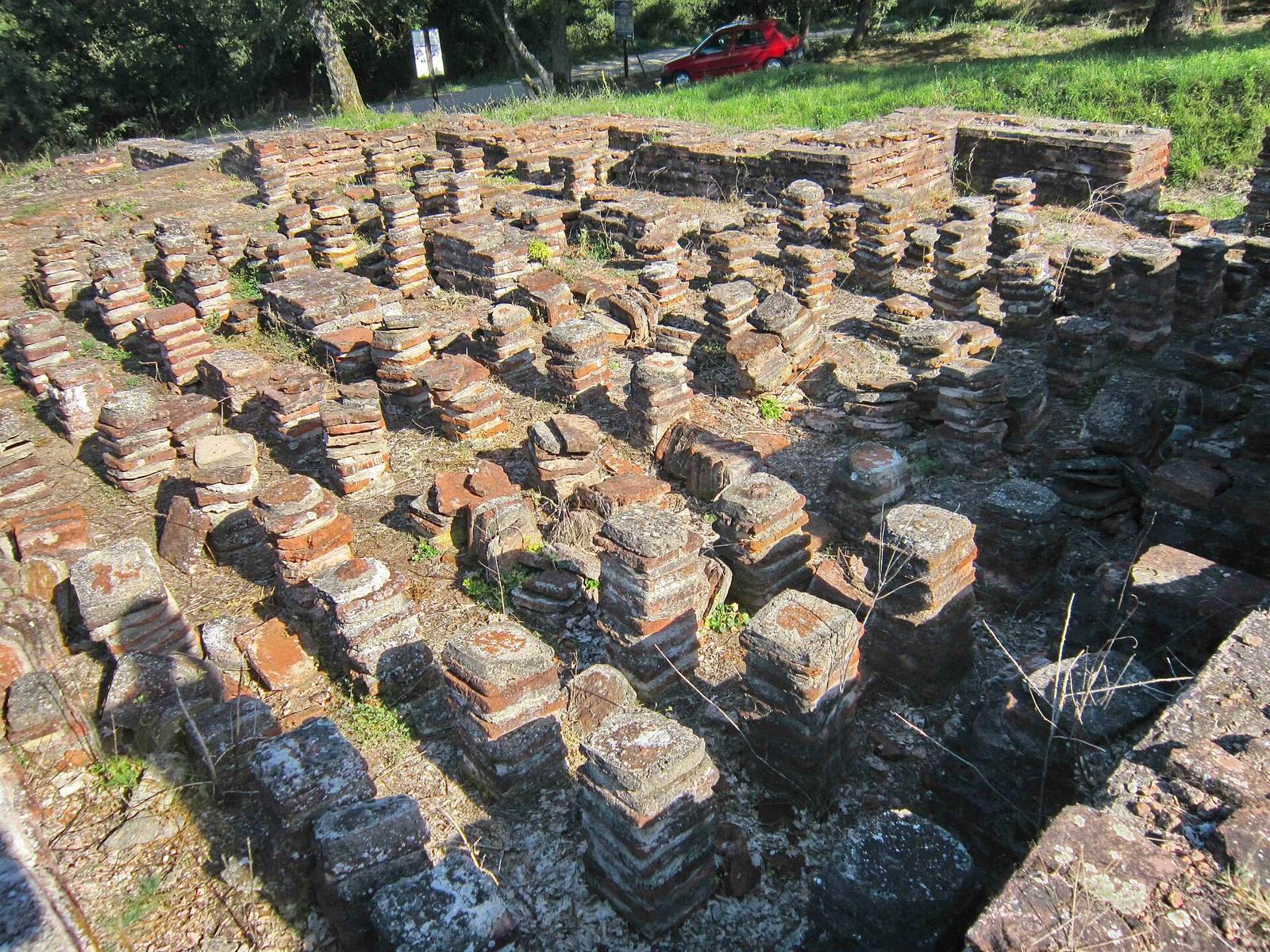
The Acropolis contained an episcopal palace with annexes. Its underfloor heating used a hypocaust, a system that circulated hot air beneath the floor.
Cathedral complex
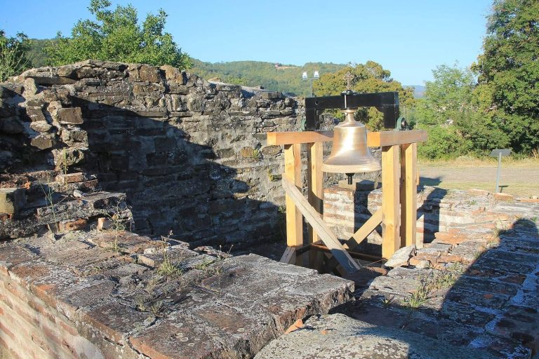
A large cathedral had three rounded sanctuary ends, an atrium (forecourt), and a baptistery, a place for Christian baptism. The cathedral complex is among the most monumental examples of Byzantine architecture in the Balkan Peninsula.
Churches beyond the Acropolis
Basilica near the civic square
In a residential quarter near the central square stood a three-aisled basilica, a long church hall with a central nave and two side aisles. It had a crypt, a chamber often used for burials or relics, and fragments of floor mosaics and frescoes survive.
Cruciform basilica
Southeast of the square was a cross-shaped basilica with an atrium, or forecourt.
Suburban basilicas
The suburbs included a double basilica and, to its south, a three-aisled basilica with a transept (crosswise arm), a narthex (entrance vestibule), and an atrium (forecourt). These churches date to the sixth century.
Church outside the walls
Beyond the city walls stood a sixth-century triconch church, with three rounded projections, an open entrance vestibule, and a forecourt.
Single-nave basilica
On the southern plateau outside the city, east of the aqueduct’s route, was a single-nave basilica. Several coins were found inside.
Tetraconch church
A church with four rounded projections stood in the northeastern suburb, preceded by a semicircular plaza.
Four-conch building
A separate building with a four-conch plan, meaning four rounded projections, is the subject of an excavation project.
Streets and urban buildings
Streets and porticoes
Rectangular limestone slabs paved the streets, which were bordered by covered porticoes. Columns supported the arches of the porticoes. Procopius’s description also names marketplaces, fountains, shops, and official residences among the city’s buildings and public features.
Public and residential buildings
Excavated and surveyed remains include baths, administrative and public buildings, houses in the northeastern suburb, and a series of small houses. A hospice has been proposed for that area.
Water supply
An aqueduct about 21 kilometres long supplied the city. The water system also included an artificial lake held by a dam about 100 metres long and 6.15 metres high. Procopius described the aqueduct as well as the city’s fountains.
Destruction layers and archaeological finds
Ovens above burned buildings
Simple ovens were built over layers left by burned buildings. This sequence has been interpreted as evidence of the last groups living at Justiniana Prima before its abandonment.
Coins
A 2010 field inventory included a group of 19 sixth-century bronze coins gathered by landowners in the eastern suburb. The finds include a coin of Anastasius from the Constantinople mint, dated 512/7, and two half-denomination bronze coins of Justin II from the Thessalonica mint, dated 568/9 and 574/5; the latter were found inside the single-nave basilica. A poorly preserved coin found beside a grave in the cemetery west of the aqueduct dates to the reign of either Justin I or Justinian I. Earlier coin hoards have also been found at the site.