Externsteine: A Sandstone Formation and Medieval Christian Site in Germany
Site at a Glance
- Popularity
- Very High
- Country
- Germany
- Primary era
- Medieval
- Eras represented
- Medieval, Early Modern, Modern
- Civilizations
- German, Holy Roman Empire
- Site type
- Religious
- Remains
- Sanctuary
On this page21 sections
History
The Externsteine are a sandstone rock formation near Horn-Bad Meinberg, Germany. The natural pillars became a place of Christian worship in the Middle Ages, while later accounts connected them with contested claims about prehistoric religion and Saxon history.
Name and early traces
Early forms of the name include Agistersten, recorded around 1093, and thon Eghesterensteyn, recorded in 1379. In 1564, the Westphalian theologian and chronicler Hermann Hamelmann used a Latin expression meaning rock of the magpies, helping spread a popular explanation of the name. A later linguistic interpretation instead links it to a Germanic root meaning sharp or pointed and to Egge, a ridge or rocky crest. The spelling Externsteine appears in the sixteenth century and became common afterward.
Stone tools found in the surrounding area indicate visits during the Upper Paleolithic and Mesolithic. Finds include flint points and flakes, as well as tiny stone tools associated with the Ahrensburg culture, a late Upper Paleolithic hunter-gatherer culture, beneath an overhang at Rock VIII. The purpose of these visits is unknown. Dating of fire traces in the grottoes places some fires between the mid-sixth century and the later Middle Ages. Thermoluminescence dating, which estimates when minerals were last heated, places one fire in the domed grotto between the mid-sixth and early tenth centuries and another between the ninth and eleventh centuries. A sample from the side grotto falls later than an estimate of 1025 ± 100 CE. Two further traces, from the main and side grottoes, have estimates of 1325 ± 50 and 1425 ± 63 CE. These results date the sampled fires but do not determine whether earlier fires occurred.
Hollow paths near the rocks are sometimes mistaken for Roman roads, but they did not originate in Roman times; their date, whether prehistoric or medieval, remains uncertain. Hamelmann described the formation in 1564 as a Germanic sanctuary destroyed by Charlemagne. The Frankish emperor’s late eighth- and early ninth-century rule included the conquest and Christianization of Saxon territories. Hamelmann’s account became popular again in the late nineteenth century and during the period from the 1920s to 1945. Claims that the rocks served as a prehistoric astronomical observatory also remain interpretations rather than established conclusions.
Medieval Christian use
Archaeological finds, particularly ceramics and metal objects, point to intermittent human presence from the late tenth century onward. A document dated 1093, preserved in copies made in 1374 and 1380, describes Abdinghof Abbey’s purchase of a farm at Holzhausen that included a feature called an Agisterstein. The transaction is considered plausible, but it does not establish that the abbey owned the rock formation. A document from around 1129 refers to a farm called Holzhausen or Egesterenstein and says that the abbot of Werden Abbey stayed there while passing through. Mass at the rocks at that time is possible.
By the medieval period the grottoes served as hermitages and Christian worship had been established at the site. An inscription in the main grotto gives 1115 as a consecration date and names Henrico, possibly Heinrich II von Werl, bishop of Paderborn from 1084 to 1127. Both the inscription’s authenticity and this identification have been questioned. The date also leaves open whether the local church authority was the bishop or Abdinghof Abbey, a Benedictine monastery in Paderborn.
Monks from nearby monasteries, possibly including Paderborn, are thought to have commissioned carved and architectural work. The tomb and upper chapel have been interpreted as medieval counterparts to places associated with the Passion, the events of Jesus’s suffering and death, in Jerusalem. The chapel has in particular been linked with Golgotha, traditionally identified as the place of Jesus’s crucifixion. The large relief of the Descent from the Cross is generally dated to the twelfth century, though an earlier date in the Carolingian period has also been proposed. It may have served as a local image of the Holy Sepulchre, Jesus’s tomb in Jerusalem and an important Christian pilgrimage destination. The rocks’ use as a medieval pilgrimage site remains uncertain, and a sixteenth-century attribution of the relief to Lucas Cranach the Elder is considered unlikely.
From the early thirteenth century, control of the surrounding area passed from the abbey to the House of Lippe, the ruling dynasty of Lippe. Abdinghof’s ecclesiastical control of a chapel at the rocks is documented from 1366 into the seventeenth century. Hermits are mentioned in 1385 and 1469. A reference in 1385 to an Upper Altar probably concerns the altar in the elevated chamber.
From hermitage to modern development
The hermitage apparently became a refuge for bandits and was dissolved by local rulers in the early sixteenth century. This took place around the time the Reformation reached Lippe in 1538, after which church activity at the site ceased. Around 1592, a local forest warden lived in the caves. In about 1660, Count Hermann Adolf of Lippe-Detmold established a hunting lodge and leisure residence below the rocks. It may also have been intended to help control long-distance traffic, but saw little use, deteriorated, and was demolished around 1810 at Princess Pauline of Lippe’s request.
A timber-framed forest house and inn stood near the formation from at least 1665. The innkeeper’s son commissioned a large Neo-Gothic hotel beside it in 1867. A nineteenth-century revival of medieval Gothic architecture, the hotel and its restaurant shaped the site’s appearance for about a century before the building was demolished during redevelopment from 1964 to 1966. The Wiembecke stream was dammed in 1836 to form a pond below the rocks. The pond was drained during excavations and landscape work in the Nazi period and restored after 1945.
A long-distance road through the cleft between Rocks III and IV was paved and improved in 1813. A tramway ran beside the road from 1912 to 1953, with a stop near the rocks. In 1936 the road was shifted southeast to protect the formation, and iron hooks were used to secure the unstable boulder on Rock IV.
Nationalist claims, excavation, and protection
In the 1920s, nationalist amateur researcher Wilhelm Teudt promoted the idea that the rocks were the site of the Saxon Irminsul, a reported sacred pillar associated with pre-Christian Saxon religion whose precise location is uncertain. Heinrich Himmler, a leading Nazi official and head of the SS, adopted Teudt’s proposal for a sacred grove commemorating ancestors. In 1933 he founded the Externsteine Foundation and became its chairman. Nazi-era research also involved the SS research organization Ahnenerbe, which pursued Germanic ancestry and cultural history, and the Rosenberg Office, a Nazi Party organization concerned with ideological and cultural affairs. The Irminsul identification remains unproven.
Excavations in 1881 and 1888 were later judged to have damaged more than they revealed. A probing excavation followed in 1932 for the Free State of Lippe. In 1934–35, geologist Julius Andree directed larger excavations, assisted by the Reich Labour Service, a Nazi state labor organization. The project sought evidence of a pre-Christian Germanic sanctuary. Its surviving records are incomplete, and the work is generally understood as research shaped by that prior objective. Some ceramic and metal finds from the excavations are held by the Lippisches Landesmuseum in Detmold.
The rocks received protection in 1926. Early plans aimed to restore the surrounding area by moving the road, removing modern structures, and eliminating the pond. SS control of the Externsteine Foundation prevented separate protected areas from being consolidated under the Reich Nature Conservation Act of 1935. In 1953, ten natural monuments were brought together in a 140-hectare nature reserve; the present reserve covers about 127 hectares. The rocks are also protected as an archaeological monument. The area joined Natura 2000, the European Union network of protected areas, in 2004, and the formation was designated a National Geotope in 2006.
Remains
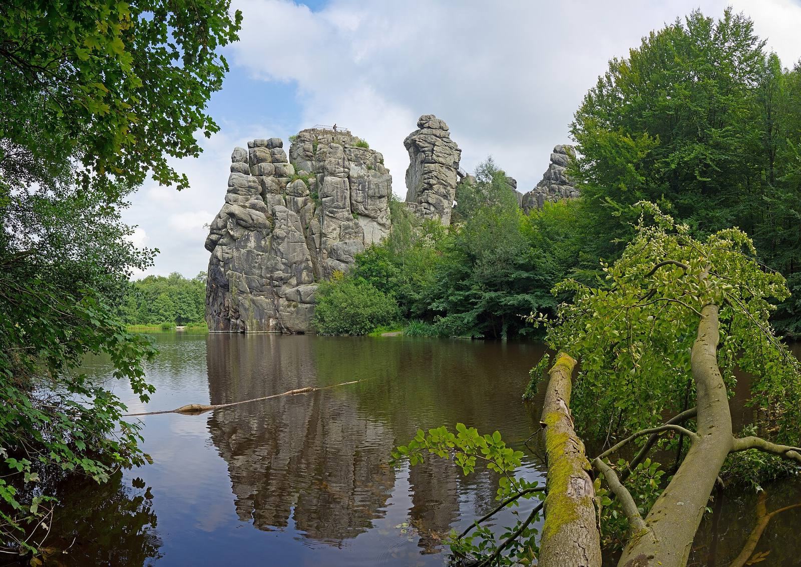
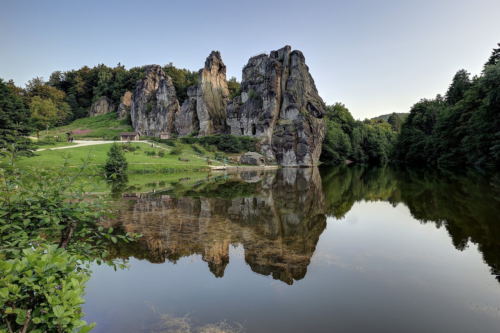
The Externsteine form a ridge running broadly southeast to northwest for several hundred metres, between the wooded rises of Bärenstein and Knickenhagen, near the point where the Teutoburg Forest approaches the Eggegebirge. The Wiembecke flows past the rocks and forms a pond at their foot. The formation lies roughly 250–290 metres above sea level and rises at most 47.7 metres above the pond. From smaller rocks partly concealed in the forest, the ridge continues into 13 prominent, mostly free-standing pillars numbered from northwest to southeast. Rocks I–V form its main group, with about eight less-studied rocks continuing southeast.
The sandstone was deposited in a shallow sea during the Early Cretaceous, roughly 145 to 100 million years ago. Around 70 million years ago, its layers tilted from horizontal to nearly vertical. Later weathering and erosion shaped the pillars, leaving rounded, pillow-like forms. The northeastern side, conventionally called the front, bears numerous signs of human working and has a modified, ruin-like appearance; the southwestern side has fewer such marks and a more natural profile. A road runs through a cleft between Rocks III and IV.
Rock I and its carved spaces
Summit and access
Rock I includes the large Grotto Rock, Rock Ia, and the smaller Rock Ib, joined to it near ground level. The summit of Rock Ia has been levelled into a plateau. On its southwestern side, about two metres below the summit, the outline of an angular room can be seen. A stairway, present by at least 1663, begins between Rocks I and II, climbs to Rock Ib, and continues to the top of Rock Ia; traces of earlier stairways also survive. A gap between the two parts of Rock I was widened to make a passage to the rear of the formation.
Grotto chambers
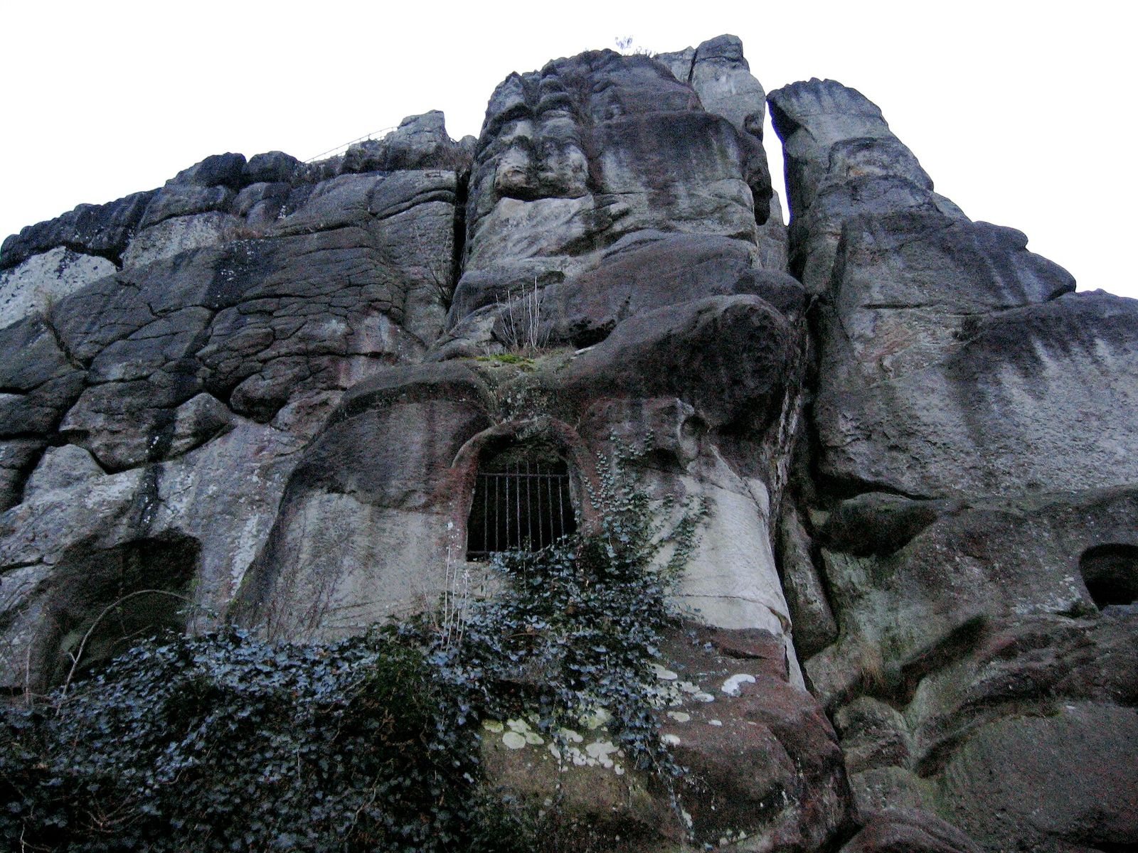
Three connected chambers extend along the northeastern side of Grotto Rock. The domed grotto, about four metres long, opens at the rock’s narrow southeastern end. It narrows near the floor and widens upward. Its irregular surfaces show few chisel marks and have been attributed to fire. Beside the entrance is a worn standing figure holding a key, often interpreted as Saint Peter, one of Jesus’s apostles and traditionally regarded as the first bishop of Rome.
A narrow corridor leads to the rectangular main grotto, which extends northwest and was shaped with hammer and chisel. The chamber measures about 11 by 3.5 metres and is about 2.5 metres high. A hemispherical basin, roughly 1.25 metres across, is sunk into the floor beside the southwestern wall. A narrow rectangular doorway and a wider arched opening admit light. A medieval inscription and a grotesque face are carved beside the rectangular doorway.
The rectangular side grotto extends northeast at a right angle from the northwest end of the main chamber. Its worked southeastern wall contains two rectangular recesses, one about human height and a smaller square one at chest height. On the opposite wall, beside an earlier fire site, a large sign was cut about one centimetre deep. One part was described in the late nineteenth century; the other was uncovered beneath plaster in 1929. Teudt and others read it as a runic or Jul symbol, while comparison with marks on execution swords led to its accepted interpretation as a gallows sign. That reading is associated with the chamber’s early-modern use as a prison for the town of Horn.
Descent relief and Coffin Stone
The 5.5-metre-high relief of the Descent from the Cross is carved into the rock face just before the domed grotto. Above a rectangular doorway is a hollow outline resembling the legs, body, and wings of a bird, perhaps intended to hold a relief made from another material.
Above the Coffin Stone, at the foot of Grotto Rock, a large window pierces the outer wall of the side grotto. A channel about four metres long runs down through the rock from the chamber and emerges outside level with the head end of the stone. Its interior opening, beside the window in the floor, is sealed with cement. The Coffin Stone is worked on all sides, with a tomb recess beneath an arch and a human-shaped hollow carved into its northwest face. A small platform above it is approached by stairways on two sides, whose damaged remains can still be seen.
Tower Rock and Stair Rock
Tower chamber
Rock II, or Tower Rock, has a roughly square, tower-like profile when viewed from the southwest. Its elevated chamber runs northeast to southwest and has niches at both ends. The rectangular southwestern niche is framed by two round columns. At the northeastern end, a round-arched niche contains a carved platform and a narrow upright that may represent an altar. A circular window above it faces sunrise at the summer solstice. Another opening extends about two metres into the northwestern wall and aligns with sunset at the summer solstice. These orientations have prompted suggestions of astronomical use, but the proposed purpose remains an interpretation. A male head with an open mouth is carved at hip height near the eastern end of that wall.
Crown and pulpit
The elevated chamber’s ceiling was forcibly broken away. On the hard-to-reach summit, which partly overhangs the chamber, a small rise called the crown has a circular depression cut into it. At the northeastern foot of Tower Rock is a stone platform known as the pulpit. Seven step remains follow its front and one side, and the top includes a standing area about 35 by 30 centimetres.
Stair Rock
Rock III, or Stair Rock, connects to the Tower Rock chamber by an iron bridge with wooden planking. Traces of older stairways remain, along with evidence of a chamber on the rock’s southwestern side.
Rocks IV and V
Wobble-Stone Rock
Rock IV, also called Wobble-Stone Rock, supports a large boulder resting on three points. Metal bands and concrete around its base secure it. Vertical clefts on both faces, together with other projecting surfaces and extensive working marks, form shapes that have been interpreted as natural features enhanced by human work. Researcher Fritz Schäfer identified them in the 1950s. A human figure appears on the front, while the rear can be read as an animal head with a long neck. A Lippe coat of arms, dating to the sixteenth or seventeenth century, is set into the lower front.
Caller Rock
Rock V, the highest of the main group, bears a head-like figure on its northeastern side, facing southeast. Known as the Caller, it appears to combine natural weathering with surfaces shaped by the removal of flat flakes of stone.
Other features around the rocks
Rock formations and nearby earthworks
On the rear of Rock I, about halfway up and above the water, a shape resembles a small boat. East of Tower Rock, a dry-stone wall has been associated with buildings mentioned in medieval documents. Northeast of the formation, the Immenburg is an archaeological earthwork with a rampart.
Former hunting lodge
The former lodge stood against the eastern side of the rocks. Its central gatehouse was flanked by two squat round towers. Thin walls indicate an ornamental residence rather than a defensive stronghold. A stairway beside Rock I led to a viewing platform above the lodge. A bearded figure on the platform, along with the coat of arms on Rock IV, may relate to this phase of the site’s use.
Inn, hotel, and tramway remains
The former forest house and inn were timber-framed. Beside them stood a large Neo-Gothic hotel with a restaurant. Recesses and metal remnants next to the rocks mark the former tramway installation.