Iruña-Veleia: The Roman Town of Veleia in Álava, Spain
Site at a Glance
- Popularity
- High
- Country
- Spain
- Primary era
- Classical
- Eras represented
- Bronze Age, Iron Age, Classical, Medieval
- Civilizations
- Crown of Castile, Knights Hospitaller, Roman
- Site type
- City
On this page20 sections
History
Iruña-Veleia is the archaeological site of the Roman town of Veleia, in Iruña de Oca, Álava, Spain. An important centre of the Caristii, an ancient community of northern Hispania, it occupied a strategic passage toward the Ebro Valley and served as a station on the Roman road linking Astorga and Bordeaux. Its archaeological history reaches from Bronze Age occupation into the medieval period. Under Rome, Veleia lay in Tarraconensis, a Roman province in Hispania, the Roman name for the Iberian Peninsula.
Before and during the Roman period
Before Veleia took shape, a large settlement in the area may have served as a central place for the Zadorra Valley. Occupation began in the Middle and Late Bronze Age and continued through the first millennium BC. Iron Age communities drew cultural influences from the continent, the central Iberian plateau and the Ebro Valley. From the second Iron Age, ironworking, fast-wheel pottery production and cereal farming developed.
An honorific inscription to Augustus, Rome’s first emperor, was dedicated by the Carietes and Vennenses and found at Largo Argentina in Rome. It provides an early indication of connections between people in the region and Rome. Archaeological evidence places initial changes at Veleia in the reign of Tiberius, followed by wider transformation under the Flavian dynasty, which succeeded the Julio-Claudian dynasty. During the first half of the first century AD, Roman-style houses replaced the settlement’s huts.
Veleia flourished most in the late first century, during the Flavian period, when the city covered about 80 hectares. The Roman writers Pliny the Elder and Ptolemy included it among inland cities of the Caristii. Pliny also placed the Carietes and Vennenses in the Clunia administrative district and listed the Velienses among its five civic communities.
Growth, contraction and the late Roman town
Changes to the town continued in the second century, including alterations to buildings and drainage. Economic decline from the third century brought a gradual retreat from some buildings. Activity revived to some extent in the fourth century, when former public areas were taken over by houses and workshops.
Veleia’s last major public construction was a wall, built in the late third or early fourth century. It formed part of a broader imperial effort to secure communications and centres involved in moving taxes and supplies. Its function is considered more commercial and economic than military. The area enclosed by the wall covered slightly more than 10 hectares. The late Roman Notitia Dignitatum, a record of offices and military deployments, lists a cohort, or Roman army unit, at Veleia: Cohors I Gallica Equitata Civium Romanorum.
Incursions into the Iberian Peninsula in the early fifth century did not immediately end activity in the town. The latest evidence for urban use includes burials made in the late fifth century inside rooms of buildings that had already been abandoned.
Later use and rediscovery
One interpretation proposes that Iruña was Victoriacum, said to have been founded in 581 by the Visigothic king Liuvigild during campaigns against the Vascones, an ancient people of the western Pyrenees. This identification remains a proposal, and only a limited area of the town has been excavated.
By the mid-fourteenth century, the site had a priory belonging to the Order of St John of Jerusalem, Rhodes and Malta, a Catholic religious and military order. The priory depended on the commandery of Burgos and Buradón, an administrative unit of the order. Its position on the Roman road, later part of the Camino de Santiago pilgrimage routes, is thought to have helped sustain its importance. The priory buildings were still visible in the nineteenth century.
The earliest known written account of Iruña’s past dates to the sixteenth century and a manuscript by Diego de Salvatierra. Álava’s Commission of Monuments carried out the first known fieldwork in the nineteenth century under Florencio Janer. Around 1900, scholar and priest Jaime de Verástegui investigated the area north of the enclosure. Gratiniano Nieto Gallo excavated several sectors between 1949 and 1954, and Juan Carlos Elorza Guinea led work by the main gate in 1974 and 1975. Eliseo Gil Zubillaga began investigations in 1994.
Studies from 2005 to 2007 examined the site’s extent and chronology. Test excavations beyond the walls and aerial photography revealed extensive, well-preserved areas of the early imperial town. Work connected with a proposed wall rehabilitation assessed its condition and helped identify previously unrecognized sections and construction phases. The planned intervention and associated investigations were later suspended. Iruña-Veleia has been listed as a Property of Cultural Interest since 22 May 1916.
Finds and the authenticity dispute
An inscribed altar found in October 2012 bears the name for people from Veleia and confirmed the identification of the site with the ancient town. The same year, excavations outside the enclosure uncovered a Roman road and a large public building, evidence that settlement extended beyond the walls at least into the fifth century.
In 2006, a team directed by Gil publicized inscribed pottery fragments that it initially dated from the third to sixth centuries. The finds were presented as potentially containing very early Basque writing and an early image of the crucifixion, prompting extensive scholarly debate. A commission appointed by the Provincial Council of Álava in 2008 questioned the authenticity of many of the exceptional pieces and judged them almost certainly false. The council revoked excavation permission from Lurmen, the company directed by Gil.
A 2014 report by Spain’s Institute of Cultural Heritage concluded that 35 of 39 pieces submitted for analysis were false. It cited stainless-steel elements incompatible with the claimed period and incisions that cut through deposits formed while the objects were buried. In June 2020, a court found Gil guilty of fraud and collusion with an external collaborator in presenting a false report. The court concluded that contemporary incisions, made by Gil or other people, had been used to make the objects appear to bear ancient inscriptions. Gil’s appeal was dismissed, and he later appealed to the Constitutional Court. Some researchers continued to defend an ancient origin for the inscriptions, while others considered their linguistic and epigraphic features anachronistic. In August 2020, fourteen scientists publicly argued that the question remained a scientific controversy.
Remains
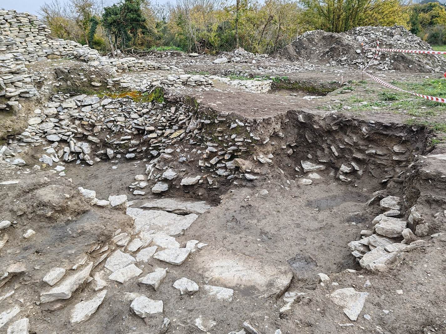
The archaeological area follows a meander of the Zadorra River. A late Roman wall encloses about 10 hectares and has a perimeter of more than 1,200 metres. It averages about 9 metres in height and is between 4 and 5.5 metres thick. Inside and beyond this boundary are remains of earlier settlement, Roman houses and public structures, as well as evidence of later use.
The Roman wall and gates
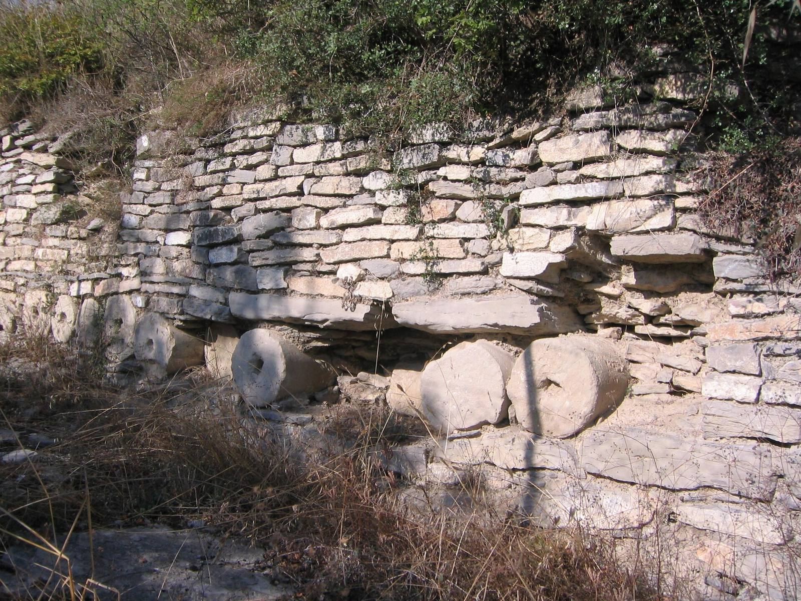
The wall has a core formed from successive layers of stone and lime mortar held between two outer faces. Builders reused earlier material, including column drums, inscribed stones and altars. Its known entrances include monumental gates on the south and east, another gate to the north, and smaller secondary doorways on the west and northwest.
Surviving sections vary between carefully cut stone and rougher rubble construction. The wall’s towers have square or semicircular plans. Quarrying for building stone later damaged substantial stretches, particularly around the principal gate.
Houses within the enclosure
Pre-Roman dwellings
Pre-Roman houses had rectangular or circular plans. Some were supported by posts set into holes in the natural bedrock; others rested on continuous foundations of limestone slabs. Walls were made from adobe, rammed earth and branches, with thatched roofs. Some houses had sunken floors.
Roman town houses
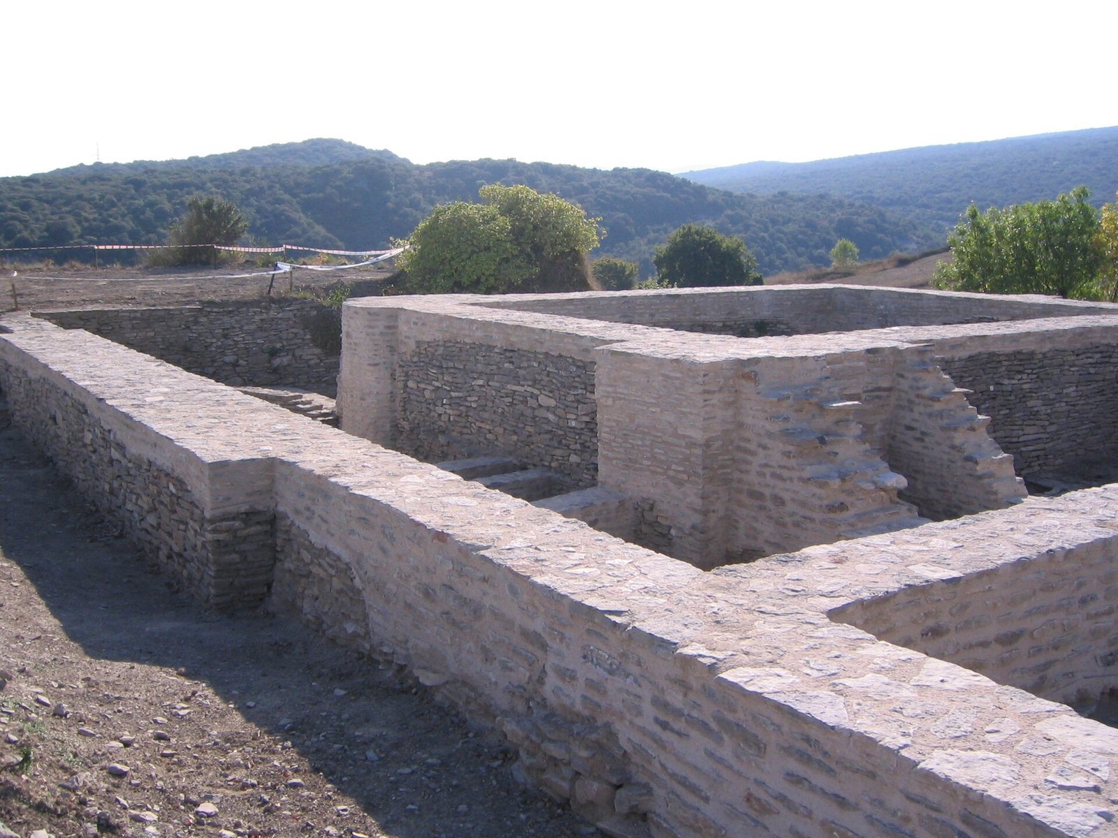
Roman houses, known as domus, arranged rooms around central courtyards and included cisterns built from Roman concrete, a mixture of aggregate and mortar. During the Flavian period, some houses were extensively rebuilt on a larger scale. One is known as the House of the Impluvium or the House of Pompeia Valentina.
Other Roman buildings and the road
Early imperial building north of the wall
A large early imperial building lies north of the enclosure. It was uncovered around 1900 and later incorporated into the line of the late Roman wall. It was once popularly identified as a castellum aquae, a water-distribution reservoir, but it is an earlier building.
Southern structures and the road outside the enclosure
Mosaic pavements and large structures have been located in the southern area beside the river. Excavations in 2012 outside the wall uncovered a road about 6 metres wide, with sidewalks whose surfaces had been stripped, and a large Roman public building.
The Roman circus
In 2026, archaeological investigation confirmed a Roman circus, a long arena used for public races, at the site. Remains dated to the second and third centuries indicate a structure estimated at about 280 metres long and 72 metres wide, with room for approximately 5,000 spectators. Aerial photographs, ground-penetrating radar, other geophysical methods and test trenches were used to check the identification. The building is thought to have hosted chariot races.
Medieval monastic remains
Excavation over about 3 hectares in 2012 uncovered part of the priory’s monastic installations. The remains indicate that it formed a substantial complex.
Carved stone and sculpture
The Rider Stele
The Rider Stele, dated to the second or first century BC, is a stone slab showing a mounted warrior above a crescent moon. It is held by the Álava Archaeological Museum.
The Lady of Iruña
The Lady of Iruña is a fragment of a larger-than-life statue carved from white marble. Found among rubble at the south gate in 1845, it preserves nearly 1.5 metres in height. The statue’s left hand was recovered about 150 years later among material probably brought from the Veleia area for landscaping in northern Vitoria, and has since been reattached. The sculpture is in the Álava Archaeological Museum and has been attributed to a first-century empress, possibly Livia or Agrippina.
Armored statue fragment
A separate fragment of fine white marble shows a figure wearing a breastplate and military clothing. It preserves about 26 centimetres in height. One scholar dated it to the second third of the second century and proposed that it may represent Mars, the Roman god of war, in a household shrine or altar setting. After passing into private hands, it became part of the Lázaro Galdiano Foundation Museum in Madrid.
Inscribed pottery fragments
The pottery fragments publicized in 2006 were claimed to bear Egyptian hieroglyphs, Latin and Basque words, as well as a crucifixion scene. The claimed scene is engraved on a ceramic piece measuring 10 square centimetres. It depicts Jesus on the cross with the two thieves traditionally called Dimas and Gestas, and two additional figures that may represent Mary and Saint John. The inscription claimed to appear on the cross reads RIP, expanded as requiescat in pace, meaning rest in peace.
Other claimed Latin inscriptions include punctuation, quotation marks, capital letters at the beginnings of sentences and equivalence signs, as well as modern letter forms and words, including cuore and the sequences qu, th and sh. Proposed readings of the hieroglyphs included the name Nefertiti and were challenged for failing to follow established conventions. The claimed Basque writing formed recognizable expressions.