Holzhausen Fort: A Roman Cohort Fort on the Upper Germanic Limes
Site at a Glance
- Popularity
- Medium
- Country
- Germany
- Primary era
- Classical
- Eras represented
- Classical
- Civilizations
- Roman
- Site type
- Military
- Remains
- Fort
On this page13 sections
History
Holzhausen Fort was a Roman cohort fort in Germany, on the Upper Germanic Limes, the Roman frontier system in the provinces of Upper Germany and Raetia. Its construction is generally placed under the Roman emperor Commodus around AD 185-190, in the late second century, though the dating remains uncertain. The garrison was the Cohors II Treverorum, an infantry unit named for the Treveri people of Roman Gaul.
Roman occupation
In the early third century, the unit adopted the name Cohors II Antoniniana Treverorum in honor of Emperor Caracalla. A few years later, it became the Cohors II Severiana Treverorum, honoring Emperor Severus Alexander. A building inscription dedicated by the cohort and honoring Caracalla is dated AD 213.
Coin finds do not firmly establish the fort’s construction date. The largest concentration dates to around AD 220, while coins from the reign of Septimius Severus are scarce. The fort remained in use until AD 259/260, when the Limes was abandoned.
Rediscovery and protection
The fort’s woodland setting helped its remains escape disturbance for centuries. Construction of the Bäderstraße Taunus in the early nineteenth century caused substantial damage, as stones from the fort walls were quarried for building material. The first detailed description appeared in 1859. Karl August von Cohausen investigated the site in 1874 and 1882, and Ludwig Pallat directed major excavations for the Imperial Limes Commission in 1897, 1898, 1899, and 1903. Karl Nass led the most recent scientific excavations in 1932.
Excavation focused mainly on the fort, while work on the baths and civilian settlement remained limited. Since 2005, the fort and associated archaeological remains have been part of the Upper Germanic-Raetian Limes UNESCO World Heritage Site. They are also protected as cultural monuments under Rhineland-Palatinate law.
Remains
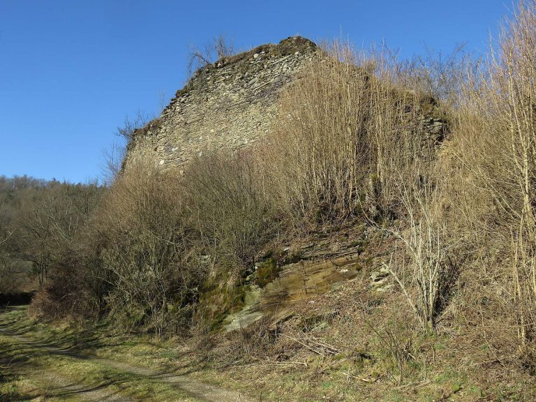
The stone fort occupies the northwest slope of Grauer Kopf, in woodland between Holzhausen an der Haide and Laufenselden. At an average elevation of 495 metres, it covers just over 1.4 hectares. Its rectangular plan measures 135.4 by 105.6 metres, with the front facing northeast. The Limes passed northwest of the fort, about 70 to 100 metres away.
Fort setting and defenses
Walls and layout
The front’s northeast orientation differed from the direction of the nearby frontier. The reason is uncertain: it may have accommodated the steep slope, or related to a nearby crossing of the Limes. A road extending from the front gate led to a crossing about 350 metres away. The two side gates stood more than nine metres apart in elevation.
The defensive wall was 1.5 metres thick, with a foundation sunk 0.9 metres into the ground and measuring 1.5 to 1.65 metres across. Builders used local greywacke and abundant lime mortar. The exterior had regular, nearly horizontal stonework, while the inner face was more irregular. Yellowish-white plaster covered the outer face, with red lines painted to imitate masonry joints.
Ditch, gates, and towers
A V-shaped ditch ran outside the wall, measuring 5.5 to 6 metres across and usually 1.4 to 1.6 metres deep. It reached two metres beside the rear gate. A strip of ground separated the ditch from the wall, while a broad earth bank inside the fort supported a walkway along the defenses. The ditch was interrupted only before the left-side gate facing the Limes.
Gates pierced all four sides. The broadest, at the front, measured 8.4 metres and had two passages divided by a central pier. Excavation evidence indicates that a bridge crossed the ditch in front of it. Rounded towers occupied the corners. Internal fittings survive in three towers and have been reconstructed in the northeast one; they may have supported movable artillery.
Interior and associated remains
Headquarters and other buildings
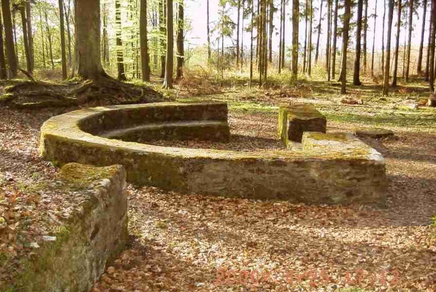
Excavation exposed parts of the principia, the fort’s headquarters building. Its rear section contained an apse-shaped shrine for the military standards, with masonry surviving to a height of one metre. Service and meeting rooms flanked the shrine; the room to the northwest had a hypocaust, an underfloor heating system. Other interior buildings were probably built of timber or half-timber. Excavations in 1932 identified three more buildings northwest of the headquarters, including one interpreted as a barracks.
Baths and civilian settlement
The baths stood northwest of the fort, between it and the Limes, near the source of the Hasenbach, which may have supplied their water. Surviving apses and numerous roof tiles suggest that the complex included hot and warm bathing rooms.
Traces of a vicus, the civilian settlement associated with a fort, were found outside the front gate, the right-side gate, and the rear gate. Uneven ground in the surrounding forest may indicate that further settlement remains lie below the surface.
Frontier line and watchtowers
Route of the Limes
The adjoining Limes followed the terrain, running east for a little over a kilometre before turning south near watchtower Wp 2/36. It continued south to Wp 2/39, then turned southeast toward the small fort on Dörsterberg. Along this stretch, the route descended by about 50 metres and passed mainly through dense woodland. Near Wp 2/41, it reached farmland southwest of Laufenselden.
Watchtowers
Several towers stood along this section of the frontier. One stone tower had a nearly square plan, about 4.15 to 4.21 metres by 4.12 to 4.20 metres, and walls 0.6 to 0.65 metres thick. Large postholes occupied its corners, with some extending below the foundations. It faced east toward the Limes and stood about 31 metres from the frontier palisade.
Another tower stood about 25 metres from the palisade and 80 metres north of a valley extending beyond Roman territory; its garrison probably monitored the valley. A further stone tower measured 4.9 metres on each side, with walls about 0.8 metres thick. It stood on a slight east-facing slope, about 50.5 metres west-southwest of the palisade. Other towers lay roughly 25 metres south-southwest and 20 metres from the palisade, the latter at an exposed position with a wide view of the surrounding area.