Karakorum: Capital of the Mongol Empire
Site at a Glance
- Popularity
- Very High
- Country
- Mongolia
- Primary era
- Medieval
- Eras represented
- Medieval
- Civilizations
- Mongolian, Yuan
- Site type
- City
On this page20 sections
History
Origins in the Orkhon Valley
Karakorum was a Mongol-built imperial city near Kharkhorin, Mongolia, conventionally founded in 1220 and later the Mongol Empire’s capital. The Orkhon Valley had long been a center of steppe power. The Xiongnu, Göktürks, and Uyghurs had ruled in the region, and the Uyghur capital of Karabalgasun, also called Ordu-Baliq, lay about 27 kilometers northwest. Naiman and Kereit confederations also occupied the surrounding area, linking the new Mongol center to an established political landscape.
Mongol troops assembled at a place called Karakorum in 1218–1219 before campaigning against the Khwarazmian Empire, a state centered in Central Asia and Iran. The city’s foundation is conventionally placed in 1220, when Genghis Khan’s headquarters moved to the Orkhon. Whether he established a permanent capital then is disputed: he was campaigning in Khwarazm, and may instead have ordered his main camp and family to be stationed in the valley. Takhai Balgas, an earlier settlement associated with a Kereit ruler, has been proposed as a possible site for his residence.
Ögedei’s capital
Karakorum remained a relatively small encampment until Ögedei, Genghis Khan’s son and successor, became great khan in 1229. As the empire’s supreme ruler, he promoted the creation of a permanent capital, and urban construction was underway by his reign. After the defeat of the Jin dynasty, a Jurchen-led state in northern China, Ögedei ordered the city walls and the Palace of Myriad Peace in 1235. The palace was finished the following year.
Karakorum became the empire’s capital in 1235 and held that position until 1260. It was both a base for imperial government and a principal camp where a khan could leave his family during military campaigns. The city also produced weapons and military equipment. Under Ögedei and later great khans Güyük and Möngke, rulers and envoys gathered there, and leaders made decisions about succession and new campaigns.
Russian princes visited in connection with Mongol confirmation of political authority. Yaroslav Vsevolodovich and his sons Alexander and Andrey were associated with these visits. After Yaroslav died in 1246, his sons were summoned to Mongolia amid a dispute over succession to the grand-princely throne of Vladimir. Andrey received the title.
Yuan rule and later conflict
In 1260, amid the Mongol Empire’s political division and Kublai Khan’s struggle with his brother Ariq Böke, the imperial capital moved first to Shangdu and later to Dadu, present-day Beijing. Karakorum became a provincial administrative center under the Yuan dynasty, the Mongol-led dynasty that ruled China from 1271. Kublai’s forces disrupted the city’s grain supply in 1260. Kaidu, a Mongol prince fighting the Yuan, captured Karakorum in 1277, but Yuan forces and the commander Bayan of the Baarin drove him out the next year. Prince Ulus Buqa plundered the city’s markets and granaries in 1298–1299.
The city expanded eastward in 1299. Its Buddhist temples were renewed in 1311 and again between 1342 and 1346, while public buildings were erected during the first half of the fourteenth century.
After the Yuan dynasty fell in 1368, Karakorum again became a Mongol political center. Biligtü Khan made it his residence in 1370. Ming forces, from the Chinese dynasty that followed the Yuan, badly damaged the city in 1372 and destroyed it in 1388. A chronicle by Saghang Sechen records that a 1415 assembly of Mongol leaders decided to rebuild Karakorum. In the sixteenth century, Batu-Möngke Dayan Khan made it his residence and restored its role as a capital. The city later passed between rulers descended from Genghis Khan and the Oirats, a western Mongol confederation, before being abandoned.
In 1585, Abtai Sain Khan began building Erdene Zuu beside the ruins. The first permanent Buddhist monastery in northern Mongolia, it developed into a major religious, political, and economic center in Khalkha, where nomadic camps gathered.
Rediscovery and archaeological study
In 1889, Russian explorer Nikolai Yadrintsev identified the ruins as the former Mongol capital and found examples of the Orkhon script, an ancient Turkic writing system. Linguist and ethnographer Wilhelm Radloff confirmed the identification. D. Bukinich led the first excavations in 1933–1934, followed by a Soviet-Mongolian expedition led by Sergei Kiselyov and Lydia Yutukhova in 1948–1949.
Karakorum became part of the Orkhon Valley Cultural Landscape, inscribed on the UNESCO World Heritage List in 2004. A museum devoted to the ancient capital and the Orkhon region opened in Kharkhorin in 2011, displaying archaeological finds from the area. Restoration work on monastery ruins was completed in 2015, and a three-dimensional reconstruction of the city incorporating archaeological research was produced in 2020.
Remains
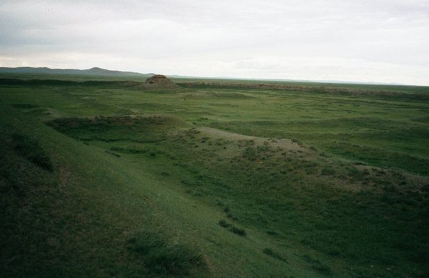
The remains occupy an elongated rectangle about 1.5 by 2.5 kilometers, extending from south to north in the Orkhon Valley, east of the Orkhon River and beside Erdene Zuu. The central area contained stone buildings and streets, while surrounding spaces included gers, or felt tents. An earthen wall enclosed the city, with four gates facing the cardinal directions. It was designed to control approaches rather than withstand a determined attack.
Urban quarters and religious buildings
Residential and commercial quarters
Different parts of the city housed craftspeople, merchants, and envoys. William of Rubruck, a Flemish Franciscan friar and envoy to the Mongol Empire, described separate residential areas for Muslim traders and Chinese craftspeople. His account also recorded Buddhist temples, two mosques, and a Nestorian church, belonging to a historical tradition of Eastern Christianity. He counted twelve temples. The largest Buddhist temple he described was tent-shaped and about 30 meters high.
Fields and canals
Fields lay beyond the eastern city wall. Canals irrigated the agricultural land, supplied by an extensive system attributed to Chinese builders.
Workshops and street remains
Buildings and streets
Excavations have revealed paved roads, brick and sun-dried mud-brick buildings, floor-heating systems, bed stoves, and four kilns. Along part of the main street, wooden strips served as expansion joints among and beside the stone paving. Mud-brick channels carried water or drainage.
Craft production and finds
The central craftspeople’s quarter included workshops for blacksmithing, working silver and gold, casting bronze, making glass, and processing bone. Finds include evidence of work in copper, gold, silver, iron, glass, and bone, as well as birch bark. Iron objects include wheel hubs. Chinese and Central Asian ceramics and coins have also been recovered. The concentration of Chinese coins in the crafts quarter supports its identification as a Chinese crafts district.
Palace and great stupa
Palace of Myriad Peace
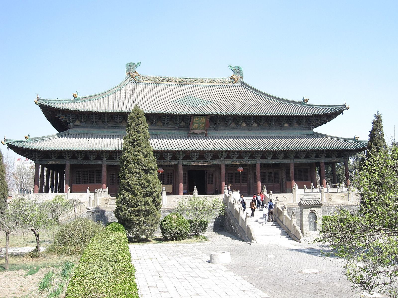
The Palace of Myriad Peace, also known as Tumen Amgalan Ord, was built in Chinese architectural style within its own walled precinct. Rubruck described a hall divided into a central space and two side sections by two rows of columns. Three doors opened to the south. At the north end, the khan sat on a raised position reached by two stairways, with the men’s place to his west and the women’s to his east. Möngke Khan enlarged the palace. In its court stood a Silver Tree made by Parisian goldsmith Guillaume Bouchier. Sculpted from silver and other precious metals, it bore silver fruit, four golden serpents, and a mechanical angel with a trumpet. The serpents released wine, mare’s milk, mead, and rice beer into a silver basin.
The palace’s archaeological location remains uncertain. Kiselyov identified remains in the city’s southwest, built on a granite base, as Ögedei’s palace; beneath them lay a Buddhist shrine with wall paintings dating from the late twelfth to early thirteenth century. German-Mongolian excavations in 2000–2004 instead linked a large building in the palace area to the great stupa temple. Another proposal places the palace beneath Erdene Zuu, but that identification is not conclusive.
Great stupa temple
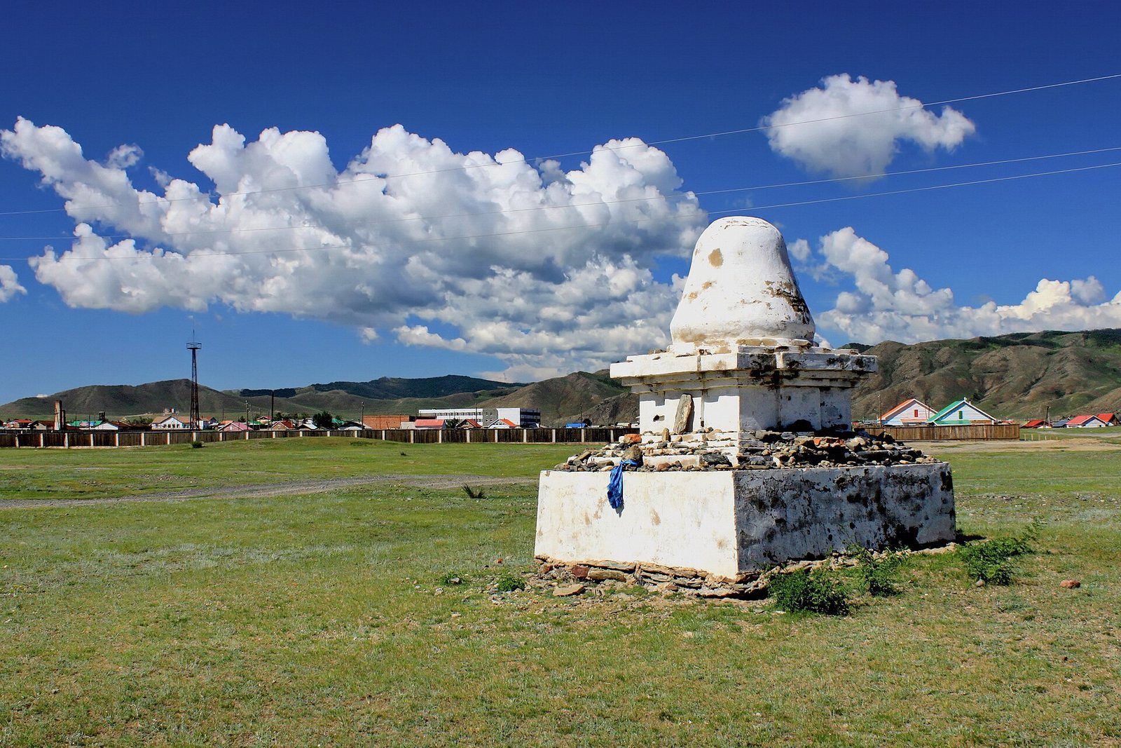
Möngke oversaw completion of the great stupa, a Buddhist monument, also called the Pavilion of the Rising Yuan. A building on Erdene Zuu’s northwest side, once considered the palace, has also been identified as a stupa structure about 90 meters high. The competing identifications of these buildings reflect continuing uncertainty about how the palace and temple precincts were arranged.
Inscription, tortoises, and administration
Inscription column
A large stone inscription discovered in the foundation of an older temple carries the same short text in Chinese and Mongolian. The mid-fourteenth-century inscription claims that Genghis Khan established Karakorum as his capital in 1220, a statement that informs debate over the city’s foundation. Eight other fragments found in the late nineteenth and early twentieth centuries belong to the same column. The broken stone was later reused in Erdene Zuu’s construction.
Stone tortoises
Three large stone tortoises were found near Erdene Zuu. One stands in front of the stupa remains and served as the base for the inscription column. Tortoise forms have been interpreted as symbols of Karakorum, with Chinese cosmological associations of longevity and the four cardinal directions.
Official seal
An official seal recovered at the site bears Chinese writing and Phags-pa, a square script developed under Yuan rule. It provides evidence of Northern Yuan administration in Karakorum, including during Biligtü Khan’s period. The Northern Yuan was the Mongol political regime that continued after the Yuan lost control of China.
Erdene Zuu
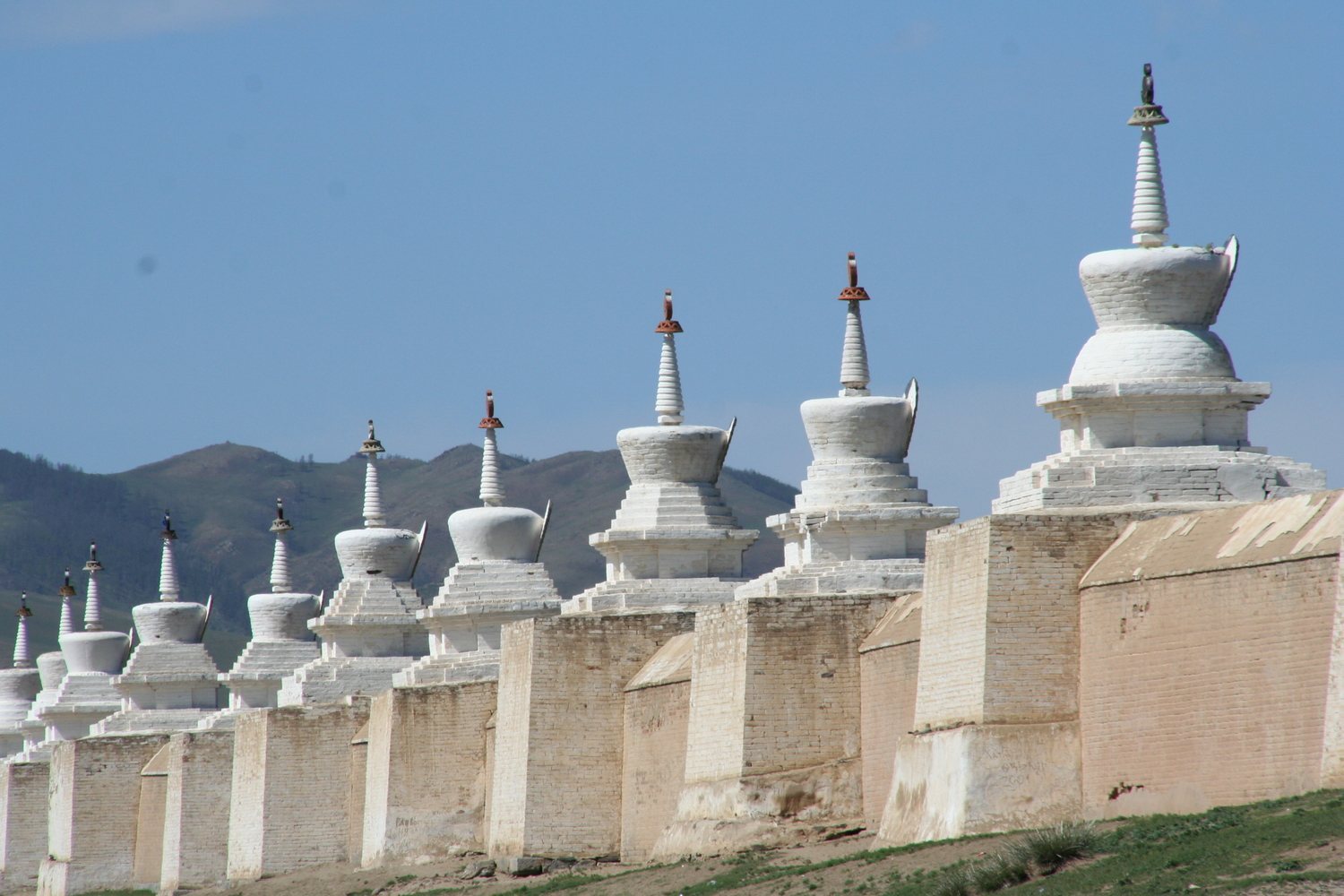
Erdene Zuu stands beside the city ruins, within a square outer wall. Its builders reused stone and other materials from Karakorum. About 62 temples stood within the enclosure in 1870, combining Chinese and Mongolian styles. Most were destroyed during Mongolia’s communist period, and some buildings have since been reconstructed. The three principal temple buildings stand parallel to one another on an elevated platform. Archaeological investigation within the monastery’s inner precinct has also examined the possibility that the former khan’s palace lay there.