Monte Albán: The Zapotec Capital of Oaxaca
Site at a Glance
- Popularity
- Very High
- Country
- Mexico
- Primary era
- Classical
- Eras represented
- Classical, Medieval
- Civilizations
- Zapotec
- Site type
- City
On this page23 sections
History
Foundation and regional growth
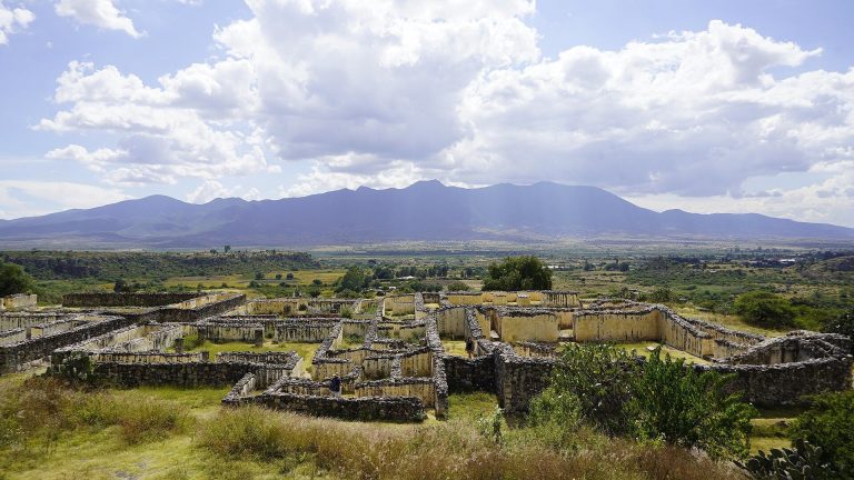
Monte Albán is an ancient Zapotec city on a mountain ridge in Oaxaca, Mexico, founded around 500 BCE. It became the Zapotec capital and a major political, economic, and agricultural center. Its foundation came near the end of the local Rosario phase, around 700–500 BCE, on ground that appears to have been uninhabited.
The city’s emergence coincided with a sharp decline in population at San José Mogote, previously the leading settlement in the northern Etla Valley. Elites from San José Mogote may have helped establish Monte Albán. Other communities followed different paths: Tilcajete grew during this period and may have resisted incorporation into the expanding state. By about 300 BCE, Monte Albán’s population was estimated at 5,200.
As its influence grew, the city expanded through warfare, the incorporation of communities, and colonization. Its reach extended across much of the Valley of Oaxaca and into neighboring highlands, the Cañada de Cuicatlán, and the southern valleys of Ejutla and Sola de Vega. Monte Albán also became a center of exchange, with connections to the Gulf Coast and the Valley of Mexico. During the Monte Albán II phase, around 100 BCE–AD 200, its population was estimated at about 17,200; estimates for its height reach 35,000. Its residents included people from more than one ethnic group.
Classic-period connections and change
During the Early Classic, a period of ancient Mesoamerican history, Monte Albán maintained close ties between its elites and Teotihuacan, a powerful city in central Mexico. A Zapotec neighborhood at Teotihuacan provides evidence of these connections. Relations shifted during Monte Albán IIIA, around AD 350–500, when new building at Monte Albán stopped and local pottery showed strong Teotihuacan influence. The political relationship ended around the start of the sixth century. The cause remains disputed, and a new connection with Xochicalco, another major central Mexican city, has been proposed.
After the break with Teotihuacan, monumental building resumed and locally distinctive Zapotec pottery returned. Pitao Cocijo, the Zapotec rain deity, became especially prominent, while funerary practices gained importance in the early Xoo phase, a late phase at Monte Albán dating to around AD 500–800. Political control across the valleys also changed. Monte Albán’s earlier military dominance gave way to alliances among competing centers.
Decline and later use
During the Late Classic, other regional centers asserted their independence and Monte Albán’s political reach diminished. Public works and building maintenance ceased toward the end of the Xoo phase, in the eighth century, as the ruling elite and much of the population departed. The city was largely abandoned by around the ninth or tenth century, while people increasingly lived in settlements on the valley floor. Wider instability following Teotihuacan’s decline may have contributed to the region’s urban decline.
Abandonment did not end the site’s ceremonial use. Zapotec people from the valley continued to visit it for rituals, and Mixtec people later reused its ceremonial precinct. Small-scale reoccupation, the reuse of older structures, and ritual visits continued into the colonial period. The Spanish gave the site its present name, Monte Albán, reportedly because its landscape reminded them of Italy’s Alban Hills. Its ancient Zapotec name is uncertain. The Mexica name Ocelotépec means “Jaguar Mountain,” while Dani Baán and Yukú Kuììn are names attributed to Zapotec and Mixtec usage.
Investigation and preservation
Guillermo Dupaix investigated the site in 1801. J. M. García published a description in 1859, and A. F. Bandelier issued further descriptions in the 1890s. Leopoldo Batres conducted the first intensive archaeological investigation in 1902. Large-scale excavations began under the Mexican archaeologist Alfonso Caso in 1931. Eulalia Guzmán assisted with work at Tomb 7 in 1933, and Caso, Ignacio Bernal, and Jorge Acosta went on to excavate the monumental center. Their work helped establish a pottery chronology spanning Monte Albán’s foundation through the end of the Postclassic period.
From the late 1960s, Kent Flannery and Joyce Marcus investigated the valley’s earlier development, including through extensive work at San José Mogote. Beginning in the early 1970s, Richard Blanton and colleagues surveyed and mapped parts of Monte Albán beyond its previously excavated core. Later research led by Blanton, Gary Feinman, Steve Kowalewski, and Linda Nicholas extended across the valley. Restoration and reconstruction carried out mainly during Caso’s excavations, from 1931 to 1948, shaped much of the monumental area visible today; Arturo Oliveros undertook further restoration in the 1990s. UNESCO inscribed Monte Albán together with the Historic Centre of Oaxaca as a World Heritage cultural property in 1987. Urban growth threatens areas with archaeological value, and the site’s division among four municipalities complicates efforts to address that pressure.
Remains
Ridge and civic center
Terraces and plaza
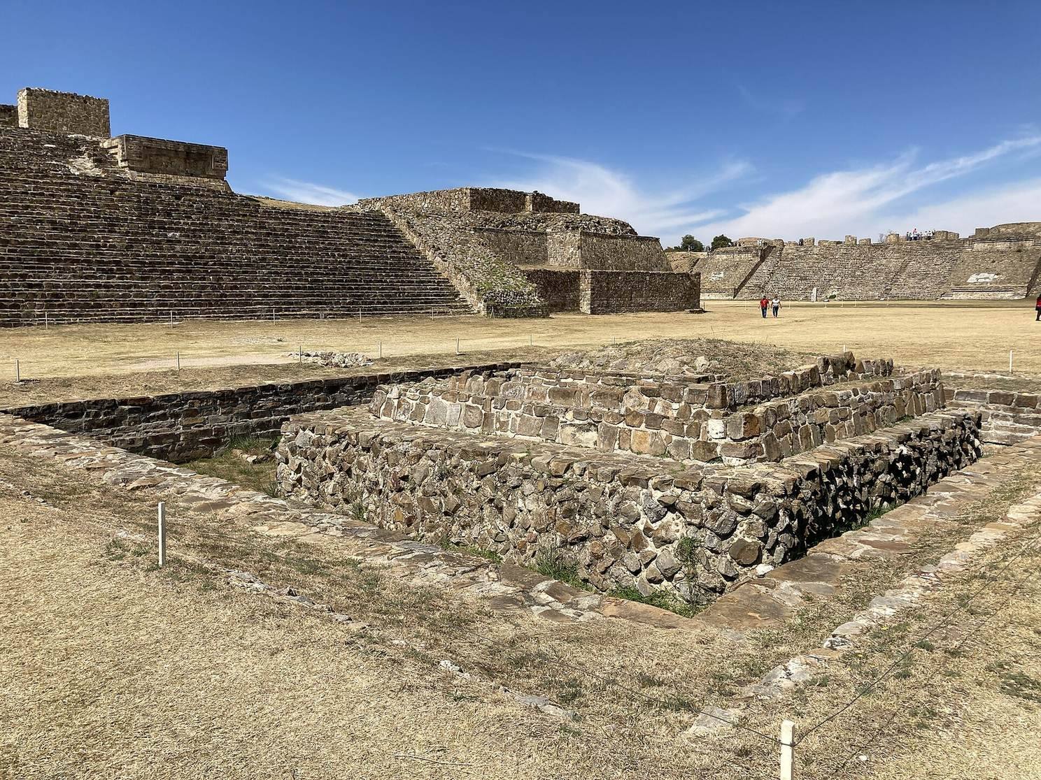
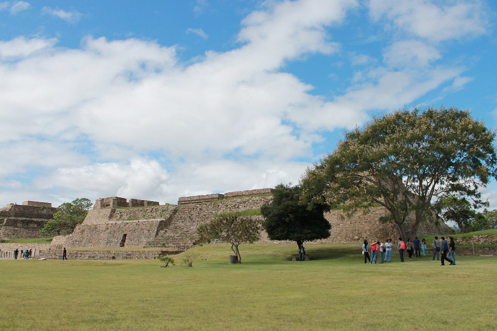
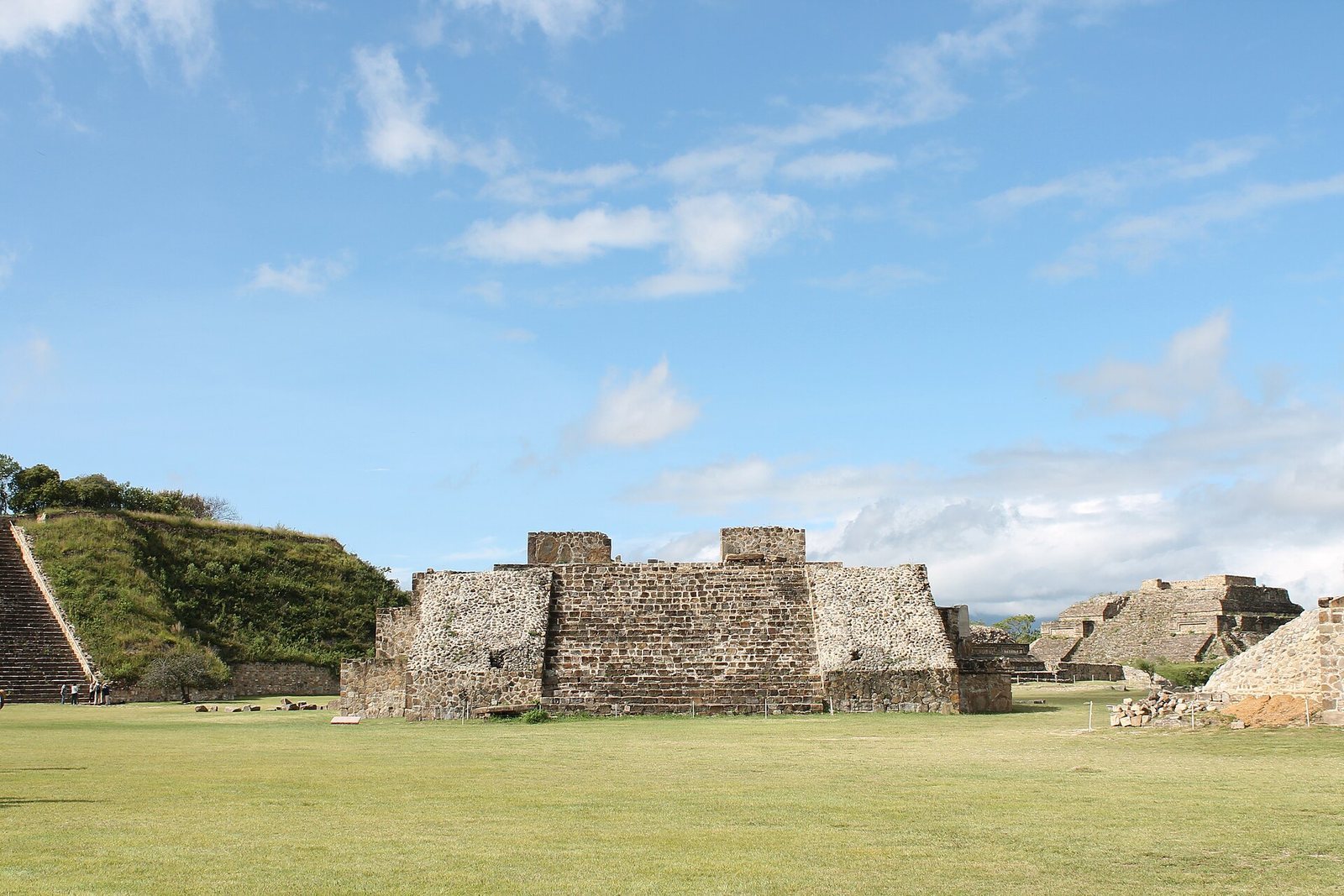
The city occupies a low ridge where branches of the Valley of Oaxaca meet. Its partly excavated civic-ceremonial center stands on a ridge artificially leveled about 1,940 m above sea level and roughly 400 m above the valley floor. Several hundred constructed terraces and about a dozen clusters of mound buildings extend across the ridge and its slopes. The Main Plaza forms a broad, nearly rectangular platform about 300 m long and 150 m wide, with an axis slightly east of northeast. White plaster covered its surface, which could hold the population for public state rituals. Large platforms and stairways mark its northern and southern edges; smaller platforms, including places for temples, elite homes, and ballcourts, line the east and west. A north–south row of mounds occupies the center.
Construction and defenses
Builders cut and leveled the mountain crest and slopes. Many buildings have low profiles and substantial sloping sides, a form that may have suited the region’s earthquake-prone setting. Some platforms comprise several tiers built one above another. Their decoration adapted a design combining a sloping wall with an upright panel, finished in some cases with a paired projecting molding. Earthquakes destroyed some buildings toward the end of the Xoo phase. Defensive walls begun along the northern and western slopes during Monte Albán I reached up to 9 m high and 20 m wide. After AD 800, another wall was constructed atop the South Platform, restricting access from the south. Nearby ruins on the hills of Atzompa and El Gallo are traditionally considered part of the ancient city.
Buildings around the Main Plaza
The Great Ballcourt
Built around 100 BCE, the Great Ballcourt lies north of the eastern platform. Its central court measures about 25 m long, with end areas roughly 7 by 22 m; the full interior length, including those areas, is about 60 m. Excavations indicate that stucco once covered its walls. Players struck the ball with their hips, elbows, and knees, and a thick lime coating on the sloping side walls helped return it to the court. A smaller court stands near Tomb 105, and five ballcourts are known in the archaeological zone.
Building J
Near the center of the Main Plaza, Building J has an unusual arrow-like plan and an alignment unlike that of most other structures. It served as an astronomical observatory, and its orientation and stairway have been associated with observations of Capella. More than 40 large carved slabs set into its walls date to Monte Albán II. They carry place names, sometimes accompanied by other writing, and often show inverted heads. The carvings are interpreted as records of places claimed through conquest or control; one identified case concerns Zapotec conquest in the Cañada de Cuicatlán.
Building P
Building P is a temple platform on one side of the Main Plaza. A narrow, chimney-like chamber runs through its stairway. It may have allowed observers to watch the sun pass directly overhead, an event that occurs twice a year at the site, on May 8 and August 5. Building P and Building J are both linked with astronomical observation.
The Palace
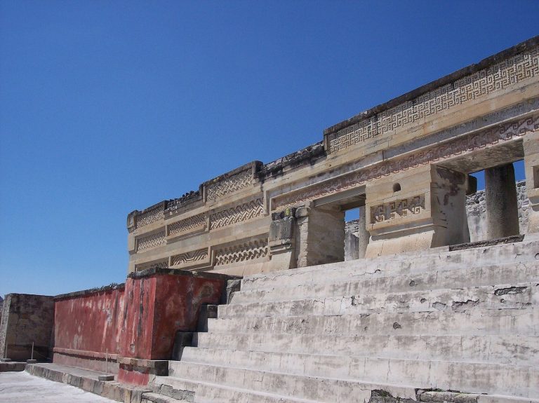
The Palace in the Main Plaza dates approximately to AD 350–800 and may have housed nobles or priests. A narrow entrance leads into the complex, where a small altar stands in a central courtyard. A tunnel beneath the palace may have provided private access to the plaza and nearby areas, but it has not been fully explored. The surviving remains consist mainly of wall foundations, with a rectangular block above the doorway.
Building L and the Danzantes stones
Building L is among Monte Albán’s oldest structures. Rooms, some later enlarged or divided, surrounded its central square courtyard. Carved stones and stone monuments beside the building gave the adjoining space its name, the Plaza of the Danzantes. More than 300 of these stones have been recorded. They show naked men in contorted poses, sometimes with signs of genital mutilation, alongside writing signs and calendar symbols. The figures’ movements led to the name “Dancers,” but they are generally interpreted as captives who were tortured or sacrificed, possibly leaders of rival communities; the interpretation is not certain. Their style has been linked to Olmec influence. Some stones were set horizontally and described as swimmers, while upright examples were called dancers, and their arrangement may have formed a sequence. Some better-preserved carvings are displayed in the site museum.
The South Platform
At the southern end of the Main Plaza, the South Platform is about 40 m high and nearly square, with sides around 140 m long. Built in two tiers during the city’s apogee, approximately 500–800, it has carved stone monuments bearing Zapotec writing signs at its base. Its upper surface contains a courtyard and two pyramid platforms: the principal one lies on the city’s north–south axis, and a smaller one stands to the southeast. Older carved stones were reused at the platform’s corners. A stairway about 40 m wide provides access from the north.
The North Platform residence
An elite residential palace on the North Platform dates approximately to AD 300–600. Rooms of different sizes surround a central courtyard with an altar rather than a tomb. Only the wall foundations remain. The rooms had floors made of lime and sand and painted red; the roofs probably used materials that have since decayed.
Carved monuments and stelae
Stone monuments across the site include examples covered entirely with writing signs, calendar symbols, and numbers. They commemorate events in Monte Albán’s history and provide evidence of Zapotec writing and mathematical and astronomical knowledge. Stela 18, erected between 100 BCE and AD 300, is about 5.8 m high. It may have served as a timekeeping instrument: its shadow marked local noon, while seasonal changes in the shadow helped organize measures of time and space. The largest stela, about 6 m high, is aligned north toward the North Star.
Homes, tombs, paintings, and farming
Residential areas
Elite homes commonly had three or four rooms arranged around an inner courtyard, with a tomb beneath a smaller courtyard reached by stairs. These tombs were lined with stone and often decorated with painted murals. Lower-status residents lived on the mountain slopes in houses built on terraces. Their homes typically had one or two rooms of adobe brick and a partly enclosed central courtyard; many hillside houses were made from materials that did not endure.
Tombs and burial objects
More than 170 tombs were found during Caso’s field seasons, including Tombs 104, 105, and 107. Tomb 7 began as a Zapotec tomb in the Classic period and was reused for Mixtec elite burials during the Postclassic. Its excavation revealed the largest known deposit of Mesoamerican goldwork. Many objects from the tomb are now in museums, including the Regional Museum of Oaxaca.
Painted remains
Remains of mural painting were found inside Mound B and on the outside of Mounds E and H. The buildings may have been painted red, and traces of green, yellow, and white also survive. Better-preserved tomb paintings are known from Tombs 72, 103, 104, 105, 112, 125, and 160.
Terraces and water
Terraces served farming as well as housing. Small dams stored rainwater, while the nearby Atoyac River and fertile valley soils supported the agricultural economy associated with Monte Albán.