Yagul: A Zapotec City-State and Archaeological Site in Oaxaca
Site at a Glance
- Rating
- 4.9
- Popularity
- Very Low
- Country
- Mexico
- Primary era
- Medieval
- Eras represented
- Classical, Medieval
- Civilizations
- Zapotec
- Site type
- City
On this page16 sections
History
Yagul is an archaeological site and former Zapotec city-state near Tlacolula de Matamoros in Oaxaca, Mexico. Built and occupied by the Zapotecs, a major Indigenous civilization of southern Mexico, it was first settled around 500 to 100 BC and later became a prominent Postclassic capital. The site is also known locally as Pueblo Viejo, meaning “Old Village.”
Early occupation and regional development
Yagul’s first known occupation belongs to the Middle and Late Preclassic periods, broad phases of ancient Mesoamerican history that preceded and accompanied the rise of large urban states. Elaborate burials from this period, accompanied by ceramic vessels shaped as human or animal figures, indicate that local elites were increasingly influenced by Monte Albán, the major Zapotec political and urban center in the Valley of Oaxaca.
The wider region had already supported human activity for much longer. Evidence from the surrounding landscape reaches back to at least 3000 BC, including rock paintings at nearby Caballito Blanco. Residential, civic, and ceremonial construction expanded at Yagul around AD 500 to 700, during the Classic period, when major Mesoamerican cities and political centers developed.
Postclassic capital
Most of the visible architecture belongs to the period from AD 1250 to 1521. During this Late Postclassic phase, Yagul served as the capital of a city-state, a politically organized territory governed from a central urban settlement. Its population exceeded 6,000 immediately before the Spanish Conquest.
Yagul’s growth followed the abandonment of Monte Albán around AD 800. As that earlier center declined, communities in the Valley of Oaxaca established themselves in smaller regional centers such as Lambityeco, Mitla, and Yagul. The city continued to be occupied during the Spanish Conquest. Afterward, its population was moved to nearby Tlacolula, where their descendants continue to live.
Archaeology and protection
Archaeological investigation at Yagul expanded through the work of Ignacio Bernal and John Paddock during the 1950s and 1960s. Bernal and the archaeologist Gamio excavated the ceremonial center in 1974, bringing much of the visible core to archaeological attention.
Yagul is cared for by Mexico’s National Institute of Anthropology and History, the federal institution responsible for archaeological research, conservation, and heritage protection. On 13 October 1998, the site was declared one of Mexico’s four Natural Monuments, and the Mexican government designated the Yagul Natural Monument in 1999. The protected area covers 1,076 hectares and is administered by the National Commission of Natural Protected Areas.
In 2010, Yagul became part of the UNESCO World Heritage property Prehistoric Caves of Yagul and Mitla in the Central Valley of Oaxaca, inscribed under criterion (iii). The wider property includes the archaeological site, prehistoric caves, Caballito Blanco, and the surrounding natural landscape.
Remains
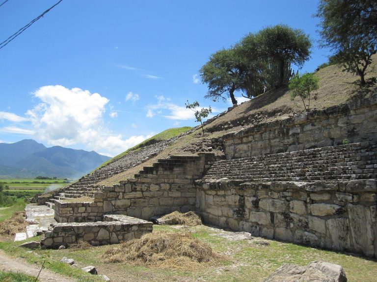
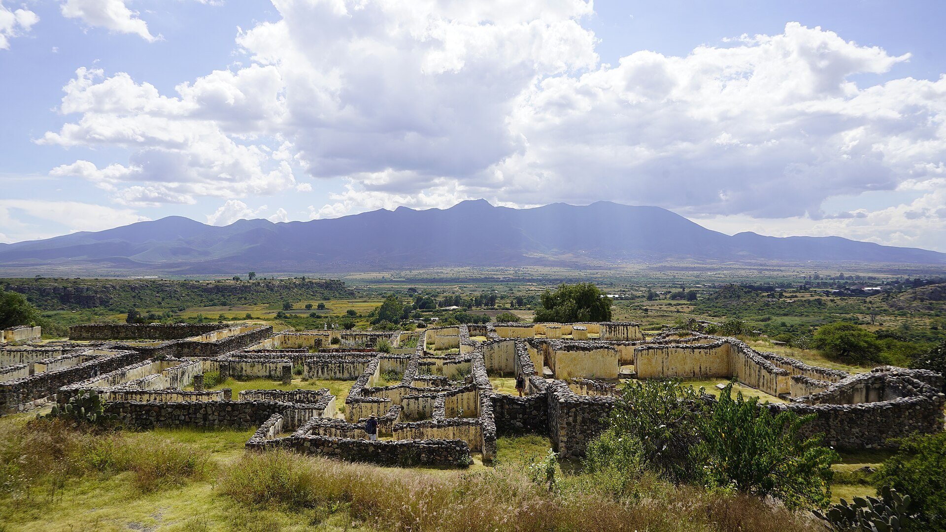
Yagul occupies a volcanic outcrop surrounded by fertile alluvial land in the Tlacolula arm of the Valley of Oaxaca. The Salado River flows south of the site. Its main construction material is river cobble made from volcanic rock, including basalt. The settlement is arranged around a hill and has three principal areas: a fortress, a ceremonial center, and residential zones.
Fortress and residential terraces
The fortress occupies cliffs northeast of the settlement. Natural formations and artificial walls protected it, while lookout points provided views over the Tlacolula Valley. One of the observation points was reached by a narrow bridge. Residential terraces extend south, east, and west of the hill, although many remain unexcavated. Classic-period residences lie northwest of the excavated ceremonial center, while lower-status Postclassic residences are thought to have surrounded the central area.
Ceremonial and elite architecture
Ballcourt
The ceremonial center contains large patios bordered by monumental buildings, a ballcourt, and an elite residential complex. The restored ballcourt runs east to west and is the largest in the Valley of Oaxaca. It measures 47 metres overall, with a central field 30 metres long and 6 metres wide. Built during the Classic period between AD 500 and 700, it was widened between AD 700 and 900. A carved serpent’s head once fixed to the top of its southern wall is now held at the Regional Museum in Oaxaca. Mesoamerican ballcourts were used for a formal game with athletic, social, and religious dimensions.
Palace of the Six Patios
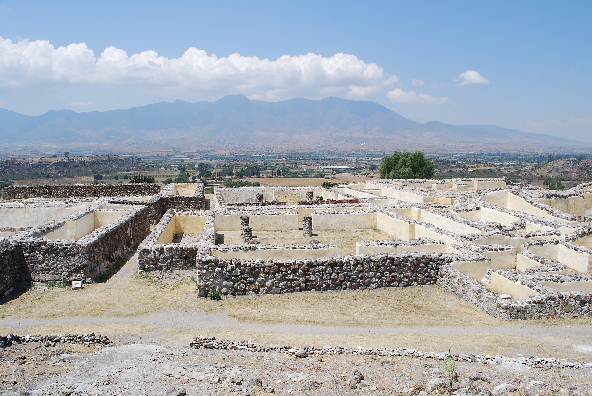
The Palace of the Six Patios is a maze of rooms and passageways formed by three elite compounds. Each compound contains two patios surrounded by rooms. The northern patio in each pair was probably residential, while the southern patio may have served an administrative purpose. Every patio has an entrance to a tomb.
The palace walls have dressed-stone faces and stucco surfaces over cores of rough stone and clay, while the floors are made of red stucco. Patio F opened toward the ballcourt and lower patio complexes and appears to have had a more public role. A low bench in one room may have been used to receive visitors. The complex also included a temple.
Patio 1
Patio 1 is a large open space immediately southeast of the Palace of the Six Patios. Rooms border every side except the south, where a temple stands directly beyond it.
Patio 4 and Tomb 30
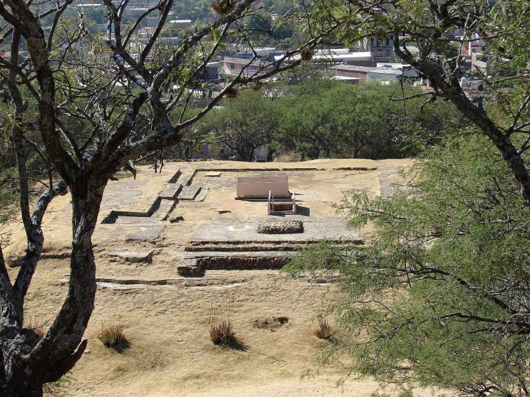
Patio 4 lies southeast of the ballcourt within a temple, patio, and altar complex. Four mounds surround a central altar, and the complex remained in use from at least the Classic period through the Postclassic period. A frog-effigy sculpture stands at the base of the eastern mound.
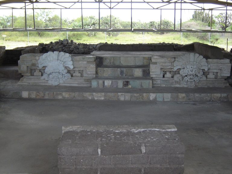
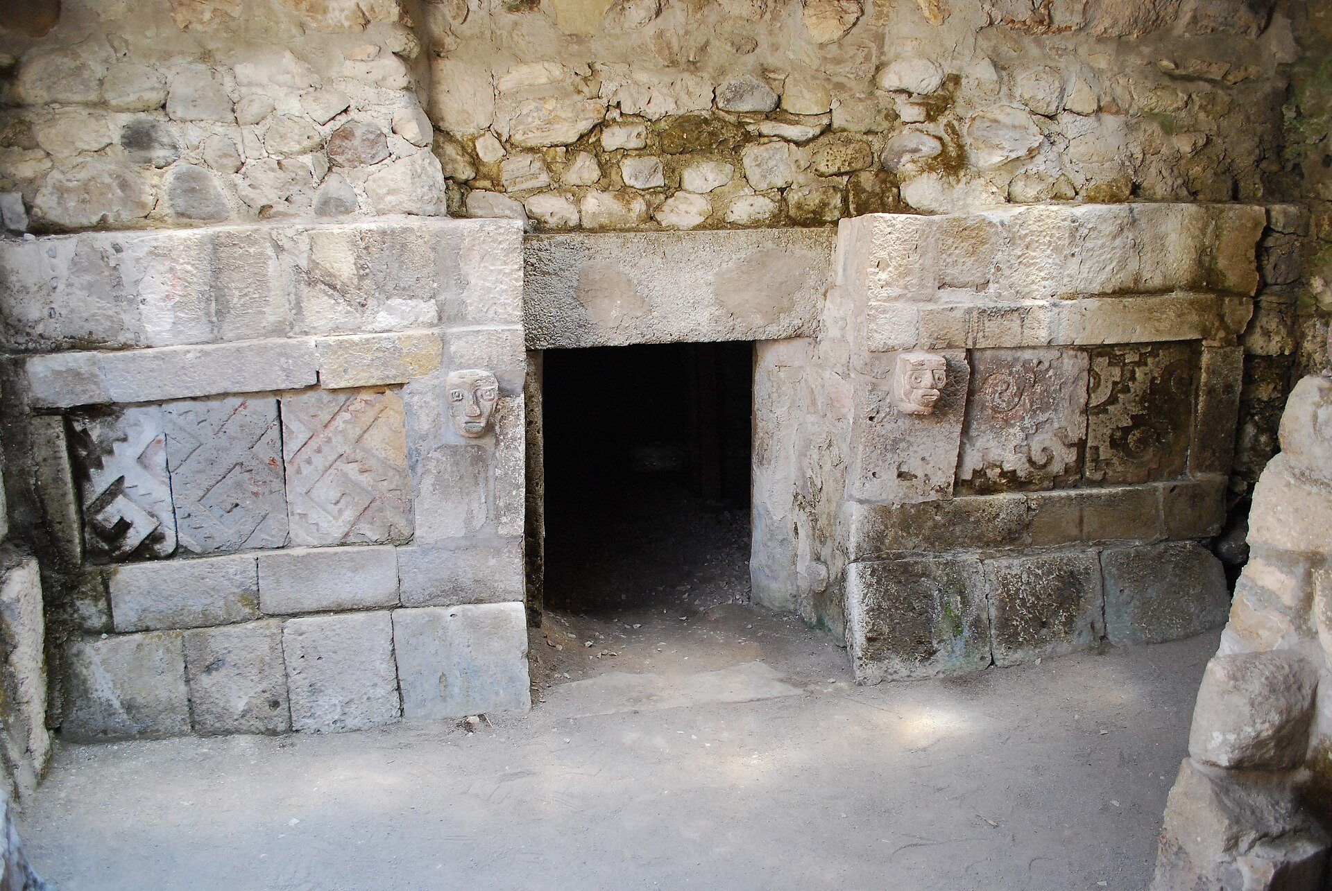
Postclassic Tomb 30 lies beneath Patio 4. It has three chambers with decorated panels. The main chamber has a facade bearing two stone-carved human heads, while its doorway is formed by a stone slab carrying hieroglyphic inscriptions on both sides. Hieroglyphic inscriptions are written signs carved or painted on a surface, and at Yagul they also occur on other tombs and funerary structures.
Administrative and decorated structures
Council Chamber
The Council Chamber is a long, narrow room south of a narrow street, aligned from east to west. Steps from Patio 1 provided its entrance. Two pillars, each 2 metres wide, divide the entrance into three sections. The room was once decorated with stone mosaic. Its non-residential character and the absence of a shrine or temple suggest that it served an administrative function.
Decorated Street
The Decorated Street runs east to west between the Palace of the Six Patios on the north and the Council Chamber on the south. Its southern wall extends for more than 40 metres and carried geometric stone mosaics comparable to those at Mitla, another important pre-Hispanic center in the region.
Building U
Building U stands on an artificial platform in the northern part of Yagul. A tomb lies beneath its floor. The building is reached by a staircase on the south and overlooks much of the settlement.
Tombs and funerary remains
Approximately 30 tombs have been found at Yagul, sometimes arranged in pairs. Some contain hieroglyphic inscriptions. Their placement beneath patios, palaces, and other buildings connects funerary architecture with the organization of the ceremonial and elite areas.