Ricina: An Ancient Roman Town in Italy


Site at a Glance
- Rating
- 4.3
- Popularity
- Low
- Country
- Italy
- Primary era
- Classical
- External website
- Open
- Eras represented
- Classical
- Civilizations
- Roman
- Site type
- City
On this page18 sections
History
Ricina is an ancient Roman town in Italy, at present-day Villa Potenza, a hamlet of Macerata in the Marche. The settlement grew beside an earlier Italic centre, possibly inhabited by the Piceni, the pre-Roman people of the central Adriatic region. Small-scale rescue excavations suggest substantial occupation from the later second century BC, while most of the town’s known urban development belongs to the period from the first century BC to the fourth century AD.
From Italic settlement to municipium
Ricina occupied a favourable position in the Potenza valley. The Potenza River was probably navigable in antiquity, and several roads connected the settlement with inland and coastal communities. The Flaminia Prolaquensis, a branch of the Via Flaminia linking Nuceria Camellaria and Ancona, passed through the area. Other routes included the Via Salaria Gallica, roads to the Roman colony of Potentia at the river mouth, and the road to the municipium of Pausulae. A valley road from Trea to Potentia crossed Ricina and linked it with the coastal port.
By the middle of the first century BC, Ricina had become a municipium, a town incorporated into the Roman state while retaining a degree of local civic administration. Veterans of the Civil Wars were settled there during this period. The town prospered under Augustus and Tiberius, when funerary monuments, inscriptions, an aqueduct, and major public works demonstrate its expanding Roman character. The earliest certain written reference appears in the first century AD, when Pliny the Elder listed Ricina among the principal centres of Picenum. His description led later historians to regard the settlement as older than its earliest direct written evidence.
Imperial expansion and colonial status
Public construction continued during the second century AD. Streets and squares were repaved, and the town’s baths were renovated. Municipal finances may already have been under pressure in the first half of that century, when a curator rei publicae Riciniensium was appointed. This official supervised the finances and administration of the town.
In AD 205, the emperor Septimius Severus elevated Ricina to colonial status and gave it the name Helvia Recina Pertinax. A colonia was a settlement established or reorganized under Roman authority, often involving the settlement of colonists. The new name honoured Publius Helvius Pertinax, the emperor whom Septimius Severus had succeeded in AD 193. An inscription calls Septimius Severus the colony’s founder, probably because he sent new colonists there, and indicates that the town was constructed or, more likely, substantially rebuilt under his rule.
The origin of the name Ricina remains uncertain. A late epigram, rediscovered by Niccolò Peranzoni in the early sixteenth century and later reproduced by Pompeo Compagnoni and the abbé Colucci, connected the name with a temple of Venus Ericina. Venus Ericina was a form of Venus associated with the sanctuary on Mount Eryx in Sicily. Peranzoni, Compagnoni, and Colucci themselves questioned the epigram’s authenticity because its grammar and vocabulary seemed to belong to the Late Empire.
Several other traditions have also shaped the town’s later reputation. Local antiquarians claimed that Ricina was founded by a mythical King Cino, that its inhabitants formed Julius Caesar’s Twelfth Legion, and that it possessed a solid-gold statue of Hadrian, marble squares, and fountains. These claims are undocumented and helped portray Ricina as a “small Rome.”
Christian traditions and destruction
Christianization was traditionally associated with Saint Julian the Hospitaller, who was said to have lived as a hermit beside the Potenza and ferried lepers across the river. Flavianus is identified as Ricina’s first bishop and as a martyr of approximately the third century. Another tradition says that Saint Peter stopped at Ricina while travelling from Dalmatia to Rome and established an early Christian community there, but this claim is also undocumented.
The last recorded bishop of Ricina was Claudius, attested in 410 and later venerated as a saint. He is also regarded as the first bishop of Macerata. Ricina still appeared on the Peutinger Map in or around AD 393, but Gothic invasions in the fourth or fifth century encouraged much of its population to move to hill settlements. This movement contributed to the emergence of the medieval centres of Macerata and Recanati.
The first probable sack was carried out by Ostrogoths under Radagaisus in the early fifth century. During the Gothic War, the sixth-century conflict between the Ostrogothic kingdom and the Byzantine Empire, troops commanded by Teja, the last Ostrogothic king, completely destroyed Ricina. Byzantine forces under Belisarius were then camped at Macerata on the hill above.
Medieval reuse and archaeological investigation
The ruins remained substantial in 1341, when the Rector of the March allowed the Guelphs of Macerata to fortify themselves among them during attacks by the Ghibellines. Macerata’s statutes of 1432 permitted residents to take building material from the ruins, including by demolishing ancient structures. This practice contributed to the town’s near-total destruction.
Excavations began in the nineteenth century, including Servanzi Collio’s work in the baths in 1873. Twentieth-century scholars such as the archaeologists Nereo Alfieri and Giuseppe Tucci further investigated Ricina. Much of the ancient settlement is now obscured by modern urbanization, although these studies revealed intensive building activity, especially during the Imperial period.
Aerial photography and field survey by the Potenza Valley Survey Project of Ghent University, beginning in 2000 and 2001, clarified the town’s general organization. Geophysical surveys carried out by Eastern Atlas in July and October 2013 located and mapped additional subsurface remains. Studies of Roman pottery supplied chronological and functional information, while research on stone architectural decoration improved understanding of the town’s urban development. The archaeological area is publicly managed as a ruin under the archaeological heritage authorities of the Marche.
Remains
Urban layout and public buildings
Ricina occupied a fairly regular, almost rectangular and largely flat area of approximately 22 hectares. A rectangular circuit of walls enclosed the town, although the full extent of the urban fabric has not been exposed. The settlement was organized around a network of streets, with a valley road crossing it from approximately southwest to northeast.
Principal road and street grid
The valley road functioned as the principal decumanus, a major Roman street. Its modern continuation is covered by the SS361. A surviving stretch of basalt paving, discovered in 1963 during the construction of a fuel station, is about 5 metres wide and preserves wheel ruts. Smaller streets joined the main road to create a regular urban grid. A possible northwest to southeast axis may have linked the decumanus with a Roman bridge over the Potenza. Earlier observations placed the bridge a few metres upstream from the present bridge, while the axis passed directly in front of and parallel to the theatre’s stage building.
Forum and possible Capitolium
The forum was probably near the crossing of the principal road and a north to south street, approximately at the centre of the town. North of this central area stands a rectangular building at least 18 by 33 metres. It is oriented northwest to southeast and lies perpendicular to the decumanus. The building may have bordered the forum on its southern side and may have been the principal temple, possibly the town’s Capitolium. A Capitolium was a principal Roman temple traditionally associated with Jupiter, Juno, and Minerva, although that identification at Ricina remains hypothetical.
Commercial and storage buildings
On the northeast side of the principal road, a portico opened onto rooms identified as shops and storerooms. Crop marks and other field traces also reveal a row of similar rectangular rooms beside a corridor or portico. These spaces may have been tabernae, commercial or workshop rooms opening onto a street, or an horreum, a storage building for goods or agricultural produce. Numerous fragments of dolia and amphorae support the storage-building interpretation.
Baths and water installations
Public baths were identified and excavated in 1873. They may be the baths mentioned in an inscription concerning the inheritance of Tuscilio Nominato. Under Trajan, that inheritance was used to repave squares and streets and to renovate a balneum, or bath building. A large cistern, which may have served a public facility or bathing complex, and possible public or bathing installations remain visible in the agricultural area.
Theatre and amphitheatre
Roman theatre
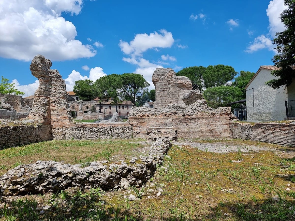
The theatre, built in the second century AD, is the principal surviving monument above ground. Its artificially raised cavea, the semicircular seating area, was constructed on otherwise flat ground and probably reached about 17 metres in height. The theatre measures approximately 75.45 metres in width and 62.55 metres in length, while the cavea is also given as approximately 71.80 metres in diameter.
Three seating tiers accommodated about 2,000 spectators. The building probably had marble surfaces, many of which were reused during the Middle Ages, and included Doric and Corinthian capitals. The orchestra, the space between the audience and the stage, the cavea, and the brick stage facade remain recognizable. The theatre is now surrounded by the modern houses of Villa Potenza.
Amphitheatre
Aerial photography in May 2009 identified clear traces of an amphitheatre east of the theatre. The amphitheatre may originally have been connected with the theatre and may therefore have formed part of a single architectural complex.
Domestic, extramural, and funerary areas
Private houses and settlements beyond the walls
Several large domus, or private houses, are visible through crop marks. Numerous mosaic pavements, often polychrome, belonged mainly to these residences. Habitation also extended outside the walls. Evidence occurs southwest of the presumed southwest gate along the road to Trea, while crop marks and a broad scatter of Roman material on the northeast side indicate another extramural settlement.
Necropolises and funerary monuments
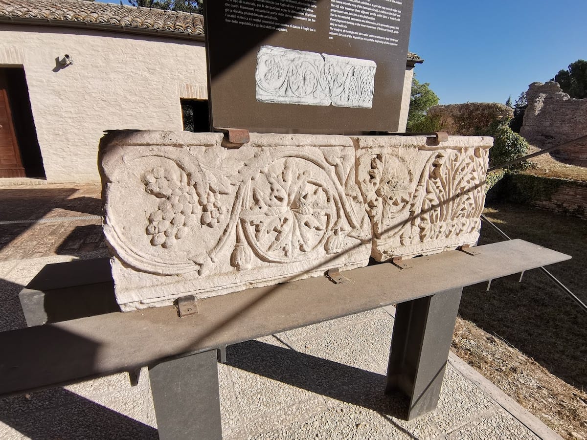
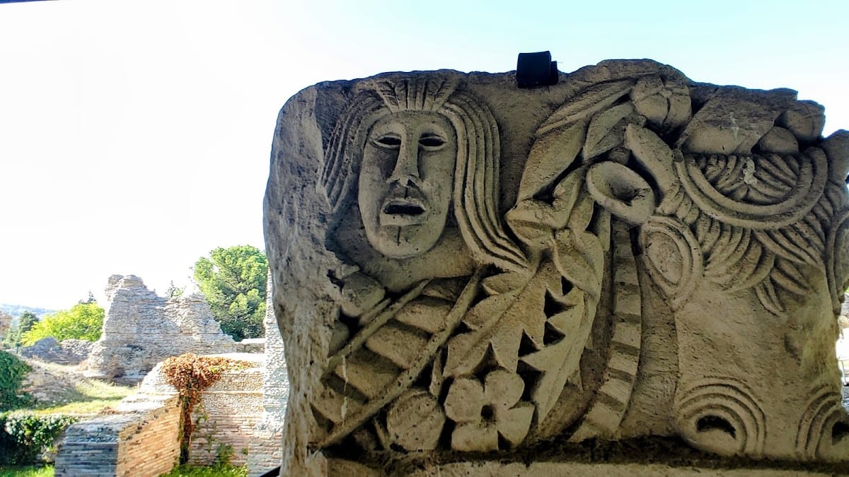
Necropolises lay at opposite ends of the town. Burials and remains of funerary monuments appeared west of the settlement along the state road. A second concentration of funerary material lay very close to the Potenza, where carved stone blocks were recovered from the river. Their forms allowed at least six funerary monuments of different types to be reconstructed.
In 1966 and 1967, the sculptor Valeriano Trubbiani discovered 150 mostly carved and decorated stone blocks in the riverbed. They had probably been reused during the medieval period as part of a river embankment. The blocks are now kept beneath a covered structure near the theatre, where they preserve evidence of the town’s funerary architecture.
Inscriptions, sculpture, and religious objects
Roman material from Ricina is preserved in the civic collections of Macerata. It includes lamps dating from the late first century BC to the second century AD, a rectangular bronze seal from the early Imperial period, an octagonal limestone capital, and a limestone slab bearing fragments of a monumental first-century AD inscription. The inscription probably records a curator fani, an official connected with the supervision of a temple.
The collections also contain eight Latin inscriptions, including five from Ricina and two of uncertain provenance, together with a brick stamp and several sculptural fragments. Ricina-related material includes an inscription associated with the freedwoman Octavia Primitiva, a fourth- or fifth-century Christian inscription, and a second-century funerary inscription for Vettius Ianuarius. Other pieces mention the Velina tribe and a freedman of the Cincii who was a sevir Augustalis, a municipal priest associated with the imperial cult and often drawn from the freedman class. A late-first-century-BC portrait bust represents a freedman of the Clodian family, while a limestone stele names members of the Annian family and another funerary plaque commemorates Marcus Tedius Sabinus.
A marble altar dedicated to Mercury, dating from the early Imperial period, is preserved in the lapidarium of the Palazzo Comunale in Macerata. Another inscription records the construction of baths and roads using Tuscilio Nominato’s inheritance. Because Trajan is called divus, or deified, the inscription belongs to the period after his deification, under Hadrian. A reconstructed inscription dated to AD 205 records the dedication of the colony Helvia Recina to Septimius Severus.
Two marble divine heads, probably decorative architectural elements, may have belonged to buildings at Ricina. One may represent a bearded Heracles crowned with vine leaves and may have formed part of a trapezophoron, a decorated support for a table or altar. The other depicts a mature, bearded Dionysus and may originally have belonged to a double herm with a youthful Dionysus. Both are broadly dated to the first or second century AD.
A small seated female deity in a high-waisted tunic is identified as Fortuna and was intended for domestic worship. A sub-ogival terracotta roof ornament, or antefix, retains traces of white slip and depicts a beardless Pan with flowing hair and horns. It is attributed to a Tarentine production of the early third century BC.
A strigilated marble sarcophagus formerly kept at the entrance of the Mozzi-Borgetti Municipal Library has a frontal relief of a praying figure between two standing figures, with Corinthian columns at the ends. Its provenance from Ricina has not been established.