Archaeological site of Fontaines Salées: A Prehistoric, Celtic, and Gallo-Roman Spring Complex in France

Site at a Glance
- Rating
- 4.4
- Popularity
- Low
- Country
- France
- Primary era
- Classical
- External website
- Open
- Eras represented
- Stone Age, Bronze Age, Iron Age, Classical
- Civilizations
- Celtic, Roman
- Site type
- Economic
- Remains
- Production Complex
On this page14 sections
History
The Archaeological site of Fontaines Salées in France is a spring complex whose earliest installations were built by Neolithic communities around 2309–2223 BC. Extending across Foissy-lès-Vézelay and the southern part of Saint-Père near Vézelay, it preserves evidence of salt production, bathing, religious activity, burial, and settlement over more than four millennia. The springs were used from the Final Neolithic through the Middle Ages, and the site later became a Celtic and Gallo-Roman sanctuary with thermal facilities.
Neolithic and Bronze Age use
The first spring-capture installations date from the Final Neolithic. Radiocarbon dating and tree-ring analysis carried out in 2001 placed their construction between approximately 2309 and 2223 BC. The place was formerly known as the “salt well,” reflecting the importance of its mineralized water. The early wells were later abandoned after the Early Bronze Age and became filled with flood deposits carried by the Cure River. Some were reused at the end of the Bronze Age, possibly for watering livestock.
The springs and their surroundings also acquired funerary uses. Cremation burials belong broadly to the Late Bronze Age, while activity around 900 BC included the placement of burials at the nearby Poron height. These remains indicate that the area continued to hold more than a purely practical importance after the earliest wells had ceased to function.
Iron Age production and Celtic worship
During the Iron Age, people produced salt by heating brine until the water evaporated. Burning fuelwood also generated a large amount of potash, so the installations may have supported purposes beyond salt making. Salt provided a way to preserve meat and fish, while nearby ironworking and commercial activity helped maintain use of the area. Sixteen hollowed oak trunks found in 1942 were dated to the Iron Age and formed part of nineteen saltwater-capture wells.
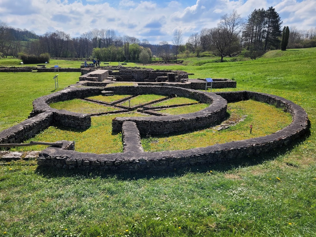
From the Final La Tène period through the fifth century AD, the area between the village and the Saint-Jean-Baptiste chapel was used extensively, as shown by ceramic and metal finds. A circular Celtic sanctuary was established around one of the springs, where the goddess Sulis was worshipped. During Roman rule, this religious tradition developed into a sanctuary dedicated to Sulis-Minerva, a combined Celtic and Roman identification linking Sulis with Minerva, the Roman goddess associated with wisdom, crafts, and strategic warfare.
Roman sanctuary and baths
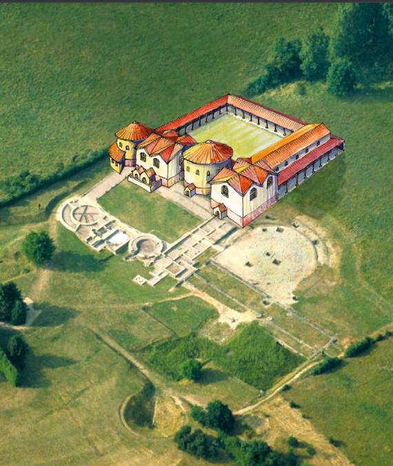
Following the Roman conquest of Gaul in 52 BC, Fontaines Salées developed as a Gallo-Roman sanctuary and thermal establishment. The baths grew during the first and second centuries AD, gaining mixed bathing facilities, heating installations, and a palaestra, an exercise area associated with Roman bathing complexes. Their unusual thermal establishment drew users from relatively distant areas. The sanctuary continued to attract attention because the site stood beside an important road serving the mining and ironworking center of Les Ferrières. A new Roman sanctuary was built beside the earlier Celtic one.
Destruction, craft activity, and later taxation
In the second half of the third century, Alamannic invasions devastated the surrounding region. The thermal establishment was looted and destroyed, although salt exploitation continued. Parts of the ruins were adapted by small-scale salt workers, who reduced brine, prepared salt-preserved foods, and processed hides. After regional stability returned in the fourth century, local inhabitants occupied the site again. The sacred character of the water remained recognized through a well beside a workshop, enclosed symbolically by a ring of pebbles.
A large rural estate identified in aerial photographs was known from the fourth century as Vercellacus, apparently a name derived from its owner. It was later transmitted as a Carolingian villa, meaning a substantial rural estate or landed administrative center. Salt extraction ended after the royal salt tax, or gabelle, was introduced intermittently in the twelfth century and definitively in the thirteenth. Local people nevertheless continued to sell salt illegally. In the fifteenth century, the monks of Vézelay established a salt store and closely supervised its revenues.
Royal authorities and monastic tax farmers punished illegal salt producers and traders, known as faux sauniers, by sending them to the galleys or imposing the death penalty. Thick layers of backfill progressively buried the site until the eighteenth century. During the seventeenth and eighteenth centuries, royal administration also sealed the springs, and Fontaines Salées subsequently fell into obscurity.
Excavation and preservation
A mammoth tusk found at the nearby Poron height in 1930 preceded the archaeological investigations. René Louis, a medieval historian, began excavating in September 1934 while searching the Cure valley for the location of the legendary Battle of Vaubeton, described in the medieval French heroic poem known as the chanson de geste of Girart de Roussillon. Working with Robert Dauvergne and Bernard Lacroix, he uncovered the Gallo-Roman baths and older prehistoric remains. Major excavation campaigns continued, including work between 1942 and 1961.
The site was classified as a French historic monument by orders dated 25 January 1936 and 14 January 1942. It is regarded as one of Burgundy’s major archaeological sites. A visitor and archaeological interpretation building designed under the direction of architect Jean-Paul Philippon was constructed in 2016 and opened in 2017. It presents the history and geology of the springs, the archaeological investigations, and the finds recovered from the site.
Remains
Springs and geological setting
Fontaines Salées lies at the northern edge of the Morvan, on the left bank of the Cure, about 40 metres from the riverbank and near a ford on the former road between Autun and Auxerre via Quarré-les-Tombes. The river runs here from south-southeast toward north-northwest. The springs emerge where the Morvan’s crystalline rocks meet the Lower Jurassic sedimentary margin of the Paris Basin. Two major faults intersect in this area: the Morvan fault follows the river, while the Fontaines Salées fault shifts it toward the northeast and has an average displacement of about 15 metres toward the northwest.
Deep groundwater rises through saline clays before encountering the Morvan granite. The resulting water contains chloride and sodium and is mineralized at approximately 9–12 grams per litre. Its temperature is about 15.2–16 degrees C. The water is slightly radioactive and accompanied by gases composed mainly of nitrogen, with recorded proportions of 91.7 percent nitrogen, 6.42 percent helium, and 1.23 percent carbon dioxide, together with argon and other gases. One well produces gas intermittently and is surrounded by a dressed-stone rim.
Prehistoric wells and wooden installations
The prehistoric wells were dug into sandy ground that had previously been used as a sand quarry. The first was found during sand extraction in 1933. Eighteen wells dating to the first millennium BC were uncovered between 1942 and 1961. They are vertical and cylindrical, generally 1–1.4 metres deep and about 1.5 metres across, and were cut into the sand. Some served as collecting pits where brine accumulated after filtering through the sand, while others drew water from below the sand through naturally pressurized upward-flowing wells.
Sixteen hollowed oak trunks found in 1942 formed part of the water-supply and salt-capture system. Radiocarbon analysis dates them to the Iron Age, and their exceptional preservation allows their construction to be examined closely. They were used in nineteen saltwater-capture wells. Their size suggests that the trees had been preserved for several generations before being felled. Hollowing the trunks was a collective task carried out with copper or bronze axes, and two different working methods were used by two groups.
Poron burials and earlier finds
Five burials were discovered at Poron between 1937 and 1939, at depths of 50–60 centimetres. They appear to have formed three rows, with roughly two metres between graves, and may represent part of a larger urn field. One complete funerary urn contained a smaller urn that could pass through its neck, a bowl, two bronze bracelets, and a Neolithic flint arrowhead with a tang and barbs. The arrowhead was cracked in a manner consistent with exposure to fire, linking it to the cremation context.
The Poron area also yielded a mammoth tusk at a depth of one metre, together with bones and fragments of dark pottery in the soil above the sand. An intact Gallo-Roman roof tile, known as an imbrex, was found there in 1934. These discoveries add prehistoric and Roman material to the archaeological evidence surrounding the springs.
Roman baths and sanctuaries
Thermal establishment
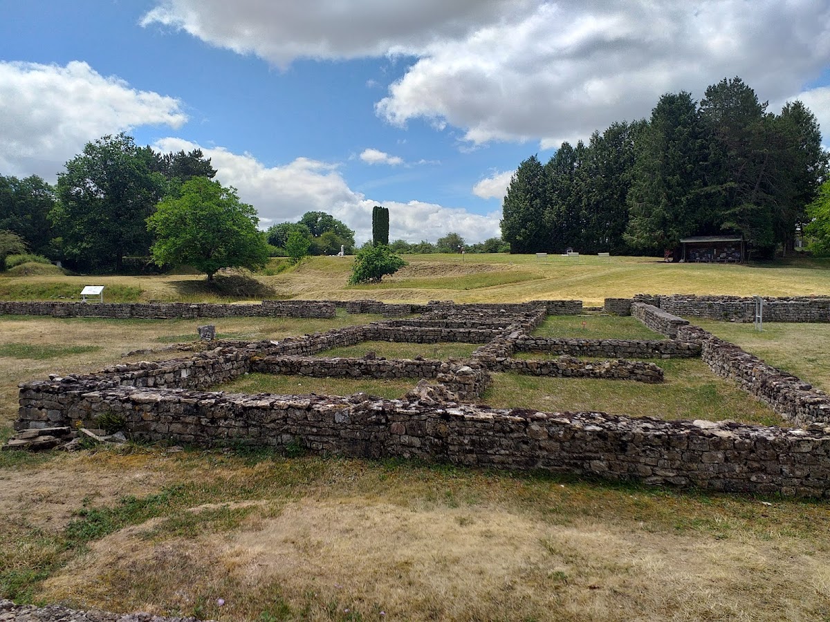
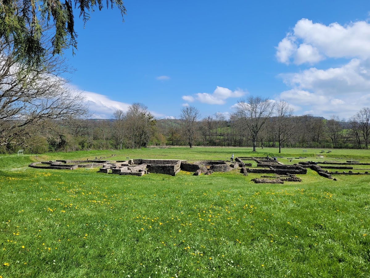
The earliest known thermal installations date from the first century AD and were relatively simple. Enlargements during that century added a changing room and facilities for steam or warm bathing. In the second century, the baths became a mixed establishment for men and women, with a heating system and a palaestra. The thermal complex was later looted and destroyed during the third-century invasions, after which parts of its fabric were adapted for salt processing and other crafts.
Religious complex
The early Roman sanctuary contained a saltwater-capture installation and a sacred basin at the center of an area enclosed by a circular open gallery. A later Roman sanctuary was attached to the earlier Celtic sanctuary. The surviving remains therefore preserve successive religious arrangements around the springs, connecting the Celtic worship of Sulis with the Roman-period veneration of Sulis-Minerva.
Later workshops and reoccupation
After the destruction of the baths, the adapted areas supported brine reduction, the preparation of preserved foods, and hide processing. These artisanal installations produced approximately 250 coins bearing portraits of the Roman emperors Constance II and Decius. Following fourth-century reoccupation, a well beside a workshop was enclosed by a symbolic boundary of pebbles. The thermal complex may at this stage have received freshwater from sources that have not been located, while the earlier prehistoric wells had been buried by deposits carried from the Cure.