Mothia (Motya): An Ancient Phoenician City in Sicily
Site at a Glance
- Rating
- 4.6
- Popularity
- Medium
- Country
- Italy
- Primary era
- Classical
- External website
- Open
- Eras represented
- Iron Age, Classical
- Civilizations
- Carthaginian, Phoenician
- Site type
- City
On this page26 sections
History
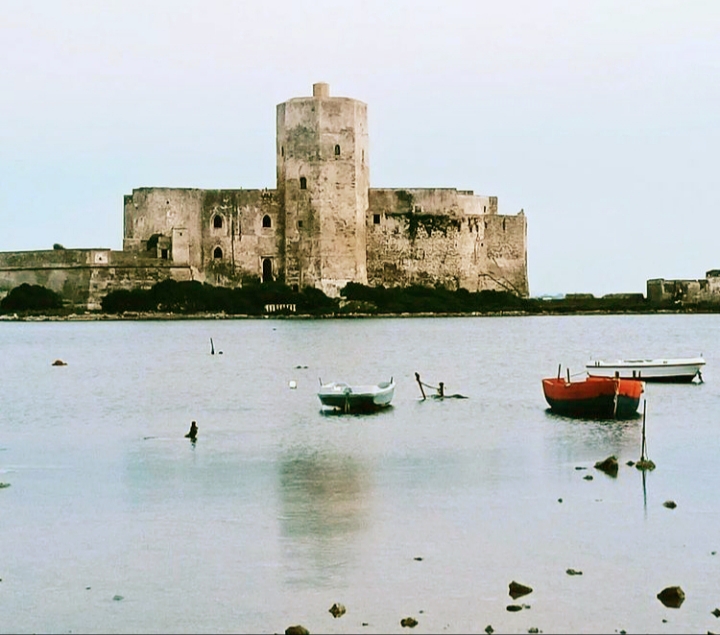
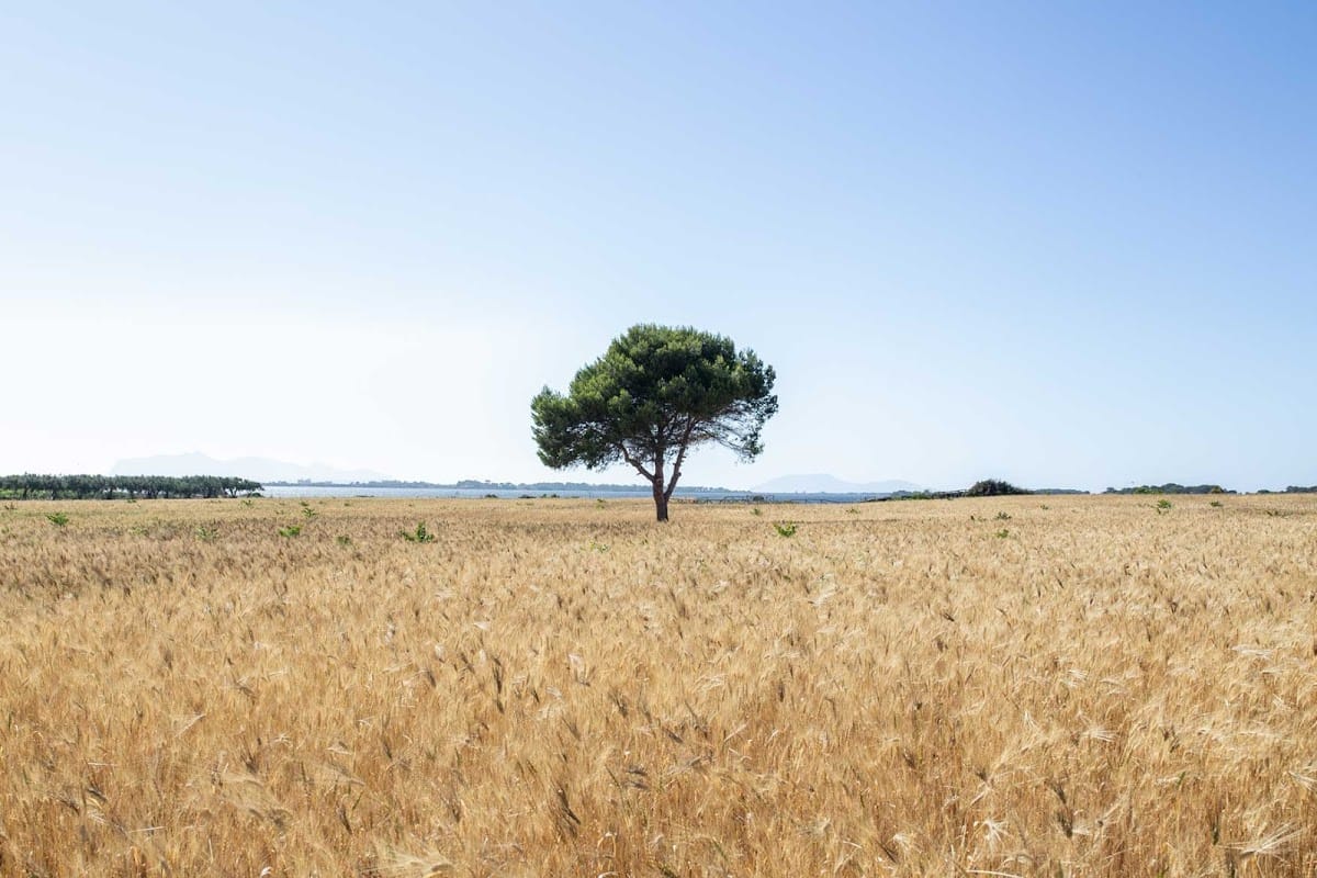
Mothia (Motya), also called Mozia, is an ancient Phoenician city on San Pantaleo Island in Italy, near Marsala, founded in the eighth century BC during the Phoenician period. The island lies in the Stagnone Lagoon off western Sicily, about 1 kilometre from the mainland. Phoenicians were maritime communities from the Levant who established trading settlements across the Mediterranean. Mothia became a prosperous port and one of the principal Carthaginian strongholds in Sicily, although the precise nature of its political dependence on Carthage remains uncertain.
Early settlement and Phoenician expansion
San Pantaleo Island had been occupied during a prehistoric or protohistoric phase, and settlement was established by the end of the eleventh century BC. Phoenician settlement and the foundation of the city are generally placed in the eighth century BC. The earliest excavated levels in the Kothon area date to the second quarter of that century.
At first, Phoenician sailors used the island as a landing place, commercial station, and base for western Mediterranean trade. Its position within the lagoon offered natural protection, and its form was regarded as comparable to that of Tyre, the major Phoenician city on the Levantine coast. By about 650 BC, Mothia had developed into a thriving port connected with communities across the central and western Mediterranean.
Greek colonization expanded in Sicily from the middle of the eighth century BC. In response, Phoenician settlement became concentrated at Mothia, Soluntum, and Panormus. Mothia’s closeness to Carthage and its position on routes toward North Africa strengthened its commercial and military value. Its fortifications may have been built or reinforced in response to Greek expeditions into western Sicily during the sixth century BC.
The second half of the sixth century BC brought a major phase of urban monumentalization. Fortifications, port installations, sanctuaries, the Kothon, and the artificial road linking the island with the mainland were constructed or substantially developed during this period. The Kothon was long understood as an inner harbour, but archaeological investigation has identified it as a sacred freshwater pool associated with nearby temples.
The name and cultural identity of Mothia
The ancient name appears in Punic coin legends in forms transcribed as Mtw, mṭwʾ, or hmṭwʾ. Its meaning is uncertain. Proposed interpretations connect it with spinning or wool working, while Greek tradition associated the name with a woman called Motya who was linked to the myths of Heracles. The Greek forms Motye and Motya were recorded by Hecataeus of Miletus, an early Greek historian and geographer, and by the historians Thucydides and Diodorus Siculus.
Mothia’s culture developed within a Phoenician world while remaining closely involved with Greek Sicily and Carthage. The city’s sanctuaries, imported objects, artistic works, burial customs, and later sculpture reflect these overlapping connections. This mixture is especially clear in the remains of the religious precincts and in marble statues associated with the city’s final centuries.
Wars with Syracuse and the destruction of 397 BC
Mothia was drawn into the conflicts between Carthage and the Greek cities of Sicily. In 409 BC, Hannibal Mago sheltered his fleet in the gulf around the island while advancing against Selinus. In 407 BC, Mothia and Panormus became permanent stations for the Carthaginian fleet during the expedition led by Hamilcar. The Syracusan exile Hermocrates later devastated the territories of Mothia and Panormus.
Dionysius I, the tyrant of Syracuse and a major Greek military ruler in Sicily, attacked Mothia in 397 BC as part of Syracuse’s war against Carthaginian power in western Sicily. The inhabitants cut the causeway to the mainland and resisted from the walls, streets, and houses. The Syracusans nevertheless captured the city after a siege in which they employed military engines, including an early large-scale catapult.
Diodorus Siculus, a Greek historian of the first century BC, provides the principal surviving narrative of the siege. According to his account, the population was massacred and the city destroyed. Dionysius installed a garrison under an officer named Biton, while his brother Leptines used Mothia as a naval base. In 396 BC, the Carthaginian general Himilcon recovered the city, but Mothia did not regain its former importance. Himilcon founded or developed Lilybaeum on the mainland promontory and transferred the remaining inhabitants there.
Later occupation and changing use
Archaeological evidence indicates that activity continued after the destruction of 397 BC. Isolated Hellenistic and Roman villas have been identified, and a house discovered in 2006 contained cooking vessels, Phoenician-style pottery, altars, and looms associated with a prosperous population later than the traditional account of the city’s destruction. The tofet continued in use until approximately the third century BC.
After the First Punic War ended in 241 BC, Sicily came under Roman rule and Mothia was eclipsed by Lilybaeum. The island was probably largely abandoned after the Roman conquest of Sicily. In the later Roman period, parts of the former Kothon were adapted for fish farming and salt production.
During the eleventh century, Norman rulers granted the island to the Abbey of Santa Maria della Grotta at Marsala. Basilian monks from Palermo settled there and called it San Pantaleo, dedicating the island to the saint associated with their religious order. In the second half of the sixteenth century, the island passed with the monasteries of Palermo and Marsala to the Jesuits.
Rediscovery and archaeological investigation
The identification of San Pantaleo with ancient Mothia was first proposed by the German traveller and scholar Filippo Cluverius in the seventeenth century. Eighteenth-century antiquarians described visible remains, and Innocenzo Coglitore identified the site definitively with ancient Mothia in 1883.
In 1792, the island was granted as a fief to the notary Rosario Alagna, who received the title Baron of Mothia. Under his patronage, early excavations began with authorization from the custodians of western Sicilian antiquities. In 1793, Alagna recovered a sculptural group showing two lions attacking a bull. The group is now displayed in the island museum.
In 1806, ownership passed to small landowners, who cultivated the island mainly as a vineyard. Viticulture remains active. Investigations in 1865, 1869, and 1872 were poorly documented, and Heinrich Schliemann excavated at Mothia without result in October 1875.
Joseph Whitaker, an archaeologist and heir to an English family enriched through Marsala wine production, purchased the entire island in the early twentieth century. He directed the first major systematic excavations from 1906 to 1929, established the museum, and arranged and protected the exposed areas. His campaigns revealed the Cappiddazzu sanctuary, part of the Archaic necropolis, the House of the Mosaics, the tofet, the North and South Gates, and the Casermetta. Pirro Marconi completed the excavation of Cappiddazzu in 1930.
Further work followed from 1955, when an English expedition from the University of Leeds, directed by Benedikt Isserlin and involving Pierre Cintas, investigated the North Gate, South Gate, and Kothon. The expedition also exposed a prehistoric hut in the Cappiddazzu area. From 1964, the University of Rome La Sapienza, under Sabatino Moscati and in cooperation with the local archaeological authority directed by Vincenzo Tusa, investigated Cappiddazzu, the tofet, the industrial area south of the Archaic necropolis, and the settlement.
From 1971, the island belonged to the Giuseppe Whitaker Foundation. Excavations under Antonia Ciasca concentrated especially on the city walls from 1974, while campaigns directed by Gioacchino Falsone and Antonella Spanò Giammellaro investigated the settlement between Cappiddazzu and the North Gate from 1977. Later work examined the House of the Mosaics, the House of the Amphorae, and Zone B.
Between 2002 and 2012, excavations by La Sapienza under Lorenzo Nigro substantially revised the understanding of Mothia. Six areas were investigated, including the Kothon and its temples, the western and eastern slopes of the acropolis, the western gate and fortress, the tofet, and residential and industrial quarters. Underwater archaeology began in 2005 under Sebastiano Tusa of the Superintendency of the Sea. Investigations along the submerged road identified structures interpreted as landing quays or embankments. Work and conservation at the tofet resumed in 2009, revealing its sanctuary entrance and a connected cultic space.
The Giuseppe Whitaker Foundation owns and manages Mothia. The Whitaker Museum preserves archaeological material from the island, including the Motya Charioteer and the sculptural group of two lions attacking a bull. In 2006, Mothia and ancient Lilybaeum were placed on Italy’s tentative list for UNESCO World Heritage designation as Mothia Island and Lilybaeum: The Phoenician-Punic Civilization in Italy.
Remains
Mothia occupied most of San Pantaleo Island, whose archaeological area covers about 650,000 square metres. The island measures approximately 850 metres from north to south and 750 metres from east to west. Its walls followed a circuit of about 2.5 kilometres and originally enclosed the whole island. An elongated southern elevation rises 6 to 7 metres above sea level and was probably the acropolis, or fortified elevated centre. Lower ground of about 2 metres surrounds it, including the western Kothon area, while a further elevation of 5 to 6 metres in the north contains the Cappiddazzu sanctuary.
City plan and fortifications
The central settlement had a fairly regular street grid. Long streets ran approximately northeast to southwest and crossed at right angles. Residential quarters extended across much of the centre and may have included gardens and cultivated plots. Buildings along the beaches followed the shoreline rather than the central grid, and a possible ring road connected the centre with peripheral districts. Workshops and other industrial installations occupied the northern and eastern coastal zones, while a district near the Kothon probably contained shipyards or warehouses. The Archaic necropolis and tofet lay on the northern periphery, and the House of the Mosaics occupied the southern coast.
City walls
The city wall stood on a soft limestone shelf about 2 to 3 metres above the narrow beach. Surviving sections are concentrated on the southeast, east, and north sides and represent several construction and repair phases following broadly the same line. The earliest major phase, dated to about 550 to 520 BC, used small-stone masonry, mud mortar, internal fill, and upper courses of greyish mudbrick. The wall was about 1 to 1.1 metres thick and included rectangular two-room towers measuring about 8 by 5.5 metres, spaced at intervals of roughly 20 to 23 metres.
Between about 520 and 480 BC, a foundation of large limestone blocks was added, rising about 1.5 metres. Reddish-brown mudbrick covered with lime formed the upper parts, and the North Gate was strengthened by two projecting towers. A third phase, dated to about 480 to 450 BC, added projecting rectangular towers, including examples with side staircases made from carefully cut local sandstone slabs. The final major phase, from about 450 to 397 BC, produced walls as much as 5 to 5.2 metres thick. Large square towers, including the Eastern Tower, South Tower, and Western Fortress, stood at changes in direction. Some wall bases survive more than 5 metres high, together with sections of their mudbrick superstructure.
North Gate and mainland road
The North Gate consisted of three successive gateways set about 22 metres apart. Each had two openings divided by a central wall. The outer gateway is the best preserved and may have carried the sculptural group of two felines attacking a bull as a crowning frieze. Three successive road surfaces lay outside the gate. The latest was about 10 metres wide and paved with large limestone slabs marked by wheel ruts, with adjoining pebble strips that may have served pedestrians. Four earlier pebble surfaces lay inside the gate.
The artificial road from the North Gate to the Birgi promontory on the mainland was about 1.7 kilometres long and 7 metres wide, sufficient for two carts to pass side by side. It rested on a foundation about 12.5 metres wide and was surfaced with irregular stone slabs. Low protective walls, about 45 centimetres high, bordered the road. Built around the middle of the sixth century BC, it was associated with the relocation of the necropolis to Birgi. Rising sea levels have left part of the road submerged. Near the modern shoreline, a pebble-paved area and submerged squared-block structures may represent a small harbour or quay. A widened platform about 500 metres from the North Gate measured approximately 10 by 14 metres and may have served as a resting place or the base of a small building.
Sanctuaries and sacred spaces
Cappiddazzu sanctuary
The Cappiddazzu sanctuary lies inside the walls near the North Gate. Its earliest phase, at the beginning of the seventh century BC, included shallow pits cut into rock and containing ovine and bovine bones, probably from sacrifices. A first building with rough-stone walls and a small pit or well followed in the second half of the seventh century BC. In the fifth century BC, an ashlar building with architectural fragments including Egyptian-gola anta capitals was constructed. It was probably destroyed in 397 BC, and some of its materials were reused in the foundations of a later rebuilding.
The best-preserved remains belong to a fourth-century BC reconstruction. This large tripartite building stood within an enclosure measuring about 27.4 by 35.4 metres. In front of it was a rectangular stone slab with one large central hole and two half-holes at the sides, probably designed to hold three conical betyls, sacred stones understood to represent or embody deities. The sanctuary also preserves an oval cistern, plaster fragments, and floors from several periods. Later interventions date from the first century BC to the fifth century AD. A small Byzantine basilica once stood there but was removed during early twentieth-century excavations.
Kothon and temple complex
The Kothon is a rectangular sacred pool measuring approximately 52.5 by 35.7 metres. It was cut into the rock to a maximum depth of about 2.5 metres and enclosed by a wall of carved limestone blocks. A drain led toward the sea. Seven calcarenite blocks set into the marl connected the pool with freshwater springs and the water table. The ancient sea level was about 1 metre lower than today, making the basin unsuitable for large ships.
The pool formed part of a sacred complex with the Temple of Baal, a sanctuary associated with Astarte, and a sanctuary of the Holy Waters. Baal and Astarte were major West Semitic deities worshipped in eastern and western Mediterranean traditions. The earliest sacred area developed around a natural spring-fed pool during the first Phoenician settlement, and the temples of Baal and Astarte date to approximately 800 to 750 BC. The pool and surrounding circular temenos, an enclosed sacred precinct, were monumentalized with the city between about 550 and 520 BC. A central platform probably supported a statue of Baal, while a channel connected the pool with a sacred well in the adjacent temple.
Several superimposed temples were identified in Zone C, including Temples C5, C1, and C2, along with other religious installations. After the destruction of 397 or 396 BC, part of the nearby wall was dismantled and a channel was opened through the pool’s wall toward the sea. In later periods, the basin became a fishpond and then a salt-producing installation.
Tofet
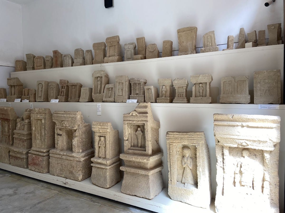
The tofet occupies about 60 metres of the northern coast between the sea and the city wall. A tofet was a Phoenician-Punic open-air sanctuary containing urn burials, often involving cremated infants or children. At Mothia, the possible association with child sacrifice to Tanit or Baal Hammon remains unproven.
The sanctuary probably functioned from the beginnings of the settlement in the seventh century BC until after the Syracusan siege, perhaps into the third century BC. The earliest urns rested directly on natural rock, sometimes beneath stone cairns topped by an upright stone. Later burials became denser and were marked by slabs, small upright stones called cippi, or stelae. During a major reorganization in the middle of the sixth century BC, the sacred area was extended by terracing. A small rectangular temple, about 10 by 5 metres and oriented east to west, was built beside a possible altar or platform.
Later burial layers contained numerous large stelae and cippi, some carrying inscriptions or symbolic and anthropomorphic representations. After the destruction of the city, the sanctuary was reorganized. The temple foundations were used for deposits of votive terracottas, including wheel-made and mould-made figurines, while earlier stelae and architectural fragments were incorporated into raised terraces. Pebble walkways were constructed on the eastern and western sides.
Industrial and residential quarters
Ceramic-production area
The northern and eastern industrial zones included a partly excavated ceramic-production complex in Areas K and K East. The principal installation was established in the sixth century BC, remodelled in the fifth century BC, and destroyed during the siege of 397 BC. In Area K, a bipartite building attached to the city wall opened southward onto a work area with a small furnace. A large pithos, a large storage vessel, stood in the floor, while a square rock-cut well with footholds was connected to terracotta pipes.
The installation probably included places for storing clay and unfired material. A larger multilobed furnace stood to the southeast, near an overturned stone basin with a spout that may have been used in clay processing. Area K East contained a circular rock-cut well, terracotta pipes that probably carried rainwater from the walls, and a plaster-lined rectangular basin filled with very fine siliceous sand, presumably for ceramic manufacture. Another building included a basin with traces of burning and metal slag, possibly indicating metalworking. A separate pebble-paved area contained a rough-stone wall that may have formed part of the siege defences.
Industrial area near the necropolis
A second industrial district near the Archaic necropolis operated from the beginning of the seventh century BC until the destruction of Mothia in the early fourth century BC. It covered about 23.5 by 21.5 metres and contained roughly twenty rock-cut pits, most of them elliptical and about 2 metres deep. Their sides were coated with a layer of grey-green unfired clay. Some pits retained traces of burning and were incorporated into irregular rooms, while two wells supplied water.
Large quantities of marine shells, particularly murices, were found in the area. These shells supplied the raw material for purple dye, and the installation has therefore been interpreted as a place for tanning and dyeing leather and possibly textiles. Two large elliptical furnaces at the southern end probably served in the manufacture of vessels. A well contained pottery of the Thapsos facies, a Bronze Age ceramic tradition dating to approximately the eighteenth to sixteenth centuries BC, including undecorated fruit-bowl vessels.
Central settlement
Only portions of the central street network have been exposed. One visible street runs northwest to southeast between building fronts. A vertically set stone at a corner probably served as a wheel guard and marks an intersection with a partly visible cross street. Four circular drainage pits were cut into the rock below the beaten-earth surface.
A building on the northern side contained a large room with a substantial threshold, a raised platform reached by three steps, and a drain leading to a well. The platform may have been a sacrificial altar, suggesting that the complex had a religious function. Another narrow room contained a rectangular bench, while a third had a central pillar and traces of burned bones. Materials from the fourth and possibly third centuries BC indicate activity after the destruction of 397 BC.
House of the Mosaics
The House of the Mosaics stands on the southeastern coast, on a slope descending toward the sea, and was built on two levels against the city fortifications. Its northern and eastern part consisted of a large rectangular peristyle court, a courtyard surrounded by rooms or a colonnade, with residential rooms around it. The southwestern side served as a service area.
The court had a black, white, and grey pebble mosaic. Its surviving northeastern section contains panels showing a lion attacking a bull, a griffin attacking a deer, and a lion and deer in separate panels. Diamond motifs divided the panels, which were bordered by bands of meanders, lotus flowers, palmettes, and waves. A small southwestern room had a checkerboard floor made from cocciopesto, a waterproof flooring material of crushed pottery and mortar, together with white stone flakes.
The service sector contained six rooms, some incorporating an earlier building. One room held a well and was later used for a hearth. A channel along the western side carried rainwater from the court down the slope. A storage room preserved three large pithoi, while another contained five Doric capitals and one Corinthian capital that appear to have belonged to at least two phases of the courtyard. Alterations and the partial stripping of building materials changed the house over time. The date of the building and its mosaic remains debated, with features of the pavement compared with third-century BC mosaics from Eretria, Olbia, and Tarsus.
Casermetta
The Casermetta stands against the outside of a large tower on the southern fortifications, between the House of the Mosaics and the South Gate. It had two sections separated by an open corridor, with a stair at the corridor’s end leading to an upper level above the defensive walls. The upper floor retained part of a cocciopesto surface and a rainwater drain.
The eastern ground floor contained three rooms, including two adjoining rooms at the front and a larger inner room connected with both the corridor and one of the front rooms. The western section had three poorly preserved rooms in a row. The building used a framed masonry technique in which regularly spaced sandstone blocks formed the wall framework and door jambs, while smaller stones set in mortar filled the intervening spaces. The door jambs retain sockets for wooden frames. The Casermetta postdates the large defensive tower and was destroyed by fire, possibly during the siege of 397 BC, but its original function and precise date remain uncertain.
Southern fortifications and the dry dock
South Gate and adjoining quarter
The area between the Kothon and the South Gate preserves several superimposed building phases. An early seventh-century BC courtyard house extended into the space later occupied by the gate and was destroyed between the end of the seventh and the beginning of the sixth century BC. A similar building was then reconstructed beside an early fortification wall.
Around the middle of the sixth century BC, the area was reorganized in connection with the Kothon. Around the middle of the fifth century BC, the earlier defensive wall was demolished and replaced by fortifications incorporating the South Gate and a tower on the quay beside the Kothon channel. A later quarter inside the walls contained irregular buildings along a narrow alley, with courtyard wells and terracotta rainwater channels connected to the fortifications. During the siege, ditches were dug outside the walls and the excavated material was used to form a barrier at the gate. After the city’s destruction, the quarter was abandoned.
Ship-repair channel
The channel associated with the Kothon lay within the city walls and was probably constructed in the second half of the sixth century BC. It was remodelled in the second half of the fifth century BC and altered again later. Its floor was paved with calcarenite blocks and contained a semicircular lengthwise groove for a ship’s keel. The side walls were faced with squared blocks laid in projecting courses, creating stepped surfaces. Triangular block structures stood at the ends, and grooves in the quays held wooden supports.
The arrangement probably allowed a vessel to be supported for repair, with its keel resting in the central groove and its hull held by the triangular structures and wooden elements. The channel widened northward toward the pool and lacked paving in that section. Its entrance was later closed at both ends by walls built over accumulated mud, while the innermost channel walls belonged to a late reorganization.
Burials and sculpture
Archaic necropolis
The Archaic necropolis occupies a levelled rocky area on the northern coast. The city wall crossed it, leaving some tombs inside the urban enclosure. Most burials were cremations placed in small pits cut into rock or soil, together with a cinerary vessel containing the cremated remains and accompanying objects.
Cinerary containers included coffers made from six rough tufa slabs, amphorae, and monolithic stone blocks with a central square cavity covered by a slab or matching block. Grave goods mainly consisted of Phoenician-Punic pottery and imported Greek-Corinthian vessels, which date most burials to the late eighth and seventh centuries BC. Some graves contained iron daggers and swords, or ornaments of gold, silver, and bronze. One richer burial held fifteen ceramic vessels, including six imported Corinthian examples, and a Phoenician terracotta female figurine expressing milk from her breast as a fertility symbol.
A group of sixteen graves was enclosed by a rough-stone wall between the city wall and the industrial area. Their similar assemblages may identify them as an early group of colonists. When the city walls were built around the beginning of the sixth century BC, the main necropolis was relocated to the Birgi promontory, although another cemetery continued on the island’s northeastern shore.
Motya Charioteer and Motya Maiden
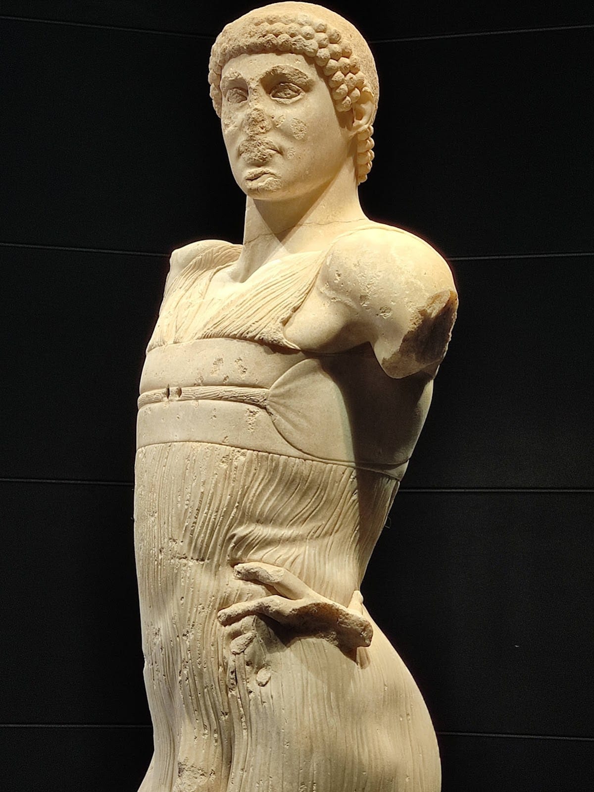
The Motya Charioteer is a marble statue discovered in Area K in 1979 and displayed in the Whitaker Museum. It is a finely executed Greek or Greek-influenced work, but its interpretation and origin remain disputed. It has been identified as a charioteer, Heracles, Melqart, Apollo, or Alcimedon. The statue may have been looted from a Greek city conquered by Carthage between 409 and 405 BC, or it may have been commissioned at Mothia itself. The possible identification with Alcimedon, an occasional charioteer for Achilles in the fighting over Patroclus’s body, remains unconfirmed.
In 2025, excavations by the University of Palermo directed by Paola Sconzo uncovered the lower part of a marble statue nicknamed the Motya Maiden in Area K. Probably dating from the late sixth or early fifth century BC, it preserves the folds of a chiton, a striding pose suggesting movement, and metal joints that connected its lower and upper sections. The sculpture is finely executed but damaged, and only its lower portion survives. Its discovery provides further evidence for the presence and influence of Greek art in a Phoenician-Punic city.