Tel Michal: A Multi-Period Coastal Trading and Military Site in Israel
Site at a Glance
- Rating
- 4.3
- Popularity
- Very Low
- Country
- Israel
- Primary era
- Classical
- Eras represented
- Bronze Age, Iron Age, Classical, Medieval
- Civilizations
- Abbasid, Achaemenid, Phoenician, Ptolemaic, Roman, Seleucid
- Site type
- Military
- Remains
- Fort
On this page27 sections
History
Tel Michal is an archaeological site on the central Mediterranean coast near Herzliya, Israel, occupied by successive communities from the Middle Bronze Age onward. Its ancient name is unknown. The Arabic name was Dhart Makmish, while the modern name derives from a twentieth-century proposal linking that name with the Phoenician god Resheph-Mekal. No established etymological connection links Mekal with the Hebrew name Michal. Over time, the site served as a trading post, military station, settlement, cultic center, industrial area, and watchtower site.
Bronze Age foundations and coastal trade
The first substantial settlement was established at the end of Middle Bronze Age IIB, around 1800/1750 to 1550 BCE. It was probably a trading post connected with the Hyksos-ruled Egyptian sphere. The Hyksos controlled parts of Egypt during the Second Intermediate Period, before the New Kingdom, and Tel Michal’s Hyksos scarabs and Egyptian alabaster vessels reflect contact with that wider commercial and political world. Imports and other finds also indicate connections with Cyprus and the Aegean. The settlement was apparently destroyed by tectonic activity.
During Late Bronze Age I, around 1550 to 1400 BCE, the site expanded. A small fort, dwellings, and a coastal trading station formed a settlement with links to Cyprus and possibly to the Canaanite or Syrian coast. After this settlement was destroyed, occupation resumed during Late Bronze Age II, around 1400 to 1200 BCE. The inhabitants enlarged the earlier rampart, but the settlement was largely abandoned during the fourteenth or early thirteenth century BCE, perhaps as international commerce declined.
Iron Age communities and cult
After an interval of roughly three centuries, settlement resumed around the tenth century BCE. Commercial connections and cultic remains suggest Phoenician involvement, although direct activity by the Kingdom of Israel in the central Sharon is not attested. The community practiced viticulture, pottery production, and fishing. The settlement was abandoned in the tenth century BCE, resettled, and abandoned again during the eighth century BCE. The eastern hillocks contained dwellings and cult places, while wine presses indicate organized production.
Persian-period expansion
Tel Michal reached its greatest importance during the Persian period, beginning in the second half of the sixth century BCE. It functioned as a trading post connected with Cyprus and the Aegean and also supported Persian military and administrative activity. Six settlement phases have been identified. The earliest probably included a Persian army camp whose soldiers lived in tents. A later settlement in the first half of the fifth century BCE used imported or probably Cypriot pottery, and one phase may have been destroyed during the Egyptian revolt against Persia in 459 BCE.
Later Persian phases brought more substantial construction, including a fort, warehouse, dwellings, and storage installations. During the fifth and fourth centuries BCE, the settlement developed into a planned town covering approximately 1.5 to 2.5 acres. Its importance was closely connected with Phoenician commercial activity in the region. A Phoenician temple remained active until the second century BCE. Tel Michal and nearby Arsuf may have represented competing Sidonian and Tyrian settlements in southern Phoenicia during the early Persian period, but this remains a historical hypothesis rather than a certain identification.
Hellenistic and Hasmonean phases
In the Hellenistic period, the settlement’s organization changed substantially. A large fortress replaced the earlier small fort, and residential and industrial areas were reorganized. Tel Michal remained in use under both Ptolemaic and Seleucid rule. The Ptolemies ruled Egypt and parts of the eastern Mediterranean after Alexander the Great’s death, while the Seleucids controlled much of the Near East during the following Hellenistic period.
Seleucid control probably ended when John Hyrcanus, a Hasmonean ruler who controlled parts of Judea and the surrounding region, conquered Jaffa. Tel Michal was subsequently occupied during the Hasmonean period. Alexander Jannaeus, a later Hasmonean king, established a fort there, probably as part of a defensive line along the Yarkon River. The settlement was later abandoned, interrupting the long sequence of occupation on the high mound.
Roman and Abbasid occupations
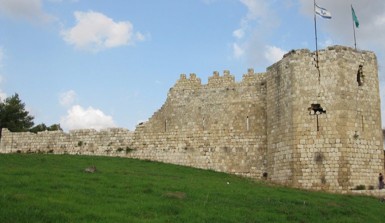
During the Roman period, a large fortress was built around 10 to 50 CE. It served as a base and anchorage for the Roman army and is the only fortress of its type identified along Israel’s Mediterranean coast. After its abandonment, the high mound again ceased to be continuously occupied.
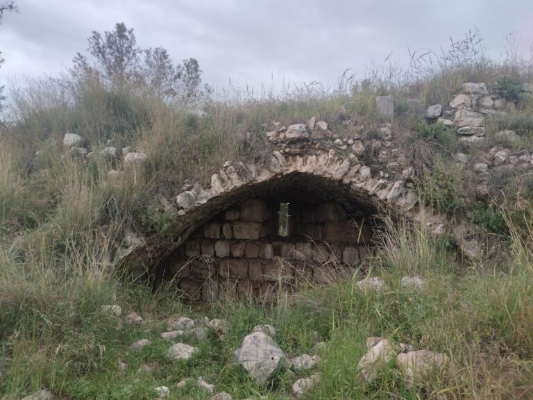
A final short occupation took place during the Abbasid period, probably in the eighth or ninth century CE, when a small watchtower was built on the high mound. The Abbasid caliphate ruled much of the Islamic Middle East from the eighth century onward. The tower may have formed part of an early warning network against enemy ships. Nearby Apollonia had by then eclipsed Tel Michal, and roughly seven centuries separated the Roman and Abbasid phases. A few burials on the mound dating to the thirteenth century are the latest evidence of occupation. The site was later abandoned and covered by sand.
Excavation and changing landscape
Jacob Ory surveyed Tel Michal in 1922 and excavated there in 1940, followed by R. W. Hamilton in 1944. Nahman Avigad directed a salvage excavation on the northern hill from 1958 to 1960. Four further excavation seasons took place between 1977 and 1980 under Ze’ev Herzog and James Muhly, and Herzog conducted another salvage excavation in 1982 after construction machinery exposed plastered structures east of the high mound. These investigations established the site’s sequence from the Middle Bronze Age through the Early Arab period and clarified its regional role in the western Yarkon basin. Construction of Herzliya Marina destroyed part of the western mound and placed a road over it, while the remaining coastal habitat is regarded as endangered.
Remains
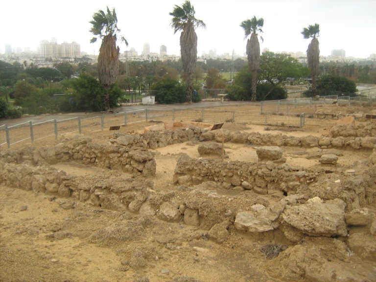
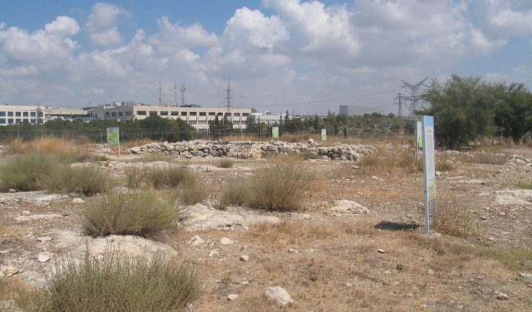
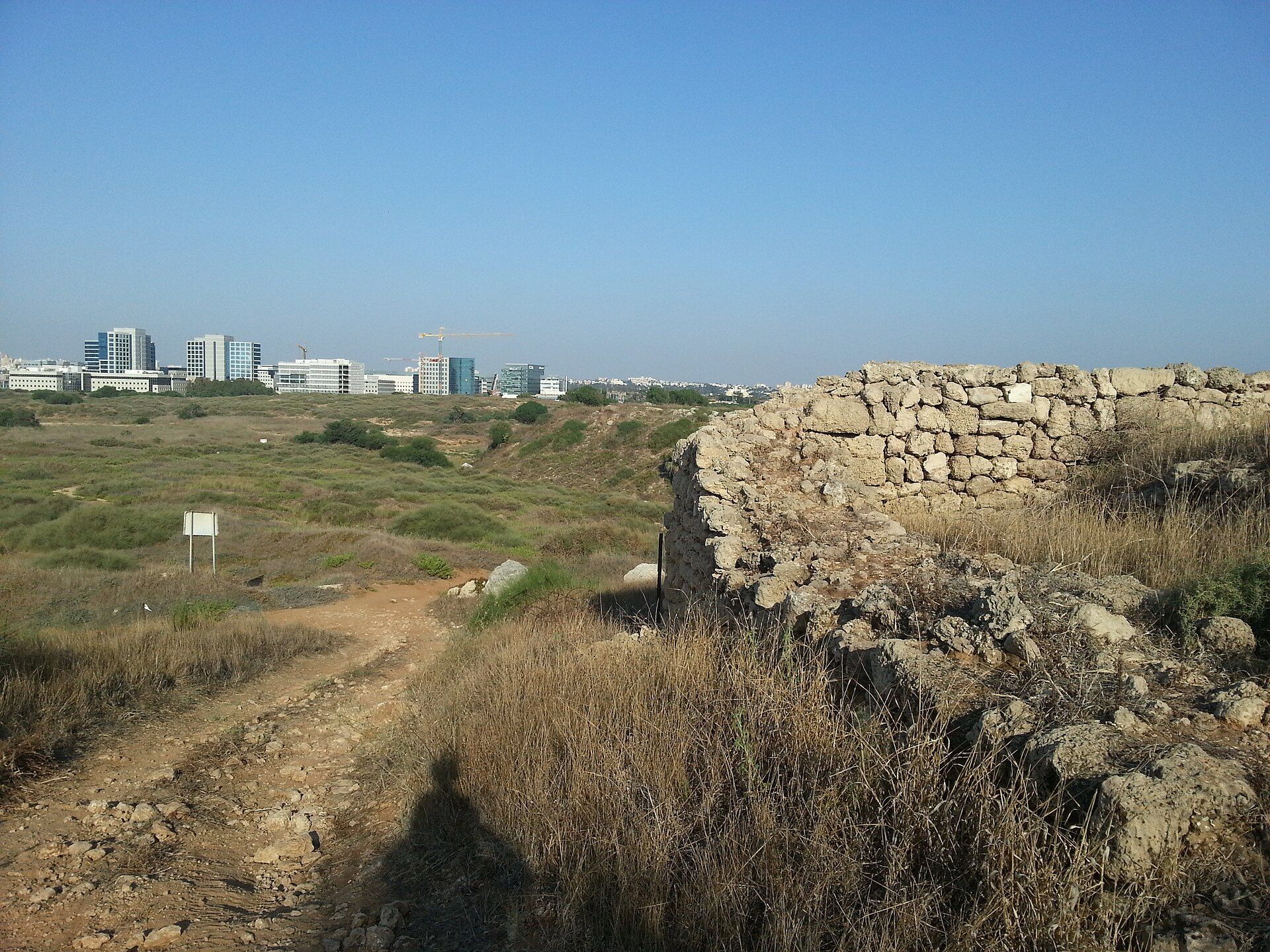
Tel Michal occupies five hills on a coastal kurkar ridge, a formation of rock created from cemented wind-blown sand. Four hills lie close together. The highest mound rises about 30 meters above sea level, covers roughly three-quarters of an acre, and is separated from the other hills by ravines leading toward the sea. The northern hill is a rectangular plateau about 250 by 175 meters and approximately five meters lower than the high mound, with the Gelilot Stream along its northern side. Smaller hillocks lie northeast, east, and southeast of the high mound. The northeastern hillock covers about 2,000 square meters, while the eastern and southeastern hillocks rise to about five meters.
Bronze Age earthworks
Early settlement platform
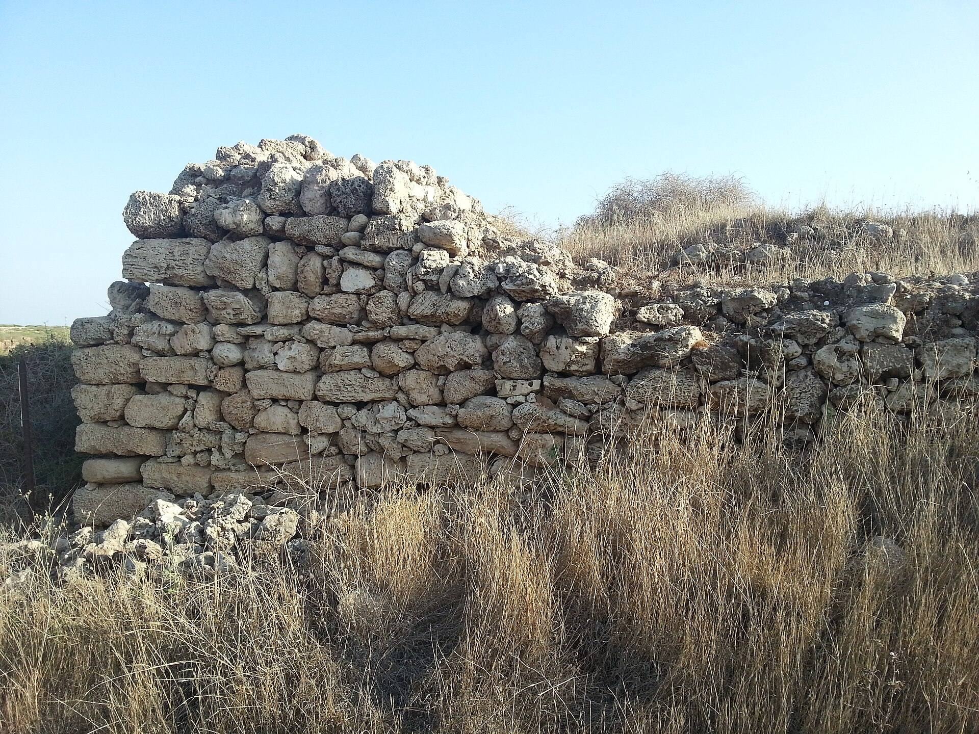
The present high mound is only the eastern summit of a much larger, originally square tell. A tell is an artificial mound built up through successive layers of settlement and rebuilding. Part of the earlier mound collapsed during the Bronze Age, after which inhabitants raised and reshaped the surviving area with artificial fills that included reused pottery fragments. The earliest settlement stood on a platform four meters high, made from alternating layers of red clay and sand. A brick retaining wall supported its northern side, and a sloping sand glacis, or defensive earth embankment, stabilized the platform. The settlement covered approximately one-half to three-quarters of an acre, although its structures have not survived.
Late Bronze Age fortifications
During Late Bronze Age I, an earth fill about ten meters high and thirty meters wide enlarged the high mound and established much of its present shape. A small fort on the northern side commanded the approach from the coast to the ridge, while dwellings stood to its south. The sandy strip below the fort may have provided a place where trading vessels were anchored or beached. Late Bronze Age II inhabitants expanded the earlier rampart and added a retaining wall at its base.
Iron Age cult and production areas
Northeastern cult compound
The northeastern hillock contained a walled, open-air cult compound measuring approximately 10 by 10 meters. Its central base may have supported an altar. The hillock continued to serve a religious function in the Hellenistic period, when a small rectangular altar was built over the remains of the Persian-period temple.
Eastern cult room
The eastern hillock contained a cult room with a square eolianite base, an eolianite being a rock formed from cemented wind-blown sand. The base may have served as an altar or offering table. Four chalices and other vessels were found nearby. Two rectangular structures on the southeastern hillock had benches along their walls. The three hillocks may have served as family cult places.
Wine production installations
Two pairs of long wine presses east of the high mound indicate organized viticulture. These installations formed part of the site’s Iron Age industrial activity alongside pottery production and fishing.
Persian-period settlement and cemetery
Fort and military installations
The high mound contained six Persian-period archaeological strata. The earliest included a northern fort, several silos, cooking ovens, and ash pits, an arrangement associated with a garrison and food storage. Buildings along the northern edge continued to serve military and administrative purposes during later phases. In the final Persian phase, a fort occupied the northern edge, dwellings stood in the center, and the southern area was used mainly for silos.
Planned town and industrial areas
Persian-period domestic and industrial areas included houses on the southern mound, a planned settlement, pottery kilns, wine presses, and a warehouse containing about twenty jars. These features reflect the combined commercial, craft, storage, and agricultural functions of the town.
Persian temples
Two Persian-period temples stood outside the high mound, one on the northern hillock and another on the eastern hillock. The northern temple yielded dozens of terracotta votive figurines, objects deposited as religious offerings. The eastern hillock also contained a mud-brick building on stone foundations with plastered benches. Nearby, six unused lamps had apparently been placed as an offering.
Northern cemetery
A Persian-period cemetery occupied part of the northern hill. Excavation exposed approximately 120 burials, including stone or mud-brick cist graves, which were enclosed by slabs, simple pit graves dug directly into the ground, and infants buried in storage jars. Wooden coffins or wooden burial coverings are also represented. Grave goods included bronze bowls, iron tools, silver rings, beads, and stamp seals. The assemblage resembles fourth-century BCE material from Kamid el-Loz in Lebanon.
Hellenistic and Hasmonean remains
Hellenistic fortress
A Hellenistic fortress measuring approximately 20 by 25 meters occupied the high mound. It had a central courtyard and stood near houses and a kiln. The northern hill contained a large, probably communal wine press with two collection vats, the larger holding approximately 7,000 liters. The northeastern hillock retained its cultic function, while the eastern hillock contained a round silo. A hoard of 47 silver tetradrachms, large coins valued at four drachms, was found near the silo and dates one settlement phase to the third century BCE.
Hasmonean fort and wine press
A small Hasmonean fort stood at the center of the high mound, and a small wine press lay about 500 meters south of it. Coins from the reign of Alexander Jannaeus were recovered from both installations.
Roman fortress and later watchtower
Roman fortress
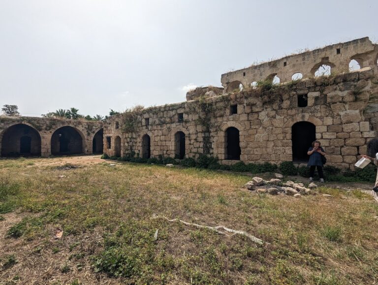
The Roman fortress measured approximately 31 by 38 meters and is the most prominent surviving feature at Tel Michal. Its foundations were made from coarse eolianite, while the superstructure used dressed eolianite blocks laid as headers. The entrance was on the northern side, and a tower stood in the center of the inner courtyard. The tower may have functioned as a lighthouse at night. A coin associated with the Bar Kokhba revolt was found at the site. Its perforation probably shows that it was reused as a pendant and may have been brought to the Sharon by Roman legionaries as a souvenir.
Abbasid watchtower
The Abbasid watchtower was built on a foundation of concrete and stone blocks. Sherds of Khirbat al-Mafjar ware and plaster decorated with geometric designs date it to the eighth or ninth century CE. Its position on the high mound supported its possible role in observing and warning against approaching ships.
Archaeological finds and coastal habitat
Tel Michal has yielded local pottery, Cypriot imports, East Greek pottery with geometric and floral decoration, Hyksos scarabs, Egyptian alabaster vessels, unusual coarseware kraters with black or black-and-red horizontal and wavy decoration, and vessels with horizontal handles. Votive figurines, ritual vessels, jewelry, burial goods, coins, storage jars, ovens, ash pits, kilns, wine presses, and storage facilities together reflect trade, craft production, religious activity, burial practices, and military occupation.
The site also remains a Mediterranean coastal habitat. Its plants include sea daffodil, coastal evening primrose, desert broom, annual wormwood, and hairy joint-pine. Red foxes, gerbils, hares, stone-curlews, spur-thighed tortoises, reptiles, and birds associated with sandy environments form part of the surviving fauna.