Maya Ruins of Tulum: A Maya Walled Port City in Mexico
Site at a Glance
- Rating
- 4.7
- Popularity
- Medium
- Country
- Mexico
- Primary era
- Medieval
- External website
- Open
- Eras represented
- Classical, Medieval
- Civilizations
- Maya
- Site type
- City
On this page23 sections
History
The Maya Ruins of Tulum are the remains of a Maya walled city in Zona Hotelera Tulum, Quintana Roo, Mexico. Built and chiefly developed during the Late Postclassic period, after AD 1200, the city occupied a rocky coastal promontory above the Caribbean Sea and reached its greatest prominence between the thirteenth and fifteenth centuries. It served as a major port for Cobá and combined commercial, administrative, religious, residential, and political functions.
Early occupation and the rise of a coastal city
Tulum may originally have been known as Zamá, a name interpreted as “City of Dawn” because the settlement faced the sunrise. The name Tulum is associated with a fence, wall, trench, or enclosure, an appropriate reference to the fortified city. An inscribed monument known as Stela 1 carries a date corresponding to around AD 564, but the inscription does not prove that Tulum was founded then. The stela may have been transported from another place, possibly Cobá, and reused at Tulum. Structure 59 also contains features associated with the Early Classic Maya period, approximately AD 400–500, indicating earlier activity at the site.
Most of the surviving buildings belong to the Late Postclassic period, the final major Maya era before and during early Spanish contact. Cobá was a major urban center in the northeastern Yucatán whose peak occurred around AD 650. It used Tulum as an important fishing port and possibly as a trading port. Tulum later developed into a long-distance commercial crossroads, connecting land and maritime routes across the Yucatán, the Gulf coast, Central America, and the Guatemalan highlands.
The city stood in a strategic position between the provinces of Cochuah and Cozumel. Its elevated coastal setting, defensive walls, access to fishing grounds, and landing place for canoes supported several kinds of activity. Tulum became especially important in the trade of obsidian, some of which may have come from Ixtepeque in Guatemala, about 700 kilometers away. Other goods found at or associated with the site include jade, copper, flint, ceramics, incense burners, gold, salt, textiles, and feathers. These materials reflect contacts with central Mexico, the Yucatán, Guatemala, and other parts of Central America.
Late Postclassic prominence and religious life
From around 1250, Tulum functioned as a combined civic, administrative, religious, residential, and commercial center. Its position on the coast helped it remain a strategic point in peninsular trade until the Spanish conquest. Some murals show influence from the Mixteca-Puebla tradition of highland Mexico, while the city’s temples and sculpture emphasize the religious importance of the Descending or Diving God, a figure shown descending headfirst and associated in interpretation with Venus.
Tulum’s political and religious importance was expressed through its restricted central precinct, temples, platforms, causeways, and monumental buildings. The settlement also included residences and facilities connected with water collection, storage, fishing, and maritime exchange. The coastal cove and beach gave small vessels access to the sea, while a break in the offshore reef helped guide canoes toward the landing place.
Spanish contact and abandonment
Maya inhabitants still occupied Tulum when Spanish exploration began in the early sixteenth century. Juan Díaz, a member of Juan de Grijalva’s expedition, recorded the city in 1518 and described it as wealthy and impressive. Tulum was abandoned by the end of the sixteenth century, although the precise cause remains uncertain. The disruption of Maya society and the high mortality associated with Old World diseases may have contributed to the end of its occupation.
Colonial references later disappeared, and the abandoned city became known again to the wider scholarly world after John Lloyd Stephens and Frederick Catherwood visited and documented the ruins in 1841. Their account, published in 1843, and Catherwood’s volume of lithographs from 1844 encouraged further archaeological interest. They mapped the walls and recorded several buildings, including the Castillo.
The Cult of the Talking Cross and archaeological investigation
In 1850, the Cult of the Talking Cross began as a movement that used a speaking wooden cross to mobilize Maya rebels against Spanish colonial control. Around 1870, María Uicab, the movement’s priestess at Tulum, made the city an operational center, replacing Chan Santa Cruz as its principal base. A Spanish missionary was reportedly killed on her orders. A later claim connected his remains with excavations at Tulum, but the identification of the skeleton is uncertain.
Systematic archaeological and restoration work continued through investigations by Sylvanus Morley and George P. Howe from 1913, the Carnegie Institution between 1916 and 1922, Samuel Lothrop in 1924, Miguel Ángel Fernández in the late 1930s and early 1940s, William Sanders in 1956, and Arthur G. Miller in the late 1970s. In 1974 and 1975, Mexico’s National Institute of Anthropology and History organized topographic surveys and consolidation around the walls and surrounding areas. These investigations helped establish the importance of Tulum’s Late Postclassic occupation. The archaeological zone has formed part of Tulum National Park since 1981, protecting the coastal archaeological and natural environment, including beaches, mangroves, wetlands, and cenotes, natural limestone sinkholes or caverns containing groundwater.
Remains
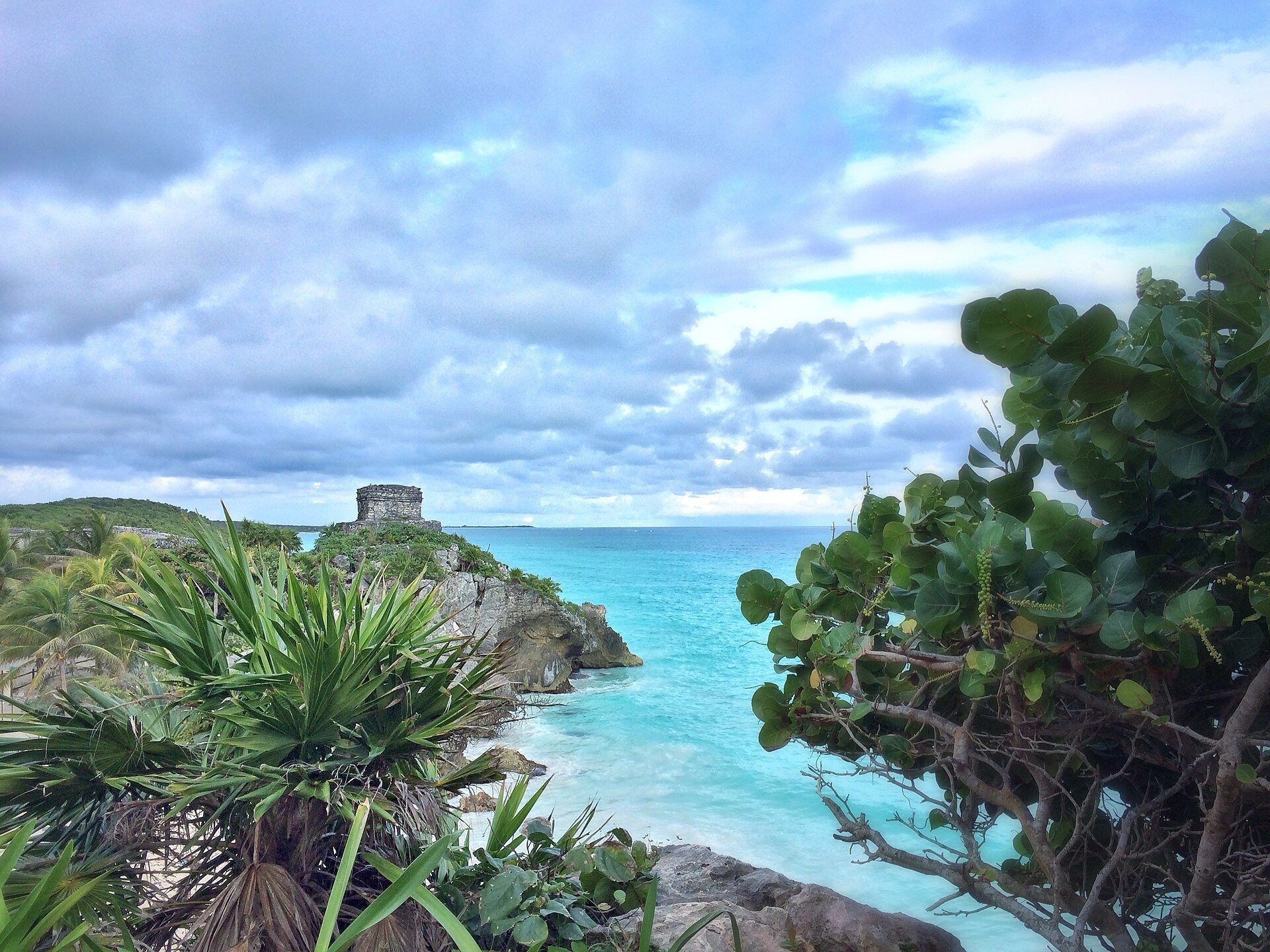
Tulum occupies a rocky promontory approximately 12 meters above the Caribbean Sea. Steep cliffs protect the eastern side, while walls enclose the principal landward area. The main ceremonial and administrative sector formed an approximately rectangular enclosure described as about 700 by 300 meters. Within it, a more restricted monumental precinct extended about 380 to 400 meters from north to south and approximately 170 meters from east to west. Residential areas continued for roughly 5 kilometers along the coast beyond the main enclosure.
Walls, entrances, and central precinct
The Great Wall
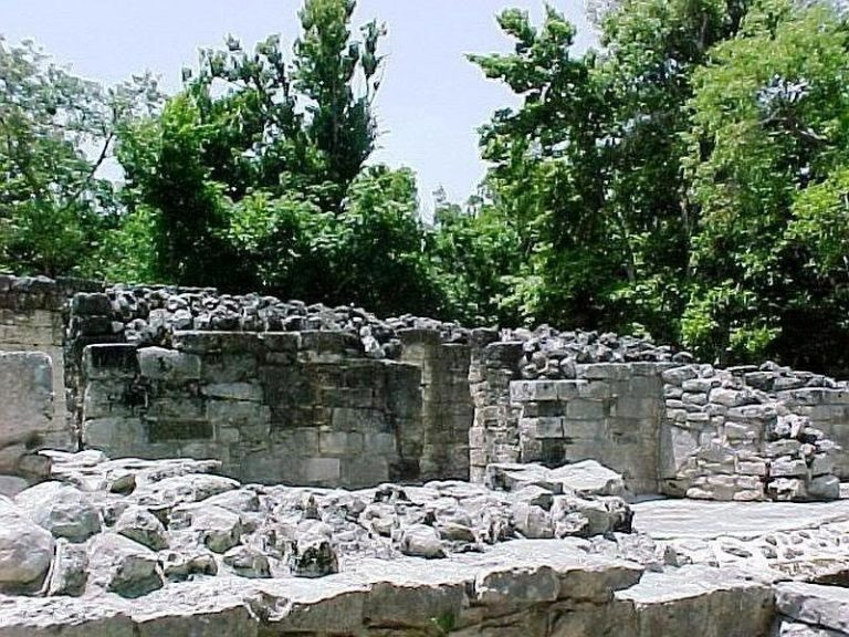
The Great Wall enclosed the principal landward sector on the west, north, and south. It stands approximately 3 to 5 meters high and is about 6 to 8 meters thick. Its length along the side parallel to the sea is about 400 meters, while the shorter sides measure roughly 170 meters across. The wall consists of a raised platform and parapet, with small interior steps leading upward. Five narrow, vaulted entrances pierce the enclosure, with one near the middle of the western side and two each on the northern and southern sides.
The entrances use the Maya corbelled, or false, vault. This construction method forms a ceiling by placing masonry courses that project inward until they meet, rather than by building a true arch. Small structures at the northwestern and southwestern corners have been identified as watchtowers or lookouts. The wall therefore served both defensive and administrative-religious purposes. The cove and sandy beach below provided access for fishing and trading canoes, while the opening in the offshore reef helped indicate the approach to the landing place.
The Inner Wall and central precinct
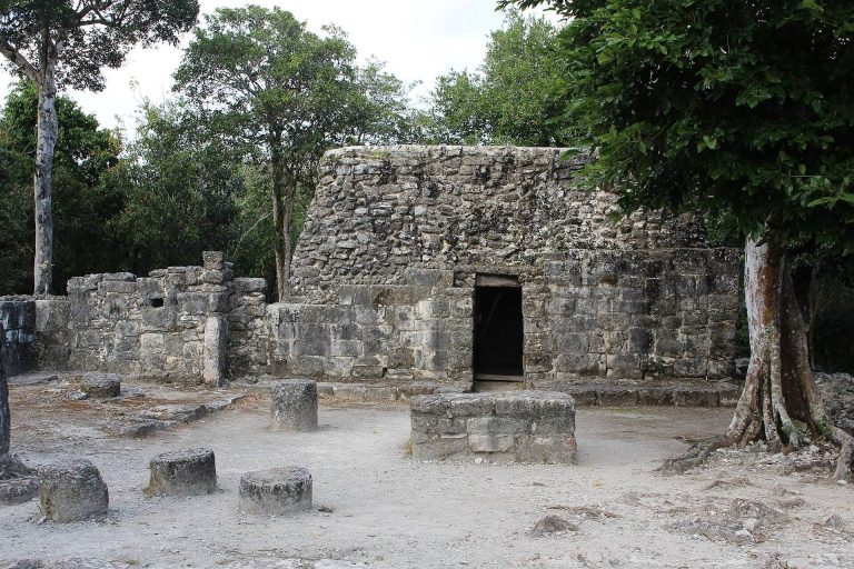
A smaller Inner Wall enclosed the central precinct in a rectangle approximately 30 by 50 meters. It had three entrances, two on the west and one on the south. Buildings surrounded an interior patio and included pyramid bases, temples, small altars, rooms, and platforms. Five temples in the precinct had single corridors, while the temple atop the Castillo contained two rooms. Structures 3, 9, and 10 had differing plans, including single-room arrangements and interior porticoes that supported their roofs.
Raised internal causeways directed movement between principal temples and residential platforms. The Main Causeway also functioned as a street lined with residential buildings. The architecture of the East Coast Maya is characterized by low substructures with a step around the base, narrow doorways, columns supporting larger buildings, one or two small windows, rear altars, and roofs made from beams and rubble or from vaults. Tulum’s buildings resemble those at Chichén Itzá, although on a smaller scale.
Principal temples and ceremonial buildings
The Castillo
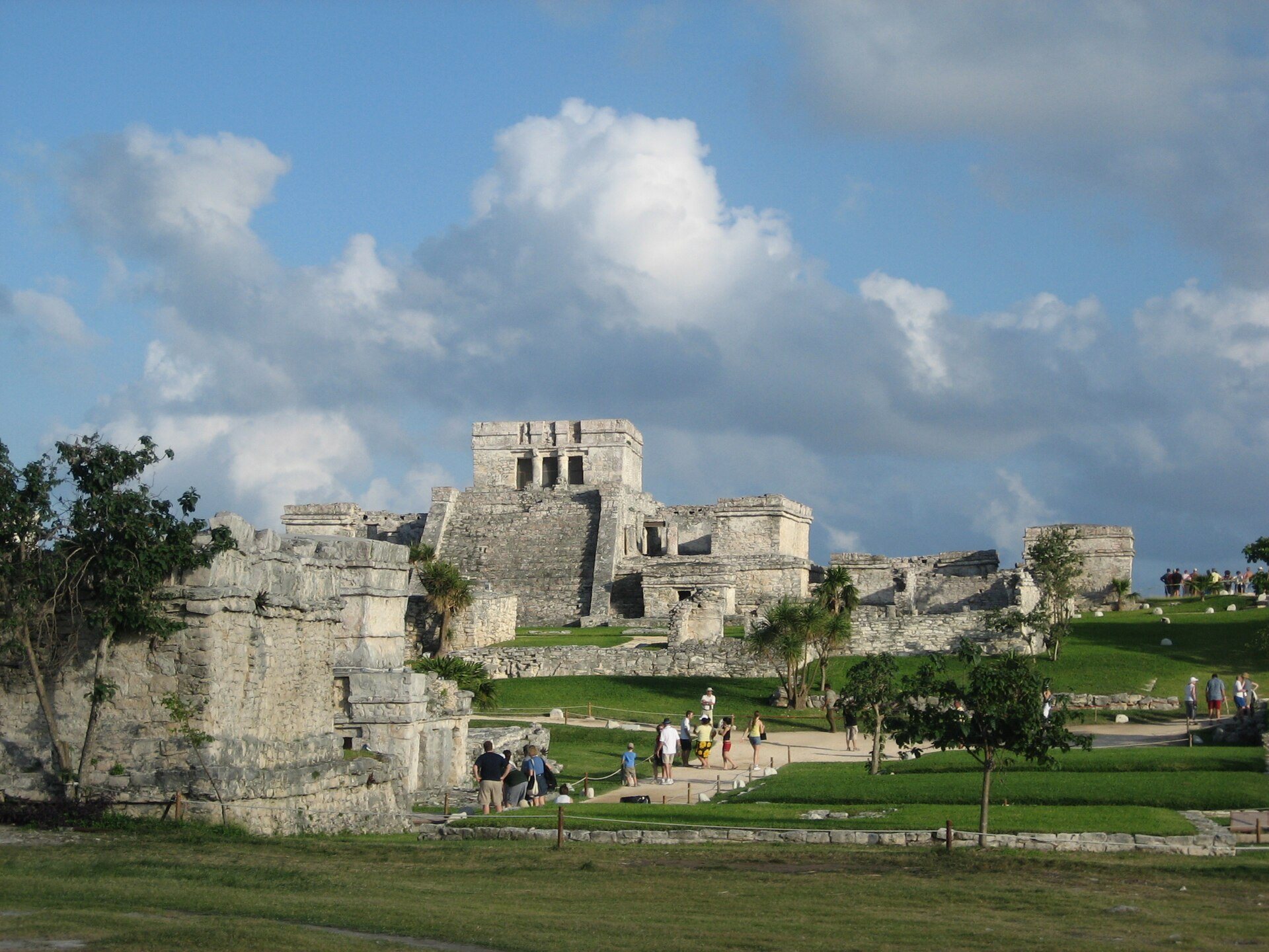
The Castillo is Tulum’s tallest and most prominent building, rising approximately 7.5 meters at the edge of the Inner Wall and above the Caribbean cliff. Its present form developed through several construction stages. An earlier, smaller building was filled in and strengthened with a retaining wall before later construction was added above it.
The upper temple contains two vaulted rooms and three entrances whose lintels are supported by serpent-shaped columns. The facade has two plain moldings and three niches. The central niche retains the remains of a once-polychrome stucco figure interpreted as a descending figure. Serpent motifs appear on the upper lintels, and two altars stand beside the main staircase. A platform in front may have been used for dances or processions. A small shrine associated with the Castillo may have served as a beacon for incoming canoes, marking the break in the offshore reef opposite the cove and landing beach.
The Temple of the Descending God
North of the Inner Wall, the Temple of the Descending God stands on a small raised base. Its single-room temple has a flat roof, a western staircase, two benches at the rear, and a narrow window. Murals decorated the facade and the northeastern and southwestern corners. Their imagery includes interlaced borders, religious scenes, and figures associated with rain, the sun, the moon, copal, feathers, and maize.
The interior walls were polychrome and showed offering-bearing deities, a border representing the night sky, stars, and stylized serpents. A figure above the entrance has wings, a headdress, and an object in its hands. The building’s imagery forms part of Tulum’s wider association with the Descending or Diving God.
The Temple of the Frescoes
Near the center of the city, the Temple of the Frescoes is one of Tulum’s best-preserved and most extensively decorated buildings. It developed through several superimposed construction phases and originally stood beside a dwelling surrounded by a portico on three sides. The lower structure contained the oldest temple chamber, while the building also included a lower gallery and a smaller upper gallery. Its form may have supported observation of the sun.
The facade has a double molding, a niche above the entrance, rosettes, human figures, and interlaced spirals. The second construction phase included polychrome stucco figures. Murals inside and outside the lower section and first level show deities, intertwined serpents, and offerings of flowers, fruit, and maize. Dark blue and white survive among the interior colors.
Arthur Miller interpreted some of the paintings as supernatural beings appearing between darkness and light in Xibalba, the Maya underworld. Another interpretation connects the images with birth, renewal, and Venus as the morning star. Large stucco masks once decorated the northeastern and southwestern corners. They were painted in several colors and have been interpreted either as an ancient creator deity, possibly Itzamná, or as Kukulcán. A mural on the eastern wall has been associated with the Mixteca-Puebla style. The overlying gallery and later conservation helped protect the surviving paintings.
The Temple of the Wind
The Kukulcán Group lies just north of the Castillo and includes several smaller structures, particularly the Temple of the Wind. This sanctuary stands on a natural elevation and has a rounded substructure. The form has traditionally been associated with Kukulcán, the feathered-serpent deity of Yucatec Maya tradition, or with Ehécatl, the Aztec wind deity.
Elite and residential buildings
The House of the Halach Uinic
North of Structure 24, the House of the Halach Uinic occupied a small platform and was separated from that structure by a patio. A halach uinic was a high-ranking Maya political leader, commonly translated as “great lord,” so the building has been interpreted as an elite residence or administrative structure. The platform originally had four entrances, and its principal western entrance connected with the Main Causeway.
The facade had a portico with six entrances supported by four columns and a pilaster. The building had thirteen entrances in total, making it the widest at Tulum. It was built without interior columns, and the facade probably carried stucco figures in individual niches. One surviving sculpture above an interior entrance depicts the Descending God and retains details of the figure’s costume and traces of its original colors.
The House of the Columns
The House of the Columns is an L-shaped building set on a broad base. Its main entrance had four columns, while the western wing was probably added later. The building had a flat roof and small windows with surviving rings that once supported curtains. A large southern entrance was formed by four columns.
Inside, a large hall connected with five windows, a long room, a small central altar, and a covered sanctuary whose interior wall projected beyond the northern facade. The western wing had steps and separate entrances. These arrangements show the building’s division into broad interior spaces, smaller rooms, and a distinct sanctuary.
The House of the Chultun
Opposite the Temple of the Frescoes, the House of the Chultun stands on a columned base with steps to the east and north. It probably housed an important official. Its portico had two columns, and a long central corridor contained a small sanctuary. A second corridor was later added on the north.
The facade collapsed after its supporting wooden beam failed. A stucco statue depicting a Maya head had stood above the entrance. The building’s chultun, a human-made underground or partly underground storage cavity, was used for collecting rainwater and may also have stored grain. When such a feature was no longer usable, it could be adapted for burials or household refuse.
The House of the Cenote
The House of the Cenote was built over a natural freshwater cenote near the northeastern entrance of the Great Wall. The cavern formed through the dissolution of limestone and collected rainwater. Its water was described as dirty and brackish because of bat excrement in the cave. The building went through at least two construction phases. The first was a two-room house; a smaller room was later added at the southwestern corner and reached by a staircase. Another staircase descended toward the water at the cenote entrance.
The surviving building is organized around four corridors. The western corridor has a portico with two columns and two interior benches and contains a sanctuary. A central room links the entrances with the southwestern dwelling, which has an opening toward the cenote. Tombs containing the bones of several individuals were found within the buildings and may have served as family crypts.
Earlier monuments, water, and archaeological finds
Stela 1 and Structure 59
Stela 1 bears an inscription corresponding to AD 564. Its date is considerably earlier than most of Tulum’s visible architecture, which belongs to the Late Postclassic period. The monument may therefore have been transported from elsewhere, possibly Cobá, and reused at Tulum. It was later acquired by the British Museum. Structure 59 contains stylistic elements associated with the Early Classic period, approximately AD 400–500, providing further evidence for activity before the city’s Late Postclassic prominence.
The coastal landing place and freshwater sources
A small beach and cove provided relatively easy access to the sea for fishing and trading vessels. The offshore reef contained a break opposite the site, near the landing place, and the shrine associated with the Castillo may have helped mark this opening. A small cenote near the northern wall supplied freshwater to the city.
Archaeological materials and the cave skeleton
Objects recovered from or near Tulum include flint, ceramics, jade, obsidian, copper objects, gold, incense burners, and other materials. Their origins and styles indicate contact with central Mexico, the Yucatán, Guatemala, and Central America. The range of materials reflects the city’s position within long-distance exchange networks.
In 2016, underwater exploration of the cenote cave system associated with Tulum recovered the skeleton of a woman approximately 30 years old who may have lived at least 9,900 years ago. Her skull showed three injuries and crater-like and tissue deformities that may have resulted from a bacterial relative of syphilis. The remains were initially mistaken for the Chan Hol 2 skeleton but were later identified as a different individual.