San Gervasio: A Maya Pilgrimage and Settlement Center on Cozumel
Site at a Glance
- Rating
- 4.5
- Popularity
- Medium
- Country
- Mexico
- Primary era
- Medieval
- Eras represented
- Classical, Medieval
- Civilizations
- Maya
- Site type
- City
On this page18 sections
History
San Gervasio is a pre-Columbian Maya archaeological site in the northern third of Cozumel, Mexico. Founded around AD 300 above the island’s largest permanent groundwater source, it developed through successive Maya periods into a major settlement whose surviving buildings belong mainly to the East Coast architectural tradition of the Caribbean coast of the Yucatán Peninsula.
Foundation and Early Growth
San Gervasio began as a small community supplied by the groundwater source beneath the site. Around AD 600, it entered a period of rapid growth, with new construction and probably stronger connections to settlements on the northern coast of Quintana Roo. The settlement consisted of several architectural groups rather than one compact center, a pattern that remained important throughout its later development.
After about AD 1000, San Gervasio expanded substantially. This growth may have been connected with the rising political and economic importance of Chichén Itzá. Between approximately AD 1000 and 1200, the Itzá may have governed Cozumel from San Gervasio and directed trade between the Yucatán and the Ulúa region. By about AD 1200, the settlement had become the largest on Cozumel.
Late Pre-Hispanic Center
San Gervasio remained Cozumel’s largest settlement until the arrival of the Spanish. During the late pre-Hispanic period, it served as the center of a network of smaller communities across the island. Its groups were linked by raised, paved Maya roads called sacbés, which connected residences, temples, plazas, and other structures.
The site was also an important pilgrimage and worship center associated with Ix Chel, a Maya goddess connected with childbirth, fertility, medicine, and weaving. Maya women were reported to have sought to travel to Cozumel and make offerings at least once in their lives. Colonial descriptions compared the island’s pilgrimage importance with that of Jerusalem and Rome.
The precise connection between San Gervasio and Ix Chel remains uncertain. Colonial descriptions of an oracle probably refer to a shrine near present-day San Miguel de Cozumel, and no archaeological evidence directly links a particular building at San Gervasio with the goddess. Ka’na Nah has sometimes been proposed as a possible temple of Ix Chel, but that interpretation has not been confirmed.
Spanish Contact and Abandonment
The first Spanish expedition reached Cozumel in 1518 under Juan de Grijalva. Hernán Cortés arrived in February 1519 with eleven ships. In 1520, a flotilla led by Pánfilo de Narváez stopped at the island. Lucas Vázquez de Ayllón attributed the disappearance of much of the Maya population to smallpox introduced by Indigenous auxiliaries brought from Cuba.
San Gervasio was abandoned between 1520 and 1600. Although it was the largest settlement on Cozumel at the time of Spanish contact, the principal settlements named in Spanish accounts cannot be securely matched with San Gervasio. The site’s original Maya name is also uncertain. One tradition identifies it as Tantun Cuzamil, meaning “Flat Rock in the Place of the Swallows.” The name San Gervasio was adopted in the twentieth century from the patron saint of the owner of a nearby ranch.
Archaeology and Conservation
Archaeological work in the early 1970s by researchers from Harvard University and the University of Arizona produced detailed plans of the surviving remains and reconstructions of the possible original appearance of several buildings. Investigation of El Ramonal began in 1997 as part of an INAH project examining the inhabitants of Cozumel during the Late Preclassic and Early Classic periods.
Conservation has included restoration of part of the wall surrounding the Plaza Baja and of the Building of the Battlements. San Gervasio is preserved within a protected Mexican archaeological park and is conserved by INAH. The archaeological zone extends across several square kilometres, while only part of District 1 and nearby structures is open to visitors.
Remains
San Gervasio is organized into several architectural groups connected by sacbés, or raised and paved Maya roads. The principal groups are Manitas, Chichán Nah, El Álamo, Nohoch Nah, Murciélagos, Ka’na Nah, and El Ramonal. Most surviving buildings date from after approximately AD 1200 and reflect the East Coast tradition. Earlier construction also survives, including a building at Murciélagos dating to around AD 800.
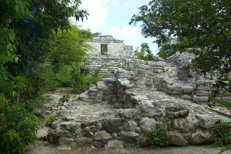
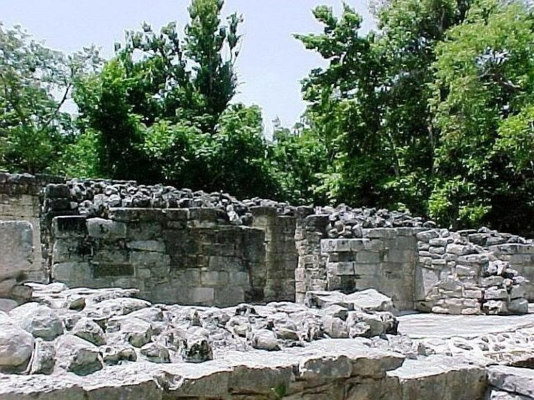
Many stone buildings have lost their roofs and upper wall sections, making their original forms difficult to reconstruct. Archaeological plans have nevertheless supported proposed drawings of how some structures may have appeared. Construction varied across the site, including masonry, timber and thatch, wooden beams covered with poured mortar, and rooms roofed with corbelled arches. A corbelled arch is made by projecting courses of masonry inward until they meet.
Central Plaza and El Álamo
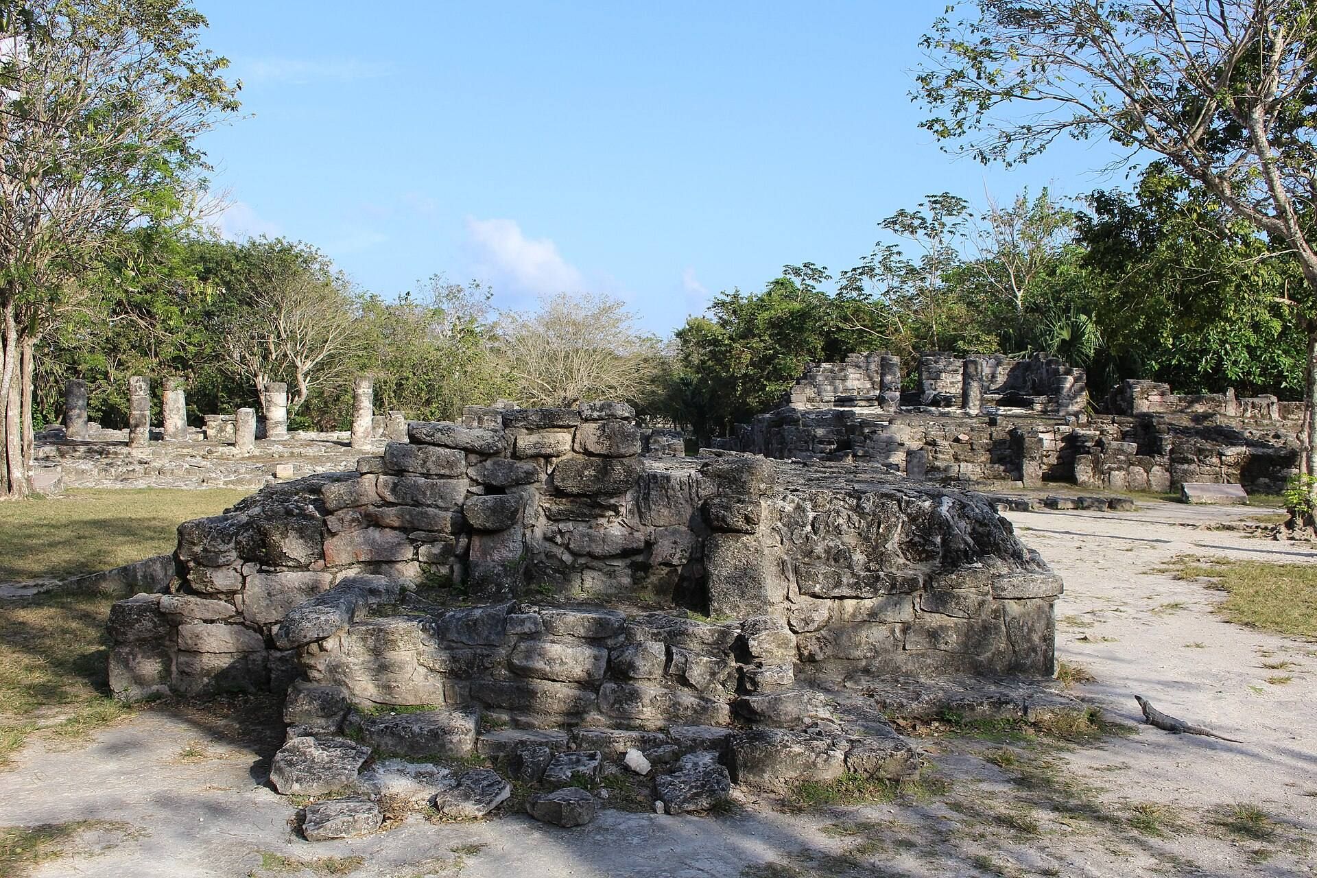
The Central Plaza Group contains rectangular buildings arranged around a central altar platform. The group included temples, oratories, altars, and a building for visitors attending religious events. Some structures had timber-and-thatch roofs, while others used wooden beams and poured mortar or corbelled arches. Additional stone, wooden, and thatched structures stood around and between the plaza and Manitas.
El Arco
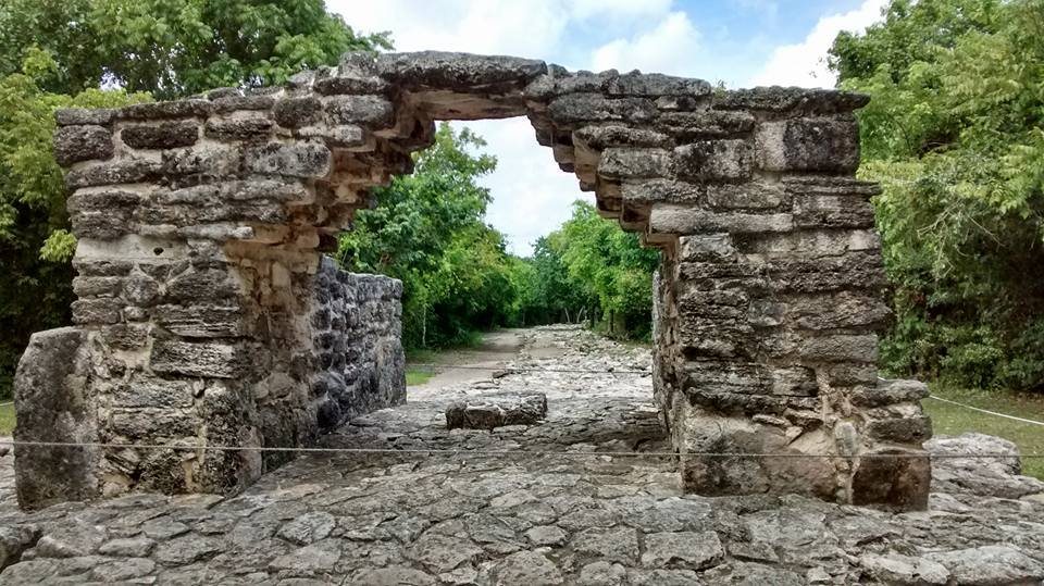
El Arco is a simple arch approximately seven feet high at the northeastern side of the Central Plaza Group. It forms an entrance from the north and west and spans the principal religious pathway, a sacbé running northeast from the plaza. The arch was reconstructed during the 1980s using comparable examples from sites on the east coast of Quintana Roo, including El Cedral on southern Cozumel.
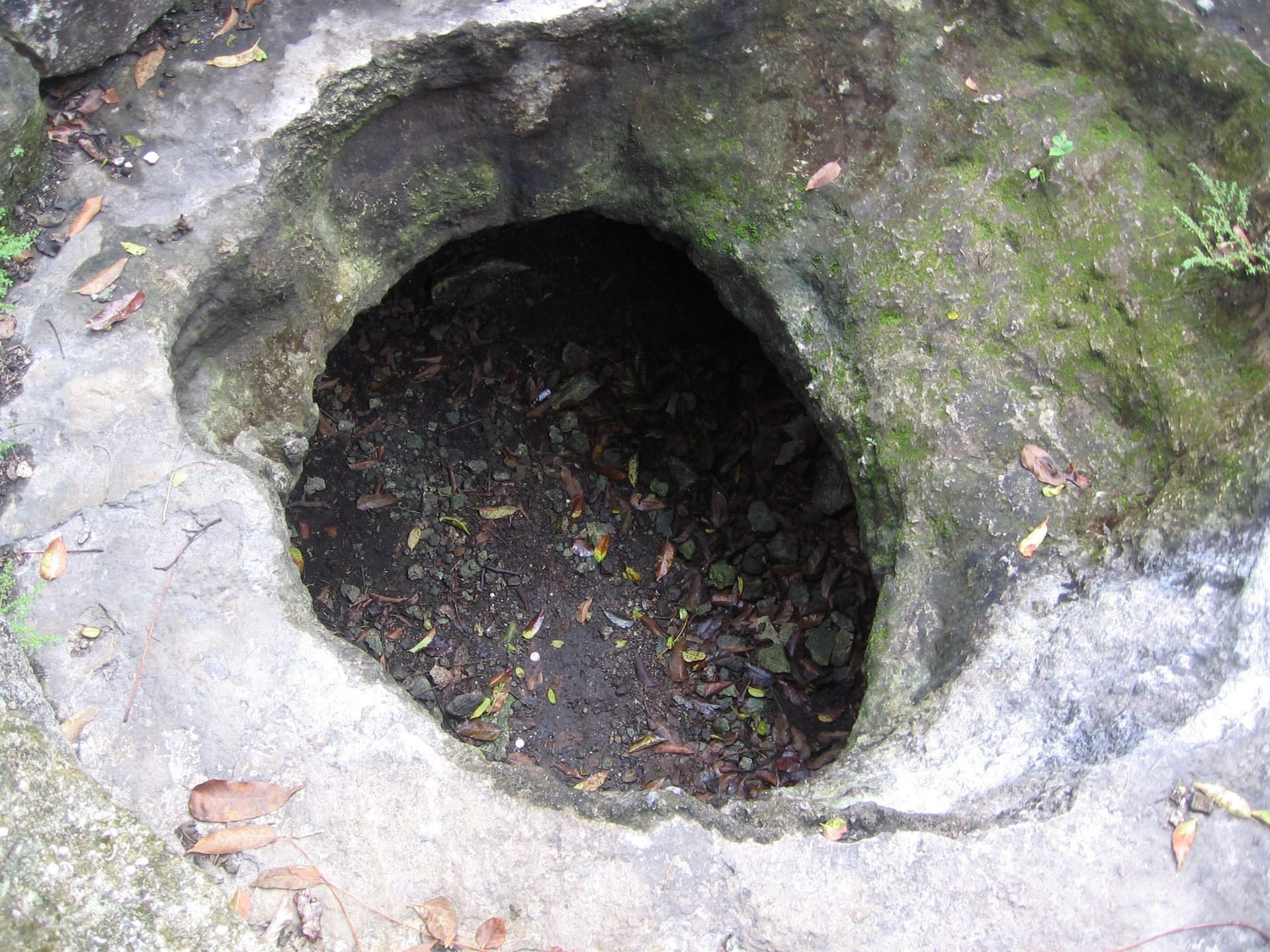
North of El Arco, on the western side of the pathway, is a small natural opening in the bedrock. It is a cenote, a karst depression or opening that can expose or connect with groundwater, and formed part of the site’s groundwater environment.
Manitas Group
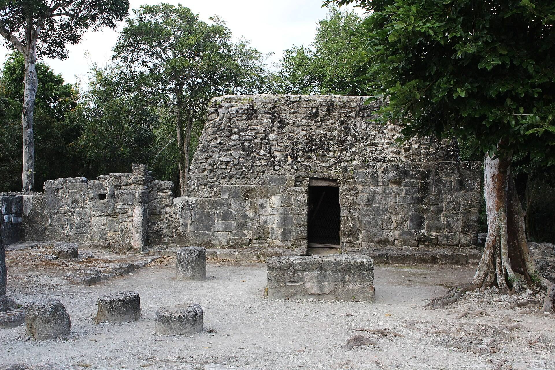
The Manitas group dates to the final centuries of pre-Hispanic occupation. Its principal building, Las Manitas, is an elite residence in the East Coast style and is identified by INAH as structure SE(AIV)30. The residence has two rooms. Its front room is an open, porch-like space with a built-in stone bench, while a doorway leads to a smaller rear room interpreted as a bedroom. Chichán Nah stands immediately east of the residence, placing a ritual structure beside the residential building.
Las Manitas
Las Manitas takes its name from human hand impressions preserved on its walls. Five impressions are recorded on the façade, with additional examples on the interior walls. They were made by pressing painted palms and fingers onto the surface, and red was the most commonly used color.
La Tumba
La Tumba is another structure in the Manitas group. Its alignment corresponds approximately to sunrise at the December solstice and sunset at the June solstice. The same general orientation occurs in the Manitas and Central groups, which are connected by Sacbé 2.
Chichán Nah
Chichán Nah, meaning “Small House,” is a small Postclassic temple immediately east of Las Manitas. INAH identifies it as an oratory in the East Coast style. A larger outer room leads to a smaller inner sanctuary containing an altar. The building has traditionally been interpreted as a chapel for the family of the halach uinik, the principal political authority, who lived at the neighboring Las Manitas residence. Its alignment resembles that of several other San Gervasio buildings, although it may not have been suitable for astronomical observation.
El Ramonal
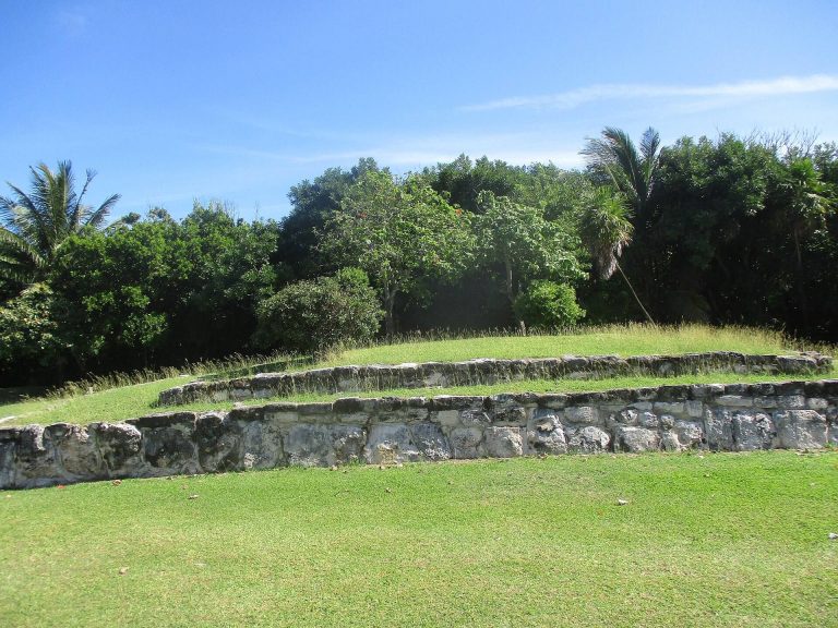
El Ramonal is a complex of three groups covering approximately 60 to 80 by 200 metres. Its southern section was residential and bordered by limestone blocks reaching about 3 metres in height. Immediately north stood a raised complex resembling an acropolis, a group of platforms and buildings set above the surrounding area. Two large stepped platforms carried buildings in this section.
Some El Ramonal buildings were masonry structures, while others were made from perishable materials that have not survived. The complex also contains two oval, pyramid-like platforms whose upper buildings are no longer preserved.
Building of the Battlements
The Building of the Battlements contains rooms arranged in a T-shaped plan resembling the Maya ik sign. This sign was associated with divine breath and the breath of life, and was a principal attribute of Itzamná, a major Maya creator deity associated with divine and life-giving power.
Ka’na Nah and Murciélagos
Ka’na Nah
Ka’na Nah, meaning “Tall House,” is one of San Gervasio’s tallest and most important buildings. Designated Structure C22-41-a, it has a broad stepped base supporting a small temple. The building was altered several times, with its latest construction dating to the Late Postclassic period.
Ka’na Nah faces west and originally contained a single-room sanctuary with an altar. A later phase added a wall with a central doorway across the room, leaving narrow passages on both sides that led into the space behind it. The building’s main axis corresponds approximately to sunset at the June solstice and sunrise at the December solstice. Around the June solstice, sunlight entering the temple could cast shadows on the later interior wall, leaving narrow strips of light beside the doorway.
Because of its divided sanctuary and its comparison with a colonial description of an oracle, Ka’na Nah has been considered a possible temple of Ix Chel. Its association with the goddess, however, is not archaeologically demonstrated.
Murciélagos
Murciélagos is an architectural group consisting of an irregular platform supporting five buildings. Its name, meaning “Bats,” comes from the large number of bats that once occupied the main building while it was unused.
The best-preserved building in the group was constructed around AD 800 during the Terminal Classic period, the late part of the Maya Classic era, approximately AD 800 to 1000. It is the best-preserved example at San Gervasio of that period’s architecture. Some researchers compare it with the Puuc style, while INAH regards it as a distinctive local Cozumel tradition reflecting a locally developed construction technique.
Nohoch Nah and Sacbé 1
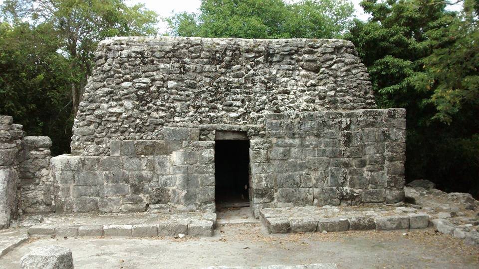
Nohoch Nah, meaning “Great House,” is a Postclassic temple built on a small raised platform with two access stairways. It is one of the best-preserved buildings at San Gervasio and retains its roof.
The temple stands at the end of Sacbé 1, a raised road beginning at El Arco in the El Álamo group. Beyond Nohoch Nah, the road changes direction and continues toward the northeastern coast of Cozumel. This arrangement has been interpreted as possibly marking the limits of the city.
Fragments of mural painting survive on the temple’s interior walls. Red, ochre, and blue pigments remain visible, although the interior can be viewed only through the doorway. Nohoch Nah has been identified as a possible temple of Kukulcán, the Maya feathered-serpent deity.