El Tintal: A Major Maya City in Guatemala

Site at a Glance
- Rating
- 4.8
- Popularity
- Very Low
- Country
- Guatemala
- Primary era
- Medieval
- Eras represented
- Iron Age, Classical, Medieval
- Civilizations
- Maya
- Site type
- City
On this page19 sections
History
El Tintal is a major Maya city in Chilar, Guatemala, occupied from the Middle Preclassic, approximately 1000–350 BC, through the Terminal Classic, approximately AD 830–950. The Maya were an Indigenous Mesoamerican civilization whose cities, writing systems, religious traditions, and exchange networks developed across parts of present-day Mexico, Guatemala, Belize, Honduras, and El Salvador. El Tintal occupied about 25 square kilometres and experienced major periods of prosperity during the Late Preclassic and Late Classic.
Early settlement and urban growth
The earliest settlement probably began as a village beside Lake Chacamat more than 800 years before Christ. Its inhabitants left mainly ceramic remains and made only limited changes to the surrounding landscape during the Middle Preclassic. During the Late Preclassic, El Tintal developed into a formally organized and rapidly expanding city. Its ruling group commissioned monumental religious and political buildings, water-management works, defensive infrastructure, and raised pedestrian routes that supported movement, communication, and exchange with other Maya cities.
Construction stopped during the third century AD, while ceramic production declined sharply. Lake Chacamat became eutrophic, meaning that accumulated nutrients encouraged excessive plant growth and reduced water quality. The loss of this important water supply coincided with wider environmental pressures and the depletion or contamination of heavily exploited resources. El Tintal was only sparsely occupied from approximately the third to the sixth centuries, although older buildings remained in use and communication and trade continued.
Renewal and the Late Classic apogee
A richly furnished Early Classic tomb in the Mano de León Complex indicates that an elite group, possibly including a ruler, continued to exist during the period of reduced settlement. Construction resumed in the late sixth century. One phase of the Selepan building, for example, dates to AD 550–610 and was built over an earlier Late Preclassic phase.
El Tintal was repopulated during the seventh century, probably through regional population growth and immigration. Expansion, new construction, renovation of earlier buildings, and increased production of ceramics and stone tools accompanied a broad economic and cultural resurgence. The city reached its second major apogee during the Late Classic.
During this period, El Tintal participated in extensive regional and long-distance exchange. Obsidian, basalt, and pyrite came from the Guatemalan highlands; jade came from the Sierra de las Minas; granite and flint came from Belize; and gastropod shells arrived from both the Atlantic and Pacific coasts. Ceramic exchange with several regions of the Maya area is also indicated by neutron-activation analysis, a method that identifies the geological sources of materials through their chemical composition.
Decline, abandonment, and later history
A second decline began during the ninth century as chronic regional warfare intensified existing social and political problems. El Tintal’s precise political position cannot be established because carved hieroglyphic monuments are scarce. Public and administrative spaces lost political and religious importance, maintenance declined, building facades were partly dismantled, and unfinished structures were abandoned. Former administrative buildings were used for patolli, a Mesoamerican board game played with marked boards and counters. A rubbish dump accumulated in Plaza B while inhabitants still occupied the city during the Terminal Classic.
El Tintal was abandoned by the end of the tenth century, broadly around AD 900–1000. This process was connected with major social and political changes in the Maya lowlands, although its precise causes and whether abandonment was gradual or abrupt remain uncertain. Forest subsequently covered the structures, plazas, and causeways. Vegetation, rainfall, wind, weathering, organic matter, and sediment obscured and damaged the ruins, while forest cover also provided partial protection from some forms of erosion.
The modern name comes from a twentieth-century chicle camp. After a camp was established near Carmelita in 1925, workers regularly entered the abandoned settlement. A camp called Tintal stood about 800 metres from the El Henequén pyramid and 1.5 kilometres from the Mano de León Complex. Heinrich Berlin visited the camp in 1951 without reporting the archaeological site. Ian Graham reported El Tintal in 1966, named it after the nearby camp, and directed the first excavations in 1970, with Joyce Marcus participating in the test-pit work.
The Mirador Basin Project carried out intermittent excavation, reconnaissance, and mapping from 1979, including a rescue excavation in 1990 under Richard D. Hansen. More systematic investigation began in 2004. The project continued between 2000 and 2014, producing a schematic map in 2005 and the first topographic survey of the central area in 2013. The El Tintal Archaeological Project began intensive, continuous work in 2014, combining mapping, excavation, laboratory research, and artefact analysis into the early 2020s.
Looting expanded from the 1970s and permanently damaged many buildings and their archaeological contexts. More than 2,000 trenches were cut into mapped structures, exposing burials and scattering human remains, ceramics, and other artefacts. Looting also encouraged illegal hunting and the trafficking of plant and animal species. The creation of the Maya Biosphere Reserve in the 1990s reduced these activities through heritage guardianship and monitoring. Since 1997, a forest concession granted to the village of Carmelita has included El Tintal and has participated in protecting its cultural and natural heritage.
Remains
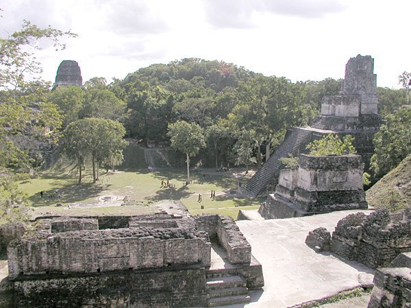
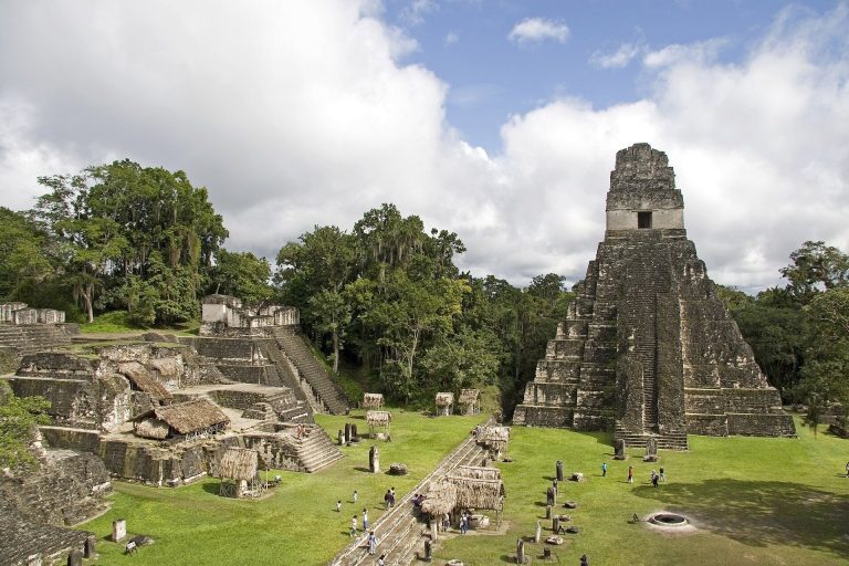
El Tintal occupies a karstic plateau, a limestone landscape shaped by irregular depressions and underground drainage, at approximately 280 metres above sea level. Tropical dry forest surrounds the site, which stands above seasonally flooded wetlands known as bajos. The known settlement contains at least 2,564 structures grouped into several architectural complexes. A survey of approximately 9 square kilometres around the monumental core recorded 850 major structures, some rising to about 50 metres.
Monumental architecture
Principal pyramids
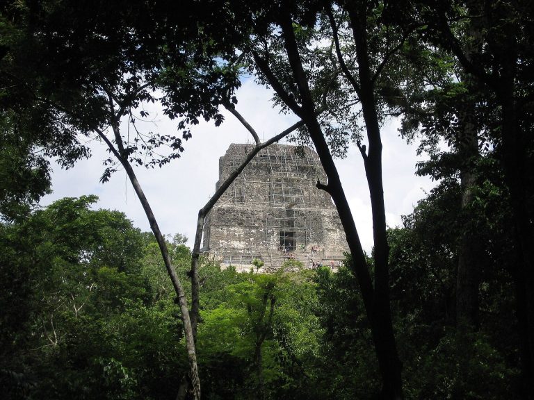
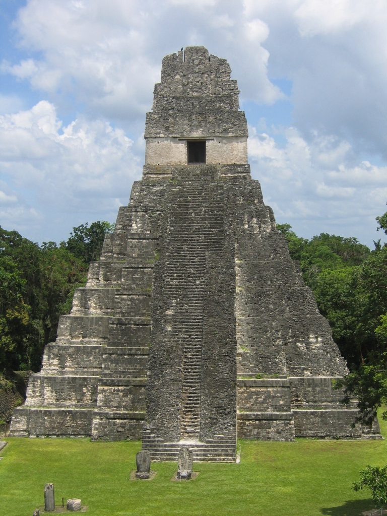
The monumental landscape includes the Catzín pyramid, El Henequén, and the Triadic Complex. Three principal pyramids rise above the forest canopy. Catzín, in the La Isla Complex, is the largest of these pyramids and stands approximately 50 metres high. Another triadic pyramid is estimated at 44 metres high and rests on a basal platform measuring approximately 105 by 78 metres. A triadic structure consists of a dominant central building flanked by two smaller buildings facing inward on the same platform. At least two of El Tintal’s largest buildings follow this arrangement.
Ballcourt
A ballcourt lies north of the triadic pyramid near the centre of the site. It is described as the largest ballcourt yet identified in the Maya lowlands, forming part of the central ceremonial landscape.
Mano de León civic and ceremonial centre
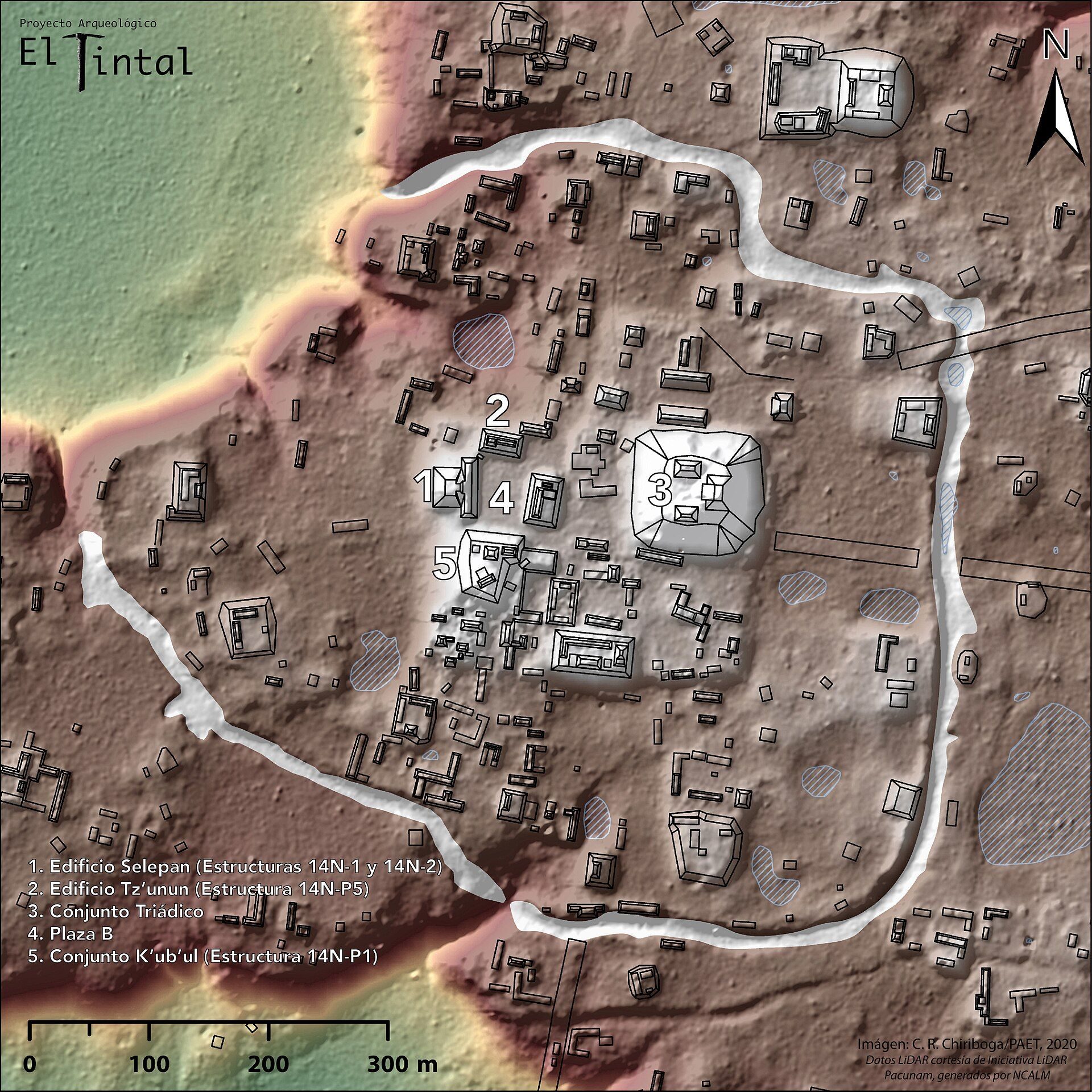
The Mano de León Complex formed El Tintal’s civic and ceremonial centre. A broad, deep ditch enclosed it for approximately 2.2–2.26 kilometres. The ditch averaged 15 metres in width and reached about 8 metres in depth. Its principal purpose was probably defensive, although it may also have helped manage water or marked a social and political boundary.
Plaza B and Conjunto K’ub’ul
Plaza B was associated with elite residential and administrative activity. The Conjunto K’ub’ul, also called Structure 14N-P1, formed the southern edge of the plaza and was the complex’s second-largest construction. During the Late Classic, it had sophisticated architecture and polychrome modelled-stucco sculptures in low relief.
Selepan
Selepan, comprising Structures 14N-1 and 14N-2, formed the western limit of Plaza B with an elongated front building. Its functions may have included administration and ritual activity. A construction phase dates to AD 550–610 and overlays an earlier Late Preclassic phase.
Tz’unun
Tz’unun, or Structure 14N-P5, marked the northern side of Plaza B. Its three broad rooms contained adjoining tombs beneath the floors and may have served as the residence of the ruling family. The complex therefore combined spaces associated with administration, ceremony, and elite residence.
Residential and peripheral complexes
El Juleque Complex
The El Juleque Complex lies west of Lake Chacamat and outside the central area. Its elaborate architecture indicates political and economic importance and probably belonged to an elite group of lower rank than the ruling group. Its buildings included limestone-masonry structures that were vaulted or terraced and coated with stucco.
Residential groups
Other residential groups contained substantial limestone houses built with advanced Late Classic techniques. Many had masonry walls, stucco finishes, and access to polychrome ceramics and other valued portable goods. These remains show that durable housing and aesthetically valued materials were also present beyond the central elite area.
Causeways and water management
Sacbés
Six sacbés, or raised engineered pedestrian causeways, connected parts of El Tintal and linked the city with other settlements in the Mirador Basin. The Graham Causeway extends approximately 23 kilometres from El Tintal’s central area directly to El Mirador. Building and maintaining this network required substantial labour and construction materials.
Canal Norte and water storage
The Canal Norte was constructed during the Late Preclassic and extends approximately 2.26 kilometres. It controlled overflow from Lake Chacamat and provided a fluvial connection with a regional drainage system. The former freshwater lake occupied part of the plateau before long-term eutrophication transformed it into the El Juleque bajo.
As the lake diminished, inhabitants increasingly relied on natural aguadas and civales, water-holding depressions or wetlands, while also constructing reservoirs and chultunes. Chultunes are underground or rock-cut reservoirs used to collect and store rainwater. These installations formed part of the city’s changing response to water conditions.
Objects and archaeological evidence
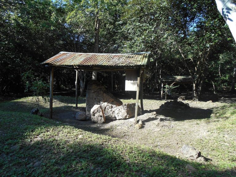
El Tintal’s remains include limestone architecture, stucco sculpture, tombs, causeways, defensive and drainage works, hydraulic channels, ceramics, flint, obsidian, bone, shell, and other stone materials. Stela 1 was carved from red sandstone probably obtained from the Altar de Sacrificios region on the Usumacinta River. It stood in a plaza for centuries before being buried inside a structure near the northwest corner of the El Pavo pyramid in the Mano de León Complex. Looters later broke it in a trench, where it rested on a stucco floor.
The stela is approximately 4.5 metres high, 2 metres wide, and 0.4 metres thick. It was recarved before the Early Classic, preserving earlier graffiti-like lines and symbols on its lower end, and was deliberately mutilated during the Late Classic. The surviving imagery includes two feet shown in profile above a band of other elements. A circular limestone altar associated with the stela had been displaced by looters.
A painted Late Classic ceramic vessel from a heavily looted area southwest of the Mano de León Complex dates to approximately AD 700–750. Executed in a modified Codex style, it depicts the Maya Maize God. Painted hieroglyphs identify it as a drinking vessel belonging to Yopaat B’ahlam. A jade plaque from El Tintal carries a design closely resembling one on an ear spool from the nearby Classic-period site of La Muerta.
Late Classic ceramics include local adaptations of regional styles, polychrome vessels, and evidence of hieroglyphic writing, apparently applied to vessels and possibly other portable objects. The damaged Stela 1 provides the principal carved-stone evidence relevant to political interpretation. Extensive looters’ trenches have affected monumental structures, triadic buildings, causeways, the ditch, canal, tombs, and hydraulic installations, obscuring much of the original archaeological record.