El Zotz: A Maya City in Guatemala’s Petén Basin
Site at a Glance
- Popularity
- Medium
- Country
- Guatemala
- Primary era
- Medieval
- Eras represented
- Classical, Medieval
- Civilizations
- Maya
- Site type
- City
On this page23 sections
History
El Zotz was a Maya city near Cruce Dos Aguadas in Guatemala’s Petén Basin. Its Pa’ka’n dynasty ruled a regional center that developed mainly during the Classic Period, amid shifting relationships with Tikal, Calakmul, and other Maya kingdoms. The city’s first civic-ceremonial center was at El Diablo, before the royal court shifted toward the central site.
Origins and the Pa’ka’n dynasty
Preclassic pottery fragments indicate activity at El Zotz before the city’s main period of growth. The Pa’ka’n ruling dynasty is thought to have originated at Bejucal and later moved its capital to El Zotz. People from El Palmar also moved west and established a royal court there after their earlier center was abandoned before the first century AD. El Diablo served as the dynasty’s first civic-ceremonial center; during the Early Classic, the court shifted toward the central site, where much of the city’s major architecture was later built.
Early Classic rule and regional ties
During the Early Classic, about AD 250 to 600, El Zotz’s rulers were drawn into the influence of powerful neighbors. The military figure Siyaj K’ak’, associated with Teotihuacan, a powerful central Mexican city whose influence reached the Maya lowlands in the fourth century, held authority over an El Zotz king. An inscription states that the king took the throne in AD 381 as Siyaj K’ak’s subordinate. El Zotz’s rulers nevertheless retained local power after Teotihuacan-backed intervention in central Petén.
Hieroglyphic texts have been interpreted to suggest that Tikal’s enemies established El Zotz during a period of weakness at Tikal, seeking an advantage in the region. El Zotz adopted architectural influences from Tikal but appears to have aligned with its opponents. An earthwork of unknown date marked the territorial division between the two cities. El Zotz also shared an Emblem Glyph, a hieroglyphic title associated with a Maya kingdom and its rulers, with Yaxchilan; the Yaxchilan royal dynasty is thought to have originated at El Zotz.
Inscriptions and a gift bowl from an El Zotz king to the king of El Perú, found at Bagaces in Costa Rica, indicate that El Zotz was politically subordinate to El Perú. El Perú was itself subordinate to Calakmul, and a jade plaque from a royal tomb at Calakmul refers to an event at El Zotz. These ties placed the city within a network of relationships shaped by rivalry among major Maya powers.
Growth, conflict, and abandonment
The settlement expanded substantially in the sixth century. Its first period of greatest activity appears to have lasted about a century, spanning the later Early Classic and the beginning of the Late Classic, roughly AD 600 to 900. Palaces and pyramids were built intensively before a rapid decline. El Zotz later prospered again during the Late Classic and was especially densely inhabited in the Terminal Classic, the final phase of the Classic Period.
El Zotz maintained close interactions with Tikal, Uaxactun, Motul de San José, and El Tintal during its renewed prosperity. Yet its rivalry with Tikal continued. A text at Tikal records that El Zotz and Naranjo fought together against Tikal on 4 February 744. The last known hieroglyphic inscription referring to El Zotz describes it as the target of a Tikal attack. The city appears not to have survived Tikal’s recovery of power, and its abandonment is placed at about AD 900.
Archaeology and protection
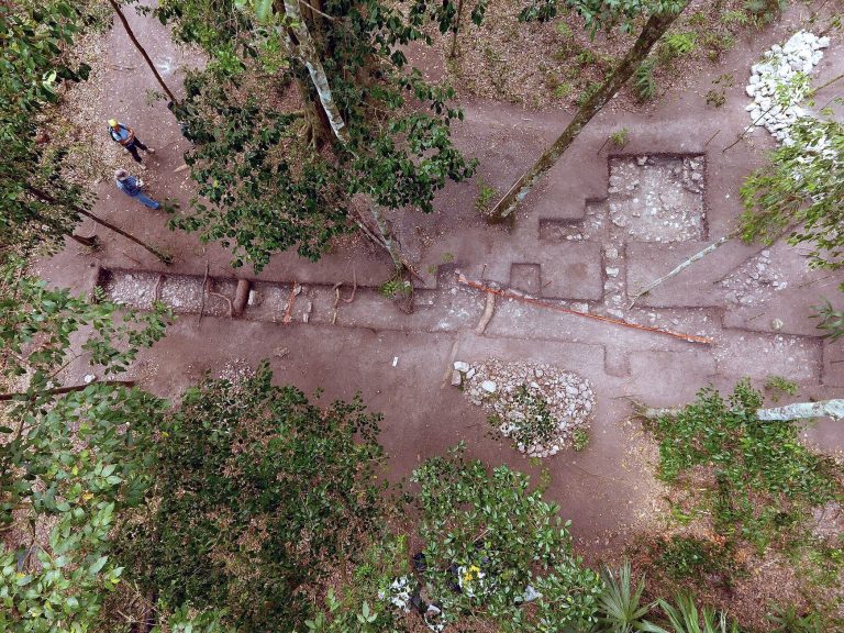
Looting drew attention to the site. Archaeologist Marco Antonio Bailey made the first official visit by the Guatemalan government in 1977 and mapped the ruins; he may also have introduced the name El Zotz, replacing the earlier name Dos Aguadas. George F. Andrews visited in 1978, and his report, published in 1986, brought the site into print. The National Tikal Project conducted investigations and rescue work in the core in 1983. Further mapping, test excavations, surveys, and excavations followed between 1990 and 2013.
A carved lintel taken from Structure M7-1 in the late 1960s was sold to the Denver Art Museum and returned to Guatemala in 1998. A royal tomb at El Diablo was discovered on 29 May 2010, with the discovery announced in July. The buried ruler is believed to have been King Chak, who may have ruled in the late fourth century and may have founded the dynasty.
The University of San Carlos of Guatemala has carried out conservation work at El Zotz. Late-2010s LiDAR surveys revealed a much larger settlement than previously recognized, with houses, palaces, raised roadways, and defensive works; the site’s scale and population density may be three or four times earlier estimates. El Zotz lies within the San Miguel La Palotada-El Zotz protected biotope, part of the Maya Biosphere Reserve and adjoining Tikal National Park. Looting, poor management, deforestation, fire, agriculture, poaching, illegal extraction, and natural disasters threaten the site.
Remains
The site extends across an area roughly 0.75 by 0.75 kilometres. Its core contains 49 buildings in four main groups, with two principal ceremonial centers: the central core and El Diablo, about one kilometre to the west. Low limestone ridges run southwest to northeast and reach about 400 metres above sea level, while intervening troughs lie around 150 metres. The site overlooks a valley with seasonal wetlands and occupies flatter ground near two springs. Tropical moist and seasonally inundated forests surround the ruins, with sapodilla among the dominant trees.
Buildings generally have rubble-and-mortar cores with layers of clay, likely taken from nearby lowland troughs. Large, finished limestone blocks sealed with mortar form the upper structures. These were coated with stucco, a smooth plaster, and painted in several colors, traces of which survive. Rooms are narrow and have vaulted ceilings. Four human-made chambers cut below plaza surfaces into limestone bedrock were probably used to store water.
The central core
Structures M7-1 and M7-2
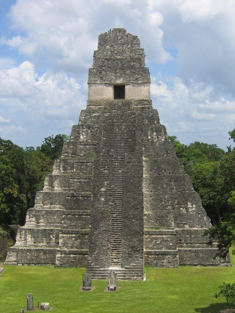
Structure M7-1 is a pyramid 22.5 metres high, with a base measuring 36 by 41 metres. Its well-finished stone shrine resembles Tikal Temple I in style. Two smaller mounds attached at its base form a group in which two buildings flank a principal structure; both mounds have been damaged by looters’ trenches. A wooden lintel, a beam spanning an opening, was made from five sapodilla planks and carved into a panel measuring 180 by 74 centimetres. Though incomplete, it shows a standing figure holding a ceremonial staff amid hieroglyphic writing. The figure’s clothing has been used to date the panel to about AD 550–650. The lintel is now in Guatemala City’s National Museum of Archaeology.
Structure M7-2 stands across a plaza from M7-1. Its base measures 21 by 33 metres, and it rises 12 metres. The likely entrance was on its south side, facing the plaza. Two looters’ trenches have damaged its eastern side.
Central Plaza
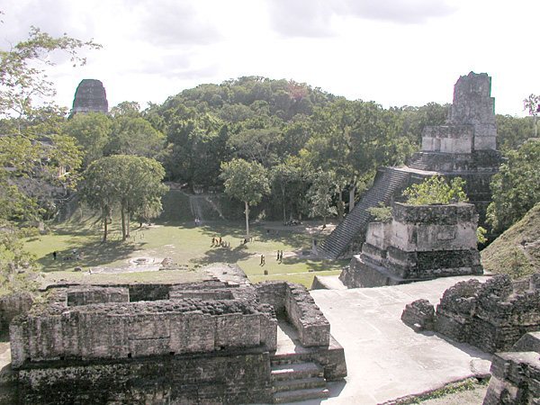
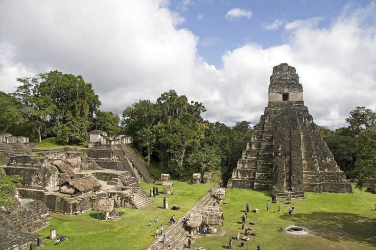
The Central Plaza is bordered by structures along its north and west sides. A ballcourt, a built court for the Mesoamerican ballgame, runs along the south; its unusually small scale compared with the city’s monumental buildings suggests a symbolic rather than practical function. Low platforms and pyramids line the west side. Six upright stone monuments, called stelae, and an altar stood in the plaza. Most of the stelae are plain and arranged in two north–south rows, with four in the western row and two in the eastern row.
Acropolis
North of the Central Plaza, the Acropolis is a group of large buildings, Structures L7-1 to L7-10, arranged around three patios. It is interpreted as an elite residence, probably a palace. Eighteen looters’ pits have been recorded there. Early Classic pottery came from a trench at L7-2. L7-6 has broad stairways on its north and south sides, while L7-7, probably built later than the other buildings in the complex, divides one courtyard into two.
Stela 1
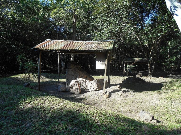
Stela 1 stands immediately south of Temple 1. It is the northern of the two monuments in the eastern row of the Central Plaza and is carved on all four sides. A human figure faces left on its front, while the back carries a panel of 39 glyph blocks. Late Classic pottery fragments found nearby have been interpreted as evidence of ritual activity.
Temple 1
Temple 1, also called Structure L7-11, stands on the northeast side of the Central Plaza. This funerary pyramid is 25 metres high and has a base measuring 40 by 40 metres. Its upper structure includes a corbel vault, formed by masonry courses that project inward. Heavy looting has damaged the building. Rescue work in 1989 installed replacement lintels, sealed some chambers, and closed the most dangerous looters’ tunnels.
The western and southern groups
Plaza of the Five Temples
West of the Central Plaza, the broad Plaza of the Five Temples is flanked by north and south pyramids of similar height. A long temple complex stands on its east side, arranged around a principal building with two smaller structures to either side. The layout resembles the Plaza of the Seven Temples at Tikal and has parallels at Yaxha. Two plain stelae stand near the plaza’s center; three more and an altar are in front of the eastern temples.
Structure L7-18
Structure L7-18 is a small pyramid on the west side of the Central Plaza and is also assigned to the Five Temples Group. Its base measures 13 by 13 metres, and it is 7 metres high. Two looters’ pits have damaged it. One pit, cut into the summit, caused serious structural damage and exposed a vaulted chamber with an intact north doorjamb. The chamber’s masonry vault and parts of its walls retain traces of stucco that indicate it was painted red, possibly with other colors. Its architectural style dates to the Early Classic. A roughly rectangular tomb with a curved roof, comparable in form to tombs at Río Azul, lay beneath the pyramid.
Structure L8-13
Structure L8-13, the north pyramid of the Plaza of the Five Temples, is 13 metres high and has a base measuring 22 by 26 metres. Thick doorjambs retain traces of a wooden lintel, and one bears pre-Hispanic graffiti. A royal tomb cut directly into bedrock lay within the pyramid and has been completely looted. Fine painted ceramic vessels showing wayob, spirit companions in Maya religious and artistic traditions, are thought to have come from the tomb.
South Group
The South Causeway begins at the southeast end of the Plaza of the Five Temples and runs to the South Group. This group is an acropolis complex of ten or more buildings on a raised platform around an interior patio. Dense vegetation covers the complex.
Eastern and southeastern precincts
East Group
The East Group is arranged around a broad plaza, with two burial pyramids along its north side. The East Causeway runs east from near Temple 1 in the Central Group to this group.
Southeastern platform
A separate complex southeast of the core consists of a rectangular platform measuring 56 by 22 metres, with a tall pyramid at its center.
El Diablo
Acropolis and temple
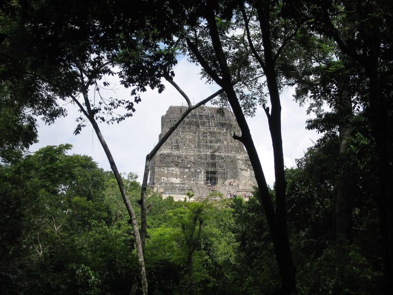
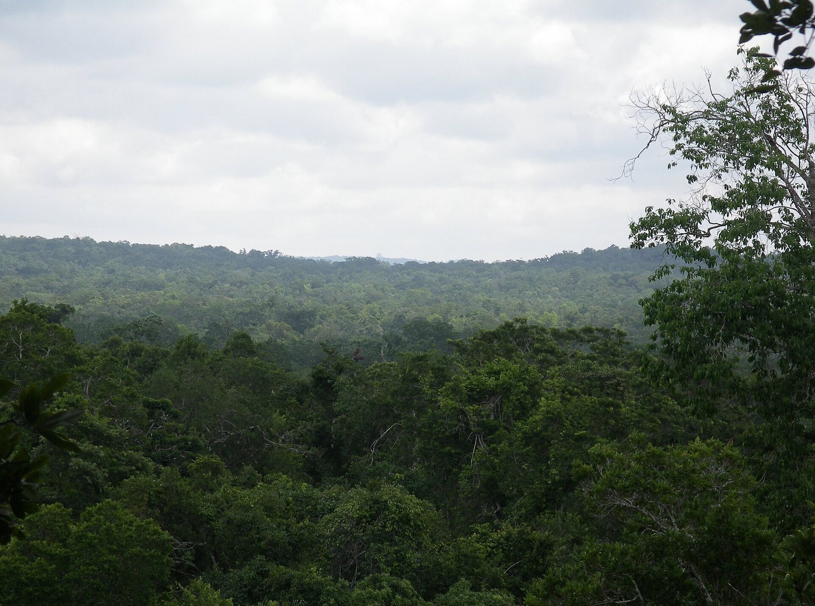
El Diablo occupies a defensive outcrop about one kilometre west of the central core, at the highest point in the area. Its artificially terraced hill supports an acropolis of large platforms arranged around at least two plazas. The main plaza is smaller and its buildings less monumental than those in the core. Tunnels dug by looters have exposed decorated substructures tentatively dated to the Early Classic, although the complex itself is thought to date to the Late Classic. The site is visible from Temple IV at Tikal.
A temple about 45 metres high, the tallest at El Zotz, is also called El Diablo. Its name is said to refer to the steepness of its sides. The complex also includes the Temple of the Night Sun and a cave beneath the cliffs. Large bat colonies shelter in caves below the cliffs; hundreds of thousands of bats are known to emerge at sunset. The name zotz and related Maya-language forms mean “bat.”
Royal tomb
The tomb held the remains of a ruler in his fifties or sixties and at least six children, aged between one and five. The children have been interpreted as sacrificial victims buried at the ruler’s interment. An obsidian blade with red residue, possibly blood, lay near them. The ruler’s jeweled teeth and ornaments of shell and dog teeth around his waist and legs resemble regalia shown in Maya ritual-dance paintings. This has prompted the suggestion that he was represented as a dancer in the burial ceremony, despite evidence of arthritis in his bones and joints.