El Mirador: A Preclassic Maya Regional Center in Guatemala
Site at a Glance
- Popularity
- Very High
- Country
- Guatemala
- Primary era
- Classical
- Eras represented
- Iron Age, Classical, Medieval
- Civilizations
- Maya
- Site type
- City
On this page24 sections
History
El Mirador is an ancient Maya city in Guatemala, occupied from about 1000 BCE and transformed by major construction beginning around 350 BCE. Its earliest settlement belongs to the Middle Preclassic, an early phase of Maya history. The city flourished especially from about 300 BCE to 150 CE, when its population and building activity reached their height. Its regional influence developed before Tikal rose to prominence.
Preclassic growth and regional influence
During the Late Preclassic, El Mirador extended its influence across the surrounding basin. La Danta served as a center for trade and religious ceremonies and as a royal residence. Raised roads linked the city with other Maya centers, connecting communities while expressing the reach of El Mirador’s rulers.
The city obtained large quantities of obsidian, volcanic glass used for tools and trade, from El Chayal in Guatemala. Tikal’s shift in the first century CE from obsidian supplied by San Martín Jilotepeque to material from El Chayal has been interpreted as evidence of El Mirador’s influence. Cerros, a Maya port center in northern Belize, may also have depended on El Mirador: its growth in the first century BCE and its supply of El Chayal obsidian suggest a possible connection. Archaeologist David Freidel proposed that El Mirador’s political reach may have extended to Yaxuná in northern Yucatán.
Intensive farming in the wetlands helped sustain the growing population. Maya farmers spread nutrient-rich mud from seasonal swamps across terraces and added lime to reduce soil acidity. They renewed depleted fields with further layers of mud. Crops included maize, squash, beans, cacao, cotton, and palm.
Decline and later occupation
Large-scale construction and occupation diminished after about 150 CE as other major Maya cities, including Tikal and Calakmul, gained prominence. The prolonged interruption in building and maintenance is interpreted as a societal collapse rather than a brief departure. Deforestation and soil erosion have been proposed as contributing factors. Lime production consumed substantial fuel: making an estimated tonne of lime cement required about five tonnes of wood and five tonnes of limestone. Erosion may also have washed soil into the seasonal wetlands, covering fertile deposits beneath two to three metres of sterile clay. Reduced harvests and famine are possible consequences.
Activity and population fell during the Early Classic, with settlement concentrated in some architectural groups, particularly in the west. People later returned on a modest scale during the Late Classic, living among and reusing the earlier buildings. They took stone from older structures, added construction to existing buildings, and sometimes demolished earlier buildings to make way for new ones. Some ceremonial structures became residences. This later settlement did not restore the city’s earlier political or economic influence, monumental building, or sculptural production. El Mirador was finally abandoned by about 900 CE.
Research and modern pressures
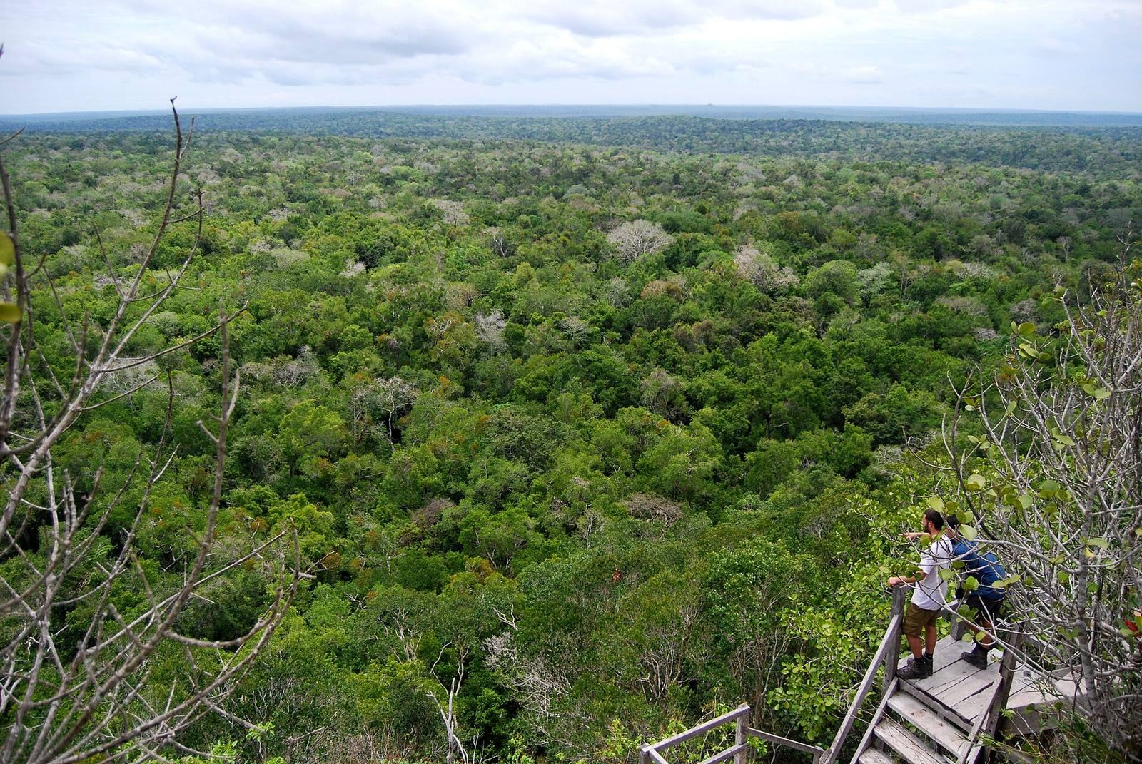
The name El Mirador means lookout or viewpoint. It is attributed to chicle contractors, who harvested natural tree latex and admired the view of the Petén forest from the buildings. Frank Vans Agnew and Enrique Shufeldt publicized the site in 1926, and Percy Madeira published photographs in 1930. A Carnegie Institution expedition led by Karl Ruppert and John Denison Jr. visited in 1933.
Ian Graham made the first site map and conducted early excavations in 1962, drawing attention to La Danta. From 1978 to 1983, a project led by Ray Matheny and Bruce Dahlin carried out the first intensive excavations. Dating work established the site’s great antiquity. A Harvard project also tested areas in the East Group and north of the Tigre Complex, recovering ceramics from the Middle Preclassic through the Late Classic.
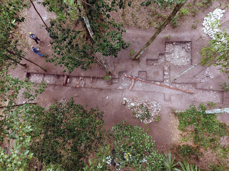
Large-scale investigations resumed in 2003 under Richard D. Hansen and Edgar Suyuc Ley. Hansen’s team undertook stabilization and conservation, including a climate-controlled shelter over a newly uncovered relief. Research on burials and dated monuments at El Mirador and other Preclassic Maya centers has challenged older portrayals of the period as culturally unsophisticated. Hansen has proposed that more than 45 mapped sites in the basin may have formed Mesoamerica’s earliest clearly defined political state. Logging, fires, logging roads, looting, and intrusive settlement have been identified as threats to the site and its surrounding basin.
Remains
El Mirador’s civic center covers about 26 square kilometres and includes thousands of structures. Many monumental buildings rise between about 10 and 72 metres, while estimates for the wider urban landscape include roughly 800 cities or centers. The city occupies terrain averaging about 100 metres in elevation, among wetlands, small lakes, lagoons, and sloping lowlands. The La Jarrilla wetland, a seasonally wet lowland beside the site, supplied clay for construction and pottery and formed part of the area’s drainage and rainwater-collection landscape.
La Danta Complex
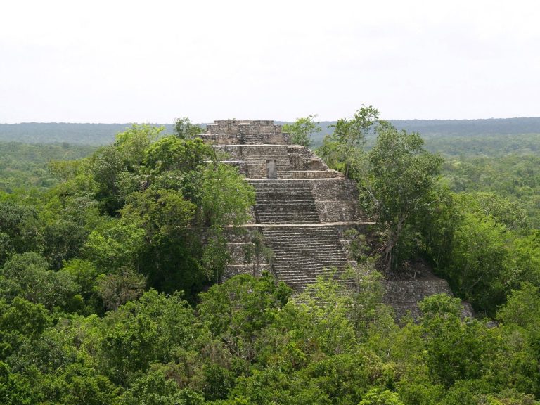
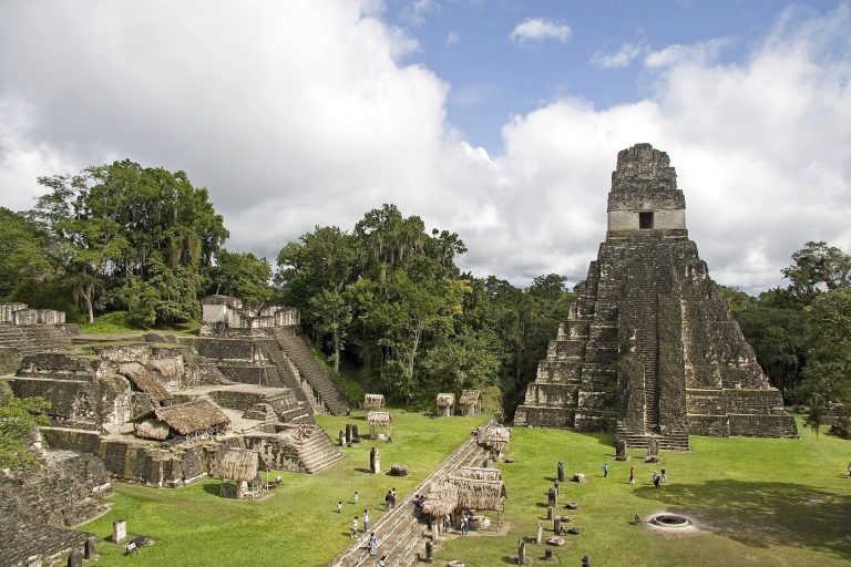
In the eastern part of the city, the Late Preclassic La Danta Complex rises across three stepped platforms. Its estimated volume is about 2.8 million cubic metres, and its supporting base covers about 180,000 square metres. The complex reaches an estimated 76 metres from its first platform to its highest point. Its main structure stands on the third platform, at the complex’s highest level; the principal facade faces west as the platforms rise eastward. Large sculpted masks once adorned building facades.
First platform
The first platform, or base, measures about 330 metres from north to south and 280 metres from east to west, and stands roughly 12 metres high. Layers of sascab, a soft calcareous building material, form its construction; its alignment lies 13 degrees and 30 minutes from true north. The platform contains the La Pava, Lagartija, and Tolok groups, two channels, a reservoir, an astronomical commemoration group, a palace, and the triadic La Pava pyramid. A central stairway at least 10 metres wide has seven steps leading toward La Pava.
Second platform
The second platform carries numerous small buildings, about one to two metres high, dating to Late Classic occupation. Their remains are poorly preserved, but a recessed stairway in one facade retains traces of sculpted masks.
Third platform
The third platform supports La Danta’s principal triadic group, a three-building arrangement on a shared platform. Exposed walls north and south of Structure 2A8-2 preserve masks flanking its stairway. The upper building included a chamber with a masonry roof. Evidence also indicates vertical walls with projecting cornices and roofs that later collapsed. The upper structure rises about 25 metres above the third platform.
Central-western civic groups
Group arrangement and enclosure
The Great Central Acropolis and the Tigre, Monos, León, Cascabel, Cigarras, and Tres Micos groups occupy an elevated plain beside the La Jarrilla wetland. Associated with administrative power, they form a cross-shaped arrangement: Tigre to the west, Cascabel to the north, Cigarras to the east, and Monos to the south. Their buildings include triadic groups raised on large bases. A wall system on the sector’s south, east, and north sides extends about three kilometres, enclosing the principal groups within roughly one square kilometre. It stands about three to eight metres high. A large wall around the northern, eastern, and southern sides of the western group was built before the Terminal Preclassic abandonment and may indicate that people perceived a threat, although its nature is unknown.
Tigre and Monos complexes
The Tigre Pyramid rises about 55 metres, making it the site’s second-highest pyramid. The large Los Monos complex reaches about 48 metres. Both form part of the central-western architectural groups, where buildings stand in triadic arrangements on broad platforms.
Causeways and settlement beyond the center
Raised roads
Thirteen raised causeways are associated with El Mirador’s connections within the city and across the basin. They were generally about 20 to 50 metres wide and stood two to six metres above the surrounding ground. A route linked the city with Nakbé, about 12 kilometres away, and another extended roughly 20 kilometres to El Tintal. The Danta Causeway connected La Danta with the city; other major roads linked it to the Great Central Acropolis and Nakbé.
Peripheral communities
Settlement around the center included Los Faisanes, Sacalero, Los Pericos, Pedernal, La Muerta, Las Ardillas, Loro Real, and La Herradura. Sacalero and its causeway date to the Middle Preclassic. From about 400 to 100 BCE, settlement spread in all directions from the urban center. La Muerta lies about three kilometres south of the Tigre Complex. Structure A2 in its Laberinto Group served a funerary purpose and has sloping walls and masks beside projecting stairways. Monument 1 depicts humanlike figures and includes a panel of hieroglyphic writing.
Buildings and construction
About 35 structures at El Mirador follow a triadic plan, with three buildings on a shared platform, often a central pyramid and two smaller structures set at right angles. El Tigre and La Danta are prominent examples. Residential buildings surrounded plazas, while ceremonial platforms and causeways connected architectural groups and settlements. Buildings were coated with plaster, and sculpted facade masks represented divine beings.
Structure 34
Structure 34 illustrates Preclassic building methods. Its tall masonry walls were coated in red plaster and supported by platforms and T-shaped bases. Long, bevelled stones formed projecting cornices, and small openings near the lower walls provided ventilation. Continuous chambers connected through narrow passages, while recessed stairs and masks flanking the central stairway shaped the building’s form.
Later residential forms
Late Classic residential areas included rectangular buildings with vaulted roofs, smaller platforms edged by low railings, and round structures in or near courtyards. Some were built by incorporating older buildings into new construction. Earlier civic groups, including the Great Central Acropolis and Tigre, also show occupation or remodeling extending from the Late Preclassic into the Early Classic. Ceramic remains indicate changes in the Tigre triadic court, the Pava Complex, and Structure 204 in the Cascabel Complex. Plaza C at Tigre had a small shrine on its east side and long domestic platforms along the other sides.
Water management, relief, and alignments
Rainwater system and relief
The city’s water system directed rain from roofs and plazas toward collection areas. A channel in the administrative area formed part of this system and ran beside a plastered relief dating to about 200 BCE. The scene shows two figures apparently swimming. It has been interpreted either as figures connected with a rain deity or as the Hero Twins Hunahpú and Ixbalanqué swimming in the underworld, Xibalba, to recover their father’s severed head. The twins appear in the Popol Vuh, a foundational K’iche’ Maya narrative.
Building alignments
Geometric patterns and alignments link buildings across the site, although earth, stone, and vegetation obscure parts of the structures. Some buildings could serve as sighting points for the sun on important dates, and other recorded alignments relate to the sun and moon. These arrangements may have created an artificial horizon in a landscape without mountains. Building-facade orientations, however, are understood as expressions of ritual symbolism rather than astronomical alignments.
Carved monuments
Stelae
About twenty carved upright stone monuments, known as stelae, have been found across the site, alongside plain examples. Some carved monuments have images on both sides and include early visual features resembling monuments at Kaminaljuyu from the end of the Preclassic. Some may have been reused as building material in platforms.
Termination deposits
The Mirador Basin’s Terminal Preclassic or Protoclassic ceramic phase, dated approximately 75/25 BCE to 420 CE, has been associated with possible termination rituals, ceremonies marking the closure of a building’s use. At Structure 204 in the Cascabel Complex, walls and floors were burned, and floors were cut to create pits for deposits placed within existing buildings. Similar ceremonial pits occurred at the La Pava and Tigre complexes.