Xunantunich: A Maya Civic-Ceremonial Centre in Belize
Site at a Glance
- Rating
- 4.9
- Popularity
- Medium
- Country
- Belize
- Primary era
- Medieval
- Eras represented
- Classical, Medieval
- Civilizations
- Maya
- Site type
- City
On this page21 sections
History
Xunantunich is the ruin of a Maya city-state and civic-ceremonial centre at San Jose Succotz in Belize, on a ridge above the Mopan River near the Guatemalan border. The settlement developed principally during the Late Classic period, when Maya political and architectural centres flourished, and became one of the major powers in the densely occupied Belize River valley.
Early settlement and the rise of kingship
Human activity in the Early Xunantunich area, about 800 metres east of the later centre, may extend back to around 3000 BC. Secure settlement begins with the Muyal phase, around 1100 BC. The population increased substantially between about 700 and 300 BC, when the nearby centre of Actuncan was the leading regional power.
River access, fertile farmland, fishing, and trade routes linking the Caribbean, the Peten, and the Maya Mountains supported the early community. At first it was a small settlement with limited regional influence. During the Preclassic period, communal feasting and ritual activity gradually contributed to social differentiation, ancestor veneration, and the emergence of kingship. A royal institution had been established at Early Xunantunich by the Late Preclassic, alongside further growth of the settlement.
Preclassic activity also took place in the later central area, although its earliest buildings are difficult to interpret. The oldest securely dated layer of Structure A-7 belongs to the Late Preclassic, but it remains uncertain whether this building formed part of the developing settlement or an independent ritual centre. Much of the settlement was probably abandoned around AD 200, at the end of the Preclassic, and construction remained limited for several centuries.
Expansion during the Classic period
Xunantunich was reoccupied on the ridge during the Samal phase, beginning in the early seventh century. It expanded rapidly between approximately AD 600 and 670, and grew still more during the Hats’ Chaak phase, approximately AD 670 to 750. During the Late Classic, it became one of the principal regional centres of the Belize River valley.
Its rise was closely connected with Naranjo, a major Maya polity in present-day Guatemala. The relationship may have involved a pressured alliance or a patron-client arrangement, while still allowing Xunantunich a degree of autonomy. Naranjo’s decline after AD 744 altered the balance between them, and the two centres increasingly appear to have acted as political equals. Xunantunich also maintained strong political and economic connections with western centres, including Ucanal in present-day Guatemala.
As Xunantunich expanded, it brought Actuncan under its control and linked the centre to the ridge by a causeway. A subordinate ruler or governor may have been installed there. This transfer of authority marked Xunantunich’s replacement of Buenavista del Cayo as the dominant power in the Mopan valley. Buenavista del Cayo probably remained its principal regional rival, with the two centres competing politically, economically, and perhaps militarily from the Samal phase onward.
The city’s expansion encouraged the growth of settlements along the Mopan, where fertile soils supported farming and crops such as cacao. In areas tested north of the core, occupation increased from 16 percent during the Ak’ab phase to 39 percent in the Samal phase and 72 percent in the Hats’ Chaak phase. Farmers lived in dispersed, kin-based village groups rather than in a densely concentrated urban population.
Warfare, royal authority, and political change
Excavations at Structure A-9 in 2016 recovered two carved panels and a burial. The panels had been made at Caracol in AD 642 as parts of a hieroglyphic stairway describing King K’an II’s victory over Naranjo in AD 631, when Caracol was allied with Calakmul. After Naranjo and Xunantunich defeated Caracol in a major war in AD 680, the panels were removed as war booty. Most were taken to Naranjo, while two were brought to Xunantunich and buried near a tomb.
The burial contained a high-status woman who died between approximately AD 670 and 740 at about 30 to 40 years of age. Ceramic vessels, obsidian knives, jade beads, animal bones, and other stone objects accompanied her. Her prominent burial place and rich grave goods place her among Xunantunich’s highest elite. She may have taken part in the campaign against Caracol, with the panels forming part of her war booty.
The first half of the Hats’ Chaak phase, especially around AD 670 to 680, was Xunantunich’s period of greatest expansion. The royal residence at the north end of Plaza A was established during this phase, while new groups were built and older areas were brought back into use.
Royal palace A-11 was violently destroyed between approximately AD 750 and 775, about a century after its construction. The cause is unknown. The destruction may reflect a major political transformation, possibly including the end of a local dynasty. The interpretation that a foreign dynasty controlled by Naranjo was removed remains disputed. After A-11 was destroyed, new groups were abandoned and monumental construction largely stopped.
Structure A-1 was then built as a new pyramid in the previously open centre of Plaza A and became the site’s spiritual centre. Structure A-7 also received its final major superstructure. Xunantunich’s regional authority subsequently weakened. Actuncan became independent again and established a local council instead of restoring a kingship. North of the core, settlement density fell from 72 percent of tested areas during the Hats’ Chaak phase to 21 percent during the Tsak’ phase, beginning around AD 780.
Independence and abandonment
Panel 2, found at El Castillo and dated approximately AD 780 to 820, gives the ruler of Katuutzwitz the elevated royal title k’uhul ajaw, commonly translated as “holy lord.” The title has been interpreted as evidence that Xunantunich had regained political independence. The panel also records military activity involving Naranjo and two unidentified places.
Stela 8 records a joint ritual at Xunantunich in AD 820 by the rulers of Xunantunich and Naranjo. Stela 9, dated AD 830, is sufficiently similar to suggest that the same ruler may still have governed the city. Stela 1 and Altar 1 formed a pair dated AD 849, although their ruler was no longer the same person recorded in AD 820 and 830. They may have been dedicated during a renovation of Structure A-1 in the presence of another ruler.
Stela 1 and Altar 1 are the last known datable inscriptions from Xunantunich. Katuutzwitz, probably the ancient name of the site or its ruling lineage, was largely abandoned between AD 849 and 890 during the wider collapse of Classic Maya civilisation. Limited human activity continued during the Postclassic period. The inscriptions indicate that Xunantunich became more independent as Naranjo declined, while retaining its alliance with that centre and placing increasing emphasis on warfare during its final phase.
Archaeological investigation
Thomas Gann began small excavations in Plaza A during the 1890s. Teobert Maler visited in 1905 and published photographs of Altar 1 and Stela 1 in 1908. At that time the modern name Xunantunich was not yet in use, and the ruins were known by the name of nearby Benque Viejo del Carmen.
Eric Thompson began systematic excavation in 1938 and established a regional ceramic chronology in 1942. Later investigations by A. H. Anderson and Linton Satterthwaite concentrated mainly on El Castillo. Michael Stewart excavated the eastern Triadic Group and Group C during the 1950s, while Euan McKie worked on Structures A-11 and A-15 in 1959 and 1960.
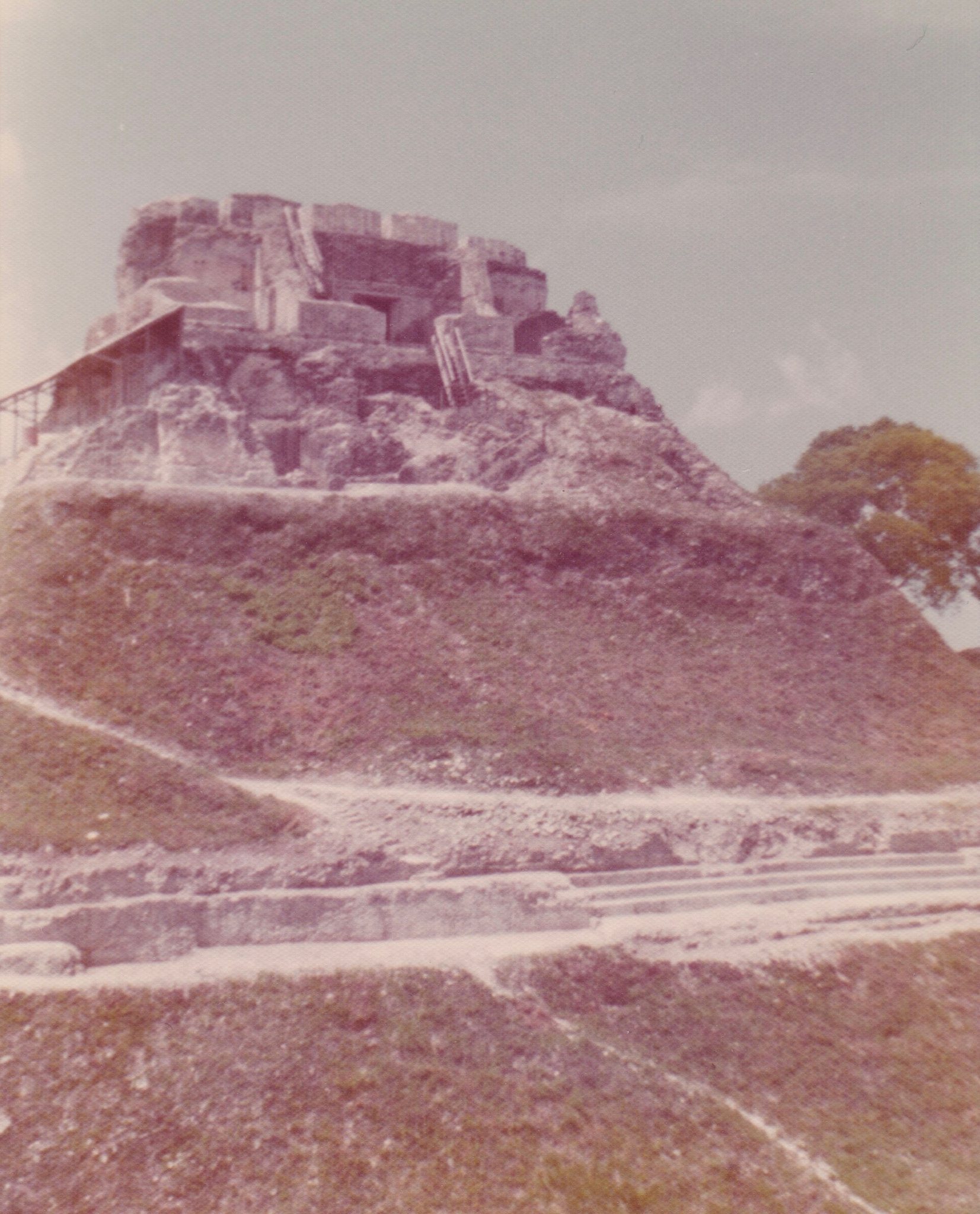
Further work cleared, consolidated, and reconstructed parts of the site. The Xunantunich Archaeological Project, conducted from 1991 to 1997, remapped the settlement, revised its chronology, excavated structures in Plaza A, conserved several buildings and the western frieze of El Castillo, and surveyed the wider settlement. Later projects consolidated additional structures and investigated the final occupation, monument conservation, the causes of rapid growth, and the circumstances of abandonment.
Remains
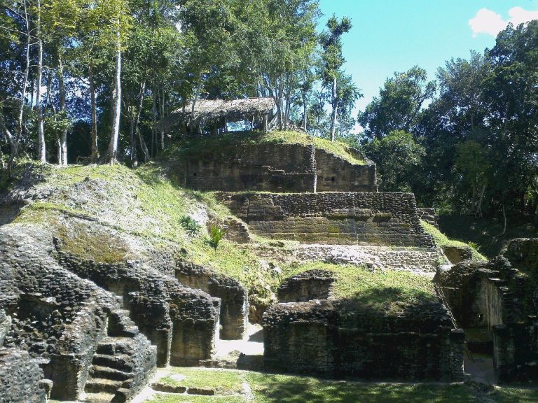
The core settlement covers about 14 hectares and is arranged around Plaza A. More than 50 structures stand in the central area, including about 30 in Plaza A and another 20 to 30 in surrounding groups. Smaller buildings extend north and east towards the Mopan River. The broader centre contains six plazas and more than 25 palaces and temples, while the wider settlement spread across several square kilometres through smaller communities and local centres.
Plaza A and its principal buildings
The northern palace
Plaza A follows a north-south axis and is divided into Plaza A-I, A-II, and A-III. Structures A-10, A-11, A-12, and A-13 enclosed Plaza A-III as a palace complex. A-11, on the northern edge, probably served as a royal residence. It was violently destroyed and then ritually filled with rubble before the settlement was abandoned. Structures A-23 to A-25 stand immediately east of this palace.
Structure A-1
Structure A-1 is a pyramid in the western middle of Plaza A, separating Plaza A-I from A-II. Built during the Late Classic, probably around AD 800, it occupied an area that had previously remained open. It became a ritual setting used mainly by rulers and elites, and four stelae and three altars stood immediately to its south. Its later renovation may have provided the setting for the dedication of Stela 1 and Altar 1.
The eastern Triadic Group
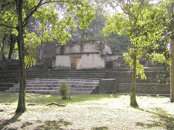
The eastern side of Plaza A contains a Triadic Group formed by Structures A-4, A-3, and A-2. A-3, the central building, probably dates to the Late Classic. It is 16 metres high and 24 metres wide, with five terraces and a central staircase 9 metres wide. A-4 was built in two phases and contained two elite burials. The small Structure A-16 stands in front of A-2, beside the passage towards Plaza A-I.
Structure A-7 and the ballcourts
Structures A-7 and A-8 border the western side of Plaza A-I, while A-9 borders Plaza A-II. A-7 has an unusually long building history. Its lowest layer is a Late Preclassic monumental building about 19 metres long and 3.55 metres high. After several centuries, a 30.6-metre-long building with vaulted rooms was constructed in the early Late Classic and repeatedly remodelled. In the Terminal Classic, it was covered by a seven-terraced pyramid with a base about 36 metres on each side. A-7 is the oldest securely dated monumental building in the later central settlement.
Ballcourt 1, formed by Structures A-19 and A-18, lies behind A-7 beside the causeway to Group B. A smaller ballcourt between A-1 and A-8 consists of Structures A-17 and A-22.
El Castillo
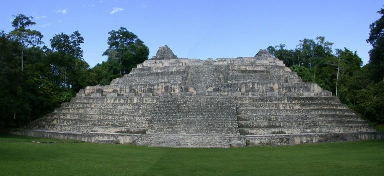
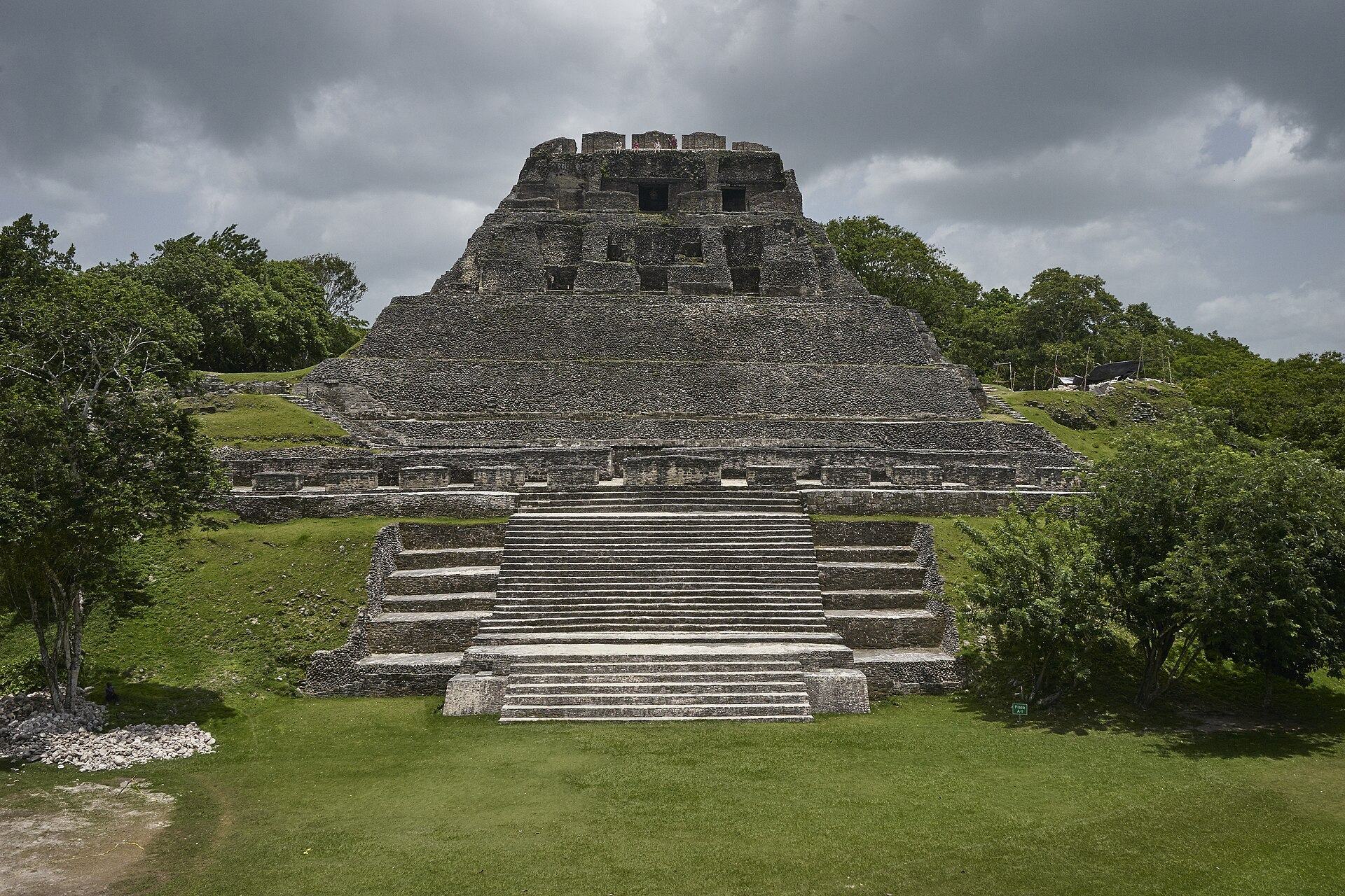
El Castillo stands at the southern end of Plaza A and rises approximately 39 to 40 metres. It functioned primarily as a royal palace, except when the northern palace A-11 was in use. A broad staircase reaches a platform about 20 metres above ground level. Above it stands another pyramid supporting Structure A-6, a group of vaulted rooms. Repeated enlargements covered smaller predecessors that may date as early as the Muyal phase.
The eastern and western sides bear reconstructed stucco friezes protected by visible fibreglass replicas placed over fragile originals. Their framed scenes relate to celestial phenomena, the birth of a god connected with the royal family, creator gods, and a cosmic tree extending between the underworld, earth, and heavens. The northern and southern friezes are eroded, while other sections were covered during reconstruction or later building work.
The upper construction developed in at least two stages. The earlier Structure A-6-2nd, dating to around AD 800, had three doorways. The later A-6-1st had doorways only on its northern and southern sides and stood above a series of terraces.
Groups B and C
Group B
Group B lies about 150 metres west of El Castillo and is linked to Plaza A by a causeway. Its nine structures form two courtyards and an open court. Structure B-1 is a small shrine containing numerous burials of children and adolescents and may have served a special ritual purpose. Structure B-5 contained a sweat bath, a heated structure used for controlled sweating with possible ritual or therapeutic associations.
Structure B-3 was elaborately furnished and repeatedly renewed into the Terminal Classic. Several buildings in the group were masonry constructions, and its proximity to the royal palace suggests an association with the ruling family. An open area immediately southeast of Group B, beside Ballcourt 1, is sometimes called the Lost Plaza and probably served as a market.
Group C
Group C lies directly south of El Castillo on a terraced slope. It contains at least eight structures, including the sweat bath C-4. Its enclosed courtyards probably served special occasions or preparations for ceremonies at El Castillo and elsewhere in Plaza A. Built during the early Hats’ Chaak phase, the group fell out of use during that same phase. Walls and ditches along its southern edge probably had defensive purposes.
Structures C-2 and C-3 are the group’s largest buildings. They may have housed young people trained in the writing rooms beneath A-5, and their courtyard may have been used to practise activities such as fighting or dancing. Simpler buildings, including C-5, C-6, and C-7, may have housed servants.
Groups D, E, and the eastern settlement
Group D
Group D lies about 200 metres east of Group C and was connected to Plaza A by a causeway running from the northern edge of El Castillo. The route passed behind a water reservoir, or aguada, before turning south towards the group. Its raised plaza centres on Structure D-6, a pyramid probably associated with ancestor veneration. Stela 11 stood in front of it.
Twelve platforms around D-6 provided housing for four households. One household occupied an entirely masonry-built structure and may have belonged to a higher-status family. Group D dates architecturally to the Late Preclassic or Protoclassic. D-6 aligns directly with the E-Group pyramids of Early Xunantunich, and a causeway connected the two areas.
Early Xunantunich
Early Xunantunich, also called Group E, lies about 800 metres east of Plaza A and nearly 150 metres from the Mopan River. It is the oldest known and longest continuously documented occupied area of the site. The group contains smaller buildings, three plazas, and a monumental platform. Plaza E includes an E-Group, a Maya arrangement associated with formal planning and often with astronomical or calendrical ritual, formed by two small pyramids on a platform.
Platform F-1, northeast of Plaza E, measures 100 by 115 metres and rises up to 13 metres high. Group O/A2-1 lies immediately north and consists of small structures, with further unexcavated buildings nearby. Early Xunantunich remained an occasional ritual place into the Protoclassic, became a craft-production area during the Late Classic, and continued in use into the Early Postclassic.
The Zapote Group
The Zapote Group lies a few metres south of the access causeway, in front of Structure A-15. It consists of two roughly perpendicular buildings, ZAP-1 and ZAP-2. Both were built during the Late Classic. ZAP-2 came first and was enlarged on its northern side before ZAP-1 was added. The buildings appear to have been occupied briefly and were probably abandoned towards the end of the Classic period.
Writing rooms, routes, and the wider settlement
Two rooms beneath Structure A-5, exposed from 2016 onward, date to the Hats’ Chaak phase. More than 400 marks were incised into their plaster, ranging from simple lines to readable hieroglyphs and including two calendar dates. The repeated motifs and varying quality of the marks suggest that the rooms may have been used to train young elites in writing, symbolism, calendrical knowledge, and history. A separate stairway connected the rooms directly with Group C, which may have housed the students.
The historical and modern approach came from the east because the ridge’s northern, western, and southern slopes are very steep. A monumental stairway near the river, about 1.5 kilometres from the core, probably marked the start of the ancient route. Near the site, the route passed a building now called Chaaca Patio, then continued along a paved road and up stairs to Plaza A-II.
The wider settlement extended especially along the Mopan River and included communities and local centres such as Succotz, Chan, Chaa Creek, Chan Nohool, and San Lorenzo. A 2014 lidar survey identified a large plaza north of the Acropolis and residential ruins on a western and southwestern ridge. The southern and western parts remain comparatively little explored because they lie beside the contested Guatemalan border.