Tel Arad: An Early Bronze Age City and Judahite Fortress
Site at a Glance
- Rating
- 4.7
- Popularity
- Very Low
- Country
- Israel
- Primary era
- Bronze Age
- External website
- Open
- Eras represented
- Stone Age, Bronze Age, Iron Age, Classical, Medieval
- Civilizations
- Canaanite, Israelite, Roman
- Site type
- City
On this page15 sections
History
Tel Arad is an archaeological site near Arad in Israel, built and occupied by successive communities from the Late Chalcolithic period through the Early Muslim period. Its lower city developed into an important Early Bronze Age settlement, while the hill above it later held an Iron Age fortress of the Kingdom of Judah. The site occupied an east-west route across the Arad Plain, linking the Jerusalem and Hebron area with the Arad Valley, Horvat Uza, and the Dead Sea.
Early Bronze Age city
The first settlement appeared around 4000 BCE, during the Late Chalcolithic period. Stratum V consisted of pits on the hill and nearby rises. In Early Bronze Age I, Stratum IV formed an open rural settlement in which people used natural caves and clefts as part of their living environment. During the early Early Bronze Age II, Stratum III developed into a substantial city, followed without a chronological break by Stratum II. After the earlier city was destroyed, Stratum I represented a much smaller settlement.
Early Bronze Age Arad combined farming, herding, craft production, and long-distance exchange. Its connections extended through Canaan, Egypt, Sinai, and possibly the eastern Mediterranean. The settlement participated in copper exchange through the Beersheba Valley and probably exported salt and bitumen from the Dead Sea area. These links helped connect the city to wider economic changes across the southern Levant.
Stratum III was destroyed by fire during an enemy attack. The later destruction of Stratum II has been explained in several ways, including declining rainfall, the expansion of Egyptian control over Sinai and its effect on copper exchange, and political upheavals that brought new populations into Canaan. Arad was abandoned by about 2650 BCE. A shift toward a drier climate in the middle of the third millennium BCE may have weakened agriculture and the surrounding rural hinterland, while copper-related exchange increasingly focused on sites in the Negev Highlands and the Arabah.
Iron Age settlement and the Kingdom of Judah
After a long abandonment, a settlement was established on the hill during the Iron Age. Its initial date is placed variously between the late twelfth or early eleventh century BCE and the tenth or ninth centuries BCE. The first community was either open or enclosed and was later replaced by a Judahite military stronghold. The Kingdom of Judah was the southern Levantine kingdom centered on Jerusalem.
Arad became a fortified settlement of Judah, with six successive fortresses built or rebuilt from the second half of the ninth century until the early sixth century BCE. The defenses were improved in the mid-eighth century BCE. The site suffered destruction connected with the Assyrian king Sennacherib’s campaign of 701 BCE, may have been destroyed by the Edomites near the end of the seventh century BCE, and was finally destroyed by the Babylonians in 586 BCE. The Babylonian conquest ended the First Temple period, the era associated with the Jerusalem Temple and the monarchies of Judah.
Religion, writing, and later occupation
An Iron Age temple at Arad provides direct archaeological evidence for a Yahweh cult operating outside Jerusalem within the Kingdom of Judah. Yahweh was the national deity worshipped by Israelites and Judahites. The temple’s presence indicates that religious institutions and practices in the monarchy were more varied than the biblical account alone suggests.
The temple’s date and final use remain disputed. The original excavation team placed its foundation at the end of the tenth century BCE and interpreted the ritual burial of the sanctuary during the second half of the seventh century BCE as a result of King Josiah’s centralization of worship in Jerusalem. Other archaeologists date its construction to the late eighth or early seventh century BCE and associate its destruction by fire with the Babylonian siege of 586 BCE.
About 200 inscribed pottery sherds were found at the site. They include Hebrew, Aramaic, Greek, and Arabic texts, with the Hebrew examples concentrated in the First Temple period. Military letters, administrative notes, supply records, and references to priestly families and temple duties create a sequence of evidence for life in the fortress. A 2020 study of 18 inscriptions concluded that 12 were written by different individuals, suggesting a high level of literacy among non-elite people of the period.
The fortress mound continued through Persian, Hellenistic, and Roman military phases. Arad remained in use until the end of the Bar Kokhba revolt in 135 CE, the second-century Jewish uprising against Roman rule. A proposed reconstruction of the lower city during the reign of Herod the Great, for bread production, remains uncertain.
Early Muslim reuse and modern investigation
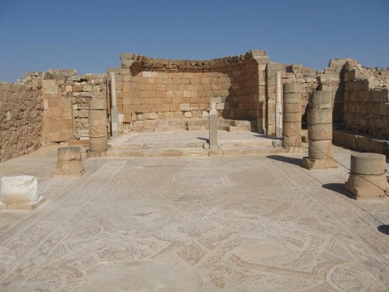
After roughly five centuries of abandonment, the former Roman citadel was rebuilt and remodelled during the Early Muslim period. It served as a waystation or defensive settlement for about two centuries. Political breakdown, rebellion, and unrest led to its destruction around 861 CE. No later permanent structures were built there, while a later Arab-period layer represents a Bedouin burial site.
The site has traditionally been identified with the biblical city of Arad. Edward Robinson, a nineteenth-century biblical geographer, connected its name with that city in modern scholarship in 1841. The identification with the Canaanite city mentioned in the Bible is disputed because Middle and Late Bronze Age remains are absent. The Iron Age identification is supported by Hebrew ostraca, inscribed pottery sherds, that mention Arad. Another proposal places the biblical Canaanite city at Tel Malhata.
Excavation began in 1962 and continued through 18 seasons during the twentieth century, with later work extending to 1984. Ruth Amiran directed most work in the lower city, while Yohanan Aharoni directed most excavations on the fortress. Eight additional seasons investigated the Iron Age water system, although the final publication of Aharoni’s fortress excavations remained incomplete after his death. Restoration has taken place in both the upper and lower areas. Tel Arad is a national park managed by the Israel Nature and Parks Authority.
Remains
Lower city
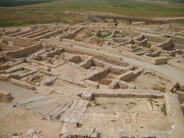
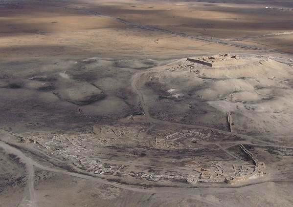
Tel Arad covers approximately 10.1 hectares and has two principal physical zones. The lower city occupied relatively low ground and covered about 100 dunams. A fortified wall approximately 1,200 metres long enclosed it. The upper settlement and fortress stood on a hill above the city, preserving a sequence of 13 occupation strata from the Early Bronze Age through the Iron Age, Persian, Hellenistic, Roman, and Early Muslim periods, followed by a burial layer.
Urban layout and houses
The Early Bronze Age city contained planned streets, public and administrative buildings, fortifications, and a water-management system. Rainwater and runoff were directed from the streets toward reservoirs in the lower central area. The extent to which the streets followed a deliberate radial plan remains disputed. Houses generally followed the characteristic Arad house plan, with a large room, a smaller adjoining room used as a store or kitchen, and sometimes an enclosed courtyard. Entrances opened from the broad side, creating a form that later appeared at other sites in the region.
Public buildings and water works
Stratum III included a city wall with towers, a central reservoir, public buildings, a palace, and a group known as the Water Fortress. The palace contained a standing stone, or stele, bearing an engraving of Dumuzi. A stele is an upright stone that could have a commemorative or cultic purpose. The same urban phase also included a possible pair of temples, identified partly through the discovery of a standing stone.
The Early Bronze Age economy is represented by large quantities of charred barley, wheat, legumes, peas, lentils, and chickpeas, together with olive stones, grape pips, sickle blades, and flint harvesting tools. The olives and grapes may have been grown locally or brought from the Hebron hills. Sheep and goat bones are numerous, with smaller quantities of cattle and donkey bones, the latter probably connected with transport. Bone needles, awls, spatulas, copper awls, textile-working tools, hide-processing implements, mortars, grinding stones, and ceramic vessels show the range of domestic and craft activities.
Hilltop fortress
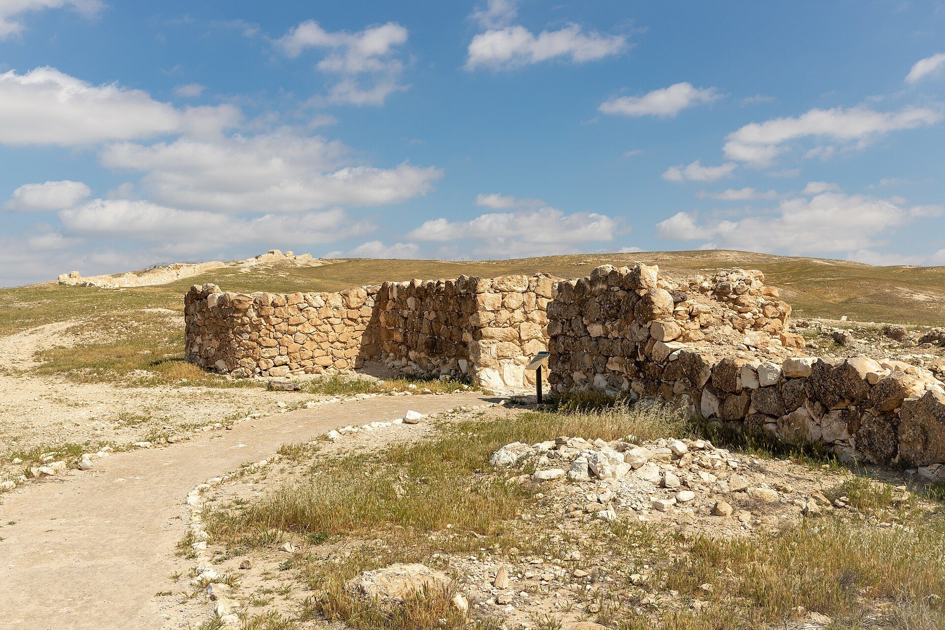
The Iron Age settlement on the hill was followed by six roughly square fortresses. Each occupied about 50 to 55 square metres and belonged to a successive phase between the ninth and early sixth centuries BCE. The defenses included a Judahite casemate fortress, whose wall was divided into chambers, later solid walls, and a monumental or towering gate.
Early settlement and fortifications
The earliest enclosed settlement contained approximately 20 to 25 dwellings arranged wall to wall around a courtyard, probably used as a sheep pen. A single eastern exit led toward the depression of the former lower city, where water was collected. Some buildings reused broadroom houses from the Bronze Age. A broadroom is a rectangular building whose main room extends across the building’s width.
Iron Age temple
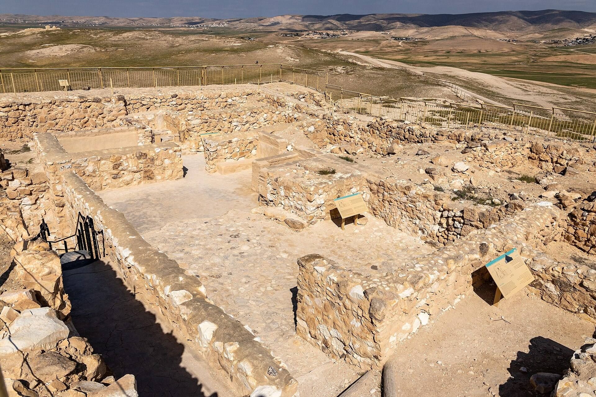
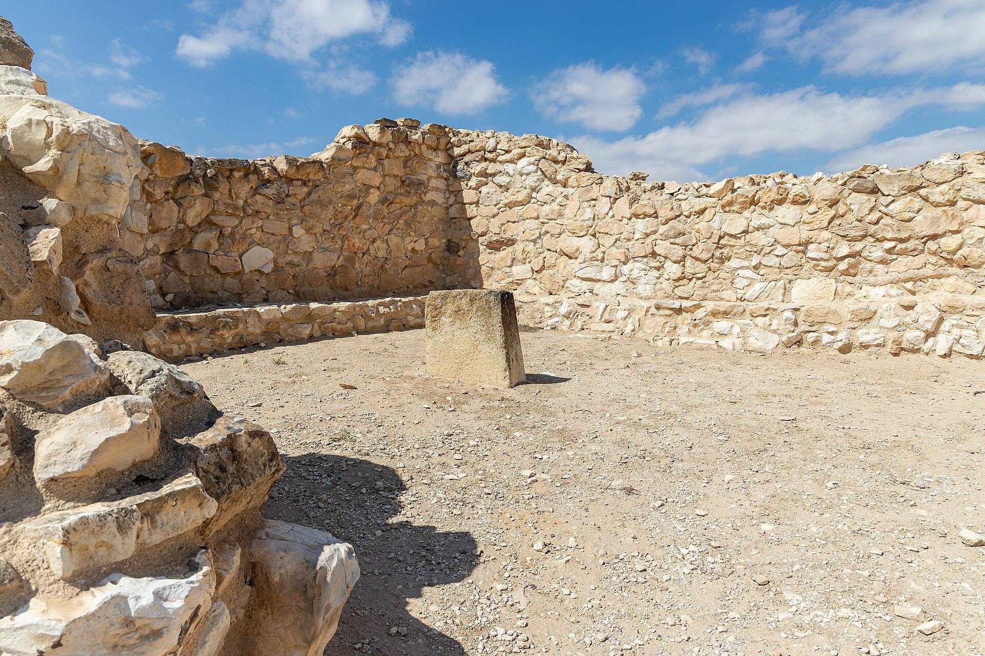
The Iron Age temple occupied part of the fortress and had three spaces arranged in sequence. Its rectangular courtyard measured about 12 by 7.5 metres and contained an altar made from earth and fieldstones, approximately 2.5 metres square. The courtyard opened into a narrow hall about 10.5 by 3 metres, with benches along its sides. A raised, recessed niche in the rear wall measured approximately 1.8 by 1.1 metres.
Two small stone incense altars stood near the niche. One was about 50 centimetres high and the other about 40 centimetres high. Dark residues remained on their upper surfaces. Analysis detected compounds related to frankincense on the larger altar and cannabis derivatives on the smaller one. The niche contained either one or three standing stones. Two were incorporated into the plaster of the wall, while a third, nearly one metre high, had smoothed sides and traces of red paint. It had fallen inside the niche and may have represented or symbolized the presence of the deity.
The temple’s design resembles cult buildings associated with Israelite and Canaanite religious settings, where standing stones could function as cult objects. Administrative and military letters from the fortress connect worship at the temple with Yahweh and do not mention other deities.
Reservoir and inscriptions
A fortress reservoir was cut into bedrock beneath the temple courtyard. About 10 metres deep, it held approximately 400 cubic metres of water in two plaster-lined chambers. The larger chamber included a small room, while the smaller had a plastered staircase for maintenance and drawing water. The reservoir supplied the fortress during ordinary conditions and sieges and also served temple ceremonies. Its use is associated with the eighth and ninth centuries BCE.
Most Hebrew ostraca from the fortress date to around 600 BCE and use Paleo-Hebrew, the ancient Hebrew script used before the later square Hebrew script became standard. Many are everyday military letters addressed to Eliashib, probably the fortress quartermaster. One refers to a “house of Yahweh,” which some scholars interpret as the Jerusalem Temple. Other writing includes an ostracon in Egyptian hieratic, a cursive Egyptian script used mainly for administrative and religious texts, and a later fragment combining hieratic and Hebrew-Phoenician signs.
Silver hoard
A silver hoard was found in a cloth-wrapped jug in a space between two rooms south of the structure identified by Aharoni as the temple. The hoard consisted of two adhering bundles of nearly pure silver weighing about 200 grams. Most of the metal was cut into pieces, accompanied by a smaller quantity of broken jewellery. The deposit has been dated either to the ninth century or, following revised stratigraphy, to the eighth century BCE.
The jewellery included two hook-shaped earrings, one incomplete, a twisted-wire ring incorporated into one earring, a circular setting that once held a gemstone, and two connected chain fragments. The setting was decorated with granulation, a technique that applies tiny metal grains to a surface. Chemical analysis indicates that the silver originated on the Iberian Peninsula and probably reached the region through Phoenician Mediterranean trade. The hoard may have belonged to a silversmith or another craftsman working in the fortress area.
Trade and material culture
The site’s pottery includes storage jars, large containers, cooking vessels, serving and eating wares, drinking vessels, small containers, and lamp bowls. No pottery workshops or kilns have been identified, suggesting that ceramic manufacture was not a major local industry. Imported Canaanite pottery, Egyptian storage jars, copper objects, Red Sea and Mediterranean shells, and cooking vessels whose clay may come from southern Sinai show the reach of Arad’s exchange networks.
Large quantities of Dead Sea bitumen were found in rooms at the site, probably for export together with salt. Cylinder seals and stamp seals, including unfinished examples, were made from locally available chalkstone and point to developed local seal production. Fine bone objects, beads, and jewellery used imported shells, gemstones, stone, and pottery, indicating that imported materials were worked locally. A clay model of an Arad house, dated to approximately 3000 to 2650 BCE, is preserved in the Israel Museum.