Túcume: A Lambayeque Ceremonial and Administrative Center
Site at a Glance
- Rating
- 4.5
- Popularity
- Medium
- Country
- Peru
- Primary era
- Medieval
- External website
- Open
- Eras represented
- Medieval
- Civilizations
- Chimú, Inca, Sicán
- Site type
- City
On this page10 sections
History
Túcume is a pre-Hispanic archaeological settlement and ceremonial complex in the lower La Leche Valley of northern Peru. It developed around Cerro La Raya, also known as Cerro Purgatorio, from about the eighth century and became a major Lambayeque, or Sicán, administrative and religious center between approximately AD 1000 and 1350.
Lambayeque development
The Lambayeque people, possibly descendants of the earlier Moche civilization of Peru’s northern coast, established Túcume as a center of administration and worship, and perhaps also as a military base. It became a later capital of the Lambayeque civilization after the earlier center of Poma, in the upper La Leche Valley, was abandoned.
A foundation tradition links the settlement to Naymlap, a legendary Lambayeque ruler said to have arrived from the sea and founded the community with local farmers near Cerro La Raya. The Spanish chronicler Miguel Cabello Valboa recorded this tradition in 1586. A search for Naymlap’s tomb at Túcume did not succeed.
Chimú and Inca rule
The Chimú, a pre-Inca state that controlled much of Peru’s northern coast, took the region around 1350 or during the later fourteenth century. They ruled Túcume until about 1470 and substantially altered parts of the Lambayeque complex. Their changes to Huaca Larga included an enlargement that gave the structure a settlement arrangement modelled on a Chimú citadel.
The Inca Empire incorporated Túcume around 1470 and held it until 1532, when the Spanish conquest ended Inca rule. The settlement was finally abandoned between 1532 and 1547. By 1547 it was already described as abandoned and ruined. The reasons for its decline remain uncertain. Excavations have revealed extensive traces of fire and more than one hundred skeletons near Huaca Larga that appear to belong to victims of human sacrifice, but their connection with the site’s final decline has not been established.
Investigation and preservation
Hans Heinrich Brüning, a German-Peruvian engineer, ethnographer, and linguist, encountered the huaca ruins by chance and became the first investigator associated with the area. His photographs and archaeological finds contributed to the creation of the Museo Nacional Enrique Bruning de Lambayeque.
Twentieth-century research included Alfred Kroeber’s plan of 1930, Wendell C. Bennett’s excavation report of 1939, Richard P. Schaedel’s plan based on aerial photographs in 1951, and Hermann Trimborn’s detailed historical and archaeological study of 1979. A major project organized by Thor Heyerdahl began in 1988 and continued into the early 1990s, with fieldwork by Daniel H. Sandweiss and Luis Alfredo Narváez Vargas. This work led to the establishment of the Museo de Sitio Túcume beside Huaca 1. The museum opened on 20 August 1993 and contains collections recovered during excavations carried out between 1989 and 1994.
Archaeological investigation has been made more difficult by the removal of protective surface layers during digging and by torrential El Niño rains. This recurring climate phenomenon can bring unusually heavy rainfall to Peru’s normally arid northern coast. Túcume is recognized as a cultural heritage property of Peru.
Remains
Layout and construction
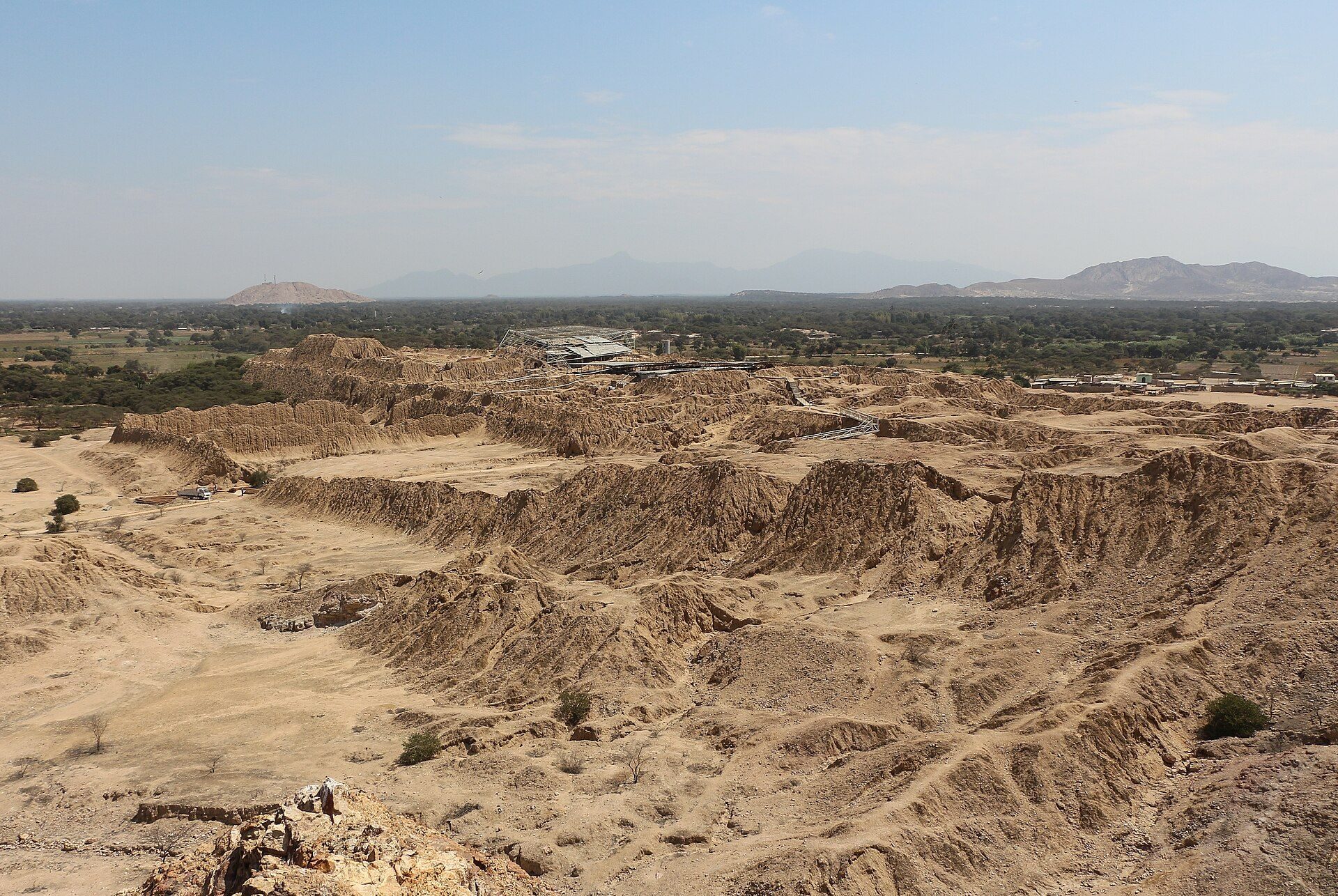
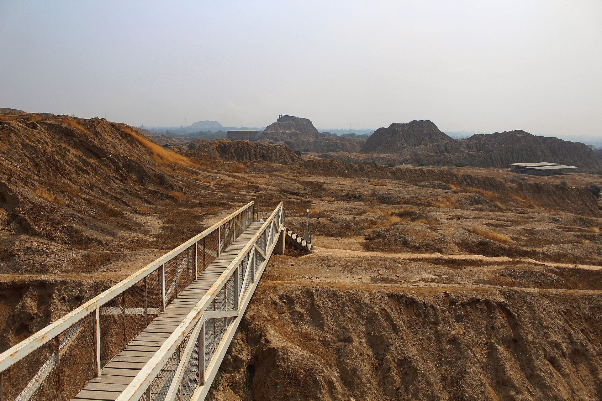
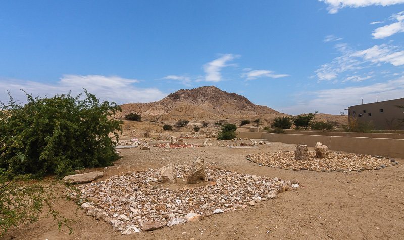
The complex covers approximately 220 hectares on a plain around and partly surrounding Cerro La Raya, about 1 kilometer east of the town of Túcume. It contains 26 major pyramidal structures and approximately 260 other structural remains. The site is in a desert landscape crossed by rivers, river oases, and fragile dry forests. Farming away from the rivers required sophisticated irrigation systems in the surrounding region.
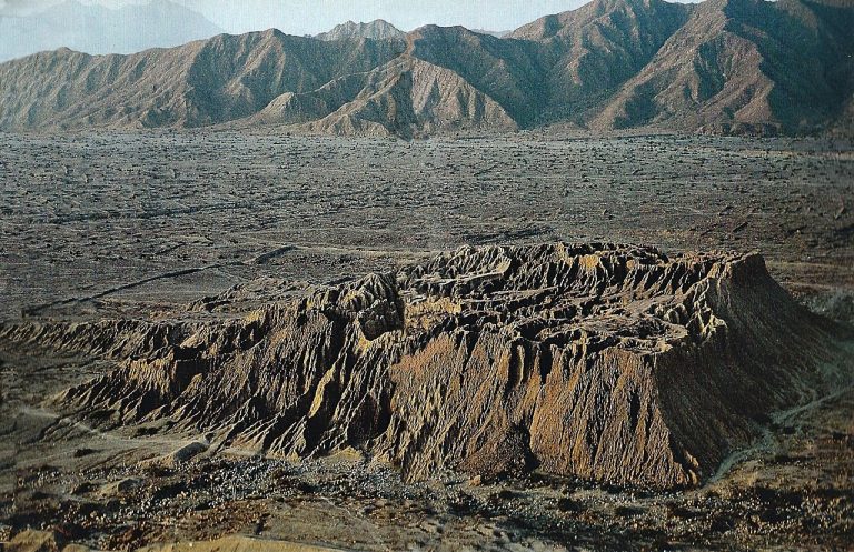
The structures traditionally called pyramids are mainly huacas, sacred places or revered entities in Andean religion. At Túcume, the term refers particularly to truncated temple mounds rather than pointed pyramids. Their wide platforms supported temples and, in upper areas, quarters for Lambayeque nobles, priests, and ruling families. Some platforms carried an additional raised section containing a sacred precinct. Walled areas and cemeteries survive around the pyramid bases, while some platforms contain buildings in the Inca style.
The principal building material is small rectangular adobe brick. Walls were plastered, and some surfaces were painted with rows of birds and other motifs. The huacas originally had geometric forms and were reached by ramps. Torrential rainfall and El Niño erosion have reshaped them so extensively that they now appear irregular and resemble natural hills. Excavation has also damaged protective surface layers, while later rainfall has caused further erosion.
Principal huacas
Huaca Larga
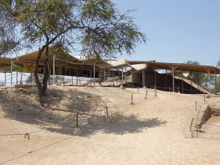
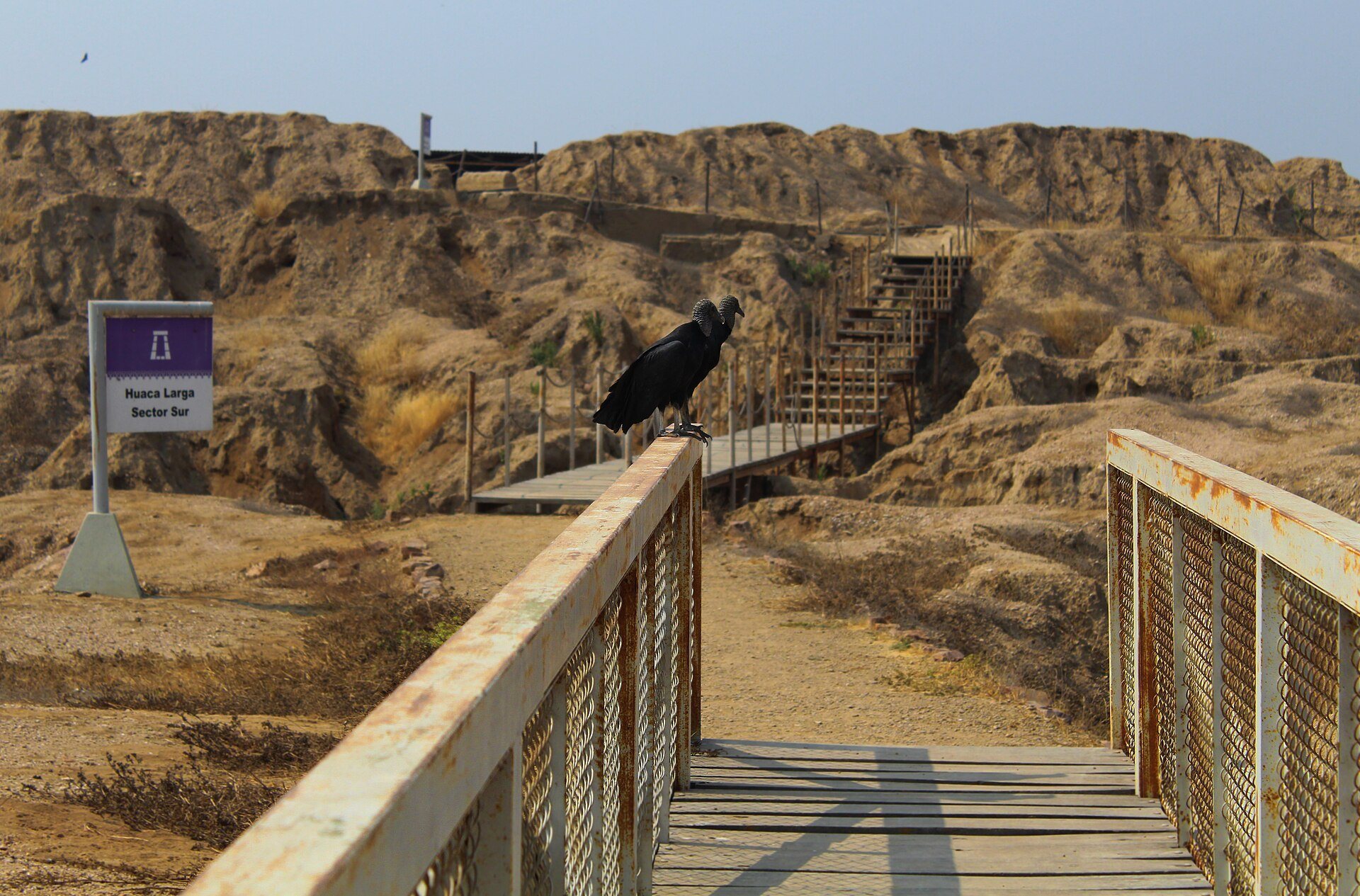
Huaca Larga is the largest structure at Túcume, with a base approximately 700 meters long and 270 to 280 meters wide. The Chimú enlarged it and incorporated a citadel-like arrangement into the earlier Lambayeque structure. Fire traces and more than one hundred skeletons found near the huaca have been interpreted as evidence of human sacrifice, although their relationship to the settlement’s decline remains unresolved.
Huaca 1 and Huaca El Mirador
Huaca 1, also called Huaca El Mirador, is currently about 30 meters high and is the tallest pyramid at the site. The Museo de Sitio Túcume stands beside it and preserves archaeological collections recovered from excavations at the complex.
Other named huacas
Other named structures include Huaca del Pueblo, also called Huaca Grande, on the eastern edge of the town, as well as Huaca de las Estacas, Huaca Pintada, and Huaca Las Balsas. Several other pyramids reach approximately 10 to 15 meters in height. Inca-style constructions on some platforms provide physical evidence of the fifteenth-century Inca conquest and occupation.