Kernavė Mounds: Hillforts of Lithuania’s Medieval Capital
Site at a Glance
- Rating
- 4.9
- Popularity
- Low
- Country
- Lithuania
- Primary era
- Medieval
- Eras represented
- Iron Age, Medieval
- Civilizations
- Grand Duchy of Lithuania
- Site type
- Military
- Remains
- Citadel
On this page13 sections
History
Kernavė Mounds are an archaeological complex in Kernavė, Lithuania, associated with the medieval city that became one of the centers in the formation of the Lithuanian state. The hillforts developed from the sixth to the fourteenth centuries, while Kernavė is regarded as the oldest known, though not the first, capital of the Grand Duchy of Lithuania, a major medieval state in eastern Europe.
Early settlement and medieval castles
Archaeologist Adolfas Tautavičius proposed that habitation on Altar Hillfort may have begun during the first centuries AD. One interpretation holds that Kernavė began to grow from a homestead in a protected courtyard behind wooden walls, although this remains a hypothesis. The central hillfort later formed part of a wider fortified settlement associated with the medieval city.
A castle stood on Mindaugas Throne Hillfort during the twelfth and thirteenth centuries. After it was burned, another castle was built there. Kernavė first appears in historical sources in 1279, under the name Kernowe. The Livonian Rhymed Chronicle describes it as a possession of Grand Duke Traidenis, who ruled from 1269 to 1282.
Destruction and abandonment
In 1365, the Teutonic Knights burned the castles of Kernavė and Maišiagala. During the final Teutonic attack in 1390, Kernavė’s defenders burned the fortifications themselves before withdrawing to Vilnius. These events ended the hillforts’ role as the active defensive center of the settlement.
Investigation and protection
Konstantinas Benediktas Stanislovas Tiškevičius described the hillforts in 1857, and Vladislovas Sirokomlė excavated there in 1859. Exploratory investigations resumed in 1979 under an expedition of Vilnius University and the Lithuanian Institute of History directed by Pranas Kulikauskas and Regina Volkaitė-Kulikauskienė. Alieksejus Luchtanas led the expedition from 1985 onward, and archaeological work has continued since 1979.
The Kernavė archaeological site became part of the Kernavė State Cultural Reserve in 1989. The reserve covers 194.4 hectares and has a protective buffer zone of 2,456.2 hectares. The archaeological site was added to the UNESCO World Heritage List in July 2004. The protected complex currently includes 18 officially recognized archaeological, historical, and cultural heritage properties.
Remains
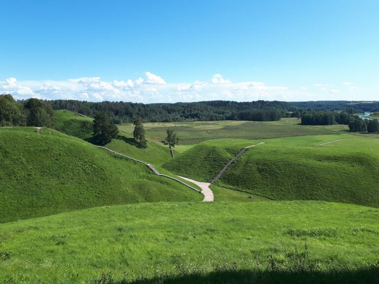
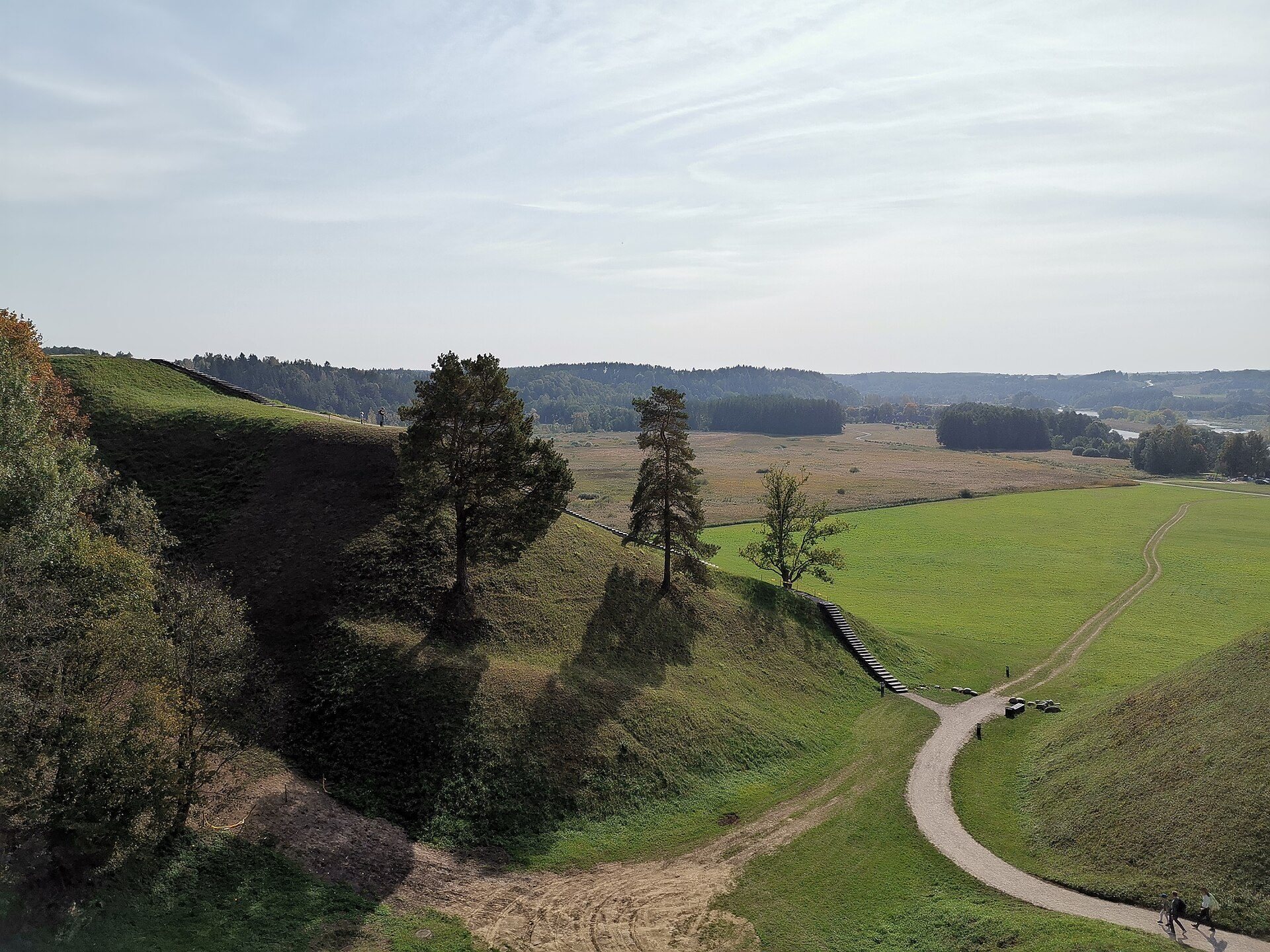
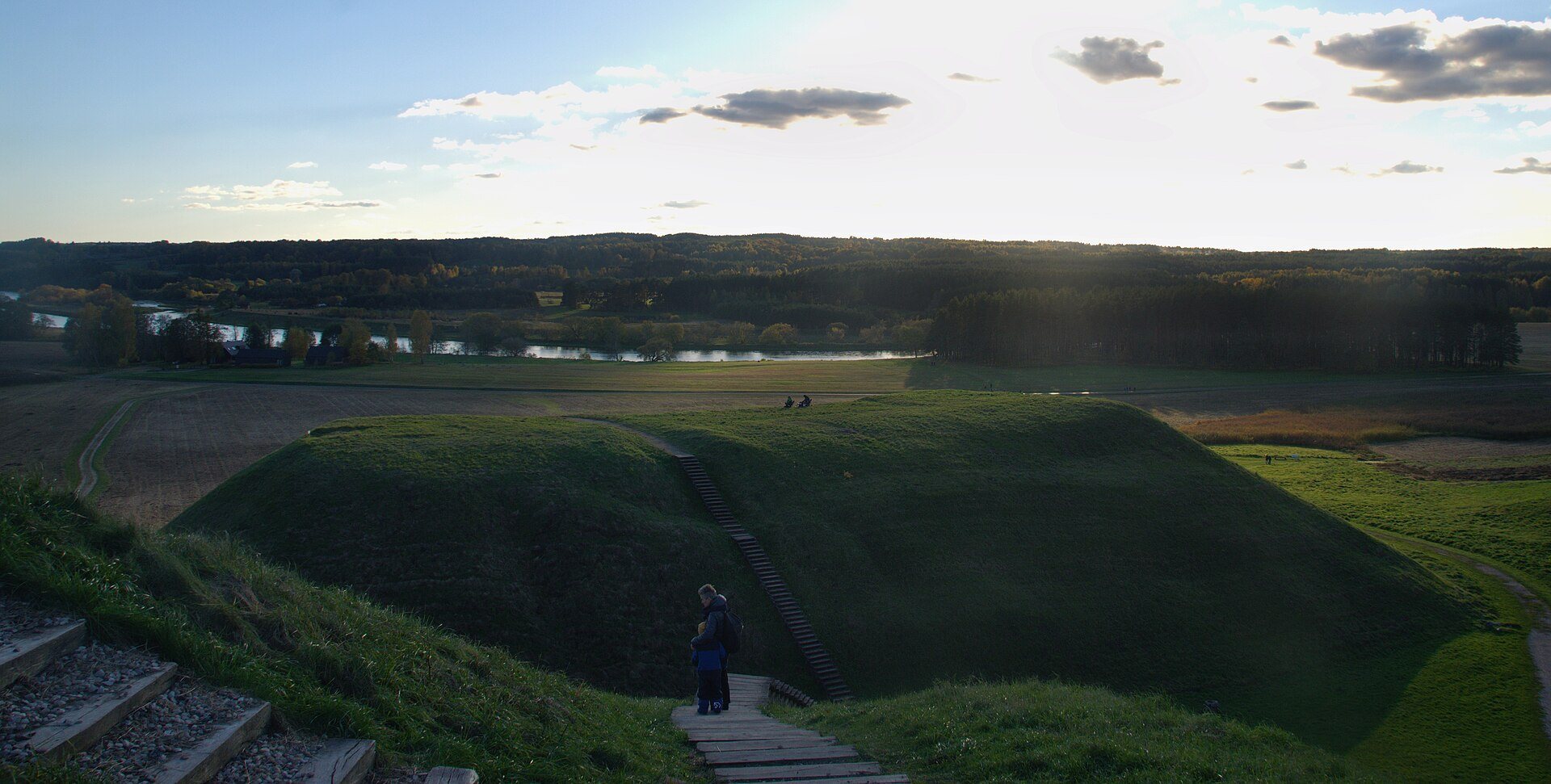
The complex occupies the right slope of the Neris Valley beside Pajauta Valley on the southern edge of Kernavė. Its principal group consists of four closely arranged hillforts, with a fifth, Kriveikiškis Hillfort, about 0.4 kilometres to the southeast on the right bank of the Kernavėlė Stream. The former medieval urban area and Iron Age settlement areas extend through the valley below. More than 50 archaeological, historical, and cultural monuments form part of the wider complex, including Kernavė Cemetery, the Kernavė Barrow Cemetery, and settlements connected with Kernavė.
The principal hillfort group
Altar Hillfort
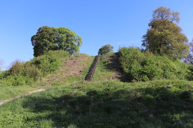
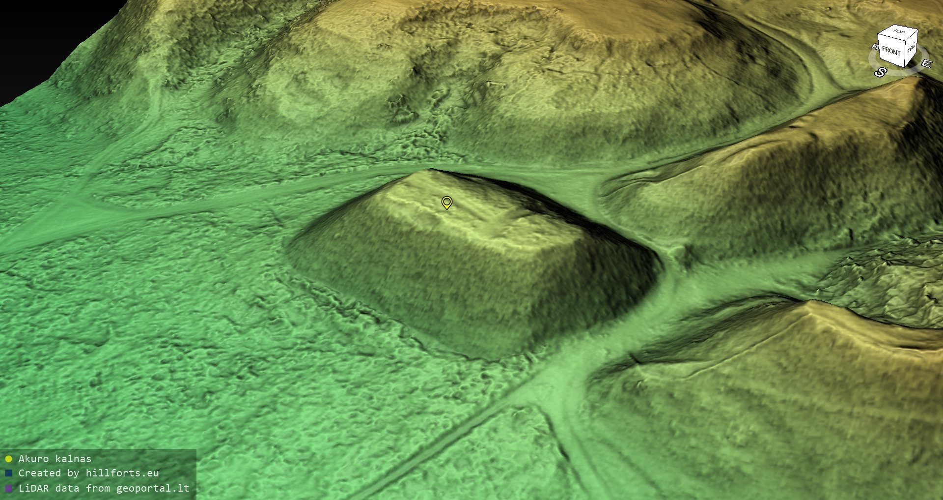
Altar Hillfort, also known as Barščiai Hill or Holy Hill, is the lowest of the hillforts. Deep hollows separate it from the neighboring uplands. The mound has the shape of a truncated cone, ending in an oval summit plateau. A dark cultural layer is visible on its slopes, containing charcoal and fragments of burned clay. In the organization of the four closely grouped hillforts, Altar Hillfort is identified as the principal hillfort.
Mindaugas Throne Hillfort
Mindaugas Throne Hillfort lies north of Altar Hillfort. Its summit overlooks Pajauta Valley and the Neris, while the other hillforts can also be seen from it. A castle occupied the hillfort during the twelfth and thirteenth centuries, and a later castle was constructed after the earlier one burned.
Lizdeika Hillfort
Lizdeika Hillfort is one of the two fore-hillforts that complemented the principal hillfort within the closely grouped defensive complex. The present name, like the names of the other hillforts, was created in the nineteenth century.
Garrison Hillfort
Garrison Hillfort formed the outer fortification of the four closely grouped hillforts. Together, the principal hillfort, the two fore-hillforts, and this outer defensive elevation organized the fortified area above the valley.
Separate hillfort and archaeological areas
Kriveikiškis Hillfort
Kriveikiškis Hillfort stands apart from the main group, about 0.4 kilometres to the southeast on the right bank of the Kernavėlė Stream. Its position forms part of the broader hillfort complex associated with the Neris Valley and Pajauta Valley.
Valley settlements and excavated areas
The valley contains the former medieval city and Iron Age settlement areas associated with the hillforts. Excavations have covered 1,755 square metres on four hillforts and at their foot, together with 4,590 square metres in the settlement areas and medieval city in Pajauta Valley. Only about 1.5 percent of the cultural reserve has been investigated. Finds from the complex are held by the Kernavė Archaeology and History Museum.