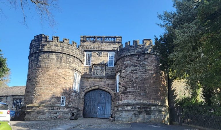
Clitheroe Castle: The Medieval Administrative Centre of the Honour of Clitheroe
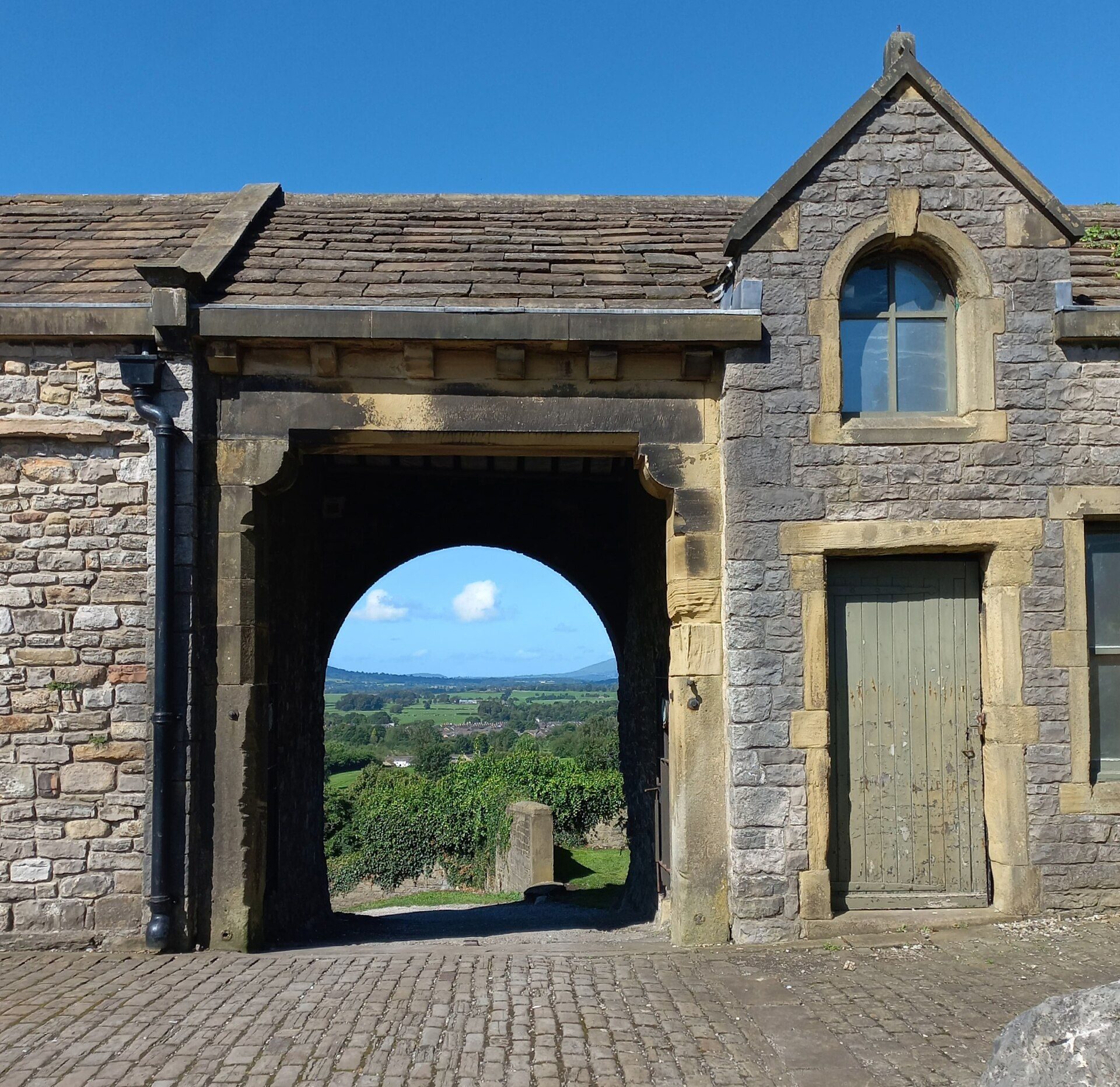
Site at a Glance
- Rating
- 4.5
- Popularity
- Low
- Country
- United Kingdom
- Primary era
- Medieval
- Eras represented
- Medieval, Early Modern, Modern
- Civilizations
- English, Norman
- Site type
- Military
- Remains
- Castle
On this page18 sections
History
Clitheroe Castle is a ruined early medieval castle in Clitheroe, United Kingdom. Generally considered Norman in origin and probably built in the twelfth century, it served as the caput, or principal administrative and judicial centre, of the Honour of Clitheroe, a large medieval estate extending along the western Pennines. The castle occupied a defensible limestone outcrop above the Ribble valley and helped control an established route through the landscape.
Norman origins and the Honour of Clitheroe
The castle’s earliest history remains uncertain. A wooden fortress may have stood here before the Norman Conquest, although a reference in the Domesday Book used to support that interpretation may instead concern Lancaster Castle. After the Conquest, Roger de Poitou granted the lands of Blackburnshire and Bowland to Robert de Lacy during the reign of William Rufus. When Roger lost his English lands in 1102, Henry I allowed de Lacy to retain them and added Chipping, Aighton, and Dutton. Clitheroe then became the centre of the new honour.
There was probably a castle at Clitheroe by 1102, and a charter of 1122 mentions its chapel. In 1138, a Scottish force led by William fitz Duncan defeated an English army at the Battle of Clitheroe. The castle does not appear in surviving accounts of the battle, although its position may have influenced the choice of the battlefield.
The fourteenth-century Historia Laceiorum attributes the castle’s construction to Robert de Lacy, who died in 1193. He is generally associated with the keep, although some fortifications may have preceded it. Additional building took place in the late twelfth century. After Robert died without an heir, his lands passed through his family to Roger, constable of Chester, whose descendants became Earls of Lincoln in 1232. The castle was garrisoned during the rebellion of Prince John, the brother of Richard I, in the 1190s.
Medieval administration and conflict
Repairs were carried out in the early fourteenth century, when a new gate was also built. After Henry de Lacy, 3rd Earl of Lincoln, died in 1311, his estates passed to Thomas, 2nd Earl of Lancaster, through Thomas’s marriage to Henry’s daughter and heiress, Alice. In 1315, during Sir Adam Banastre’s rebellion against Lancaster, Clitheroe was one of the castles raided for weapons. After Lancaster was attainted and executed in 1322, his lands passed to the Crown and were later granted to his brother Henry. They subsequently became part of the Duchy of Lancaster, a major royal estate formed from lands attached to the Lancaster inheritance.
The inner bailey probably contained a great hall, which was rebuilt in 1324. The hall hosted the Hundred Court under the honour’s steward and also held halmote courts, manorial courts dealing with the affairs of Chatburn, Worston, and Pendleton. The castle also served as a jail. Henry VI may have been held there after his capture near Clitheroe in 1464. In 1506, the castle porter was imprisoned in his own jail after attending a gathering of armed men at Whalley. Whether the keep itself served as the prison is uncertain, since a separate dungeon may have stood in the bailey.
Further repairs took place in the fifteenth century, including the construction of a new chamber in 1425. During the Wars of the Roses, a series of dynastic conflicts over the English throne, Edward IV ordered £200 of repairs. The castle later deteriorated, although records from the 1480s still name a constable and a porter. Surveys made in 1602 and 1608 described the buildings as severely ruinous and noted that some had collapsed.
Civil War, decline, and changing ownership
During the English Civil War, the seventeenth-century conflict between the forces of Charles I and Parliament, Prince Rupert left a royalist garrison at Clitheroe in 1644. The garrison repaired the main gateway and stocked the castle, but abandoned it after the royalist defeat at the Battle of Marston Moor. Lancashire militia occupied the castle briefly in 1649 during a dispute over unpaid wages. Parliament then ordered it to be slighted, or partly demolished, to prevent further military use. The extent of that demolition remains uncertain.
In 1660, Charles II granted the castle and the Honour of Clitheroe to George Monck, 1st Duke of Albemarle, as a reward for helping restore the monarchy. Ownership later passed through his family to the Dukes of Buccleuch. From the late seventeenth century, the castle became the residence of the honour’s steward. A new steward’s house was built around the time of a 1723 plan, while much of the remaining curtain wall was apparently demolished and terraced gardens were created.
Clitheroe continued to serve as the administrative centre of Blackburnshire until 1822, when the town hall in Church Street took over that role. Repairs were undertaken in 1848 because the ruined keep was in danger of collapsing. The work rebuilt its staircase tower, repaired the eastern corner, refaced parts of the interior and exterior with Chatburn limestone, and added buttresses to the southwest and southeast walls.
Public ownership and preservation
The borough council purchased the castle estate from John Douglas-Scott-Montagu, 2nd Baron Montagu of Beaulieu, in November 1920 for £9,500. The purchase formed part of a public scheme to create a memorial to the 260 local soldiers who died in the First World War. The wider grounds were subsequently laid out as a public park.
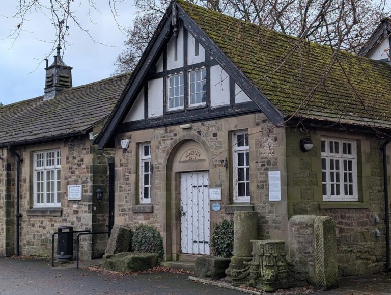
Substantial preservation work was carried out on the keep’s southeast elevation in the late 1980s. Further restoration accompanied the redevelopment of the museum in 2008, when the first archaeological survey of the site, including test excavations, was completed. The site has been a Scheduled Monument since 10 April 1915 and has been listed at Grade I since 19 May 1950. The former Steward’s House now contains Clitheroe Castle Museum, while the former courthouse is used for temporary exhibitions in the Steward’s Gallery. The museum first opened there in 1954 and reopened after redevelopment on 23 June 2009.
The chapel of St Michael
The Chapel of St Michael de Castro was mentioned in charters from 1120 and was ecclesiastically separate from the ancient parish of Whalley. It was associated with the castle and its demesne and retained its own district. Henry de Lacy withheld the chapel and its district when he granted Whalley to the monks of Stanlaw, later Whalley Abbey. The abbey obtained the advowson, the legal right to appoint the chapel’s incumbent, from John of Gaunt in 1365. After the Dissolution of the Monasteries in the late 1530s, the chapel’s benefactions were transferred to Whitewell. By 1660 it was in ruins, and by 1717 only decayed walls remained.
Remains
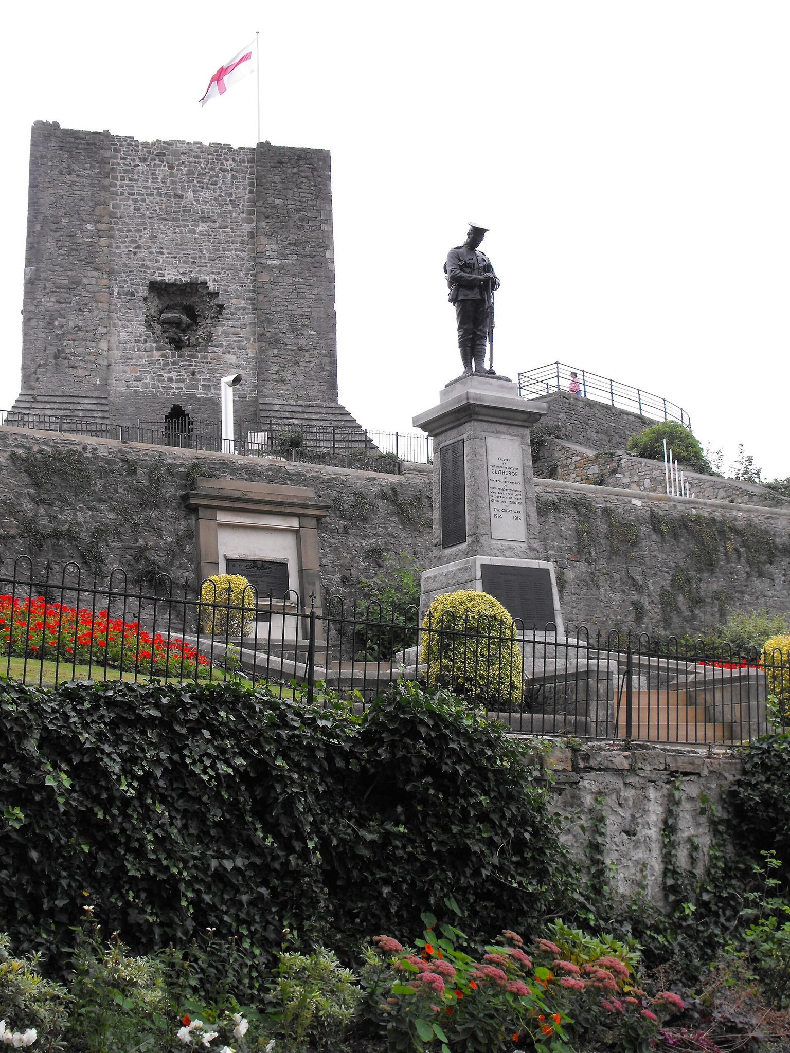
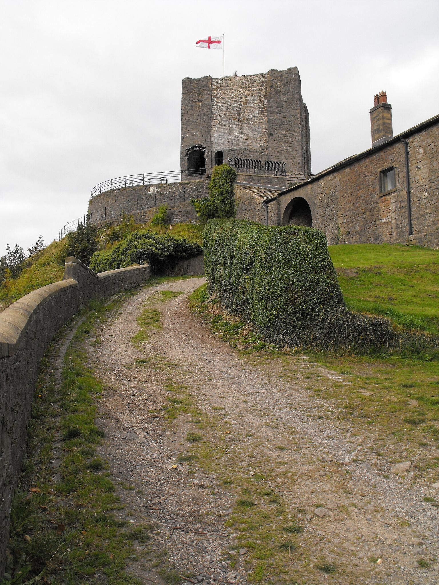
Clitheroe Castle occupies the summit of a steep limestone outcrop that rises approximately 39 metres above the surrounding land. The position overlooks the surrounding area and helps bar the pass along the River Ribble valley, while a Roman road runs just south of the castle. The site was essentially a motte-and-bailey enclosure castle, using the natural rock outcrop as its motte and a curtain wall as its principal defence. The medieval keep and parts of the curtain wall survive above ground, while archaeological remains of the gateway and other buildings lie below the surface.
The keep
Structure and entrances
The keep is a square stone tower with flat corner pilasters that resemble corner turrets. Its walls are approximately 2.7 metres thick at the base, making it the second-smallest surviving stone-built keep in England. The ground floor was probably entered from above through a trapdoor. Recessed arrowslits were placed in the middle of three walls, excluding the northwest wall. Two were later converted into entrances, while the opening in the southwest wall was blocked.
The main entrance stood on the first floor of the northwest side and was reached by an external staircase. A lower entrance in the western corner turret leads to a spiral staircase that now rises approximately 14 metres above ground level, higher than the other surviving walls. The keep probably had a parapet with at least one turret above the staircase.
Interior features
The first floor contained another doorway in the southwest wall and recessed arrowslits in the other walls. The doorway may have connected with the ramparts of the adjacent curtain wall. A feature that resembles a second doorway is a barrel-vaulted mural chamber reached through a right-angled passage. It may have been a garderobe, or toilet chamber, although that interpretation is disputed.
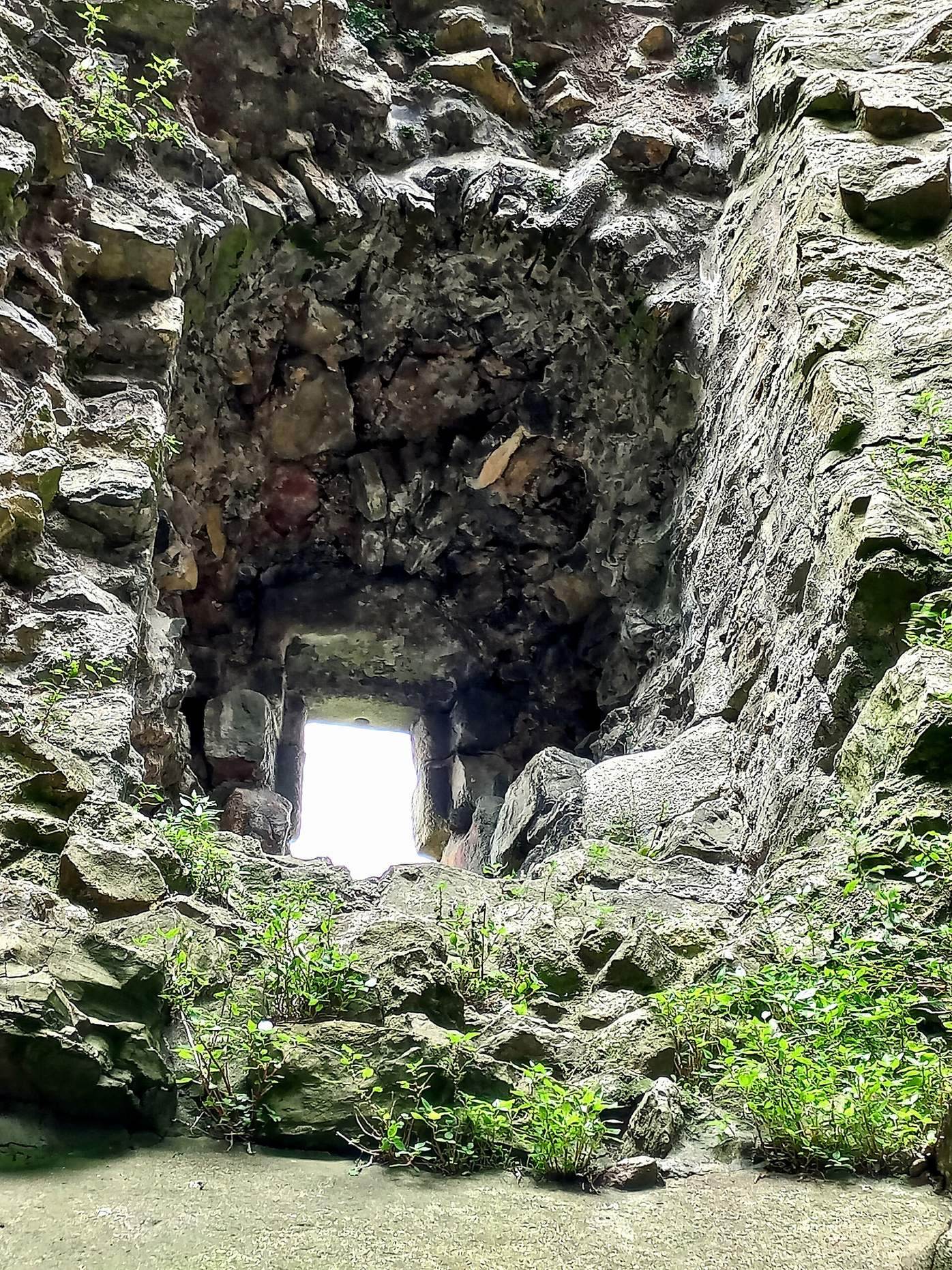
The upper walls provide no clear evidence of openings, including access points to the staircase. Restoration may have removed evidence of a second floor containing sleeping accommodation, or the walls may have concealed a pitched roof. No open fireplaces have been identified in the keep. The southeast first-floor arrow loop has widened, probably through natural decay. Local traditions attribute this opening either to a stone thrown by the Devil from Pendle Hill or to a cannon fired by Cromwell during the Civil War. Both explanations are legends rather than established history.
Gates and curtain walls
Gatehouse
The gatehouse tower probably stood near the present stone gate piers on the drive to the museum. A sixteenth-century sketch shows a two-storey, four-sided gatehouse with a Norman round-headed entrance and a smaller wicket gate. A small portion may survive in the wall to the east. The upper floor may have provided accommodation for the castle porter, who also acted as jailer.
Defensive walls
A tall embattled curtain wall probably encircled the hilltop, passing behind the Steward’s House and Steward’s Gallery before continuing around the keep. The surviving western section climbs the slope towards the summit. A wall approximately 1.8 metres thick surrounds the keep on three sides and may belong to an earlier phase than the keep itself. It may have formed a shell keep with attached buildings before the southern part was demolished and the present keep was constructed inside it.
The curtain wall around the keep was rebuilt in the mid-nineteenth century, and its newer masonry can be distinguished from the earlier fabric. The northwest external face is the best-preserved section. Another surviving part of the western curtain wall stands near the well and is separated from the other walls by the stable and courthouse buildings. The present footpath ascending the mound and the western access road are later additions.
Bailey buildings and chapel
Inner bailey
The site probably had inner and outer baileys. A second gatehouse or defensive ditch may have controlled access to the inner bailey, although no trace of those features survives. Ditches and moats mentioned in a document of 1304 are thought to have been at a lower level away from the castle and have since been filled in.
The keep was too small to contain all the essential accommodation, so the great hall probably stood where the present education suite is located. A survey of 1602 also recorded an auditor’s chamber, hall, and buttery. Stables and accommodation for garrisoned soldiers probably occupied other parts of the site. The former kitchen gardens lay in the southwest corner beside the Steward’s House.
Chapel of St Michael
The Chapel of St Michael de Castro stood at the southern end of the terrace near the old stable block. Its reinforced walls formed part of the inner-bailey wall. The chapel’s surviving history is therefore connected with both the religious organization of the honour and the defensive enclosure of the castle.
Grounds and later memorial features
The castle grounds cover approximately 6.4 hectares and include early eighteenth-century garden terraces created for the steward’s residence. After the 1920 purchase, the grounds were laid out as a public park. They include bowling greens, tennis courts, a putting green, a bandstand, a pavilion café, and specimen trees including a fern-leaf beech and a dawn redwood.
A First World War memorial stands south of the keep. It consists of a bowed soldier on a pedestal with his arms reversed and commemorates the local men who died in the war. Louis Frederick Roslyn sculpted the figure, which was also used for the memorial at Slaidburn. A separate plaque commemorating those killed in the Second Boer War was installed in 1907.
The old rose garden south of the castle contains a turret, or pinnacle, from the Palace of Westminster. The feature dates from the mid-nineteenth-century rebuilding of the palace and was presented to the borough in 1937 by its Member of Parliament, Sir William Brass, to commemorate the coronation of George VI. Corroding iron fixings later damaged the stonework, leading to conservation work by the Clitheroe Civic Society.
The castle rock
The castle stands on the southwesternmost member of a chain of Carboniferous mudmounds in the Bowland Sub-basin of the Craven Basin, known as the Clitheroe Reef Belt. The rock is a Waulsortian mudmound, a distinctive Carboniferous limestone formation composed here of light-grey, unbedded micritic limestone heavily intersected by calcite veins. Some galena and sphalerite mineralisation also occurs in the rock.
Fossils in the castle rock include especially abundant crinoid ossicles, together with gastropods and brachiopods. Its geological structure was once interpreted through theories of reef knolls, knoll reefs, and bioherms. Work by Miller and Grayson in 1972 explained the formation of the rock. The wider reef belt includes geological sites at Salthill and Bellman quarries, Crow Hill, Worsaw, Gerna, and Sykes.