Dăbâca Fortress: The Medieval Royal Fortress of Dăbâca County
Site at a Glance
- Rating
- 4.1
- Popularity
- Low
- Country
- Romania
- Primary era
- Medieval
- Eras represented
- Medieval
- Civilizations
- Hungarian
- Site type
- Military
- Remains
- Castle
On this page17 sections
History
Dăbâca Fortress is a medieval royal fortress in Dăbâca, Romania, developed under Hungarian rule from the eleventh century and serving as the political, military, and administrative center of Dăbâca County. The site occupied an important position in Transylvania from approximately the tenth to the fourteenth century, although occupation began earlier and the date of the first fortress remains debated.
Early settlement and the first fortifications
The earliest known occupation belongs to the seventh to ninth centuries. Rural Slavic communities lived in the area, and some practiced cremation burial. From the tenth century, these communities came into contact with incoming Hungarians and were gradually integrated into Hungarian society. The fortress and the Christianization of the local population are associated with the Hungarian political leadership of the eleventh century.
Two principal interpretations have been advanced for the earliest fortification. One identifies a small earth-and-timber fortress built during the first third of the eleventh century. Another places a first fortress in the ninth century, based on archaeological finds and the proposed existence of an earlier defended settlement. A Romanian historical tradition connected the site with Gelou, a local ruler described in the medieval Latin narrative Gesta Hungarorum. Later historical and archaeological studies rejected that identification, while continuing to recognize evidence for ninth-century occupation.
The fortress developed through several construction phases. It probably formed part of the Árpád-period defensive system of Transylvania, the era of the Hungarian ruling dynasty founded by Árpád and conventionally extending from the late ninth century to 1301. Its position allowed it to control the salt-transport route from Sic toward the Meseș Gate. Associated settlements included Cege, Bádok, Kide, and Csomafája.
The county fortress in the medieval kingdom
Dăbâca was initially a royal fortress and the seat of a royal castle district. It was later among seven castles granted to the Transylvanian bishopric founded in 1009. The site appears as urbs Dobuka in 1068, when King Solomon and the princes Géza and Ladislaus departed from there for the battle of Cserhalom against the Pechenegs. In 1214, Voiouoda, the ispán of Dăbâca, held a military review at the fortress. An ispán was the royal official who governed a county and its associated royal castle district.
The fortress is mentioned in 1146 and again in 1214. In 1243, King Béla IV granted three villages belonging to Dăbâca, Fatateleke, Bachunateleke, and Chegeteleke, to the counts Theotonicus and Hermann. The grant described their lands as belonging to the king’s castle of Dăbâca.
The Mongol invasion of 1241 destroyed the fortress, after which it was rebuilt. Its former political, military, and administrative importance did not return. In 1271, the fortress was granted to Ban Mikud for his military service, and King Ladislaus IV confirmed the donation in 1279. A ban was a high-ranking royal governor of a frontier or territorial province. During the thirteenth century, the county fortress declined as a center of authority, and its role was eventually taken over by Martinuzzi Fortress at Gherla.
Later medieval use and decline
In the fifteenth century, King Matthias Corvinus confiscated the fortress from Miklós Dobokai because of his participation in the conspiracy led by John of Szentgyörgy and the Szapolyai counts. The last recorded castellan was Mátyás Bádoki, mentioned during the reign of Queen Isabella. A castellan was the commander of a fortress.
A later tradition holds that Queen Isabella often stayed at Dăbâca and established a mint there. The fortress was probably inhabited until the sixteenth or seventeenth century. Another tradition associates its destruction with the period of Giorgio Basta. Its stones were later reused in the construction of Teleki Castle. A proposal made in the early nineteenth century to build the county hall on the fortress ruins was not carried out.
Archaeological investigation and interpretation
K. Hodor gave the first description of the fortress in 1837. K. Crettier investigated the site archaeologically in 1942, followed by more extensive research from 1964 onward. Excavations took place between 1964 and 1967, and a later excavation in 1986, directed by Petru Iambor, uncovered eight graves. The excavated area represents approximately one fifth of the fortress complex, while parts of the remains are now covered.
The 1960s excavations were initially interpreted by a team led by Ștefan Pascu as evidence of a ninth-century fortress belonging to Gelou. That interpretation relied heavily on the Gesta Hungarorum. Subsequent archaeological and historical work placed the main fortress complex later, particularly in the eleventh and twelfth centuries, while the wider site retained evidence of earlier settlement. Dăbâca is protected as a listed historic monument in Romania, and its importance rests on the combined evidence of the fortress, associated settlements, churches, cemeteries, and successive occupations.
Remains
Fortified enclosure and layout
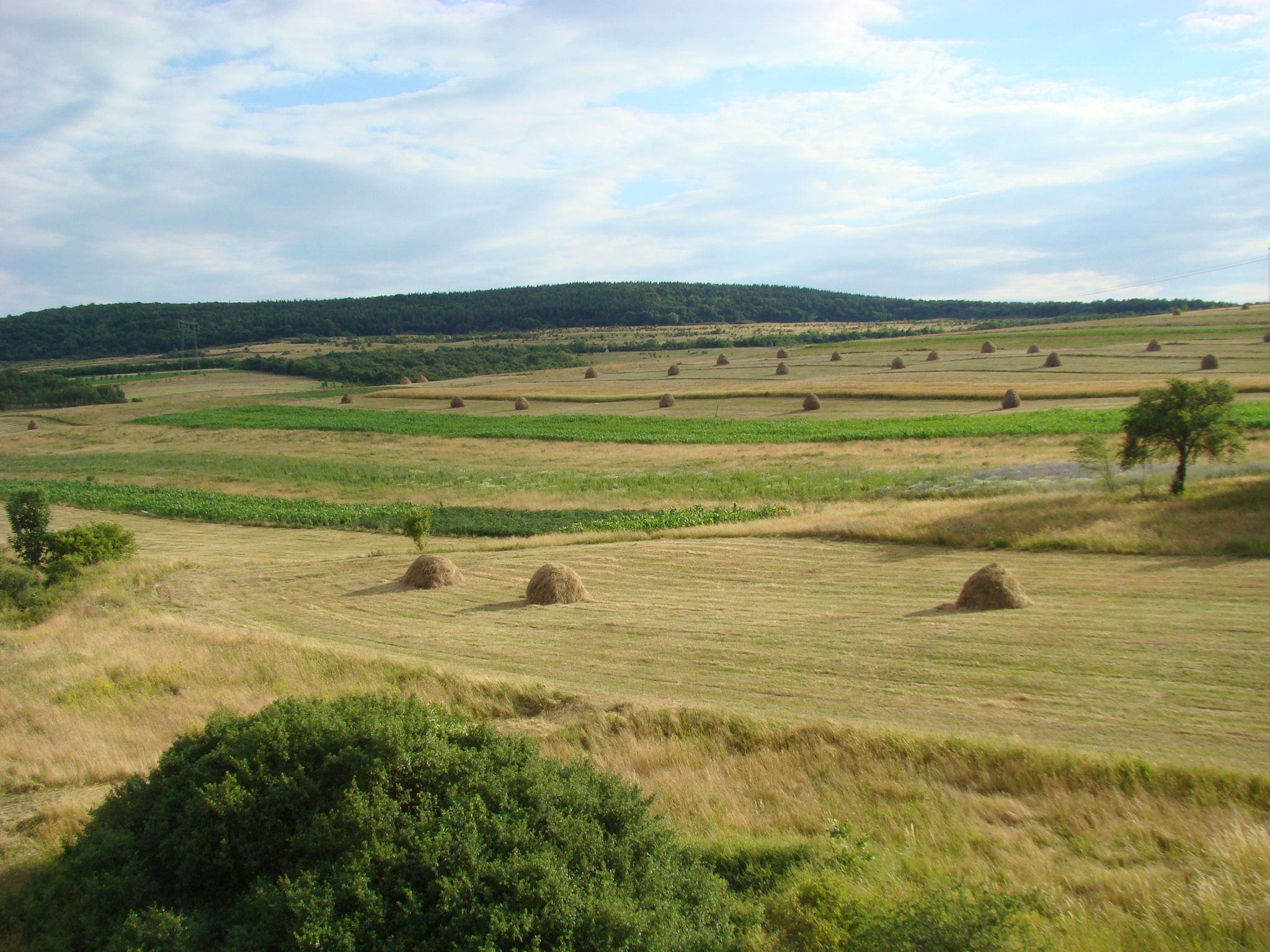
The fortress occupied the highest part of Várhegy in the Lona stream valley, west of Boncida and east of Dăbâca village. The valley narrowed between two hills and turned sharply near the settlement, creating a naturally defensible position. The nearby Nagyhegy ridge reaches approximately 529 meters above sea level.
The complex had a rounded triangular plan with its point directed north or north-northeast. Four fortified earthwork enclosures, or rings, formed a complex approximately 600 meters in diameter. The slopes on two sides descended at angles of roughly 25 to 45 degrees. Several earth ramparts and defensive ditches protected the southwestern side, while wooden palisades defended the other sides. Two entrances opened on the northern and southwestern sides, each flanked by wooden towers.
Successive fortification phases
Early earth-and-timber works
The earliest proposed ninth-century fortress used ditches and earth ramparts. It included a square tower and a connecting wall between the eastern and western parts of the first enclosure. The wall was approximately 3.2 meters thick. The tower and wall were destroyed during the Mongol invasion.
Other archaeological interpretations identify a small earth-and-timber fortress from the first third of the eleventh century. During the mid-eleventh century, this was followed by a larger box-framed earth-and-timber fortification. The expanded work occupied the areas later designated Enclosures I and II. Coins of Kings Stephen I and Andrew I were found in the area of Enclosure III, while a coin of Peter Orseolo was associated with the expanded fortification. The first fortress phase was destroyed or rebuilt during the second third to the middle of the eleventh century.
Later earth ramparts
A third phase, dating from the late eleventh century, used ramparts made from gravelly earth. A coin of King Coloman was found in this phase. Its destruction is dated to the end of the twelfth century.
Stone fortifications
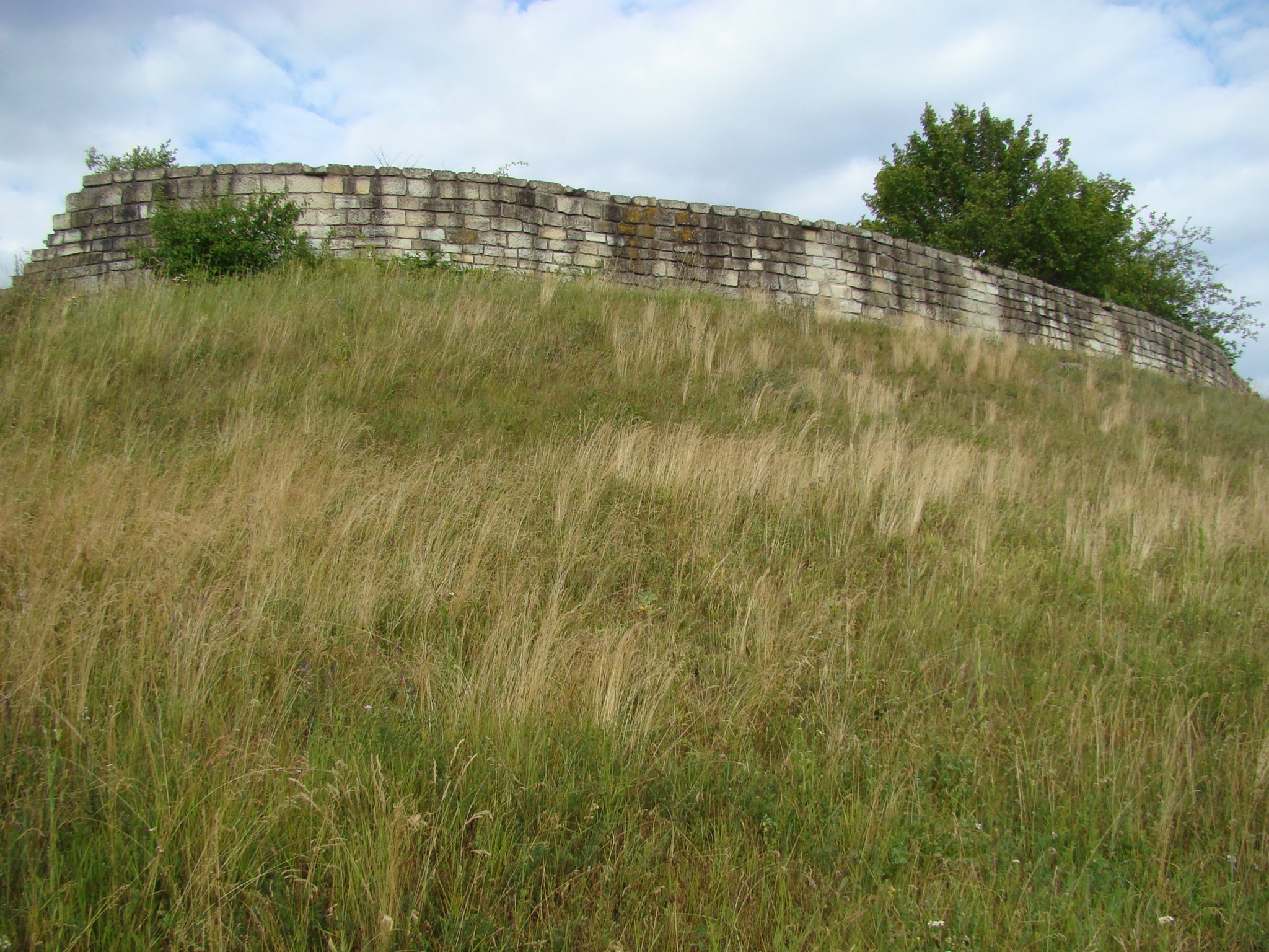
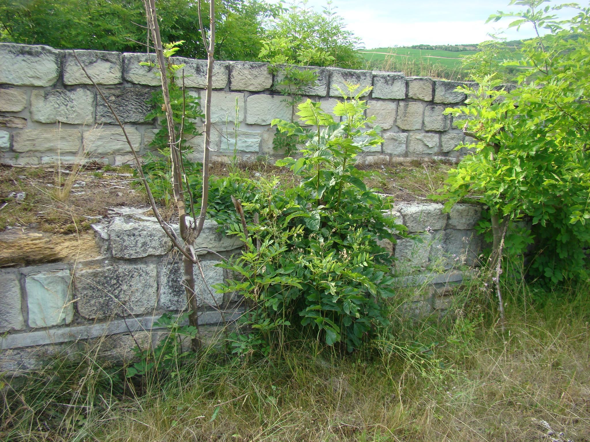
The fourth phase introduced stone walls on the site of the destroyed fortress. By the end of the twelfth century, these fortifications had replaced the palisades and included walls, towers, and probably donjons, the principal fortified towers of a castle. The stone walls were approximately 2.4 to 4 meters thick and 3 to 4 meters high. During the 1960s, the surviving wall on the rampart was restored to a height of about two meters.
Settlement areas
Several settlement areas lay within the fortress complex. Objects and features from the seventh to ninth centuries were found at three points, including the northwestern part of Enclosure IV and an area beneath the wall of Enclosure II. Their scale indicates a substantial settlement associated with the earlier Slavic population.
Settlement remains from the first half of the eleventh century were identified in the southeastern part of Enclosure III and the northwestern part of Enclosure IV. A semi-subterranean house excavated in 1980 contained a denar, a small medieval silver coin, pointing to a twelfth-century date.
A dwelling excavated in 1965 contained two spurs, a fire striker, and pottery fragments. Its proposed ninth- or tenth-century date and supposed Byzantine Christian connections remain uncertain, while the fire striker is more consistent with a twelfth-century date. A surface dwelling from the late thirteenth or fourteenth century was built over a former church cemetery, indicating that the settlement had probably become depopulated sometime between the twelfth and thirteenth centuries.
Churches and cemeteries
The oldest cemetery associated with the fortress lay south of the site near the Branistye stream. Limited excavation identified fifteen scattered cremation burials and one urn burial beside settlement features broadly dated to the seventh to ninth centuries. The pottery points more specifically toward the eighth or ninth century, although the chronology remains uncertain.
Three church-and-cemetery complexes were investigated on the southeastern side of the fortress and in the lower settlement area between 1964 and 1986. The cemeteries were medieval churchyard burial grounds, primarily dating to the twelfth century. Later burials continued at the cemetery in Alexandru Tămaș’s garden and at the Boldogasszony cemetery during the fourteenth to fifteenth and sixteenth to seventeenth centuries.
Enclosure IV church
The church associated with the Enclosure IV cemetery stood in the eastern part of the burial ground. It was a small, simple building approximately 11.5 meters long and six meters wide at the entrance, with the sanctuary to the east and the nave to the west. Its axis ran from east-northeast to west-southwest. A grave disturbed beneath the sanctuary foundation shows that the cemetery preceded the stone church, while an earlier wooden church remains possible.
The church and cemetery are primarily dated to the twelfth century. Differences in burial customs were concentrated in particular areas of the cemetery, suggesting a heterogeneous community in which pagan and Christian practices existed together.
Alexandru Tămaș church
A small church and cemetery were excavated in the garden of Alexandru Tămaș, approximately 160 meters from the Enclosure IV church at the southeastern end of the plateau. The church probably dates from the late eleventh century because coins of King Ladislaus I found in surrounding graves show that construction could not have preceded his reign.
The church had a nave approximately 4.3 meters long and four meters wide, an apse about 2.6 meters long, foundations no more than one meter thick, and walls approximately 80 centimeters thick. Its rectangular apse places it within a less common form of Árpád-period church architecture. The plan alone allows a date within the eleventh to fourteenth centuries.
Boldogasszony church
The Boldogasszony church stood in the lower settlement area and passed through three construction phases. The first was the latest of the churches identified at Dăbâca. Its date is associated with a twelfth-century anonymous denar, or alternatively with a coin struck during the reign of King Stephen II. An earlier churchyard cemetery may have preceded this building, perhaps around a wooden church or at another location.
The second church was substantially larger and is associated with a coin from the reign of King Géza II, giving it a probable twelfth-century date. The third building was approximately similar in size to the second and remained in use into the sixteenth or seventeenth century.
Archaeological finds
The excavated material includes pottery from cremation burials, Hungarian-period arrowheads with diamond-shaped blades, a plain neck ring with an angular section, twisted-wire neck or arm rings, part of a horse bit, fire strikers, spurs, a beard-shaped arrowhead, a fragment of a cross-shaped breast pendant, and other ordinary ornaments and tools.
The lower layer of the fortress contained pottery associated with the Hungarian population, including a ribbed-neck, bottle-shaped vessel linked with the Saltovo cultural horizon and ceramic cauldrons. Decorated silver pendants, probably produced in Byzantine or Kievan Rus workshops, mark the end of the earliest fortress phase. Kievan Rus was the medieval East Slavic polity centered on Kyiv.
Twenty-six hoards containing Polish, Rus, and Bulgarian coins date to the late tenth and early eleventh centuries. Later discoveries include eleventh- and twelfth-century spurs, a beard-shaped arrowhead, a Majs-type cross pendant, and ceramics illustrating the development of pottery in Árpád-period Hungary. Together, the fortress, settlement areas, churches, cemeteries, and later reuse create a layered archaeological site in which early medieval occupation, Hungarian settlement, the county fortress, Christian burial grounds, and post-medieval activity occupy the same complex.