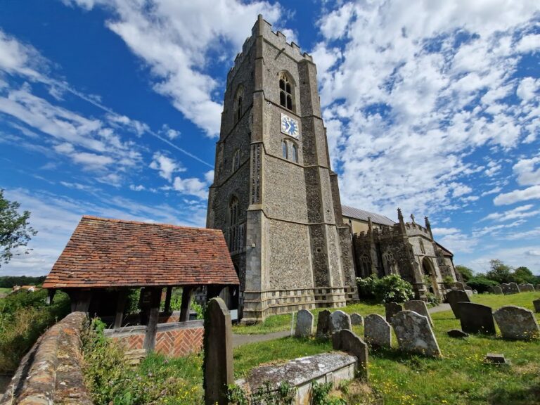
Ipswich Blackfriars: A Dominican Friary in Medieval Ipswich
Site at a Glance
- Rating
- 4.3
- Popularity
- Very Low
- Country
- United Kingdom
- Primary era
- Medieval
- Eras represented
- Medieval
- Civilizations
- English
- Site type
- Religious
- Remains
- Monastery
On this page12 sections
History
Ipswich Blackfriars is a Dominican friary dedicated to Saint Mary in the United Kingdom, founded in 1263 by King Henry III. The Dominicans, also called Friars Preachers or Blackfriars, were a Catholic mendicant order devoted to preaching and teaching, and traditionally depended substantially on charitable support. The house was the second of Ipswich’s three mendicant foundations, after the Franciscan Greyfriars and before the Whitefriars, established around 1278 or 1279. Its religious administration came under the Dominican visitation of Cambridge, the order’s regional supervisory jurisdiction.
Royal foundation and early growth
Henry III purchased land for the friars from Hugh son of Gerard de Langeston and ordered John de Vallibus, Keeper of the Peace, to deliver formal possession. The royal grant was enlarged with further land from Hugh on 26 November 1265. In 1269, Robert Kilwardby, then the Dominican provincial prior in England, acquired another dwelling plot for the community. These transactions established the friary within Ipswich’s south-eastern quarter, between the town’s principal streets and its eastern defensive boundary.
The house benefited from continuing royal and aristocratic patronage. Edward I gave alms to the friars during visits to Ipswich in April 1277, December 1296, and January 1297. Queen Eleanor’s executors gave them 100 shillings in 1291. An earlier tradition attributed the foundation to Henry de Manesby, Henry Redred, Henry de Landham, or John Hares, but these men came to be understood as later benefactors rather than founders. Henry III was established as the founder.
The friary’s landholding expanded during the fourteenth century. Alice Harneis assigned the friars a plot measuring 200 by 36 feet in 1307, and an acre on the south side was added in 1334. In 1346, the friars received a pardon concerning 100 feet of land and a ditch acquired without licence, provided that townsmen retained access for maintaining and defending the town rampart. The borough granted another 103-foot plot extending into the town ditch in 1349, requiring the friars to maintain the rampart and two gates. Three additional dwelling plots were assigned for enlargement in 1352.
Patronage, burial, and Dominican administration
Support from leading families became especially important in the later fourteenth century. Principal benefactors included Roger Bigod, probably the fifth Earl of Norfolk, Sir Robert de Ufford, Earl of Suffolk, Sir Richard and Lady Margaret Plays, Sir John Sutton, and Margaret, the granddaughter of Richard and Margaret Plays. Their connections with Blackfriars included patronage, local estates, and burials associated with the friary and other religious houses.
Local townspeople and merchants also sought association with the community. Adam de Brandeston, a former Member of Parliament and deputy butler of Ipswich who had been outlawed for felony, requested burial with the Friars Preachers in his will, proved in December 1362. Gilbert Boulge, an Ipswich wool merchant who held part of a knight’s fee at Debach in 1380, was also buried at Blackfriars. John and Agnes Fastolf had tombs there and may have belonged to later descendants of the Holebrok family.
A Dominican provincial chapter was held at Ipswich Blackfriars around 1389 or 1391. A later dispute over the rightful prior was settled in 1397, when the Master-General recognized Friar John de Stanton rather than Friar William. Friar John Sygar was appointed lector, and further administrative arrangements were made for the house.
The friary cemetery contained about 250 burials. One male skeleton had a healed amputation of the right hand and additional fractures. The injury appeared to have resulted from violent assault rather than surgery or judicial punishment, and the remains were tentatively identified with Richard de Holebrok. In 1327, a mob at Tattingstone had attacked a man of that name, tied him to a tree, and cut off his hand.
Decline and dissolution
The friars’ income relied heavily on charitable bequests, while many people requested burial at Blackfriars. Despite this support, the community became impoverished in the early sixteenth century and leased parts of its property, including gardens, houses, lodgings, and other buildings.
The friary was dissolved in November 1538 during the Dissolution, the sixteenth-century suppression of England’s monasteries and friaries under Henry VIII. Before the closure, Bishop Richard Yngworth secured church valuables recovered from the Greyfriars and had them locked in a building at Blackfriars under the prior’s supervision.
After the dissolution, the conventual buildings were leased to William Sabyn, the King’s serjeant-at-arms in Ipswich. The entire property was sold to him in November 1541, to hold in chief for a twentieth part of a knight’s fee and an annual tithe of five shillings. Sabyn was a naval captain, customs official, bailiff, portman, Member of Parliament, and benefactor of Saint Mary-at-Key. The property later passed through intermediate transfers to the Borough of Ipswich.
Destruction and archaeological investigation
The Blackfriars church disappeared within a century of the Dissolution. Other parts of the complex survived longer. The former sacristy, chapter house, and dormitory were used as a schoolroom until 1842, while the refectory had already been demolished in 1763 when the school moved into the former dormitory. The surviving range was demolished in 1849.
Nina Layard located buried footings in 1898. Scholarly analysis during the 1970s and 1980s, together with excavations by the Suffolk County Council team, identified the lost church, clarified much of the original plan, and corrected earlier interpretations. The church site is now preserved as an open grassed recreation area, while a modern housing development covers the former conventual-building area.
Remains
Church and cloister
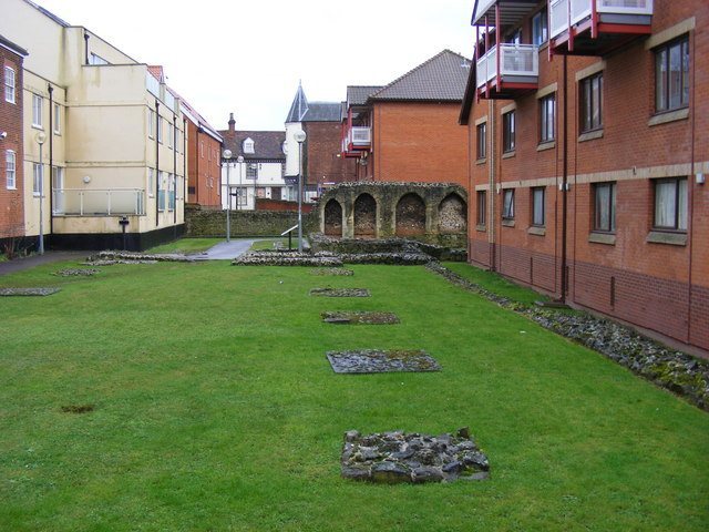
The friary occupied land between present-day Foundation Street and Lower Orwell Street. The Ipswich town rampart, reconstructed around 1200 along the line of a Viking-age defence, bordered the site on the east, while Saint Mary-at-Key lay to the south. The excavated church extended eastward from the Foundation Street frontage towards the former rampart. It was aligned east to west, with an aisled nave about 135 feet long and 55 feet wide, followed by an unaisled choir approximately 58 feet long. Its buried footings remain visible in the grassed recreation area.
The church formed the north side of a cloister, a covered walkway enclosing an open courtyard and linking the principal buildings of a friary. The choir and sanctuary met the north-west corner of the sacristy range. Excavation also established that the friars’ internal route passed through the eastern end of the nave behind the altar rather than through the choir, an unusual arrangement. The cloister lay between the church and the conventual ranges. An eighteenth-century courtyard once identified as the cloister was instead a later construction associated with Christ’s Hospital, although it may have been rebuilt on the plan of a second cloister, possibly with two storeys.
Conventual ranges
Sacristy and chapter house
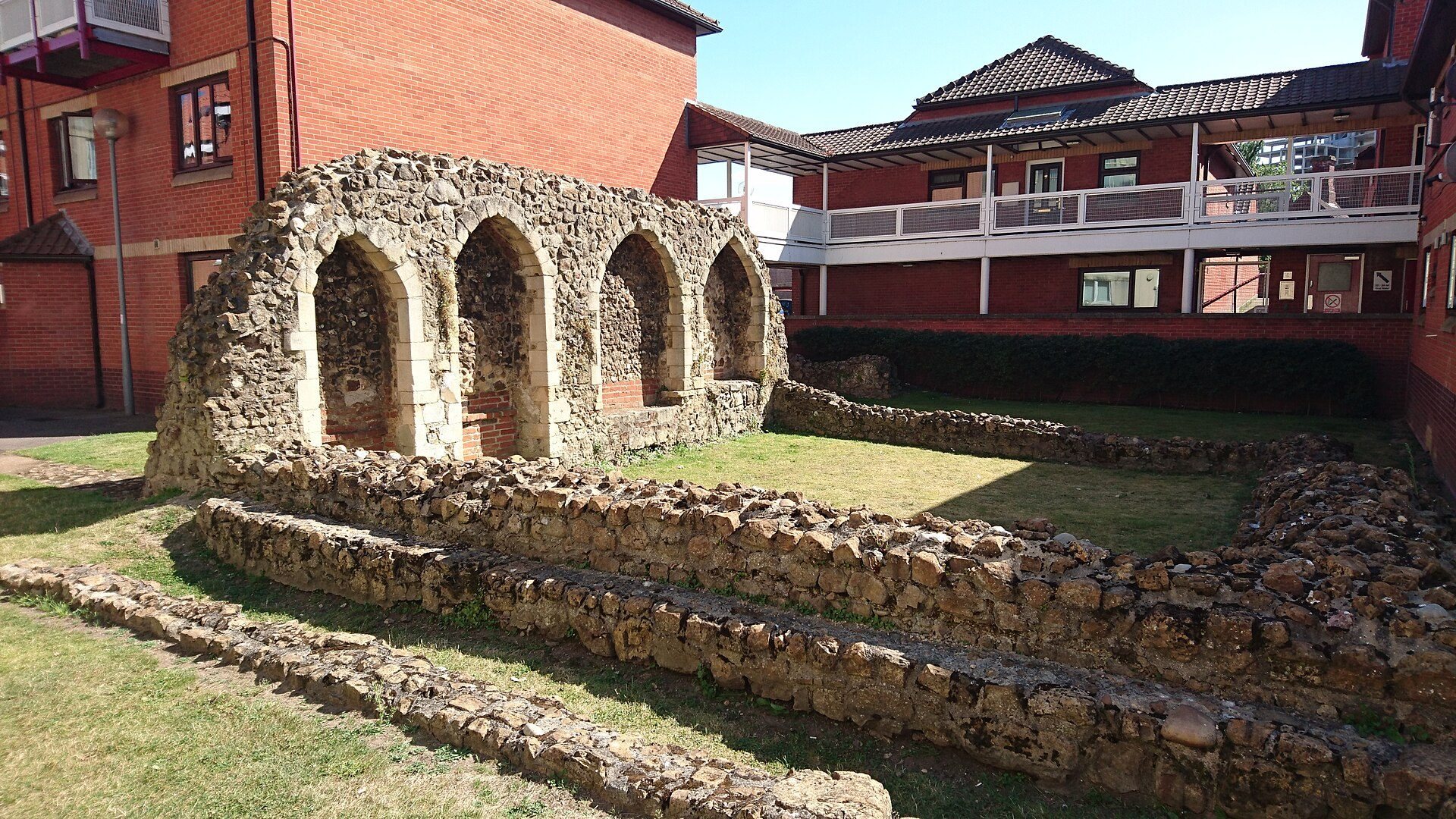
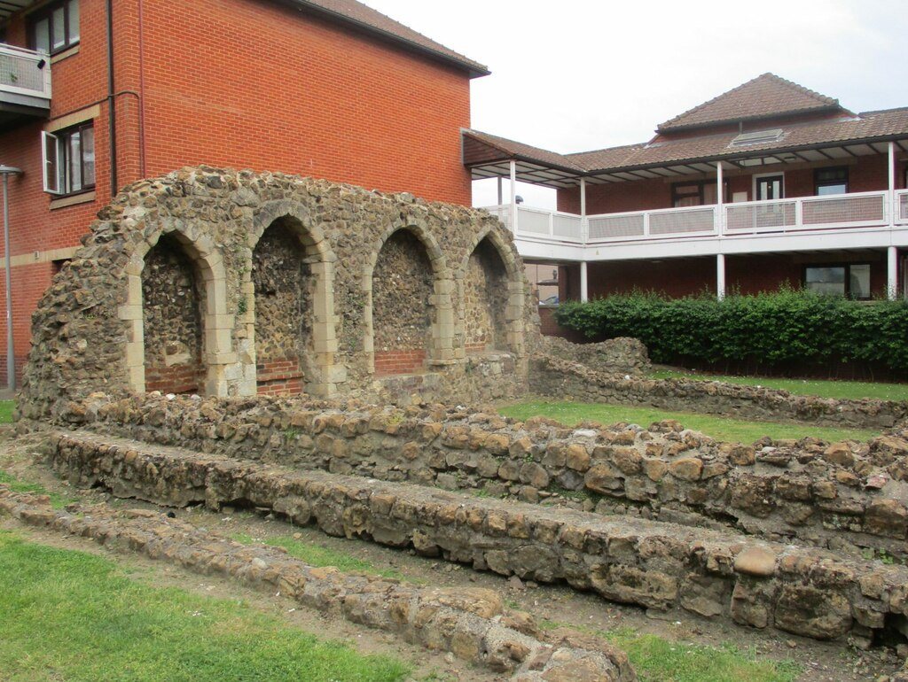
A surviving fragment of standing wall with blocked arches formed the lower part of the east wall of the sacristy, the room used to store objects needed for worship. It belonged to a range containing the sacristy, chapter house, and dormitory. The range measured about 120 feet long and 24 feet wide. Part of the standing wall proved to be a Victorian reconstruction incorporating older materials and was removed after excavation showed that it continued across the church choir. The remaining medieval fragment is a visible remnant of the former sacristy and its associated buildings.
The chapter-house frontage had an arched doorway with pointed windows on either side. Later alterations added post-medieval windows above. An upper string-course shown in an eighteenth-century view may represent the former roofline of the cloister alley. The upper floor of the range was later used as a schoolroom before the building was demolished in 1849.
Dormitory
The dormitory’s upper chamber had a fine hammerbeam roof. A hammerbeam roof uses projecting horizontal timber beams to support the roof framing without full-length tie beams crossing the room. The roof was believed to have been brought from elsewhere after the Dissolution. A nineteenth-century drawing records the interior after the chamber had been converted into a schoolroom.
Refectory
The former refectory, or frater, was the communal dining hall of the friary. Its tracery windows belonged to the Decorated Gothic phase of English architecture, recognized especially for elaborate window patterns. The designs appear to progress from geometric tracery at the northern end to more curving forms farther south, suggesting construction from the late thirteenth into the early fourteenth century. The final window had the more strongly vertical divisions associated with Perpendicular architecture.
A gabled projection at the second refectory window contained a raised lectern, where homilies or scripture could be read during meals. External steps on the south side led to it, and the windows were positioned above the level of seated diners. The northern end was the upper end of the hall. A later window and the final bay probably marked a screens passage leading to the buttery or pantry.
Additional buildings and cemetery
Structures stood or were planned east of the dormitory range by 1275. Their position beside the town ditch may have suited a convenient purpose, although their exact function is not established. The south side of the main cloister had probably disappeared by the time of Joshua Kirby’s plan of 1748. It may have extended forward across the open area and connected the dormitory and refectory at their southern ends. A freestanding wall shown in nineteenth-century illustrations may have been its rear wall, possibly enclosing a study-dormitory.
A large two-storey stone building still standing in 1845 may have been the infirmary. Buildings at the south-west corner of the complex may have occupied the former site of the prior’s lodging and guest quarters, but these identifications remain speculative. The cemetery excavation revealed about 250 burials, including the skeleton with a healed right-hand amputation and other fractures associated with the suspected attack on Richard de Holebrok.
The surviving church footings and the medieval sacristy-wall fragment are visible within the grassed recreation area, accompanied by interpretative panels. The former conventual buildings lie beneath a modern housing development.