Ivangėnai Hillfort: An Archaeological Complex in Lithuania
Site at a Glance
- Rating
- 4.8
- Popularity
- Very Low
- Country
- Lithuania
- Primary era
- Medieval
- Eras represented
- Medieval
- Civilizations
- Unclassified
- Site type
- Military
- Remains
- Fort
On this page11 sections
History
Ivangėnai hillfort is an archaeological complex in Lithuania, near Ivangėnai village in Tauragė District, comprising two hillforts, a foothill settlement, and a cemetery. The complex developed from the middle of the first millennium AD and remained in use into the fourteenth century. Its historical interpretation includes possible connections with Karšuva Castle and the better-known Pilėnai Castle.
Early settlement and the hillfort complex
The complex consists of two elevated fortified sites about 100 metres apart, together with habitation areas on both banks of the Suvirkštė and a cemetery to the southwest. The relationship between the hillforts remains uncertain. It is not known whether the second was a detached defensive outwork of the first or a separate hillfort built in a different period.
Earlier interpretation treated the first hillfort as only a natural hill, without fortifications or a cultural layer. Later surveys and exploratory investigations provided the basis for recognizing it as part of a larger archaeological complex. Liudvikas Krzywicki described the hillforts in 1905. The first hillfort was surveyed by the Institute of History in 1961, and exploratory investigations followed in 1997 under Vykintas Vaitkevičius and Gintautas Zabiela of the Lithuanian Institute of History.
Karšuva and the medieval historical landscape
The nearby village of Karšuva has prompted the proposal that the first hillfort was the site of Karšuva Castle, recorded in 1385 as Karszovini. It may have served as the centre of the Karšuva valsčius, a historical territorial and administrative district, giving the proposed castle an administrative role as well as a defensive one.
Vaitkevičius and Zabiela have also proposed identifying Ivangėnai with Pilėnai. According to the medieval chronicler Wigand of Marburg, Pilėnai Castle was destroyed on 25 February 1336 in the land of Troppen. The Samogitian duke Margiris and the entire garrison were killed in the event. Troppen appears in accounts of Teutonic campaigns into Samogitia in 1363 and 1390, while the Lithuanian written record of the area begins in 1575, when the Trepai estate and grange existed there.
The proposed identification with Pilėnai remains unresolved. If Pilėnai stood in the Trapėnai-Trepai area, its hillfort might instead be sought near present-day Trepai, about three kilometres northwest of Skaudvilė. Under that interpretation, the old capital of Karšuva would have stood at the Ivangėnai hillfort complex.
Investigation and protection
The Ivangėnai complex was designated a cultural monument by a Lithuanian Government resolution of 19 May 1998. The protected territory of the first hillfort covers 30,000 square metres, while that of the second covers 16,000 square metres. The Vėluikiai cemetery was investigated in September 2006, adding evidence for activity in the surrounding landscape from the fourth to the seventh centuries AD.
Remains
The complex lies on the left bank of the Suvirkštė, northeast of its confluence with the Ančia. The two hillforts occupy separate elevated positions, while a low-lying settlement extends across roughly one hectare on both banks of the river. The cemetery lies 520 metres southwest of the hillforts.
Fortified elevations
First hillfort
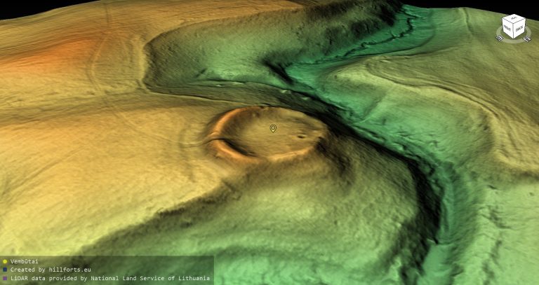
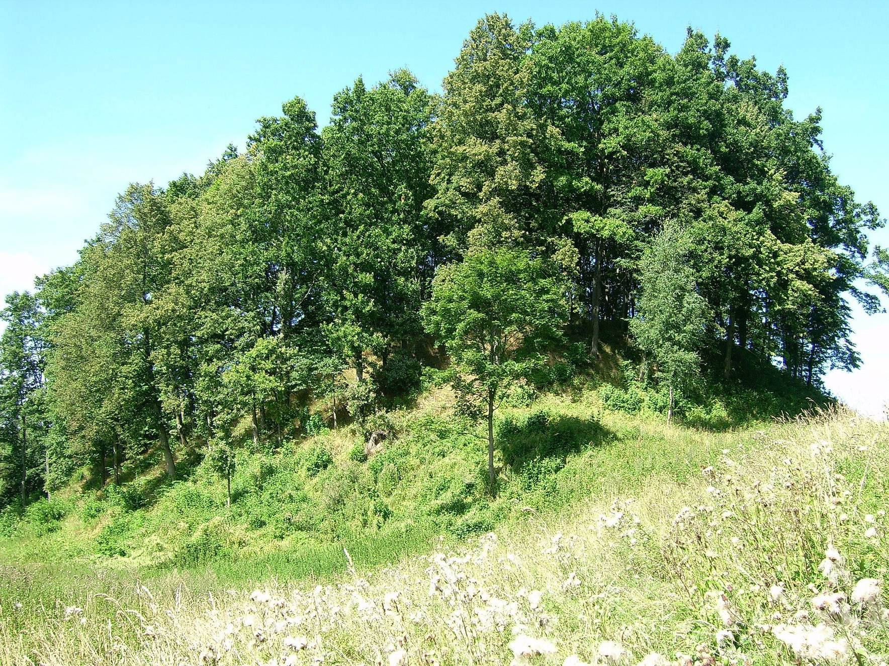
The first hillfort, known as Pilike, occupies a hill enclosed by a stream and hollow valleys on its southern, western, and northern sides. On the east, a ditch about 10 metres wide and 1.5 metres deep separates the hill from higher ground. The oval summit platform runs from northwest to southeast and measures 33 by 43 metres.
A semicircular rampart follows the eastern edge of the platform. It is approximately 4 metres high and 27 metres wide, with an outer ditch about 30 metres wide and 5 metres deep beyond it. A second rampart, about 1 metre high and 5 metres wide, was raised at the northwestern end. The surrounding slopes are steep and reach 10 to 15 metres in height.
Ploughing has damaged the first hillfort, and sections of the northeastern, western, and northwestern platform edges have slipped away. Erosion remains active on the northern slope. Sparse deciduous trees cover the hillfort.
Second hillfort
The second hillfort stands on a promontory on the Suvirkštė’s left bank. Its elongated, trapezoidal platform is oriented from east to west. It measures 27 metres in length, 17 metres across at the eastern end, and 20 metres across at the western end.
An eastern rampart, approximately 3 metres high and 18 metres wide, protects the platform. Its outer slope descends 4.5 metres to a ditch about 15 metres wide and 1.5 metres deep. The hillfort’s side slopes are steep and approximately 10 metres high.
Ploughing and erosion have damaged the second hillfort’s slopes, and a pit was dug into the top of the rampart. Dense deciduous trees and shrubs now cover the site.
Settlement and cemetery
Foothill settlement
The foothill settlement occupies approximately one hectare of low-lying ground to the northwest and east of the hillforts. It extends across both banks of the Suvirkštė and forms the habitation area associated with the elevated fortified sites.
Vėluikiai cemetery
The Vėluikiai cemetery lies 520 metres southwest of the hillforts. Investigated in September 2006, it dates from the fourth to the seventh centuries AD and provides evidence for the wider settlement landscape surrounding Ivangėnai.