Vembūtų Hillfort: A Samogitian Defensive Stronghold in Lithuania
Site at a Glance
- Rating
- 4.8
- Popularity
- Very Low
- Country
- Lithuania
- Primary era
- Medieval
- External website
- Open
- Eras represented
- Iron Age, Medieval
- Civilizations
- Unclassified
- Site type
- Military
- Remains
- Castle
On this page11 sections
History
Vembūtų Hillfort is a fortified stronghold in Lithuania near Vembūtai village, on the left bank of the Gemliukas stream. The site was used from the beginning of the first millennium to the thirteenth century. It is traditionally associated with the Samogitian duke Vykintas and with the stronghold called Tviremet, or “Vykintas’ city,” in the thirteenth-century Ipatiev Chronicle.
Early Settlement and Medieval Development
A settlement occupied about 5 hectares at the southern foot of the hillfort from the first millennium to the beginning of the second millennium. Excavations there in 2003 recovered grooved, smooth, rough-surfaced, and wheel-made pottery, together with a flint flake and a flint blade. These finds indicate sustained activity around the fortified high ground before and during the development of the medieval stronghold.
The hillfort is also known by the names Vidmantai, Kulšiškiai, and Vydmantai. Local residents call it the “castle hollow.” Although the central hillfort is relatively small, investigations around it revealed extensive fortifications and possible structures, suggesting that the defended area extended well beyond the main platform.
Vykintas’ City and the Conflict of 1251
Vykintas was a Samogitian duke involved in the political and military struggles of thirteenth-century Lithuania. In 1251, during the conflict between Mindaugas and rebellious vassals, Samogitian forces, Cuman forces, and troops of the Rus prince Danilo were stationed in “Vykintas’ city.” Mindaugas was the principal ruler of Lithuania and the central opponent of the forces involved in this rebellion.
The Ipatiev Chronicle, a medieval Rus chronicle preserving narratives about the rulers and lands of eastern Europe, names the stronghold as Tviremet. The traditional identification of Vembūtų with this place is supported by the scale of the surrounding defensive complex. A fortified area extended about 420 metres south of the main hillfort, reaching a former small lake that was later drained through land-reclamation channels. The complex also extended more than one kilometre eastward.
Streams, rivers, lakes, and marshes strengthened the site’s defences and made approach difficult. The castle and settlement complex was connected with nearby castles by roads and by kūlgrindos or kedgrindos, causeways built across wet ground or water. Its extensive fortifications indicate that Vembūtai was one of the largest defensive sites in Samogitia and may correspond to the “city of Vykintas” described by the Rus chronicler. The complex could accommodate substantial military forces and was regarded as more capable in this respect than the nearby castles of Medvėgalis, Burbiškiai, and Plinija.
Archaeological Investigation
The Institute of Lithuanian History carried out exploratory archaeological investigations at the hillfort in 1964. Later work in the surrounding settlement area and examination of the wider fortifications clarified the scale of the site and its relationship to the former lakes, marshes, streams, and routes that formed part of its defensive setting.
Remains
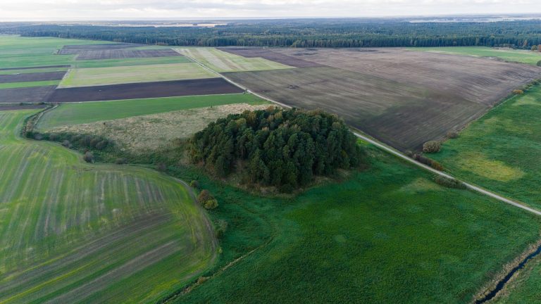
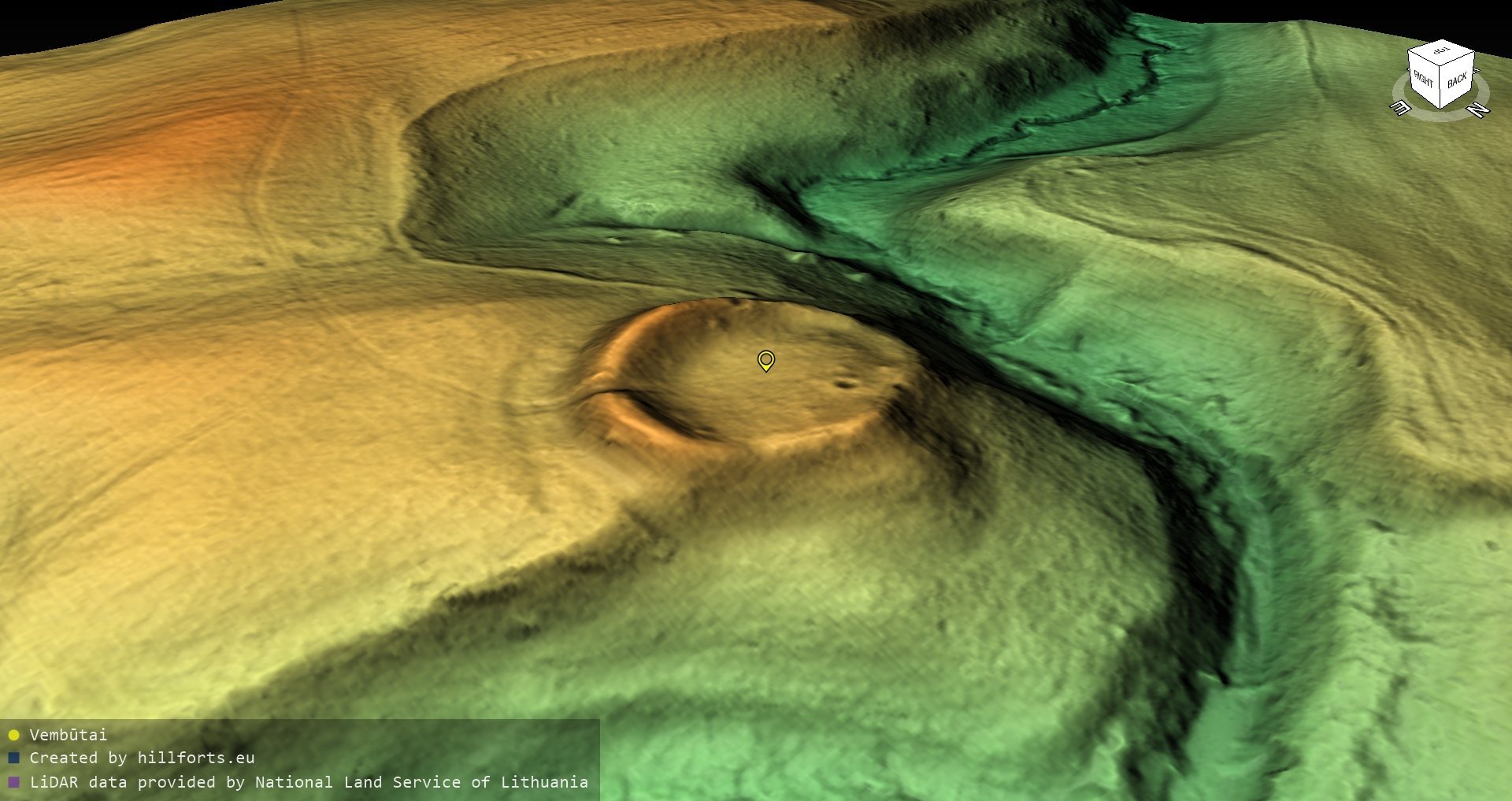
Vembūtų Hillfort occupies the edge of an upland beside the Gemliukas stream. The central platform is oval and elongated from east to west, measuring about 40 by 30 metres. It lies approximately 1.5 metres lower on the southern side and is enclosed by a rampart, a raised defensive bank, between 1.1 and 4 metres high and 7 to 16 metres wide. On the south, the outer slope of the rampart reaches 6 metres and descends to a ditch about 8 metres wide and 0.8 metres deep. The hillfort’s steep slopes rise as much as 13 metres. Pits have disturbed the platform, which is covered by very sparse trees.
Central Hillfort and Southern Defences
Main Platform and Rampart
The central platform and its enclosing rampart form the principal surviving earthworks. Their elongated shape follows the upland edge, while the southern rampart and ditch reinforce the most clearly defined side of the fortified area. The earthworks remain visible as the physical core of the wider castle complex.
Southern Fortified Area
South of the main hillfort, defensive terraces occupy the high, steep slopes beside the stream. Stones from former fortification structures have fallen into the stream bed. Across the wider complex, numerous lines of broken stones mark former barriers. Many stones were split, and some retain traces of working. Remains of a gateway leading into the castle area also survive.
Water Barriers and Extended Complex
Artificial Water Body
A substantial artificially excavated water body lies near the main castle area. The former lake south of the complex is now crossed by drainage channels, but its earlier extent formed part of the defensive landscape. Rivers, lakes, and marshes surrounded and strengthened the fortifications of both the castle and the settlement.
Eastern Fortifications and Settlement Area
East of the castle area, a hill has a cultural layer, an archaeological deposit formed by accumulated traces of past human activity, at its foot. Further east, additional fortifications and water barriers survive. Traces of a landing place on the eastern edge of the fortified area indicate that the former water bodies were once extensive. Possible traces of graves and of a place used for astronomical observations have also been identified within the wider complex.