Burghead Fort: A Pictish Promontory Power Centre
Site at a Glance
- Rating
- 4.6
- Popularity
- Very Low
- Country
- United Kingdom
- Primary era
- Medieval
- External website
- Open
- Eras represented
- Iron Age, Classical, Medieval
- Civilizations
- Unclassified
- Site type
- Military
- Remains
- Fort
On this page14 sections
History
Burghead Fort is a Pictish promontory fort in the United Kingdom, built by the Picts as a fortified power centre during the early historic period, possibly from the late third century onward. The Picts formed the principal northern British kingdoms before their political identity became part of Alba, the predecessor of medieval Scotland. Burghead probably served as the principal centre of Fortriu, a major Pictish kingdom associated with northern Scotland, from the fourth to the ninth centuries.
Origins and Pictish power
The earliest defences may have begun in the Iron Age. The three ramparts and ditches could predate the main fort, while radiocarbon dating places the principal walls in the early historic period, perhaps as early as the late third century. The fort was refurbished during the sixth or seventh centuries. Earlier activity is also indicated by a Late Bronze Age spearhead, a Greek coin from the reign of Nero, and evidence for Iron Age, Norse, and Early Medieval activity.
Burghead’s original Pictish name is unknown, and the site does not appear in any surviving annals. It may have been the place called Pinnata Castra in the second-century Geography of Ptolemy, a Greco-Roman geographer, but that identification remains uncertain. The fort’s position and nearby anchorage suggest that it may also have supported Pictish naval forces, which were important between the fourth and eighth centuries.
Royal, military, and religious functions
The fort combined secular, military, and religious roles. The higher enclosure may have contained a royal hall, the ruler’s residence, and accommodation for the royal retinue. The larger lower enclosure probably contained a settlement, with foundation stones and evidence that livestock were kept within the defences. Burghead may also have maintained important connections with the Pictish religious centres at Kinneddar, about 13 kilometres to the east, and Portmahomack across the Moray Firth.
By at least the eighth century, the fort contained a chapel. The bull carvings have been interpreted as evidence for a surviving pagan bull cult, while the underground well may have been associated with a pagan water cult. The Burning of the Clavie, a fire procession and ceremony held at Burghead, has likewise been interpreted as a possible survival of a pre-Christian fire tradition. Decorated stones found in Burghead churchyard and dated to around AD 800 were probably parts of Christian crosses. Fragments of an early Christian shrine were also found immediately outside the fort, indicating a Christian presence alongside earlier religious associations.
Attack, abandonment, and later damage
The fort was attacked in AD 742. No occupation is evidenced after the ninth century, the period associated with devastating Norse raids on Fortriu, and the fort may have been destroyed by fire during the ninth or tenth century.
Much of Burghead Fort and its layout were damaged when the harbour and town were remodelled between 1805 and 1809. General William Roy’s plan, drawn before this destruction and published posthumously in 1793, preserves evidence for the fort’s former arrangement. The underground well was rediscovered during work on the new town begun in 1809, but was later abandoned because its water supply was insufficient for the settlement.
Archaeological work in the 1890s exposed a paved roadway, and excavation of the western wall of the upper enclosure took place in 1969. The surviving walls, religious remains, and sculptures support the interpretation of Burghead as an exceptional early historic and possibly royal centre. Important Pictish sculptures from the fort are displayed in the Burghead visitor centre.
Remains
Fort Layout and Defences
Enclosures and settlement
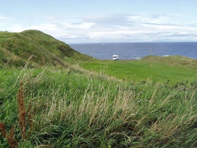
The fort occupied a promontory now largely overlain by the town of Burghead. Its inner enclosure measured about 300 metres from north to south and 180 metres across, covering approximately 5.0 hectares. It was divided into two courts, with a smaller and higher enclosure to the southwest and a larger, lower enclosure to the northeast. Each had its own entrance, and no internal gateway between them has been identified. This arrangement suggests a hierarchical relationship between the elevated western enclosure and the lower northeastern court.
Foundation stones within the lower enclosure mark buildings associated with the settlement. Excavations also exposed a paved roadway running through the fort, while archaeological evidence indicates that livestock were kept inside the outer defences.
Outer ramparts and ditches
Three ramparts and the ditches between them separated the headland from the mainland. Together they extended for approximately 240 metres by 55 metres, and each rampart was interrupted by an entrance near its midpoint. The defences were built mainly from earth and rubble. A small section of the innermost outer rampart survives as Doorie Hill, while other sections of the inner ramparts reach about 3 metres in height.
Upper enclosure wall
The western wall of the upper enclosure had a massive base about 8 metres thick and survives to roughly 3 metres high. It may originally have risen to 6 metres and possibly supported a wooden superstructure. Stone revetments formed its front and rear faces around an internal framework of transverse and longitudinal timbers. The centre was packed with stone rubble and rolled pebbles, while layers of oak laid on sand formed the foundations. Oak beams from the framework probably projected through the sandstone walls.
Lower enclosure ramparts
The ramparts of the lower enclosure were also constructed around a timber framework, but large iron spikes held the structure together. This method has been distinguished from earlier British Iron Age construction and associated with the Murus Gallicus tradition, a late Iron Age continental European technique using stone, timber framing, and large iron fasteners.
Burghead Well
The underground Burghead Well lies in a chamber cut into natural rock at the foot of a cliff. Twenty stone steps descend to a square chamber measuring approximately 5 square metres. A square opening in the floor is bordered on every side by a ledge about 0.9 metres wide. An underground spring feeds the water-filled basin, which is approximately 1.3 metres deep. Objects recovered while the chamber was being cleared included a stone with a bull relief, part of a Pictish stone cross, and several Spanish coins. A Celtic stone head was also recovered from the well. The chamber remains accessible and is associated with the fort’s possible water cult.
Sculptures and religious remains
Bull panels
Up to thirty stone panels carved with bulls were found during the nineteenth-century destruction of the fort. Most were incorporated into the quay wall of Burghead Harbour and were lost. Six survive, including two in the Burghead visitor centre, two in Elgin Museum, one in the National Museum of Scotland in Edinburgh, and one in the British Museum in London.
The surviving carvings date from the fifth century or later. They may originally have formed a frieze set into the fort’s ramparts. Their unusually naturalistic style has no known equal in early medieval art and may reflect a warrior cult associated with strength and aggression.
Christian features and carved stones
The fort contained a chapel by the eighth century. Decorated cross stones from around AD 800 were found in the nearby churchyard, and fragments of an early Christian shrine were discovered immediately outside the fort. A symbol stone from Easterton of Roseisle was found near Burghead in 1894. These remains form part of the evidence for Christian activity at the site alongside its earlier religious associations.