Citânia de São Julião de Caldelas: A Fortified Hilltop Settlement in Portugal
Site at a Glance
- Rating
- 4.2
- Popularity
- Very Low
- Country
- Portugal
- Primary era
- Classical
- External website
- Open
- Eras represented
- Bronze Age, Iron Age, Classical, Medieval
- Civilizations
- Unclassified
- Site type
- Military
- Remains
- Fortified Town
On this page16 sections
History
Citânia de São Julião de Caldelas is a fortified castre settlement in Portugal, developed by prehistoric communities on São Julião hill and monumentalized around 900 BC during the transition from the Late Bronze Age to the Early Iron Age. Overlooking the lower Homem Valley, it grew into one of the principal fortified settlements in the region because of its access to thermal, woodland, pastoral, hunting, mineral, and stone resources.
Early occupation and monumentalization
The earliest evidence of activity dates to the fourth or third millennium BC and includes Penha-type pottery. Intermittent occupation also took place toward the end of the second millennium BC, when inhabitants built huts with gravel floors and postholes.
A more permanent and monumental settlement began to develop around 900 BC. Approximately nine huts stood within an acropolis protected by a wall, while a separate area contained rock engravings connected with ritual activity. Ana Bettencourt estimated the initial population at about 40 people. This early occupation is regarded as the oldest known settlement phase in the Cávado basin.
Expansion and the Roman-period community
The settlement gradually expanded and reached its greatest development at the beginning of the Common Era. By then, it had become a large fortified community enclosed by four concentric walls. Its political leadership is associated with Malceino, son of Dovilonis, whose name appears on a stone statue of a warrior found at the site.
Citânia de São Julião was sustained by a wide range of activities. Archaeological evidence points to weaving, fishing, copper and bronze casting, ironworking, woodworking, milling, leatherworking, basketry, dyeing, and beekeeping. These activities, together with evidence for food production and the use of local resources, reveal a community with varied technical skills and connections beyond its immediate hilltop setting.
The Suebian and medieval parish
During the sixth-century rule of the Suebi, a Germanic-speaking people who established a kingdom in northwestern Iberia, the settlement appears to have acquired a Christian or early Christian church and become a parish. Its name may have been Senequino or Senesquio, recorded in the late-sixth-century Suebian parish organization associated with the Council of Lugo. The possible development of this name into Sanguinho has been connected with medieval place-names and the Sanguineto stream, now called the Tojal stream.
A census of the Diocese of Braga from 1089 names the settlement as Santo Adriano do Monte. It ceased to function as a parish during the reign of Sancho I of Portugal, probably between the 1188 division of the archdiocese’s properties and revenues and the first royal inquiry of 1220. Afterward, it was joined to the parish of São Vicente as the place of Crasto.
Pelágio Aires is recorded as lord of Crasto in the 1258 inquiries. In the general inquiries of 1288, during the reign of Denis of Portugal, Crasto was required to pay taxes under pressure from the king’s steward. This fiscal pressure probably contributed to the end of occupation, although archaeological evidence indicates habitation continued into the time of Afonso V of Portugal. A coin from his reign and fifteenth-century pottery belong to this latest recorded phase.
Tradition, excavation, and conservation
Medieval and later traditions associated the settlement, particularly Cova da Moura, with Moors, a passage leading to the Homem River, buried treasure, enchanted women, and a golden bell. A deep, water-filled shaft beside the cave entrance was recorded and buried in the early 1980s. Another tradition identifies Corte da Vaca as the settlement’s cemetery, although its stones may instead have supplied material for megalithic funerary constructions in Coucieiro.
Nineteenth-century writers and investigators were already taking an interest in the site. The first excavations were undertaken in the 1930s by João Martins de Freitas, parish priest of Caldelas. He identified the remains of a church and a communal building with benches associated with women’s weaving. Some recovered material is held by the Pio XII Museum at the Seminary of São Tiago in Braga.
Scientific excavation began on 8 September 1981 under the Archaeology Unit of the University of Minho and Manuela Martins, in collaboration with the D. Diogo de Sousa Archaeology Museum and Vila Verde municipality. Short campaigns continued through 1985 and resumed in 1991. Ana Bettencourt carried out associated work between 1989 and 1996, with support from regional, municipal, academic, heritage, and youth institutions. The investigations clarified the inhabitants’ diet, crafts, technical practices, culture, and external connections, while showing substantial continuity in building methods, pottery forms, and stone objects during the transition from the Late Bronze Age to the Early Iron Age.
The site was included in a Portuguese-Galician proposal concerning the Castreja culture for World Heritage status in 2004. In 2005, Manuela Martins submitted a proposal to classify Citânia de São Julião, Sanfins, and Briteiros as UNESCO World Heritage sites. The settlement is classified as a Property of Public Interest under Decree 28/82, published on 26 February 1982. In 2021, the parish council and local volunteers made much of the ruins visible and accessible, although deterioration, collapsed structures, vegetation, and the threat posed by an eucalyptus plantation to the outer wall continue to affect the site.
Remains
Fortifications and ritual areas
Acropolis and concentric walls
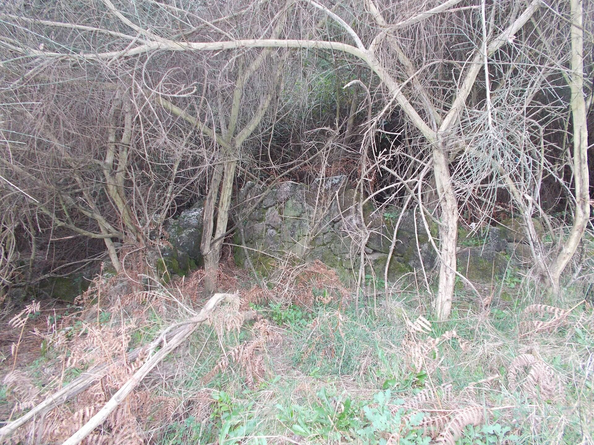
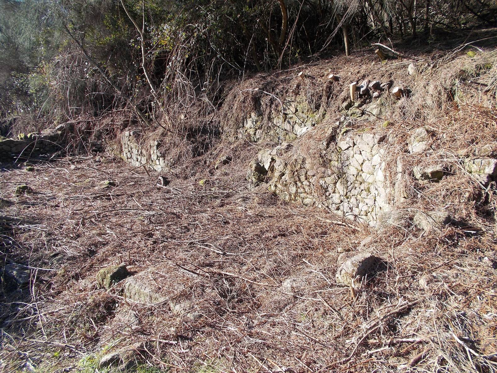
The settlement occupies the summit of São Julião hill, which extends across the parishes of Ponte and Coucieiro in Vila Verde municipality. The hill overlooks the final part of the Homem Valley, and the community developed around Cova da Moura. Its earliest monumental arrangement consisted of about nine huts within an acropolis enclosed by a protective wall. At its fullest extent, the settlement was surrounded by four concentric walls, creating a layered defensive organization across the hilltop.
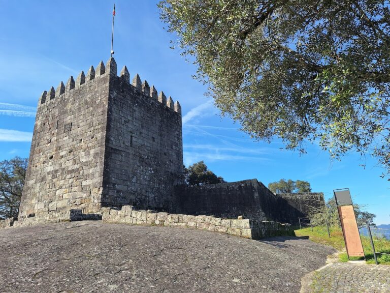
The surviving fortifications and domestic remains are incomplete and deteriorated. Sections of the houses, the turret, and the walls have collapsed, while a furnace and other houses have been destroyed. Paths have also deteriorated, and vegetation obstructs movement through parts of the site. An eucalyptus plantation threatens the outer wall.
Rock engravings and Cova da Moura
A separate area of rock engravings belonged to the settlement’s early ritual landscape. Cova da Moura formed part of the site’s physical setting and became the focus of later traditions about hidden treasure, enchanted women, a golden bell, and a tunnel to the Homem River. Beside the cave entrance, a deep shaft containing water was recorded before being buried in the early 1980s.
Religious and communal buildings
Possible sixth-century church
The remains of a possible sixth-century church include a round structure, columns, heaps of small fragments that may have come from lamps, and crosses. One cross bears the Christian fish symbol known as Ichthys, formed from the initial letters of a Greek phrase meaning “Jesus Christ, Son of God, Savior.” These elements belong to the phase when the settlement appears to have become a Christian or early Christian parish under Suebian rule.
Communal building
An excavated communal building contained benches and was associated with women’s weaving activities. The structure provides physical evidence for organized craft work within the settlement and complements the recovered loom weights and other remains connected with textile production.
Objects, crafts, and environmental evidence
Ceramics and working equipment
Excavation and collection produced 24,711 ceramic fragments, including domestic and imported pottery, together with 352 stone objects, 21 metal artefacts, three glass objects, and three objects made from plant materials. The assemblage also includes loom weights, fishing-net weights, querns, and daggers. Moulds and slag provide evidence for copper and bronze casting, while ironworking slag shows that iron production also took place within the settlement.
Plant and animal resources
Archaeobotanical and archaeozoological work identified pollen from alder, black alder, chestnut, hazel, ash, holly, broom, pine, oak, cork oak, hawthorn, pear, willow, elder, and elm, as well as fava-bean seeds. Food resources included acorns, cultivated beans, pears, hazelnuts, and chestnuts. Willow was used in basketry, elder in dyeing, oak in tanning, and cork oak in beekeeping. Several tree and shrub species supplied material for construction and everyday objects, while many riverside plants probably came from the banks of the Homem River.
Gallaecian warrior statue
A broken statue of a Gallaecian warrior, about 1.5 metres high, was discovered during the construction of an access road to a chapel. Two fragments were recovered. The figure wears a short tunic, carries a dagger at the waist, and holds a shield bearing the Latin inscription “Malceino Dovilonis F,” meaning “Malceino, son of Dovilonis.” The statue is decapitated, so its torque, a rigid or partly open neck ring associated with status or authority, is not visible. The head, one arm, part of the chest, and parts of the legs remain unaccounted for.