La Hoya: A Fortified Prehistoric and Protohistoric Settlement in Spain
Site at a Glance
- Rating
- 4.3
- Popularity
- Low
- Country
- Spain
- Primary era
- Iron Age
- External website
- Open
- Eras represented
- Bronze Age, Iron Age
- Civilizations
- Celtiberian, Celtic
- Site type
- Military
- Remains
- Fortified Town
On this page16 sections
History
La Hoya is a fortified prehistoric and protohistoric settlement in Spain, near Laguardia in Álava, occupied from the Bronze Age into the Iron Age. The site developed through successive communities and became associated with the Berones, a pre-Roman people of the Rioja region. Its occupation extended from at least the 12th century BCE, with one reconstruction placing its beginnings as early as the 15th century BCE, until around the 3rd or 2nd centuries BCE.
Bronze Age Communities
The earliest inhabitants lived at La Hoya during the later Bronze Age, an archaeological period defined by the widespread use of bronze for tools, weapons, and other objects. During the 13th century BCE, groups arriving from central Europe entered the area and merged with earlier residents. Over time, these communities formed the population later identified as the Berones.
Between the 5th and 4th centuries BCE, Celtic groups came from the south. They joined or took control of the existing population, contributing to the settlement’s later Celtiberian phase. Celtiberians were pre-Roman communities of the Iberian interior whose culture combined local traditions with influences associated with Celtic-speaking or Celtic-connected groups.
Beronian Prosperity and Destruction
During the Iron Age, the period associated with the widespread use of iron, La Hoya became a prosperous Beronian commercial centre. Its inhabitants cultivated crops and raised animals, producing agricultural surpluses for exchange with neighbouring communities. The settlement stood on a route that connected the Laguardia area with Rioja, western Navarre, and the Cantabrian Mountains, supporting its commercial importance.
Between the 4th and 3rd centuries BCE, or more broadly between about 350 and 200 BCE, an enemy group attacked La Hoya on a market day. Fire swept through the settlement, buildings collapsed, and many inhabitants died. The destruction buried houses, everyday objects, human remains, and animals beneath the rubble. The attack may have been connected with conflict between Celtic groups in the surrounding region and may have aimed to destroy La Hoya’s commercial power.
Some survivors tried to rebuild the settlement, but occupation did not continue for long. The population later moved to a higher and more defensible hill with a source of potable water. That settlement became the origin of modern Laguardia. La Hoya was abandoned before the Roman period, and its occupation did not continue into a substantial Roman settlement.
Discovery and Archaeological Study
The site was discovered in 1935 by Alejandro Sampedro Martínez, who found large quantities of pottery while cultivating the land at the place formerly called El Torreón. He informed Carlos Sáenz de Tejada and Álvaro Gortazar, whose wider investigation produced the first report and gave the settlement the name La Hoya.
Excavations followed in 1950, directed by Domingo Fernández Medrano, Máximo Ruiz de Gaona, and Basilio Osaba, and continued under Gratiniano Nieto in 1955. The Alavese Institute of Archaeology resumed work in 1973 under the archaeologist Armando Llanos, with further excavation in 1989. About 15 percent of the settlement has been excavated, while the oldest area remains largely untouched.
The Basque Government declared La Hoya a monument in 1984, and it is formally protected as an archaeological monument. In 1986, a project directed by Armando Llanos began preserving and interpreting the site for the public. The resulting interpretation centre was the first of its kind in Álava and extended access to archaeological information beyond the main Archaeology Museum in Vitoria-Gasteiz.
Remains
Settlement and Defences
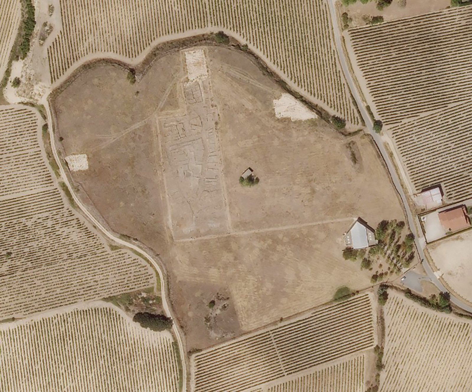
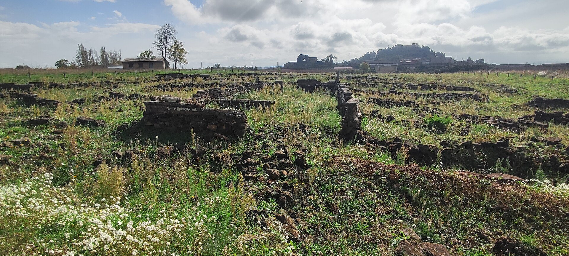
La Hoya covered approximately five hectares and stood slightly above the surrounding fields. Layers of habitation debris, collapsed structures, and accumulated soil formed a small tell, a mound created by successive occupation, about three metres high. A perimeter wall enclosed the settlement, and substantial portions of the defensive system survive.
Perimeter Wall
The wall was built or rebuilt in at least three phases. The earliest phase included a western section made partly from timber beams and stakes and an eastern section made from stone. Their exact relationship in time is uncertain. A later and larger enclosure incorporated the eastern and northern areas, together with a separate western and northern section.
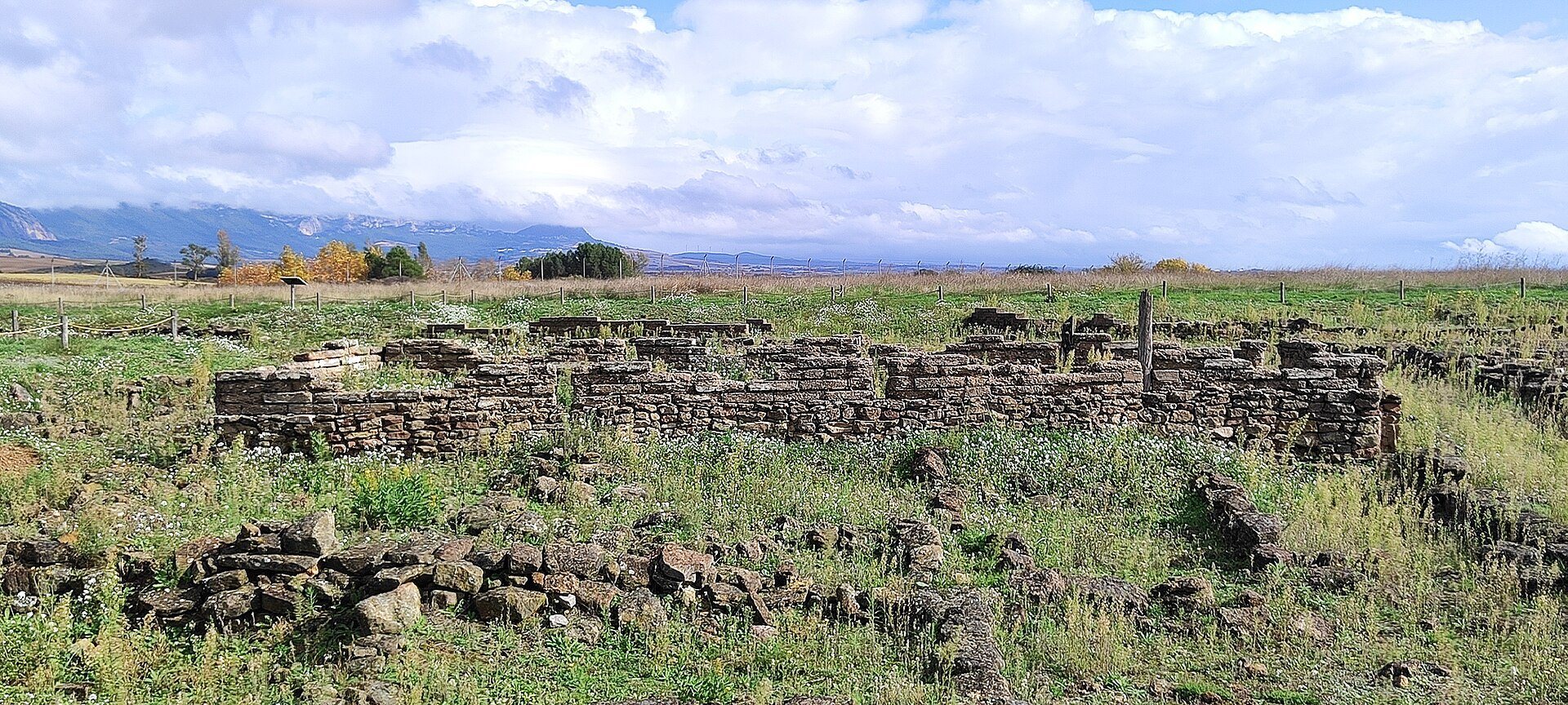
The eastern wall consisted of two parallel limestone walls, with the space between them packed with stones and earth. The western section used large stones at the base and smaller stones above, a building method associated with Celtic influence. In places, its foundations were bonded to the underlying bedrock. This later wall survives relatively well and reaches about three metres in height in some areas. A triangular structure on the southern side may have served as a defensive tower protecting the principal entrance.
Streets and Houses
The better-excavated Celtiberian quarter had four principal streets oriented toward the cardinal directions. Secondary streets crossed them at right angles or formed a grid, although some were offset rather than continuing directly across a main street. Pavements and raised crossing points helped people move through the settlement, while large stepping stones provided crossings over the streets.
Celtiberian houses were generally rectangular or trapezoidal, about 16 metres long and 5.5 metres wide, and usually contained three rooms. The central room commonly held a hearth against the main wall. Houses opened onto the streets, and some entrances also functioned as shop fronts.
House walls rested on stone socles, the lower supporting bases of walls. Upper sections used timber, interwoven branches covered with clay, or adobe, a sun-dried earth or clay building material often reinforced with plant matter. Small beams supported roofs covered with vegetation or reeds. Most roofs were two-pitched and had broad eaves, while finds along the pavements indicate that much daily activity took place outside the houses.
The earlier settlement is less fully understood. Some houses had straight walls meeting at angles, while others were circular or nearly circular. Their walls combined stone bases with stakes or beams and clay infill. Large pottery fragments were incorporated into some foundations, and floors were made from hard-packed clay painted red.
Burials and Destruction Evidence
Burial Areas
Two necropolises, or designated burial areas, have been identified at La Hoya. Cremated remains were deposited there with grave goods. Within the excavated urban area, about 200 children younger than five were buried inside houses beside the walls. Five adult bodies found in the streets are thought to have died during the attack, including one person whose neck and right arm had been cut.
Collapsed Buildings and Animal Remains
The destruction layer preserves human bodies and domestic animals beneath collapsed buildings and in the streets. Some animals had their legs tied, apparently in connection with their sale at the market interrupted by the attack. Together, these remains preserve physical evidence of the violence that ended the settlement’s long occupation.
Objects, Production, and Beliefs
Ceramics and Household Goods
The earliest pottery was made from dark or black clay mixed with small pebbles to reduce cracking. Vessels were shaped by hand or on a slowly turning wheel and fired in relatively simple kilns. They commonly had narrow bases and necks, broad bodies and mouths, and decoration made with cord impressions or finger marks. Some smaller, more carefully finished vessels may have been cups.
Later potters used faster wheels and improved kilns capable of oxidising the clay. The vessels were generally yellow in their natural colour and carried black lines or geometric designs. Finds include cups, cooking pots, decorated ceramic boxes, textile weights, small clay balls possibly used as tokens or currency, leather bags, knives, bracelets, tools, and other household objects.
Crafts and Food
Moulds for metalworking indicate that many clay and metal objects were probably made at La Hoya. Food remains and related evidence show the consumption of wheat, barley, wild plants and fruits, acorns, and meat from sheep, goats, cattle, pigs, deer, and wild boar.
Ritual Evidence
Possible religious practices are represented by snake motifs on bracelets, cattle figures on funerary stones and clothing fasteners, and deer antlers placed in wall foundations. A human skull was found inside a house, while worked skull fragments from other parts of the settlement may have been used as decoration or for another purpose. The function and religious meaning of these remains are uncertain.
Interpretation of the Site
The interpretation centre presents La Hoya’s architecture, material culture, beliefs, funerary practices, and daily life through panels, models, audiovisual material, audio guides, and a full-scale reconstruction of a house. The reconstructed interior represents the rooms, construction methods, and objects associated with the settlement. An archaeological route marked by explanatory displays and digital audio material helps interpret the excavated remains, while some objects from La Hoya are displayed at the Bibat Museum in Vitoria-Gasteiz.