Papiliakalnė Hillfort: A Fortified Archaeological Complex in Lithuania
Site at a Glance
- Rating
- 4.8
- Popularity
- Very Low
- Country
- Lithuania
- Primary era
- Medieval
- External website
- Open
- Eras represented
- Iron Age, Classical, Medieval
- Civilizations
- Unclassified
- Site type
- Military
- Remains
- Fort
On this page11 sections
History
Papiliakalnė hillfort is a fortified settlement or stronghold in Lithuania, southwest of Ginučiai at the northern end of Lake Linkmenas. It forms part of a single archaeological complex with Ginučiai hillfort, on a north-south ridge between Lakes Ūkojas and Linkmenas. The main hillfort was used from the 1st millennium BC through the middle of the 1st millennium AD and again from the beginning of the 2nd millennium to the 14th century.
Early and later occupation
The complex developed through several periods of occupation and fortification. The main hillfort belongs to both an early phase, extending from the 1st millennium BC to the middle of the 1st millennium AD, and a later phase beginning in the 2nd millennium and continuing to the 14th century. The II outwork, a fortified area positioned beside the main stronghold, also has two phases, with an earlier stage dating from the late 1st millennium BC to the middle of the 1st millennium AD and a later stage extending from the beginning of the 2nd millennium to the 14th century.
The I outwork belongs to the later period, from the beginning of the 2nd millennium to the 14th century. Together with the main hillfort and the II outwork, it formed a defended landscape along the narrow ridge. A foothill settlement occupied about 4 hectares on the eastern, western, and northern lower slopes. Its finds include stroked and rough-surfaced pottery, slag from metalworking, a stone axe, and a clay spindle whorl.
Another fortified area lies on the northwestern part of a narrow ridge at the northern foot of the hill, about 60 metres from the hillfort. Its identification remains uncertain because it may have been a separate hillfort or another fortified outwork. Its form and earthworks correspond closely with the nearby II outwork.
Investigation and protection
The Institute of History surveyed Papiliakalnė hillfort in 1958, and the finds from that work are held by the Lithuanian National Museum. Further surveys took place in 1976 and 1985. The hillfort became a cultural monument under a Lithuanian Government resolution of 13 February 2008. The protected territory covers 252,909 square metres, while the I and II outworks received legal protection under a Cultural Heritage Assessment Council act of 14 January 2009.
The protected archaeological complex includes the hillfort, forecourt, I outwork, II outwork, and foothill settlement. Ploughing continues to damage parts of the settlement on the lower slopes, affecting the archaeological deposits there.
Remains
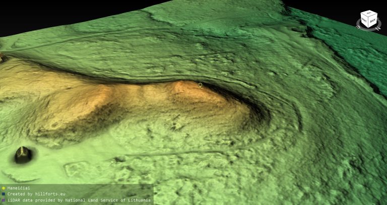
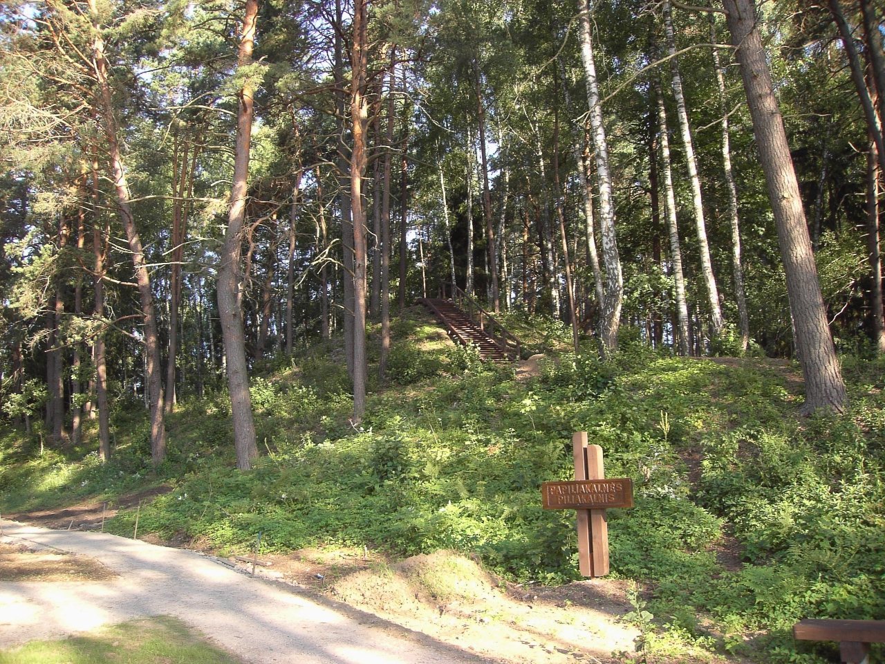
Papiliakalnė occupies the northern part of an elongated north-south hill, while Ginučiai hillfort lies farther south on the same ridge. The surviving remains consist of a summit enclosure, a forecourt, deep ditches, earthen ramparts, terraces, and two outworks. Steep natural slopes were strengthened by artificial earthworks, and many of the features are now partly spread, filled, or covered by trees and shrubs.
Main hillfort and forecourt
Summit enclosure and defenses
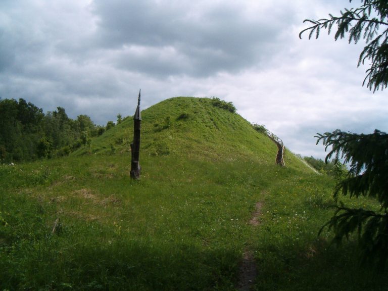
The main summit enclosure is an oval area elongated north-south, measuring about 47 by 19 metres. It is enclosed by a rampart, an earthen defensive embankment, which is highest at the two ends. At the north end it is about 2.5 metres high and 22 metres wide, while at the south end it is approximately 1 metre high and 6 metres wide. Connecting embankments along the eastern and western sides are about 0.4 metres high and 4 metres wide. A memorial stone on the summit commemorates President Antanas Smetona’s visit in 1934. The summit is partly disturbed by pits and partly covered by trees.
Additional ramparts lie outside the ditches on the eastern and western slopes. They are about 1 metre high and 8 metres wide, with outer slopes that become steeper, reaching approximately 4 metres in height before merging with the natural hillside. Their ends curve into the narrow ridge. The ramparts have partly slipped and are overgrown with trees, while the northern rampart has been partly cut away toward the northwestern edge of the summit.
Ditches, excavated defensive trenches, lie 10 to 16 metres below the summit. The northern ditch is about 8 metres wide at the bottom, 40 metres wide at the top, and 11 metres deep. The southern ditch is also about 8 metres wide at the bottom, but measures approximately 30 metres across at the top and 7 metres deep. Ditches about 5 metres wide and 1 metre deep connect them across the eastern and western slopes, with embankments along their outer sides. Raised features in the eastern ditch probably helped regulate or stabilize water flow. The ditches are partly filled and overgrown with trees.
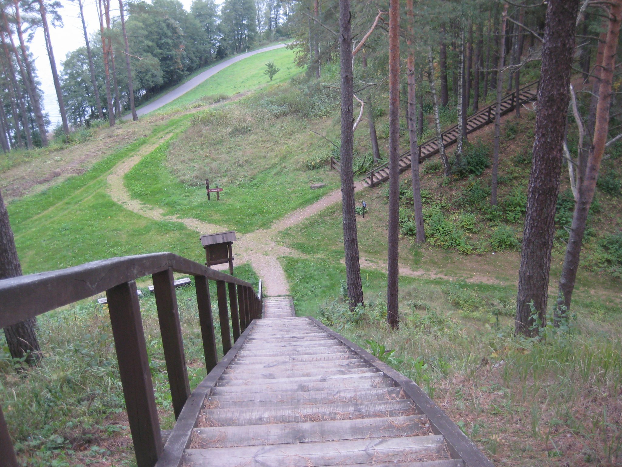
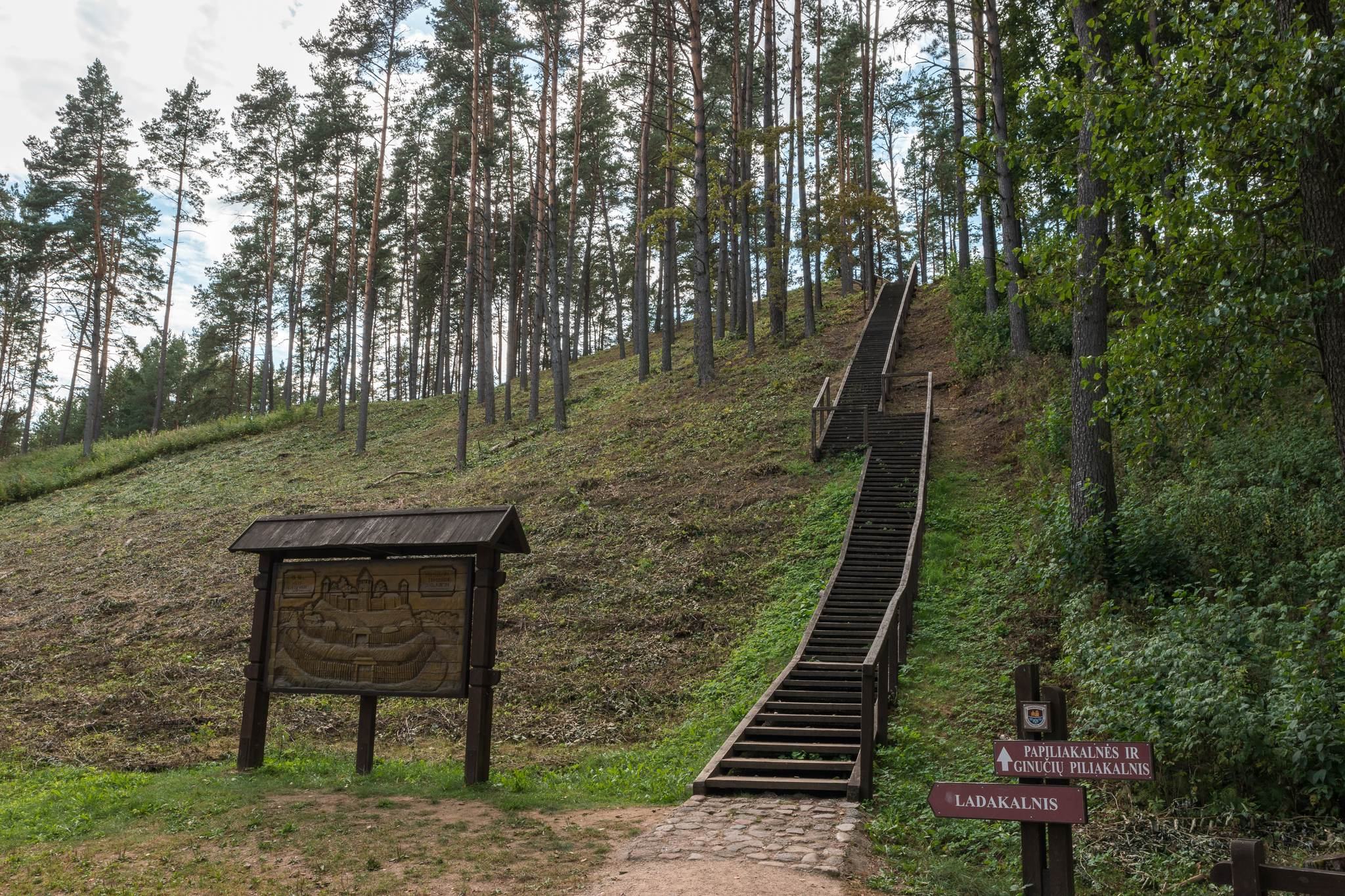
The slopes above the ditches are steep and artificially strengthened, reaching about 16 metres in height. Below the outer ramparts, the ground descends another approximately 25 metres on gentler slopes. Trees and shrubs cover the slopes, and steps were installed on the northeastern and southern sides during site maintenance. A dark cultural layer survives on the summit. It contains wheel-made pottery, formed on a rotating potter’s wheel, and fragments of hardened clay daub once used with timber or other organic materials in walls or buildings. Pits have disturbed this deposit, and isolated daub fragments also occur on the site.
Forecourt
The forecourt is an irregular rectangular enclosure measuring about 40 by 25 metres and elongated north-south. A rampart encloses it on all sides. The southern rampart is approximately 1 metre high and 11 metres wide, while the northern rampart is about 0.6 metres high and 5 metres wide. On the eastern and western sides, terraces about 6 metres wide survive in place of the more substantial embankments.
A ditch on the southeastern lower slope lies 4 metres below the forecourt enclosure. It is about 10 metres wide and 1 metre deep, with a second rampart beyond it measuring approximately 0.8 metres high, 5 metres wide, and 15 metres long. A terrace on the northern slope lies 4.5 metres below the enclosure and measures about 8 by 16 metres. The surrounding slopes rise as much as 40 metres and are covered by mixed forest and shrubs.
Outworks and northern fortified area
I outwork
The I outwork forms an elongated rectangular enclosure about 130 metres long and 10 metres wide, with a raised central section. Trees and shrubs partly cover the earthworks. At its northern end, where a ditch separates it from the main hillfort, a rampart is about 1 metre high and 9 metres wide. The southern end has a rampart approximately 1 metre high and 10 metres wide, followed outside by a second rampart about 0.5 metres high and 7 metres wide. These embankments have partly spread, especially along the eastern and western sides.
Between the two southern ditches is a curved ditch about 16 metres wide and 2 metres deep. It is partly filled and overgrown with trees and shrubs. The western and eastern slopes are steep, rising 10 to 28 metres, while the southern slope is considerably gentler and appears naturally terraced. Steps have been installed on the northeastern slope.
II outwork
The II outwork is a quadrangular enclosure elongated north-south and measuring about 26 by 14 metres. Its central area rises by as much as 1 metre. A rampart on the northern side is approximately 0.5 metres high and 9 metres wide. On the southern side, beyond a ditch, another rampart is about 0.3 metres high and 6 metres wide. Both ramparts have partly spread and are covered by vegetation.
The southern ditch reaches 1 metre in depth and 10 metres in width, with an embankment beyond it. A terrace on the northern slope lies 4.5 metres below the enclosure and measures approximately 8 by 16 metres. It has partly slipped and is overgrown with trees and shrubs. The western, northern, and eastern slopes are steep and about 20 metres high.
Fortified area on the northern ridge
The fortified area on the northwestern part of the northern ridge has a quadrangular enclosure measuring about 26 by 14 metres and elongated north-south. Its central section is raised by up to 1 metre. The northern side has a rampart approximately 0.5 metres high and 9 metres wide. On the southern side, a ditch up to 1 metre deep and 10 metres wide is followed by a rampart about 0.3 metres high and 6 metres wide. The slopes around the enclosure are steep and reach approximately 20 metres in height.