Paplienijos piliakalnis: A Lithuanian Hillfort and Curonian Castle Site
Site at a Glance
- Rating
- 4.5
- Popularity
- Very Low
- Country
- Lithuania
- Primary era
- Medieval
- External website
- Open
- Eras represented
- Iron Age, Classical, Medieval
- Civilizations
- Unclassified
- Site type
- Military
- Remains
- Fort
On this page10 sections
History
Paplienijos piliakalnis is a hillfort in Lithuania, occupied from the middle of the first millennium BC through the thirteenth century. Also known as Žarėnų piliakalnis, Plienija, and Plinija, it belonged to a fortified settlement whose cultural layer preserves evidence of buildings, hearths, and metal-smelting furnaces. The site is traditionally associated with the Curonians, a Baltic people of the eastern Baltic region, although that identification is not certain.
Early Settlement and Medieval Use
The hillfort and its settlement were used continuously across a long period extending from the middle of the first millennium BC to the thirteenth century. The settlement developed around the base of the stronghold and supported activities that included habitation, craft production, and metalworking. Its archaeological deposits contain objects made from iron, bronze, stone, clay, amber, and pottery, reflecting the varied activities carried out at the site.
The Curonian Castle of Žarė
Paplienijos piliakalnis is traditionally identified with Žarė, a Curonian castle mentioned in a document dated April 5, 1253. The document concerned the division of the southern Curonian lands between the Livonian Order, a medieval military religious order in the eastern Baltic, and Heinrich, the bishop of Courland, the ecclesiastical ruler of the medieval Diocese of Courland. The connection between the document and this hillfort remains an attribution rather than a stated certainty.
Investigation and Conservation
The Telšiai Museum of Local Lore investigated the site between 1959 and 1962, followed by archaeological reconnaissance by the Lithuanian Institute of History in 1964. Erosion had severely damaged the two outworks on the eastern side, where the Minija had washed away much of the earthworks. Measures undertaken in 1994 and 1995 stabilized the erosion, although the rampart at the northern foot of the hillfort remains damaged.
Remains
Hillfort and Defensive Earthworks
Principal Hillfort
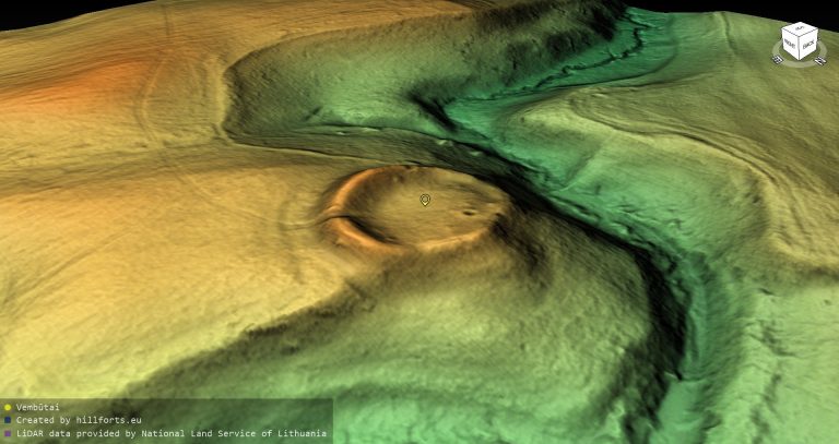
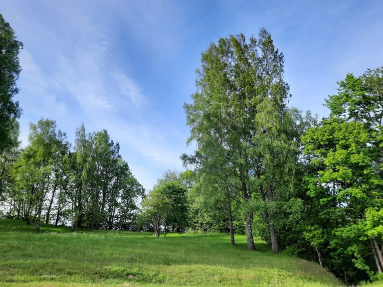
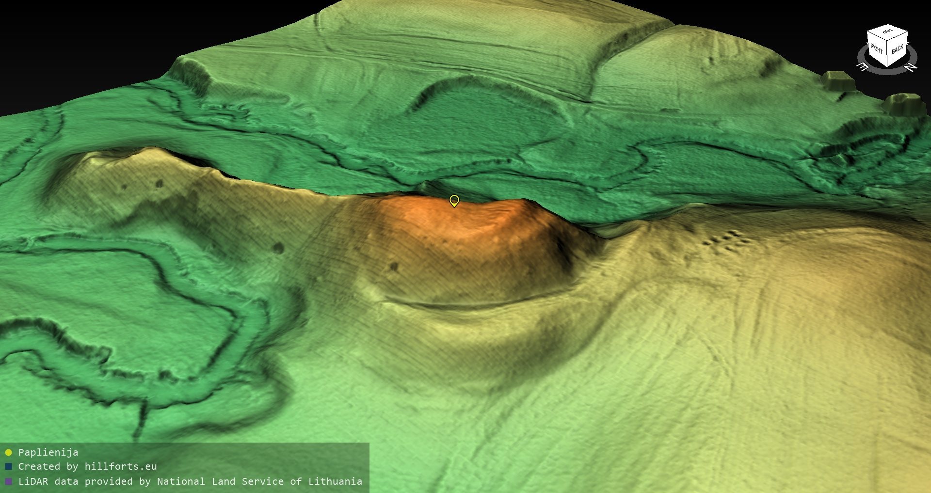
The hillfort occupies a promontory within a bend of the right bank of the Minija. Its quadrangular plateau is elongated from north to south and measures 40 by 25 metres. Steep slopes rise 25 metres above the surrounding area. Along the northern edge, a rampart measuring 30 metres in length, 1.5 metres in height, and 15 metres in width protected the plateau. Its outer slope merges with the natural hillfort slope, while a 4-metre-wide terrace lies 2 metres below the crest.
A ditch at the northern foot lies 13 metres below the rampart and measures 4 metres across and 1 metre deep. Beyond it is a bow-shaped rampart 100 metres long, 1 metre high, and 16 metres wide. Its outer slope reaches 7.5 metres in height at the southeastern end before descending toward a second ditch, which is 5 metres wide and 2 metres deep. On the southern side, an 8-metre-high slope descends to a ditch 12 metres wide and 1.5 metres deep, separating the hillfort from its outworks.
Southern Outworks
The first outwork, a fortification outside the principal enclosure, lies south of the hillfort. Its quadrangular plateau is elongated north to south and measures 38 metres in length and 2 to 3 metres in width. A rampart 1 metre high and 10 metres wide runs along its southern edge, beyond which stands the second outwork.
The second outwork has a triangular plateau extending north to south, measuring 25 metres in length and 10 metres across its southern edge. A ditch 5 metres wide and 1 metre deep was cut into its southern slope, 4 metres below the plateau. Beyond the ditch, a rampart 12 metres long, 1 metre high, and 6 metres wide rises diagonally up the slope. A large stone lies on the rampart, which represents the remains of an entrance protected by earthworks on both sides. The outwork slopes reach 18 metres in height, while erosion has almost completely removed the eastern sides of both outworks.
Foothill Settlement and Finds
A foothill settlement extends north and west of the hillfort across approximately 10 hectares. Its cultural layer, the accumulated archaeological deposit from past human activity, reaches up to 1 metre in thickness. It contains remains of buildings, hearths, and metal-smelting furnaces, linking the settlement to domestic life and craft production.
Objects from the settlement include iron knives, pins, awls, buckles, drawknives, tweezers, bronze spirals, fittings, a bracelet, a penannular brooch, a pin, and a ring. Other finds include a flint axe, stone whetstones, quern stones, clay weights, spindle whorls, amber beads, and several pottery types, including brushed, rough-surfaced, smooth, and wheel-thrown vessels. A bronze penannular brooch was also found on the hillfort plateau.
Spring
Approximately 200 metres southwest of the hillfort is a spring regarded as magical.