Päijälä Hillfort: An Iron Age Fortified Site in Finland
Site at a Glance
- Rating
- 4.6
- Popularity
- Very Low
- Country
- Finland
- Primary era
- Medieval
- External website
- Open
- Eras represented
- Medieval
- Civilizations
- Unclassified
- Site type
- Military
- Remains
- Fort
On this page10 sections
History
Päijälä hillfort is an Iron Age fortified site in Finland, near Kuhmoinen, whose main activity dates to approximately AD 1025–1150. It stands in the Päijälä wilderness on the watershed between the Kokemäenjoki and Päijänne drainage systems, beside a medieval horseback route. The elevated position may have allowed its occupants to monitor movement through the wilderness.
Early medieval use
During the eleventh and twelfth centuries, the Päijälä area may have marked a boundary between different spheres of power and resource use. The hillfort may initially have been connected with competition between the Tavastians and Karelians over control of the wilderness. Its finds and dating evidence point mainly to the early medieval and Crusade periods.
Radiocarbon dating, which estimates the age of organic material, and thermoluminescence dating, which estimates when heated minerals were last exposed to intense heat, place samples from different parts of the site within approximately AD 1026–1281. Individual results include dates of about AD 1040 for the edge of the stone wall, AD 1220 for one hearth, and AD 1260 for another. Four additional hearth dates fall at approximately AD 1040, 1070, 1100, and 1270.
The hillfort may have burned in the early twelfth century, although it may have remained in use during the thirteenth century. Jussi-Pekka Taavitsainen interpreted the remains of its wooden fortifications as evidence that the site may have been occupied for only a few decades and may have been destroyed during the twelfth century. He also interpreted approximately 79 percent of the numerous Iron Age finds as scrap metal that had served as raw material for smiths working at the hillfort. His estimate placed the construction effort for the fortifications at about 135 person-days, equivalent to roughly two weeks for ten able-bodied workers.
Investigation and protection
The hillfort was known by at least the nineteenth century and was mentioned in Hjalmar Appelgren’s dissertation in 1891. Surface investigations followed in 1907, 1918, 1962, 1970, and 2002. Archaeological excavations took place from 1985 to 1989 under Taavitsainen after Hannu Kilpinen reported finding two spearheads with a metal detector in 1983. The excavations revealed stone heaps, furnaces, hearths, and numerous iron, copper, and bronze objects, while soil and tree samples were collected for dating.
Päijälä hillfort is included among nationally valuable cultural landscapes and among sites proposed as nationally significant archaeological sites. Management of the surroundings aims to protect the archaeological structures and make them more visible. Trees are removed from the ramparts and undergrowth is cleared, while part of the surrounding area is a nature reserve on land belonging to Kuhmoinen parish.
Remains
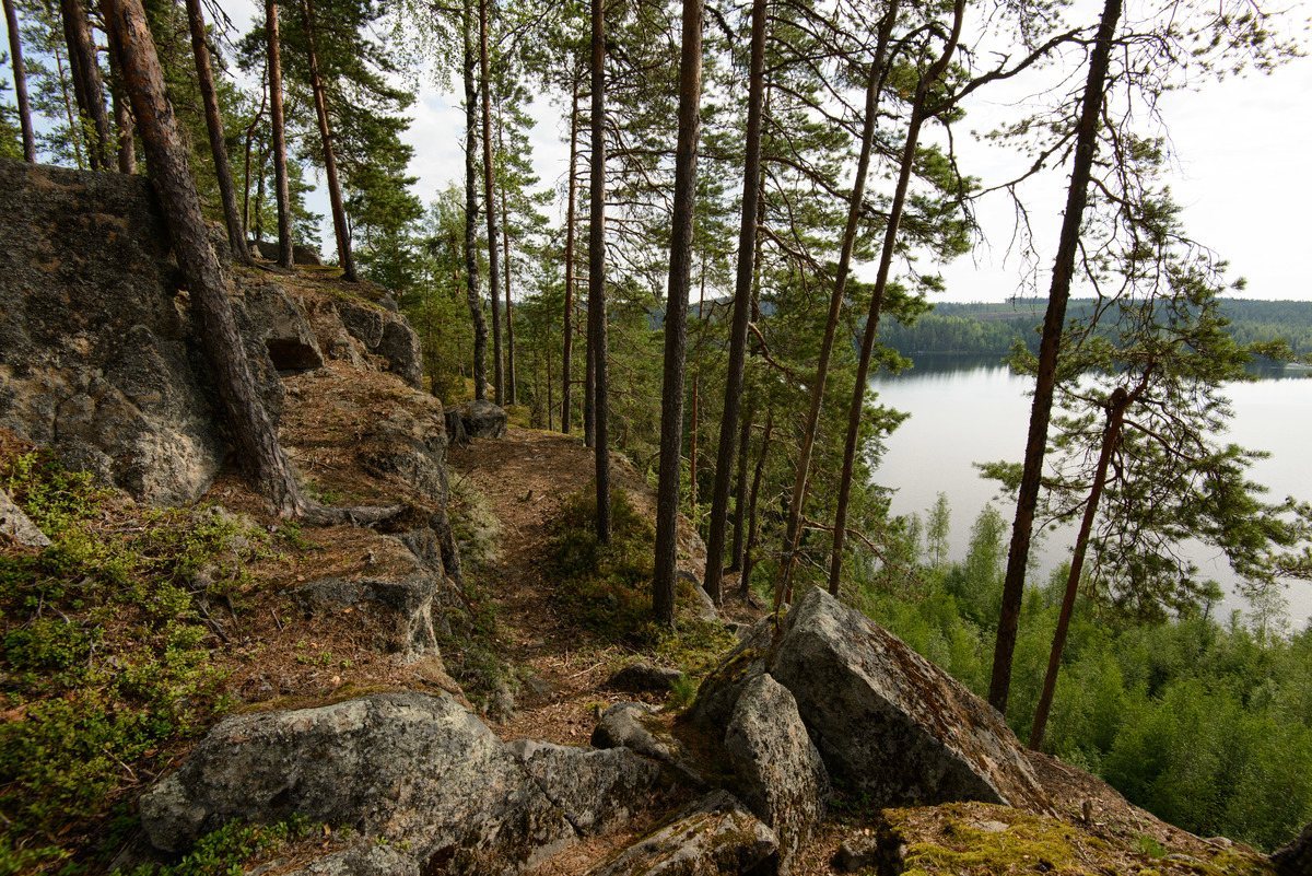
The hillfort occupies an isthmus between Linnajärvi and Saaresjärvi. Its rocky summit rises approximately 40 metres above the surrounding ground and forms a roughly 100-metre-wide enclosure with two terraces. Cliffs protect the eastern and southern edges, and the northern slopes are steep. The western side has gentler slopes and formed the weakest part of the defenses. Päijänne’s eastern shore can be seen from the summit.
Fortifications
Western stone rampart
A stone rampart crosses the western side of the enclosure. It is approximately 25–40 metres long, 1.5–2.0 metres wide, and about 1 metre high. A continuation formerly extended onto the northwestern slope. Appelgren stated that stones from this section had been rolled down the slope. Remains of wooden fortifications also belong to the defensive system.
Occupation features and finds
Hearths, furnaces, and building foundations
The summit contains hearths and foundations of buildings, together with furnace structures and eleven separate stone heaps. The heaps measure approximately 1.5–2.9 metres in diameter. These features occur alongside remains of wooden fortifications and help define the occupied area within the enclosure.
Metal objects
Excavations produced numerous iron, copper, and bronze objects. The assemblage includes weapons, tools, and ornaments dating mainly from the early medieval and Crusade periods, approximately AD 1025–1150. The large quantity of scrap metal interpreted by Taavitsainen as smithing material also connects the finds with metalworking at the site.
Water source and access works
A spring lies east of the rampart and has created a wetland in the hollow below. The path leading to the summit has been repaired, and wooden stairs were built in 2020.