Chesters Roman Fort and Museum: A Roman Cavalry Fort on Hadrian’s Wall
Site at a Glance
- Rating
- 4.6
- Popularity
- Medium
- Country
- United Kingdom
- Primary era
- Classical
- External website
- Open
- Eras represented
- Classical
- Civilizations
- Roman
- Site type
- Military
- Remains
- Fort
On this page15 sections
History
Chesters Roman Fort and Museum is a Roman military site in the United Kingdom at Chollerford, built around AD 123 as part of Hadrian’s Wall’s northern frontier system. The fort, known in antiquity as Cilurnum and by related forms including Cilurvum, Cilurno, and Celunnum, was designed to control the bridge carrying the Military Way across the North Tyne. It is regarded as one of the best-preserved Roman cavalry forts on Hadrian’s Wall and is the third-largest fort on the frontier.
Foundation and cavalry garrison
Chesters belonged to the group of 16 forts added after construction of the original wall had begun in AD 122. Around AD 123, the original Wall ditch was filled and Turret 27a, a recently built watchtower, was demolished to make space for the fort. Its position beside the North Tyne gave the garrison control of the bridge and the road running behind the Wall, while the northern gates allowed cavalry to move quickly beyond the frontier.
Cilurnum was initially occupied by the ala Augusta ob virtutem appellata, an auxiliary cavalry regiment of about 500 men whose title meant that it had been styled Augusta for its valour. Sixteen stable-barracks provided accommodation for the riders and their horses. The arrangement of the fort’s gates was closely connected with this role, particularly the three principal gates situated north of Hadrian’s Wall.
Changing Roman units
The military community changed during the Roman period. The Sixth Legion carried out building work between AD 138 and 161. Inscriptions name the First Cohort of Dalmatians and the First Cohort of Vangiones, although the evidence does not establish whether either infantry unit was permanently based at Chesters.
By AD 178 to 184 at the latest, the Second Asturians had returned the fort to cavalry use. This regiment had originally been raised in northern Spain and remained associated with Chesters until the end of the Roman period. An inscription dated to AD 286 may indicate that allied irregular troops were also present alongside the Asturians.
Chesters and its civilian settlement reached their most prosperous phase between approximately AD 180 and 250. Inscriptions from this period refer to building projects, declarations of loyalty to the emperor, religious ceremonies, and burials. By the end of the third century, activity in the settlement had probably contracted, with occupation focused within the fort and the surrounding land used mainly as fields.
Late Roman occupation and abandonment
During the third century, civil wars and invasions disrupted the traditional Roman military and provincial system. By the fourth century, the garrison’s manpower was probably drawn locally from the sons of serving soldiers. The Notitia Dignitatum, a late Roman administrative document listing military commands and civil offices, still places the Second Asturians at Chesters, although the date of its relevant section is uncertain. The fort still had room for 12 turmae, small tactical subdivisions of a cavalry regiment, or roughly 360 cavalrymen.
After Britain passed out of Roman administrative control in the early fifth century, the garrison probably dwindled and became increasingly isolated from central authority. It remains uncertain whether the Asturians were withdrawn around AD 410 or left to fend for themselves. Archaeologically recognisable occupation belongs to the early fifth century at the latest, and Chesters did not again develop into a major settlement.
Stone reuse and archaeological rediscovery
Around AD 675, Anglo-Saxon builders dismantled the Roman bridge to obtain stone for a church at Hexham. Four Roman columns believed to have come from Cilurnum were later reused in the south aisle of St Giles’ Church at Chollerton. At Chesters itself, dressed stone continued to be quarried into the eighteenth century, while farming gradually spread over the ruins.
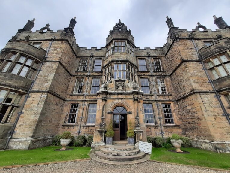
Nathaniel Clayton acquired the estate in 1796 and covered and levelled the remains to form parkland between Chesters House and the river. His son, John Clayton, inherited the estate in 1832 and removed this landscaping. Extensive excavations began in 1843, exposing much of the fort visible today and producing a large collection of inscriptions and sculpture from Chesters and other parts of Hadrian’s Wall.
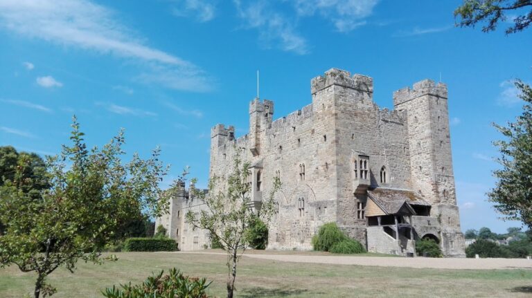
John Clayton died in 1890. His nephew, Nathaniel George Clayton, directed the last major nineteenth-century excavations between 1890 and 1895. A museum was commissioned in 1895, designed by Richard Norman Shaw, and opened in 1903. The building, which is Grade II* listed, was extensively refurbished and redisplayed in 2016.
Investigation continued after the nineteenth century. The southwest part of the commander’s residence was exposed in 1960, work on the eastern and western bridge abutments took place between 1982 and 1991, and a ground-penetrating radar survey examined the interior of the fort in 1992. The fort, the Wall, and the baths east of the fort entered the guardianship of the Ministry of Works in 1954. English Heritage now cares for the remains and administers the museum with the Trustees of the Clayton Collection. The collection became the responsibility of English Heritage in 1983.
Remains
The fort and its defences
Chesters occupied approximately 2.3 hectares and measured about 122 by 174 metres. Its rectangular plan had rounded corners and a northeast orientation. The fort was built almost entirely of stone and was divided by Hadrian’s Wall, with its northern half extending beyond the Wall line. The visible masonry belongs to several phases of the fort’s approximately 300-year use. The gates and much of the headquarters building date from the Hadrianic period, while many other structures remain beneath the ground.
The perimeter walls were about 1.5 metres thick. Four internal corner towers and probably eight intermediate square towers strengthened the circuit, with two intermediate towers on each side. An earth ramp formed the wall-walk. The walls may originally have reached about 6 metres, while the towers and gates may have exceeded 9 metres. A pointed ditch surrounded the four sides. The best-preserved perimeter masonry stands at the southeast corner, where it survives to approximately 1.9 metres.
Gates and roads
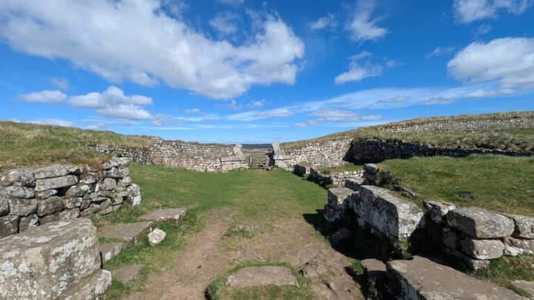
Four principal gates and two smaller side gates served the fort. The north, east, and west principal gates lay beyond the Wall to the north, supporting rapid cavalry deployment. Each had two passages divided by a central stone pier and flanked by square towers. The side gates carried the southern military road, or via quintana, through the fort, and the eastern side gate remains visible.
The North Gate incorporated a spring collected in a basin within its eastern flanking tower. The cavalry unit probably constructed this arrangement between AD 177 and 184, during the governorship of Ulpius Marcellus. A later stone-covered water pipe crossed the eastern entrance. Door-stop blocks and pivot stones survive, while the western passage was blocked with stone blocks relatively soon after construction.
The West Gate was probably blocked shortly after it was built, possibly to create a masonry platform for a ballista. A stone platform in its northern flanking tower probably supported a water tank, and a water main entered through an opening in the northwest corner. A bread oven stood against the tower’s northern wall. Later structures show that the gate area was built over after the Roman period.
The East Gate is among the best-preserved gates on Hadrian’s Wall. Its foundation stone and an iron sleeve set into a pivot stone remain in place. The sleeve protected the pivot of the gate leaf from wear, and both passages were blocked during the Roman period.
A diploma found at the South Gate refers to the governor Gnaeus Papirius Aelianus Aemilius Tuscillus. A building inscription of the Sixth Legion was incorporated into the inner wall of the eastern flanking tower. The road from the South Gate can be traced for slightly more than 1 kilometre towards the south-southwest, where it joined the Stanegate, a major Roman road across northern Britain.
Headquarters and commander’s residence
The principia, the fort’s headquarters and administrative building, followed a standard plan around a courtyard with a colonnade and an east-west basilica. Five doors connected the courtyard with the basilica, including a more elaborate central entrance and additional entrances at the eastern and western ends. A stone platform against the west wall probably served as a speaking platform for the fort commander.
Four administrative rooms stood along the south side of the basilica, with the sacellum, or standards shrine, between them. A stair in the western room led to a basement containing the troop treasury. Its vaulted ceiling survived when the room was excavated, and fragments of its oak door were recovered before the exposed wood rapidly decayed. One stair tread had been made from an altar dedicated by a soldier of the First Cohort of Dalmatians.
The praetorium, the cavalry commander’s residence, stood immediately east of the principia beside the East Gate. It passed through three building phases and included a hypocaust, a Roman underfloor heating system, a heated hall, and a later bath in its east wing. The bath partly overlay the inner perimeter road, or via sagularis. Rooms were arranged around a courtyard, and a late Roman building was added north of the residence against the East Gate’s flanking tower.
Cavalry barracks and service buildings
Two partially excavated barrack blocks in the northeast part of the fort are among the best-preserved Roman cavalry barracks known. A lane containing a drain separated them, and each block had a portico supported by wooden posts set on stone half-columns. Officers occupied larger head buildings at the eastern ends.
The barrack rooms combined horse stalls with troop accommodation. Horses occupied the front sections and riders the rooms behind, allowing rapid mounting during an alarm. The two excavated blocks could house 128 men, approximately four turmae. Wooden partitions probably divided the rooms into sleeping and living areas. The visible foundations belong to rebuilding by the Asturians in the later second or early third century, while later reductions in troop numbers produced smaller accommodation. Another barrack south of these blocks probably served infantry temporarily stationed at Chesters.
The fort probably contained six storehouses, including four smaller buildings southwest of the principia and two larger granaries near the West Gate. A long rectangular building west of the headquarters is interpreted as a workshop, or fabrica.
Wall, bridge, and civilian settlement
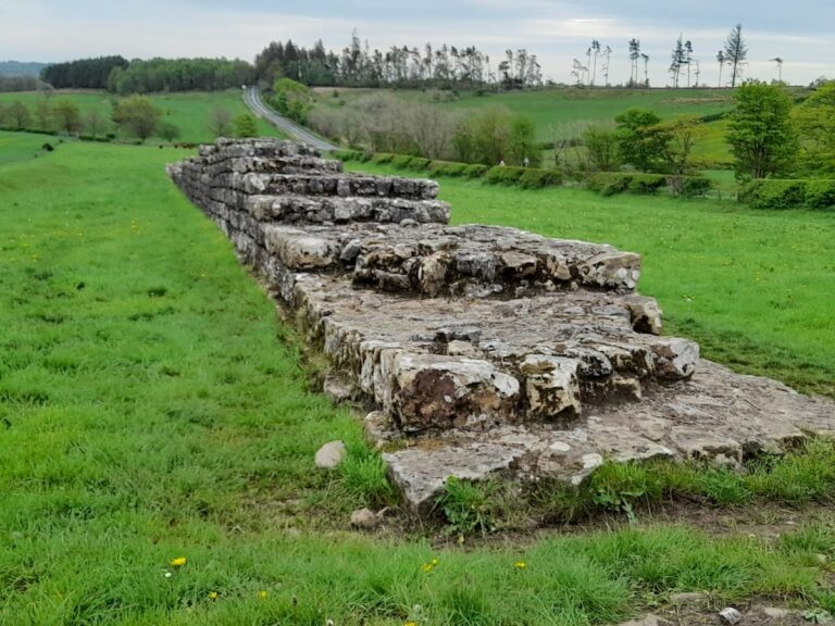
The military road between the fort and the North Tyne remains particularly clear. From the East Gate it ran towards the Wall bridge, and sections of its raised surface survive to approximately 0.8 metres high, together with a kerbstone about 1.3 metres high. Hadrian’s Wall survives mainly as foundations, low earthworks, or traces incorporated into the gate area. A 6.7-metre foundation section was exposed north of the baths, while the Wall west of the fort appears as earth rises about 0.4 metres high. The southern vallum, the earthwork and ditch system associated with Hadrian’s Wall, can be traced east and west of Chesters as shallow depressions.
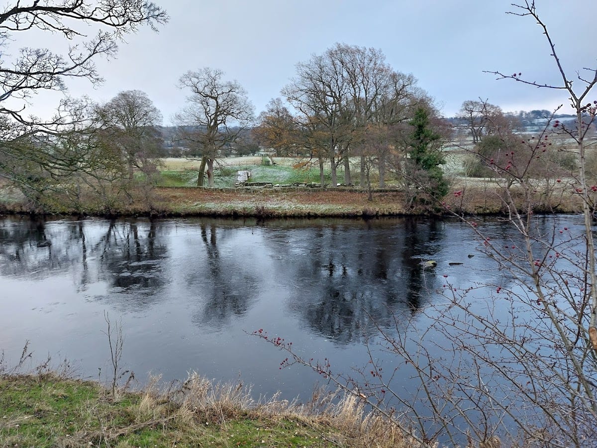
Chesters Bridge crossed the North Tyne near the fort and carried the military road behind the Wall. The eastern and western abutments were investigated during the nineteenth and twentieth centuries. The abutment on the fort side is now underwater, while substantial remains survive on the opposite bank.
The civilian settlement, or vicus, lay mainly south and southeast of the fort and extended along the North Tyne. It covered approximately 15 hectares. A trial trench made by John Clayton about 100 metres south of the fort remains the settlement’s most conspicuous ground feature. Aerial photography and geophysical survey reveal building lines, two principal streets, additional roads, and groups of buildings known as insulae.
Most of the visible building plans are rectangular strip structures on stone foundations, with timber and clay walls. Commercial rooms or shops occupied the fronts, while yards, workshops, storage areas, and living quarters extended behind them. Some buildings probably had upper storeys. Other structures may have been taverns, inns, or more elaborate houses containing several rooms and corridors.
The external bath complex
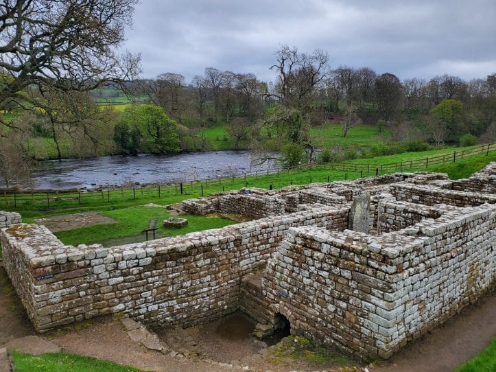
The principal bath complex stood about 30 metres from the North Tyne and 70 metres east of the fort. Discovered in 1884 and 1885, it is one of the best-preserved Roman baths in Britain, with walls surviving in places to approximately 3 metres. Several alterations, extensions, and repairs changed the building over time. Its design combined linear and circular arrangements of bathing rooms, while the precise route taken through the complex remains uncertain.
Construction and entrance areas
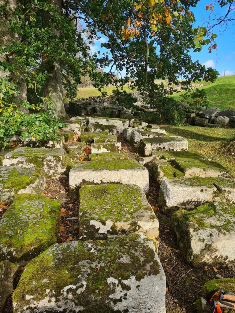
The bath walls had a rubble core bonded with mortar and faced on both sides with dressed stone. A tiled roof covered the building, and the cold- and warm-bath ranges were strengthened by a vault made from tufa ribs connected by two courses of brick bands. Nine buttresses reinforced the eastern and western walls of the latrine and warm-bath areas against the outward pressure of the vault and the steep riverbank. Their lower courses remain visible, and one buttress also carried the latrine’s wastewater outward.
Stone-paved floors, a hypocaust, and drains survive inside the complex. The northern entrance opened through a narrow veranda into a lower entrance hall, or apodyterium. This room served as a changing area, exercise space, meeting place, and setting for personal care and games. Seven arched niches in its west wall may have held statuettes, although storage for bathers’ belongings is considered more likely. A stone bench survives along the north wall.
Cold, warm, and heated rooms
A small lobby led from the entrance hall to the latrine, which occupied the lowest part of the bath so that overflow water could flush it. The latrine probably accommodated about 12 people. A western doorway led to a vestibule and corridor serving the heated rooms. The corridor may also have functioned as an unguentarium, where bathers were rubbed with olive oil before entering the heated sections.
The frigidarium, or cold room, stood at the eastern end of the vestibule and contained two cold-water basins along its north and east walls. The smaller northern basin was added later. West of the vestibule stood the sudatorium, or sweat room, heated from below by a hypocaust. Its opus signinum floor, a waterproof Roman flooring material, rested on stone supports. Hot air circulated beneath the floor and through hollow wall tiles before escaping above the roof. The furnace lay in the north wall, and the room’s intense heat required a stone entrance arch. This room appears to have been a later addition.
The caldarium, or hot room, lay south of the vestibule, while the tepidarium, or warm room, was entered through the south wall of the cold room. An earlier doorway between the warm and hot rooms was later blocked. The hot room had a heated basin in an apsidal western extension. Two furnaces in the southern walls supplied heat to the warm and hot rooms, and water was heated in a bronze boiler above the fire. A second warm- and hot-bath range south of the cold room was heated through a channel from a furnace in its south wall and probably formed part of the original Hadrianic complex.
Burials, inscriptions, and museum collections
A burial area near the baths produced the skeletons of 33 people, two horses, and a dog during excavations in the 1880s. Massive masonry along the riverbank suggests that soldiers and residents of the vicus may have buried their dead there.
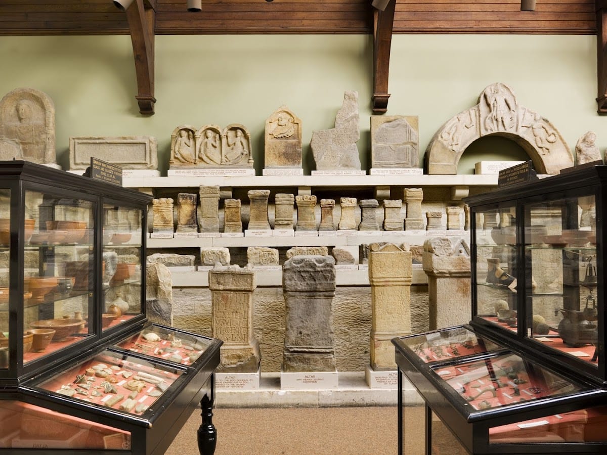
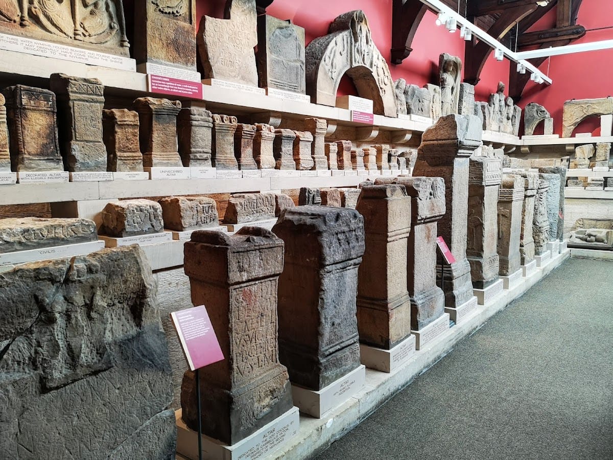
Excavations at and around the fort recovered nine altars, 11 honorific inscriptions, 13 building inscriptions, five tombstones, 10 inscription fragments, and a monumental inscribed relief. The museum preserves inscriptions and sculpture from Chesters and other sites along Hadrian’s Wall. Among them is an altar dedicated to the discipline of Emperor Hadrian by the cavalry regiment styled Augusta for its valour. The Disciplina cult expressed military discipline and loyalty within the Roman army and was particularly promoted under Hadrian.
The purpose-built museum, designed by Richard Norman Shaw, displays part of John Clayton’s Roman collection. Approximately 11,000 objects make up the collection, including material from Chesters and elsewhere along Hadrian’s Wall. Its displays interpret Roman life at Cilurnum and Clayton’s role in preserving the frontier. They also include phallic fertility symbols, objects associated with protection or good luck and explicitly linked with military buildings along Hadrian’s Wall.