Sakurai Kofun: An Early Kofun-Period Burial Mound in Japan
Site at a Glance
- Rating
- 3.6
- Popularity
- Very Low
- Country
- Japan
- Primary era
- Classical
- Eras represented
- Classical
- Civilizations
- Yamato
- Site type
- Burial
- Remains
- Burial Mound
On this page12 sections
History
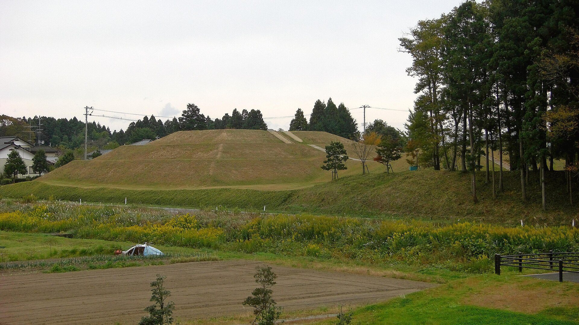
Sakurai Kofun is an early Kofun-period burial mound in Minamisoma, Japan, built during the fourth century, with construction possibly continuing into the early fifth century. The Kofun period was an era of ancient Japan associated with large burial mounds for elite and ruling individuals. Sakurai Kofun is a front-rear rectangular mound, consisting of a rectangular rear section joined to a narrower front section, rather than the semicircular front of a keyhole-shaped mound.
The Sakurai Kofun Group
The mound stands within the Sakurai Kofun Group, which extends for about 900 meters along a terrace beside the Nitagawa River. The group contains 37 identified mounds and burials. It is divided into the Kamishibusawa Subgroup in the east and the Takamicho Subgroup in the west, with Sakurai Kofun forming the largest member of the group. Its name comes from the local area traditionally known as Sakurai.
The date of construction is based on the mound’s shape and on pottery recovered from the site. A jar with a perforated base and another with a double-rimmed mouth support an early Kofun-period date. The person buried at Sakurai Kofun is traditionally considered to have been the first Ukita kuni no miyatsuko, a local hereditary ruler or administrative chieftain. This identification remains unconfirmed.
Recognition and Protection
In 1955, an archaeological team from Meiji University led by Otsuka Hatsushige surveyed the mound and brought it considerable attention. At that time, Sakurai Kofun was regarded as the northernmost known kofun in the Japanese archipelago and the largest front-rear rectangular mound in the Tohoku region. It is now identified as the fourth-largest mound of this form in Tohoku.
Sakurai Kofun became a National Historic Site on November 7, 1956, because its archaeological value helps clarify the development of kofun culture in Tohoku. A boundary investigation by the Haramachi Board of Education in 1983 led to an expansion of the protected area in June 1988. The expanded designation included parts of the front section and the surrounding ditch.
In 1994, the former city of Haramachi began a conservation and improvement project for the mound and related kofun. The group was incorporated into Sakurai Kofun Park, described as Fukushima Prefecture’s first full-scale historic-site park. The mound’s form and scale have also been considered within the distribution of front-rear rectangular kofun in Fukushima. These mounds are concentrated in the Nakadori and Hamadori regions, while keyhole-shaped mounds predominate in Aizu. This pattern has been related to cultural exchange with northern Kanto, particularly the areas corresponding to present-day Tochigi and Ibaraki prefectures.
Remains
Main Mound
Sakurai Kofun occupies a low river terrace on the southern side of the Nitagawa River, about 10 meters above the surrounding lowland. The river flows from the Abukuma Highlands toward the Pacific Ocean. The mound’s main axis runs east to west, with the front section facing west. Its principal surviving length is 74.5 meters, and its maximum height is 6.8 meters.
Rear Section
The rear section is an almost square rectangle measuring about 45 meters across. It has also been measured at approximately 42 meters long and 45 meters wide, with a height of 6.35 meters. Three stepped levels form its sides. Traces at the summit indicate two bamboo-shaped wooden coffins placed side by side. The burial facilities remain protected and have not been excavated, so the significance of the two coffin traces is uncertain.
Front Section
The front section is fan-shaped, approximately 27 meters wide and 4.5 meters high, and was built without stepped levels. A later investigation measured it at about 32 meters long, 23 meters wide at its forward end, and 3 meters high. Part of the southern side of the rear section was cut away at a later date, and the original mound may therefore have extended beyond its surviving length. The damaged area was rebuilt during the 1994 conservation project.
Ditch and Burial Passage
An encircling ditch confirmed during the 1983 investigation measures approximately 7 to 20 meters wide and 60 to 70 centimeters deep. Investigators also identified an earthen connection between the front and rear sections, together with a passage leading toward the burial area. The connection is considered to have provided a route for raising the coffins.
Related Mounds and Burials
Kamishibusawa Subgroup
The Kamishibusawa Subgroup contains one front-rear rectangular mound, one square mound, nine circular mounds, and one pit burial. Kamishibusawa No. 7 Kofun is a square mound measuring 27.5 meters on each side and 3.3 meters high. Excavated in 1999, it had an irregular ditch around the mound and a two-level burial pit directly beneath its flat summit.
The burial at Kamishibusawa No. 7 contained a box-shaped assembled wooden coffin, with masses of white clay at both ends, and a bronze mirror wrapped in cloth. Its burial method resembles practices associated with early kofun in the Hokuriku region. Alongside Sakurai Kofun, it is considered one of the oldest mounds in the group.
Kamishibusawa No. 2 Kofun
Kamishibusawa No. 2 Kofun lies immediately west of the front section of Sakurai Kofun. It is a circular mound approximately 20 meters in diameter. Traces on its summit suggest the presence of a bamboo-shaped wooden coffin, and its construction is considered to date to the fifth century.
Takamicho Subgroup
The Takamicho Subgroup contains one front-rear rectangular mound, twenty circular mounds, one square mound, and five pit burials. A cedar forest lies between the Kamishibusawa and Takamicho subgroups. South of Kamishibusawa No. 2 Kofun, an earthwork marking the boundary of an Edo-period horse pasture also survives.