Yamanoue Stele: An Asuka-Period Buddhist Epitaph in Japan


Site at a Glance
- Rating
- 4
- Popularity
- Low
- Country
- Japan
- Primary era
- Medieval
- External website
- Open
- Eras represented
- Medieval
- Civilizations
- Yamato
- Site type
- Civic
- Remains
- Monument
On this page12 sections
History
The Yamanoue Stele in Japan is an Asuka-period monument erected in 681 by the Buddhist monk Chori of Hoko-ji for his mother, Kurome no Toji. Located in Takasaki, Gunma, it is an epitaph associated with the adjacent Yamanoue Kofun, a kofun being a Japanese burial mound used for elite burials between the third and seventh centuries. The inscription is regarded as the oldest surviving example of writing in Chinese characters arranged according to Japanese grammatical order.
The monument and the Sano estate
The inscription dates the stele to the tenth month of a kanoto-mi year, identified as 681, the tenth year of Emperor Tenmu’s reign. It traces Kurome no Toji’s ancestry through Takemori no Mikoto, described as the person who established the Sano imperial estate, and through the line of Niikawa no Omi, Shitatami no Sukune, and Ogo no Omi. Chori identifies himself as a monk of Hoko-ji and states that he established the text for his mother.
Hoko-ji was a Buddhist temple associated with the later officially designated institution recorded in the early eleventh-century Engishiki document known as the Ueno Province Register of Provincial Transfers. Roof tiles bearing the name Hoko-ji were found at the Sanno Abandoned Temple Site in present-day Maebashi.
The Sano imperial estate, or miyake, was an imperial domain that provided resources and administrative support for the central court. One historical reconstruction places its establishment and administration in the late sixth century, during the reign of Emperor Kimmei. In this interpretation, Takemori no Mikoto represented or was deified as the founding generation of local estate administrators. Chori’s maternal and paternal genealogies expressed inherited authority through Kurome no Toji’s marriage to Ogo no Omi.
The estate is interpreted as having extended across Katooka and Gunma districts. Its economy relied on agriculture and water transport using the Kuragano port. The region had experienced major floods caused by two eruptions of Mount Haruna between the end of the fifth century and the first half of the sixth century. The resulting damage is proposed to have disrupted an extensive irrigation system, after which estate-related water management and labor helped restore irrigation and rice cultivation.
Relationship with the burial mound
The stele’s connection with the adjacent tumulus was once taken to mean that both had been built at the same time, allowing the kofun to be dated through the inscription. Current interpretation places construction of the tumulus before the erection of the stele. The inscription nevertheless led to the assumption that the mound was Kurome no Toji’s tomb.
The reading of the inscription’s term for “grandchild” as “descendant” is now considered more persuasive than a strictly two-generation interpretation. The date when the Sano imperial estate was established therefore cannot be calculated simply by counting generations between Takemori no Mikoto and Kurome no Toji.
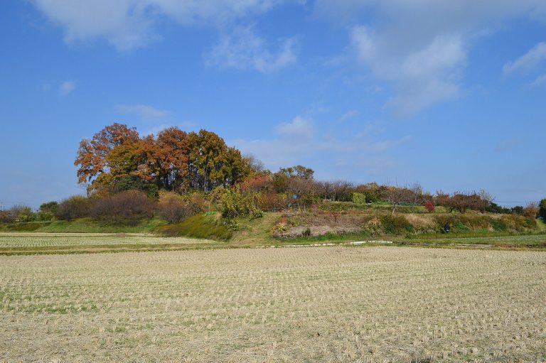
The Urushiyama and Yamana Isezuka tumuli have been interpreted as burials of local elites involved in agricultural reconstruction east of the Karasugawa River and the development of the previously little-used hills west of it. Their similar scale and stone chambers have led to their characterization as “sibling tumuli.” One has also been proposed as a possible ancestral burial ground connected with the tradition surrounding Takemori no Mikoto.
Preservation and historical recognition
During the Edo period, Matsudaira Sadanobu’s Shuko Jisshu, compiled in the 1790s, referred to the monument as the “Stele beside the Kannon Hall in Yamana Village.” Kariya Ekisai’s Kokyo Ibun, published in 1818, called it the “Yamana Village Stele.” Local traditions placed it beside a pine tree near a hall formerly standing in front of the tumulus or at the foot of the hill. By about 1875, it was said to stand on the right side at the top of the hill steps.
In 1884, Gunma governor Katori Motohiko authorized the public purchase of the land containing the stele, established its location, installed a foundation stone, and provided a protective shelter. The stele and adjacent tumulus were designated together as a National Historic Site in 1921 and raised to Special National Historic Site status in 1954. The monument forms part of the Three Stelae of Kozuke, alongside the Kanaizawa Stele and the Tago Stele, and was included in Japan’s submission to UNESCO’s Memory of the World Programme in 2017.
Remains
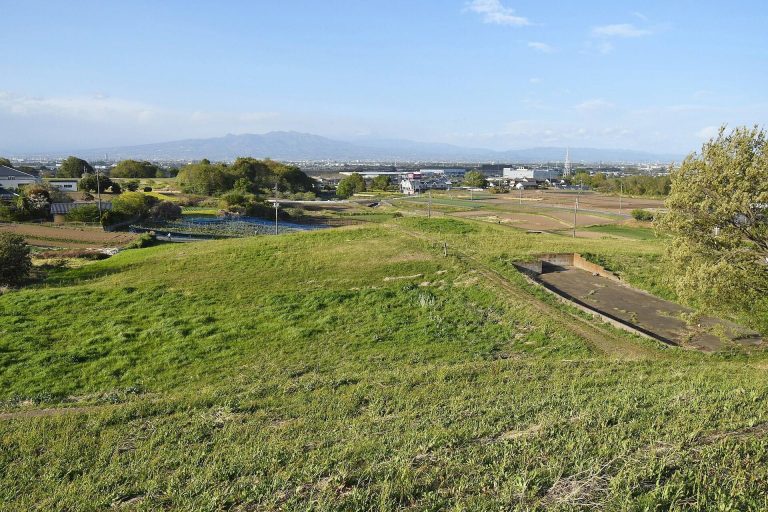
The site consists of a carved natural stone monument and the Yamanoue Kofun, positioned about 15 meters apart. The stele stands near the tumulus, while a second mound, the Yamanokami West Tumulus, lies about 200 meters farther west. The surviving features combine a seventh-century inscription with burial structures associated with the Late Kofun period.
The inscribed monument
Stone and inscription
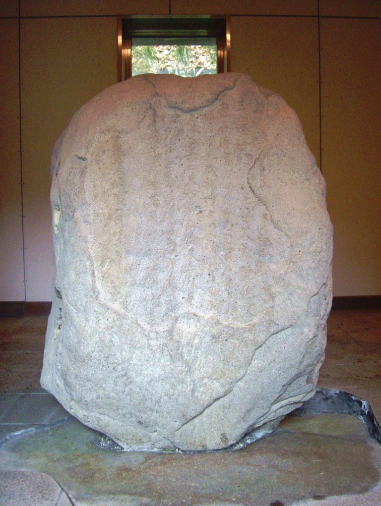
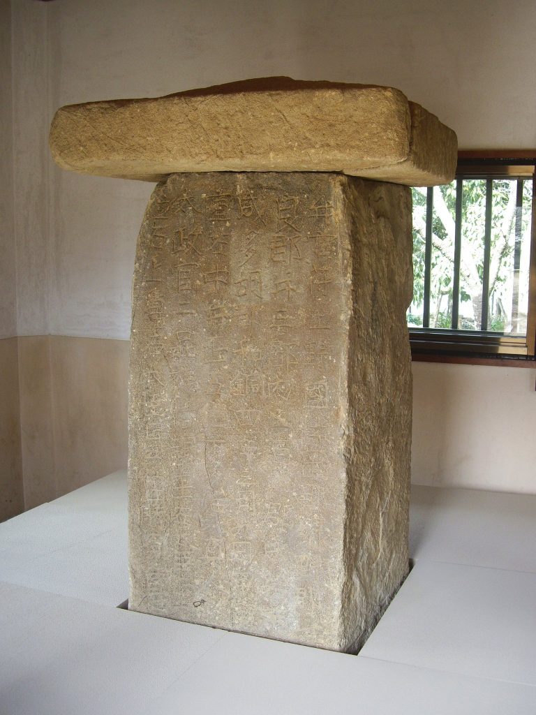
The stele is a slightly worked natural block of pyroxene andesite reportedly obtained from Mount Haruna. It measures approximately 111 centimeters high, 47 centimeters wide, and 52 centimeters thick. Four vertical lines containing 53 characters are carved into its surface. The deeply cut characters have rounded forms associated with regular script, a standardized style used for clear formal writing, while also displaying features of the older clerical script used in East Asian inscriptions and documents. Another description identifies the calligraphy as a variant of clerical script.
The inscription uses Chinese characters, or kanji, throughout, but follows Japanese grammatical order. It begins with the date, presents Kurome no Toji’s ancestry, records Chori’s dedication to his mother, and identifies Hoko-ji. This word order, also found on wooden tablets excavated from the residence of Prince Nagaya, provides evidence for a written style used in both central and regional Japan.
Protective shelter
The stele was placed on a foundation stone and given a small protective shelter in 1884. The present shelter, built of reinforced concrete in 1992, allows the monument to be viewed through a window.
Burial mounds
Yamanoue Kofun
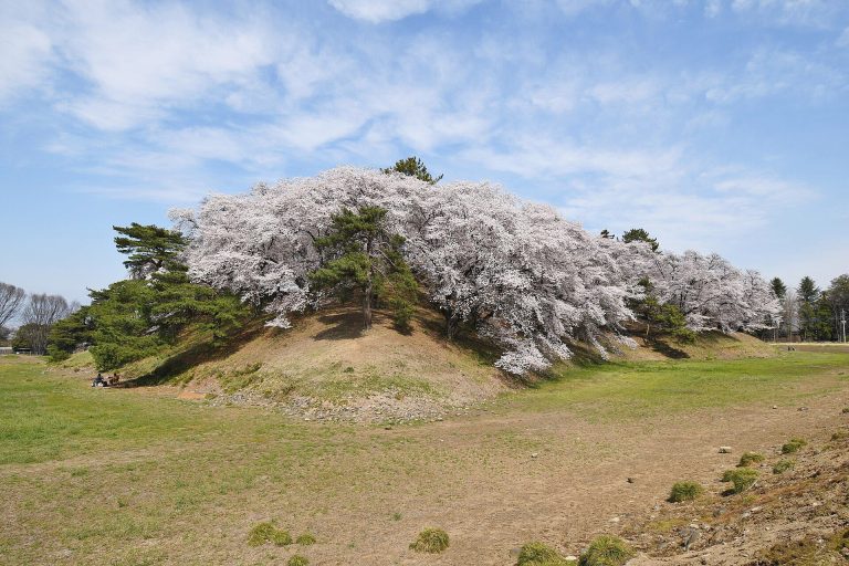
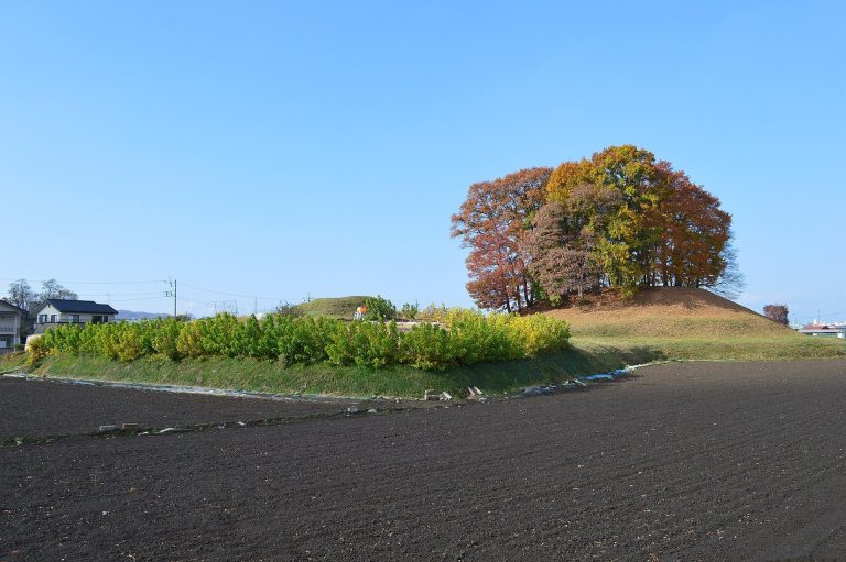
The Yamanoue Kofun lies about 15 meters east of the stele. It is a typical domed tumulus of the Late Kofun period, approximately 15 meters in diameter. Its entrance passage faces south and has a total length of 7.4 meters. The burial chamber measures 2.68 by 1.75 meters and is 1.66 meters high.
The tomb had been opened in antiquity, and no grave goods were found. It is considered possibly contemporary with, or slightly later than, the stele, although the prevailing interpretation places its construction earlier. The inscription’s reference to Kurome no Toji has prompted its identification as her possible burial place.
Yamanokami West Tumulus
The Yamanokami West Tumulus stands about 200 meters west of the Yamanoue Kofun. It is approximately the same scale and age as the Yamanoue mound, but it has collapsed and is largely buried. It is not included in the historic-site designation.
Continental influence
The use of a natural stone monument has been compared with contemporary monuments in the Korean kingdom of Silla. Silla-related immigrants were present in the region during this period, and the form of the Yamanoue Stele has consequently been associated with immigrant and continental cultural influence.