Tsuyama Castle: A Hirayama Castle and Domain Seat in Japan


Site at a Glance
- Rating
- 4.2
- Popularity
- Medium
- Country
- Japan
- Primary era
- Early Modern
- External website
- Open
- Eras represented
- Early Modern
- Civilizations
- Tokugawa
- Site type
- Military
- Remains
- Castle
On this page15 sections
History
Tsuyama Castle is a Japanese castle in Tsuyama, Japan, developed as a tiered-enceinte-style hirayama castle, a fortress built on a hill while incorporating the surrounding plain. Its history begins with a Yamana fortification established in 1441–1444 and continues with the construction of a new castle from 1603, completed in 1616 as the seat of the Tsuyama Domain.
The Yamana foundation
The first castle on the hill was known as Kakuzan Castle. Yamana Norikiyo, the shugo, or provincial military governor, of Mimasaka Province, is said to have ordered his relative Yamana Tadamasa to build it on Mount Tsuru. The Yamana clan later weakened during the Onin War, a late fifteenth-century conflict that greatly disrupted the authority of warrior families, and the earlier castle was abandoned. The mountain subsequently received the name Tsuyama.
The Tsuyama Domain
In 1603, Mori Tadamasa entered Mimasaka with a domain assessed at 186,000 koku, a measure of agricultural yield used to assess a domain’s economic scale. He established the Tsuyama Domain and began a new castle on the ruins of Kakuzan Castle. Construction and major expansion continued for thirteen years, with completion in 1616.
The completed castle became the principal residence of the lords of Tsuyama under the Tokugawa shogunate. The complex contained more than eighty buildings, including a five-story principal tower, fortified turrets, and gates. A fire destroyed the Honmaru palace, the principal innermost enclosure, in 1809, while the castle otherwise remained well maintained during the Edo period, the era of Tokugawa military government and hereditary domain rule from approximately 1603 to 1868.
Changes after the domain era
The Mori family became extinct in 1697, and the domain was placed under the custody of Asano Tsunanaga, lord of Hiroshima Domain. In 1698, a lord of the Matsudaira family, a branch of the Tokugawa-related warrior nobility, entered Tsuyama from Takada with a domain assessed at 100,000 koku. The Matsudaira family ruled until the abolition of the domain in 1871.
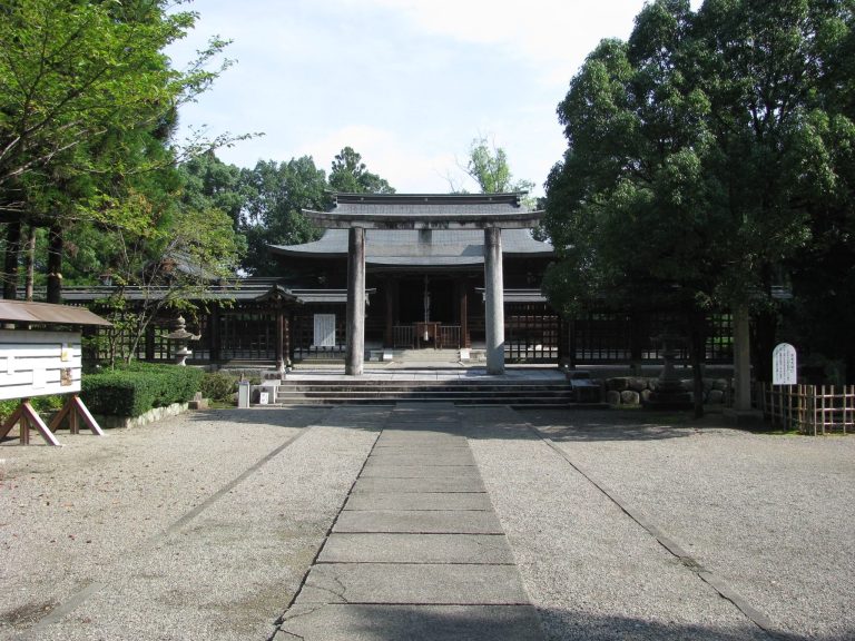
After the abolition of castles in 1873, the site came under the Ministry of Finance and was auctioned. The principal tower, turrets, gates, and earthen walls were demolished in 1874–1875. One four-legged gate was transferred to Nakayama Shrine. The collapse of the stone walls at the Koshimaki Turret site in 1890 prompted efforts to conserve the remaining ruins.
Conservation and public commemoration
Tsuyama acquired the site in 1900 and developed it as Kakuzan Park, planting large numbers of cherry trees. In 1905, the Shudokan domain school was moved to the Sannomaru, the castle’s third enclosure, and renamed Kakuzankan. A temporary imitation of the principal tower was erected for the 1936 Industrial Promotion Exposition, but it was dismantled in 1945 because of concern that air raids might use it as a landmark.
Tsuyama City formulated a preservation and improvement plan in 1988. Work carried out from 1998 through 2017 included reconstruction, repairs to stone walls, and improvements to paths and vegetation. The site became a National Historic Site in 1963 and was selected as number 67 in Japan’s 100 Famous Castles in 2006. A temporary half-scale structure reproducing the original external appearance of the principal tower was installed on its platform in 2013. The ruins remain incorporated into Kakuzan Park, which is recognized as a major cherry-blossom site.
Traditions associated with the principal tower
Tradition connects the design of Tsuyama’s principal tower with Kokura Castle. One account says that Mori Tadamasa sent a retainer, a carpenter, and an artist to observe Kokura Castle from the sea. Hosokawa Tadaoki, the lord of Kokura, allegedly allowed them to inspect the building and gave them its plans. Another tradition says that a carpenter copied the tower and brought the design back to Tsuyama.
Another tradition explains the tower’s unusual roof arrangement by claiming that Mori Tadamasa removed the tiled roof from the fourth level to evade the Tokugawa prohibition on towers of five or more floors. When officials inspected the building, he allegedly argued that the open level was only an eave and therefore did not count as a floor. The same tradition attributes the rapid journey of his retainer from Edo to Tsuyama to supernatural powers. A bell described either as Western-style or as imported from Southeast Asia was also reportedly presented by the Hosokawa family and hung in the tower until the Meiji period.
Remains
Hilltop setting and castle layout
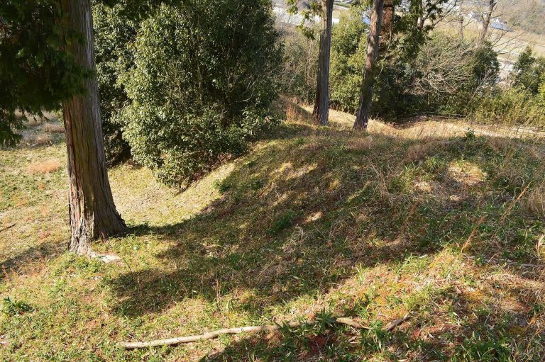
Tsuyama Castle occupies a hill in the center of the Tsuyama Basin. Natural cliffs formed part of its defenses, while the Miya River, a tributary of the Yoshii River, flows to the east. The Yoshii River lies south of the castle and its tributary, the Ida River, lies to the west. These waterways formed outer defensive lines around the principal part of the castle town.
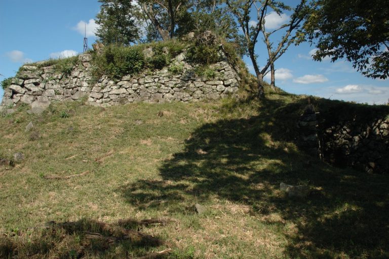
The castle was organized as a series of rising enclosures and formerly contained seventy-seven turrets, including those connected with the outer enceinte. This total exceeded the recorded numbers at Hiroshima Castle and Himeji Castle. A reconstruction model based on documents and old photographs is held at the Tsuyama Folk Museum. The principal surviving historic fabric consists of stone walls, building foundation stones, and remains of the moats.
The principal tower platform
The original principal tower
The original tenshu, the principal tower of a Japanese castle, was a freestanding, tiered tower built in 1615. It had five tiers, five stories, and one basement level, but no longer survives. Its composite plan incorporated the Sixth Gate, a turret gate, on the southern side, while entry to the tower was through a basement entrance on the east.
The tower platform stood approximately three ken high, and the basement measured 11 shaku 5 sun in height. The tower reached approximately 23 meters overall. Its first level measured 10 ken between the beams, equivalent to 65 shaku, and 11 ken along its length, equivalent to 71 shaku 5 sun.
Defensive details and roof arrangement
Each corner of the first level contained a hakama-shaped stone-dropping aperture. Gun ports and arrow slits were set through the fourth level. Meiji-period photographs show the uppermost level covered by wooden shutters or panels, while the fourth level was built at almost the same size. The upper level had an exterior gallery with a balustrade.
The fourth-level roof was made of boards with shallow eaves. This unusual arrangement is reflected in the tradition that its tiled roof had been removed, although a Shōhō-era castle plan held by the National Archives labels the tower as five levels high. The original upper level’s form and the surviving platform together preserve evidence of the tower’s distinctive design.
Reconstructed structures
Bitchū Turret
The Bitchū Turret was reconstructed in wood between 2002 and 2005. Its reconstruction forms part of the effort to restore elements of the castle’s former defensive architecture alongside the surviving walls and foundations.
Taiko wall
A wooden Taiko wall on the south side of the principal tower platform was reconstructed in 2006. It stands with the platform and stonework as part of the preserved and renewed architectural fabric of the castle ruins.
Associated buildings and features
The former Koshimaki Turret survives through its stonework, whose collapse in 1890 helped prompt the conservation movement at the site. The former four-legged gate was relocated to Nakayama Shrine. The Shudokan domain school building, moved to the Sannomaru in 1905 and renamed Kakuzankan, also remains associated with the castle’s later history.
The road connected with the Izumo Highway formed part of the castle’s regional setting. The highway was a major pilgrimage route leading toward Izumo Shrine. Local tradition says that the road was moved in 1655 so that it passed north of the graves of two retainers, Ido Uemon and Nagoya Kyuemon. A pine tree planted over the graves was said to alternate between lush and withered growth, leading to the name “Pine of Mutual Glaring.”