Genkō Bōrui: Japan’s Medieval Coastal Defense Wall


Site at a Glance
- Rating
- 4.2
- Popularity
- Low
- Country
- Japan
- Primary era
- Medieval
- External website
- Open
- Eras represented
- Medieval
- Civilizations
- Kamakura shogunate
- Site type
- Military
- Remains
- Wall
On this page7 sections
History
Genkō Bōrui is a Japanese stone defensive line in Fukuoka, Japan, built under the Kamakura shogunate along the Hakata Bay coast from March 1276. The structure formed part of the government’s preparations for renewed Mongol attacks after the first invasion of Japan in 1274. The Mongol invasions were military expeditions launched by Kublai Khan, ruler of the Yuan dynasty, in 1274 and 1281.
Construction after the first invasion
Following the 1274 attack, the Kamakura shogunate organized defenses against another foreign expedition. It also planned a military campaign against Korea for March 1276, while ordering the construction of the coastal wall. Kyushu provinces received separate sections, and most of the work was expected to be completed by August 1276. Strategically important locations were assigned different deadlines, and only part of the line had been finished when the second invasion began in 1281.
The construction burden fell on the provinces, including samurai estates and lands controlled by temples and shrines. The standard requirement was one sun, about 3.3 centimeters, of wall for every tan of rice field. Additional obligations could include one shield, one flag, and 20 arrows for each jo of stone wall. Soldiers ready for combat were initially exempt, but that exemption was soon removed. The levy was later converted into a monetary payment, commonly 114 mon for each cho of rice field. These units were historical measures of length, land area, and currency.
The 1281 invasion and later maintenance
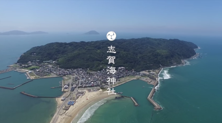
During the 1281 invasion, the completed sections of the defensive line prevented Yuan forces from landing at Hakata. Their ships instead anchored at Shikanoshima, an island in Hakata Bay off Fukuoka. Combat continued for several months, while the provinces maintained and repaired the wall. The invasion eventually failed when a typhoon forced the Mongol forces to withdraw. This storm is traditionally associated with the term kamikaze, meaning “divine wind.”
Construction continued until 1332, one year before the fall of the Kamakura shogunate, and repairs extended into the early Muromachi period, the era that followed the Kamakura government. The wall declined during the latter half of the fourteenth century. In the Edo period, many of its stones were taken for the construction of Fukuoka Castle, while other sections were abandoned and gradually covered by sand.
Images, investigation, and protection
Takezaki Suenaga, a warrior from Higo Province who fought in the battles of 1281, commissioned illustrated scrolls showing the Mongol invasions. The images also preserve views of the defensive line while it was still under construction, providing evidence for its early appearance.
Archaeologist Heijiro Nakayama introduced the name Genkō Bōrui in articles published in the Fukuoka Nichi Nichi Shimbun between June 12 and 29, 1913. Its earlier name was Ishitsuiji, meaning a stone-built embankment or wall. Excavations at Imazu in 1958 recovered human bones representing approximately 200 individuals, together with ceramics associated with people assembled for the construction work.
Surviving sections became a National Historic Site on March 30, 1931, a designation for places judged nationally important for their historical or archaeological value. Additional sections were included on March 16, 1981, although the portions in the Hakata district were not covered by the designation.
Remains
The defensive line followed approximately 20 kilometers of Hakata Bay coastline, extending from Imazu in present-day Nishi Ward to Kashii in present-day Higashi Ward. It averaged about 2 meters in both height and width. The structure was conceived as a high sand embankment faced or covered with stones, rather than simply as a conventional masonry wall. Its form was intended to obstruct an attempted landing.
Layout and construction
The embankment had a steep seaward face and a sloping landward side, while small stones filled its interior. Construction methods and structural details varied according to the Kyushu province responsible for each section. Shields and flags were positioned along the wall, and stakes were placed in the sea at irregular intervals. Together, these features formed a coastal obstacle designed to limit access from the bay and reinforce the landward defense.
Surviving sections and archaeological evidence
The remains are fragmentary. Stonework is exposed in some places, while other parts of the line remain buried, have been covered by later reclamation, or were lost when stones were removed and reused. Modern reclamation extended the shoreline seaward, leaving sections that once stood beside the coast inland. The Imazu excavation area yielded human remains corresponding to approximately 200 people and ceramics connected with the labor force gathered to build the embankment.
Related defensive walls survive in their original form along a 40- to 50-kilometer stretch of coast from Tabira in Hirado to Hoshika in Matsuura, in Nagasaki Prefecture. This wider coastal area also contains places associated with the Mongol invasions, along with place names and oral traditions thought to be connected with them.