Pfannenstiel Castle Ruins: A Medieval Spur Castle in Germany


Site at a Glance
- Rating
- 4.4
- Popularity
- Very Low
- Country
- Germany
- Primary era
- Medieval
- Eras represented
- Medieval
- Civilizations
- Holy Roman Empire
- Site type
- Military
- Remains
- Castle
On this page10 sections
History
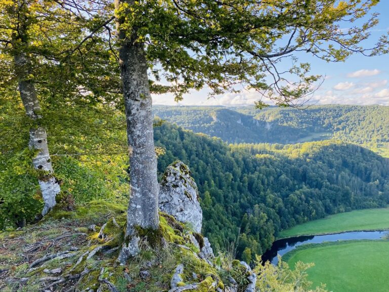
Pfannenstiel Castle Ruins are the remains of a high-medieval spur castle in Germany, above Reinfelder Hof in the municipal area of Beuron. The castle probably originated around 1250, during the second half of the thirteenth century, and its date is based on pottery fragments and masonry technique. Its original social status and affiliation are unknown. Built on a projecting ridge above the Bära valley, the castle used the natural terrain as part of its defenses.
Origins and abandonment
Little is known about Pfannenstiel’s early history. An oral tradition attributes its destruction to a nighttime fire caused by lightning. In the story, a knight’s daughter ordered a servant to drown her younger brother. Instead, the servant gave the child to an old woman in the Bära valley. After growing into a young man, the brother supposedly rejected Pfannenstiel and built Kreidenstein Castle on the neighboring rock. The tradition connects the fire and the foundation of the neighboring castle, but it does not provide independently established details about Pfannenstiel’s history.
By around 1400, Pfannenstiel was already uninhabited and belonged to the Lords of Urbach. Through Margarethe von Urbach, who brought the castle as her marriage portion, the property passed to Georg I von Werenwag.
Transfer of ownership
In 1476, Georg I von Werenwag sold the Pfannenstiel castle site, together with the cadastral district of Eck and its appurtenances, to Beuron Abbey and Hans Spretter of Mühlheim. Beuron Abbey was an ecclesiastical monastic institution governed by an abbot. During the secularization of 1803, the transfer of ecclesiastical property to secular authorities during the political changes of the early nineteenth century, Beuron’s possessions, including the Pfannenstiel ruin, passed to the Princes of Hohenzollern-Sigmaringen. They remain the owners. The former boundary between Württemberg and Baden runs through the southwestern part of the castle grounds.
Remains
The castle occupies the highest point of a long, narrow spur oriented from east to west on the eastern edge of the valley above the Bära, a left-bank tributary that joins the Danube near Fridingen. The castle site stands at approximately 804.3 metres above sea level, while the Bära valley lies at about 640 metres. The approach came from the Hart plateau to the east, a narrow strip of land between the Danube and Bära valleys. A neck ditch, cut across the ridge to isolate one part of the fortification from another, separated the outer defenses from the walled courtyard to the northwest.
Outer defenses
Outer bailey
The outer bailey occupied the western side of the complex and protected its narrow side toward the Bära valley. The slope falls into a dry valley to the north. At approximately 795.6 metres above sea level, a rampart and section ditch protected the outer bailey from the west. Visible masonry extends across a roughly triangular area measuring about 19 by 18 metres.
Castle courtyard
The walled castle courtyard lay northwest of the neck ditch and contained at least one additional building. Its position can still be identified. The courtyard formed the projecting area from which the higher entrance to the core castle was reached.
Core castle
A second, lower section ditch separated the core castle from the outer bailey on the western side. Only sparse and largely overgrown remains survive, but the surviving structures preserve the arrangement of the central fortification.
Donjon
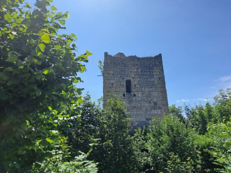
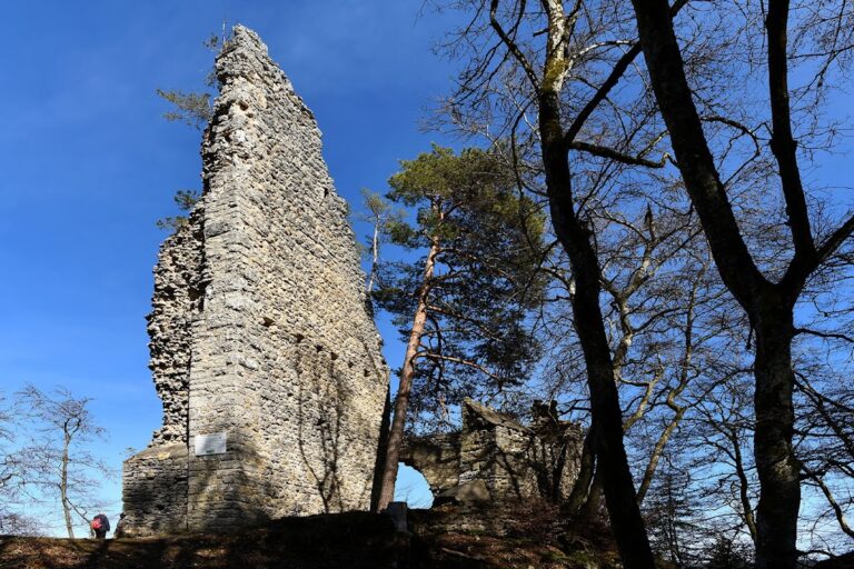
The core castle is dominated by the approximately 5.5-metre-high stump of a donjon, the principal medieval castle tower, which often combined residential and defensive functions. The tower was a residential-tower-like building about 12 metres wide, with another recorded width of 11.5 metres, and almost 23 metres long. It stood at approximately 804.3 metres above sea level and had an interior area of roughly 145 square metres.
Small ashlar, carefully shaped stone blocks, and rubble stone formed the donjon’s masonry. The northwest wall was 2.7 metres thick, the southeast wall 2.5 metres thick, and the interior side approximately 2 metres thick. These substantial walls formed the principal surviving mass of the core castle.
Wall openings and access
An opening in the northwest wall beside the ditch may have led to a projecting structure, possibly a latrine, a built sanitary installation placed over a ditch or slope. A fragment of a partition wall stands beside the opening and is not bonded into the outer wall.
The southeast wall contains a breach through masonry approximately 2.5 metres thick, with about 7 metres of wall still standing. Around 1900, the former gate jambs and the recess for a locking beam could still be recognized there. The opening is interpreted as the entrance from the projecting, trapezoidal castle courtyard. Reaching its higher level would have required either a draw-up wooden stairway or a permanent ramp.
Nearby sites