Vietzer Schanze: An Early Medieval Frontier Fort in Germany
Site at a Glance
- Popularity
- Low
- Country
- Germany
- Primary era
- Medieval
- Eras represented
- Medieval
- Civilizations
- Carolingian
- Site type
- Military
- Remains
- Fort
On this page14 sections
History
The Vietzer Schanze, also known as Höhbeck Fort, is an early medieval fortification in Germany, conventionally dated to 808. It is associated with Frankish frontier campaigns along the Elbe and appears to have served as a Saxon-Frankish outpost facing Slavic groups to the east.
Frankish campaigns and rebuilding
Charlemagne, the Frankish king who became emperor in 800, crossed the Elbe in 789 to campaign against the Wilzi, a West Slavic people of the region. Fortifications may already have stood around Höhbeck. The Frankish Annals, a record of events in the Frankish realm, name two unidentified forts on the Elbe in 808; one may have been the Vietzer Schanze. The construction date remains uncertain, and building work has also been associated with campaigns against the Linones and Smeldinger.
The fort is specifically named in 810, when the Wilzi destroyed it. It was rebuilt in 811, and an East Saxon garrison was placed there under Odo, an imperial legate, or representative exercising authority delegated by the emperor.
Frontier role and changing settlement
The fort appears to have been intended as a Saxon-Frankish outpost against Slavic groups east of the Elbe. It worked in conjunction with the Schwedenschanze, another fortification about one kilometre to the east. Its position also allowed surveillance of a river crossing and Elbe shipping. The site’s scale and placement have been interpreted as a display of power directed at observers, including people on the river.
Saxons are thought to have left the Höhbeck area in the mid-ninth century, after which Slavs settled there.
Changing identifications and excavation
In 1828, the Lüneburg district official Wedekind proposed that the site was Charlemagne’s fort. A later local historian rejected that identification, dating the Vietzer Schanze to the Thirty Years’ War and assigning Charlemagne’s fort instead to the nearby Schwedenschanze. The old form Hohbuoki has been interpreted as meaning high beech forest. In 1924, Carl Schuchhardt proposed that folk etymology had reshaped it into Hohbeke, meaning high-lying stream. A linguistic analysis in 1963 considered a development into the name Höhbeck possible, but not proof that the fort was located there.
Schuchhardt briefly excavated the site in 1897, then worked there for four and a half weeks in 1920, examining the rampart, interior, and main gate. The records and finds from that excavation were lost during the Second World War. Ernst Sprockhoff resumed work in 1954, with campaigns in nearly every year through 1965. Excavation stopped after his death in 1967.
A University of Göttingen project on Slavic settlement in the lower Middle Elbe region began in 2006, with work focused on Höhbeck and its surroundings. Excavations took place in 2008 and 2009. After the campaigns of the 1960s, a Hamburg sports club used the fort area as a sports and children’s camping ground. From the 1980s, it gradually became overgrown.
Remains
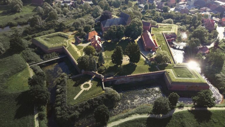
The rectangular fort measures about 70 by 170 metres and covers approximately 1.2 hectares. It stands east of Vietze on the Höhbeck’s steep northern bank above the Elbe. The Höhbeck is a glacial ridge about two by four kilometres across, formed during the Saalian glaciation, a major ice-age period within the Pleistocene. It rises about 60 metres above the Holocene Elbe valley, the lowland of the present geological epoch following the Pleistocene. Its plateau consists of gravel, sand, and boulder clay and forms an island-like landmark. Here the Elbe valley narrows to about two or three kilometres, compared with widths of up to 12 kilometres elsewhere. Walls and a ditch protected the fort to the west and south; to the north and east, a steep slope about 25 metres high descends toward the river and a stream valley.
Rampart and outer defenses
Rampart
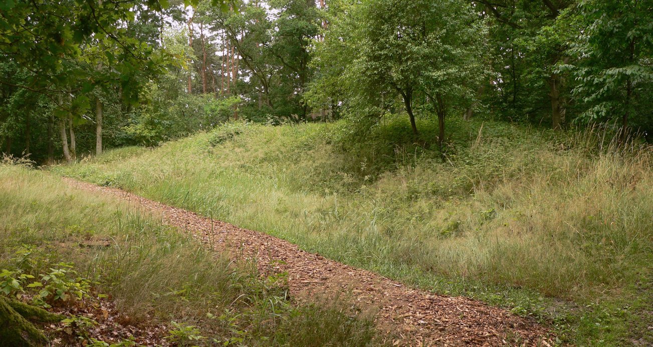
The original rampart was a timber-and-earth structure about six metres wide, with a steep outer face. It now measures about 10 metres across at its base and survives to a height of roughly two metres. Sand and clay formed its fill, reinforced internally by crosswise timbers. Tree-ring evidence suggests that the construction also used substantial quantities of lower-grade and dead wood.
Individual posts, spaced about two metres apart, formed the outer face, and their postholes survive. A wall of boards or woven branches is thought to have stood between the posts. A defended walkway, up to three metres wide, probably ran along the top behind a fence of woven branches or a plank wall. The rampart’s substructure, excluding its timber connections, has been estimated at no more than four metres high. Schuchhardt proposed a timber-and-clay wall six metres high; a later estimate also allows a wall of up to six metres, which with the ditch would create an approximately nine-metre vertical face.
Bands of clay in the lighter sand indicate a single main construction phase. Estimates place the required earth at about 5,700 cubic metres and the wood at about 2,500 cubic metres. Oak made up 55 percent of the timber, and elm more than a third. The estimated timber supply implies that roughly 14 hectares of woodland were felled, suggesting that much of the Höhbeck was cleared after construction.
Berm and ditch
Outside the rampart lay a two-metre-wide berm, a level strip between a fortification and its outer ditch, made of sand, wood, turf, and boulders. Beyond it, the ditch was about 10 metres wide and 2.6 metres deep. It now survives to a depth of about 1.2 metres.
Gates and interior
Entrances
A structure measuring about six by six metres stood at the centre of the south side, probably serving as a gate tower. Schuchhardt’s excavation also identified two small openings in the west side, each about 1.5 metres wide. Evidence indicates that the gate was renewed after a fire.
Interior features
Schuchhardt’s 1920 excavation identified postholes attributed to earlier buildings, paths made of clean sand, an open area, and several buildings within the fort.
Timbers and excavated finds
Construction timbers and dating
In 2008, excavators cut through the well-preserved western rampart and examined 25 timbers using tree-ring dating. Three retained their outer rings, giving felling dates of 805, 809, and 810. Other timbers were dated to between 656 and 724. These results support an early ninth-century construction and the proposed identification with a fort mentioned in the annals.
Burned wood from the rampart produced a radiocarbon estimate of about AD 885, with an uncertainty of plus or minus 80 years. The fire is thought to have started on the rampart’s outer side and smoldered into it.
Pottery and objects
The 1920 excavation recovered an iron spearhead 45 centimetres long from the northern rampart’s berm, as well as a bronze scabbard fitting dated to the eleventh or twelfth century. Schuchhardt initially assigned the pottery to Frankish and Saxon groups; it was later considered probably older, from the Roman Imperial period, partly because dating methods were less advanced at the time.
Sprockhoff’s excavations produced about 1,000 pottery fragments, most assigned to the Roman Imperial period or the late Middle Ages. Other sherds of Slavic, Saxon, and western origin have been dated to around AD 800. Together, the finds reflect activity at the site across several periods.