Via Domiziana: The Roman Road to Puteoli and the Bay of Naples
Site at a Glance
- Popularity
- Medium
- Country
- Italy
- Primary era
- Classical
- Eras represented
- Classical
- Civilizations
- Roman
- Site type
- Infrastructure
- Remains
- Road
On this page8 sections
History
Via Domiziana, the modern name for the Roman Via Domitiana, was a major road in Italy, built in AD 95 under Domitian, an emperor of the Flavian dynasty. It offered a more direct journey from Rome toward Puteoli, Misenum, and Baiae than the earlier route through Cumae and Neapolis. The road also improved connections to the ports of Puteoli and Portus Julius, the home port of Rome’s western imperial fleet in the waters around Baiae and Cape Misenum.
Construction and extension
The road incorporated an existing secondary route between coastal towns in Campania rather than being built entirely anew. Its line also partly followed the course planned for a canal between Rome and Puteoli under Nero, and made use of works begun for that project. Construction of the canal ended when Nero died, and it was never completed.
In AD 102, the emperor Trajan extended the Via Domitiana to Neapolis, now Naples, along a coastal section that already connected the area with Puteoli. The 1st-century Roman poet Statius wrote a poem praising Domitian and the road’s progress. His poem also offers evidence for imperial road building in Rome.
Damage and restoration
Alaric, king of the Visigoths, damaged the road in AD 420. In AD 455, Gaiseric, king of the Vandals, destroyed it. Rulers of the Kingdom of Naples partly restored the route during the Middle Ages, and the kingdom oversaw its reconstruction in the 16th century.
Modern roads
During the 20th century, successive state roads, including one later reclassified as a provincial road, were built in part along the ancient alignment. The modern Via Domiziana is a coastal road leading north from Naples.
Remains
Route and landscape
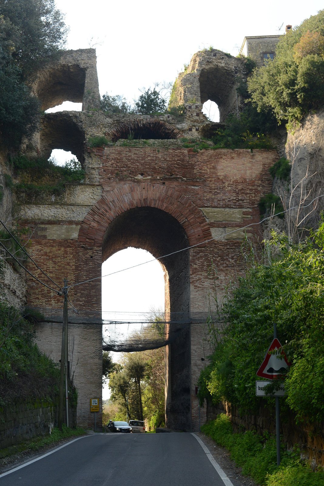
The ancient road ran for 33 Roman miles, about 49 km, from Sinuessa, now Mondragone, to Puteoli, now Pozzuoli. At Sinuessa it branched from the Via Appia, a major Roman road running south from Rome, and crossed the Savone and Volturno rivers. Beyond Volturnum, it continued south past the marshy area of Lago Patria, crossed the Clanis, now the Regi Lagni canal, and reached Liternum near present-day Giugliano in Campania. It then followed the western shore of Lago di Licola to Cumae, passed through the Monte Grillo pass beneath the Arco Felice, and continued north of Lake Avernus to Puteoli.
Bridge across the Volturno
A large bridge with multiple arches carried the road across the Volturno. Some of its remains are incorporated into the medieval castle at Castel Volturno.
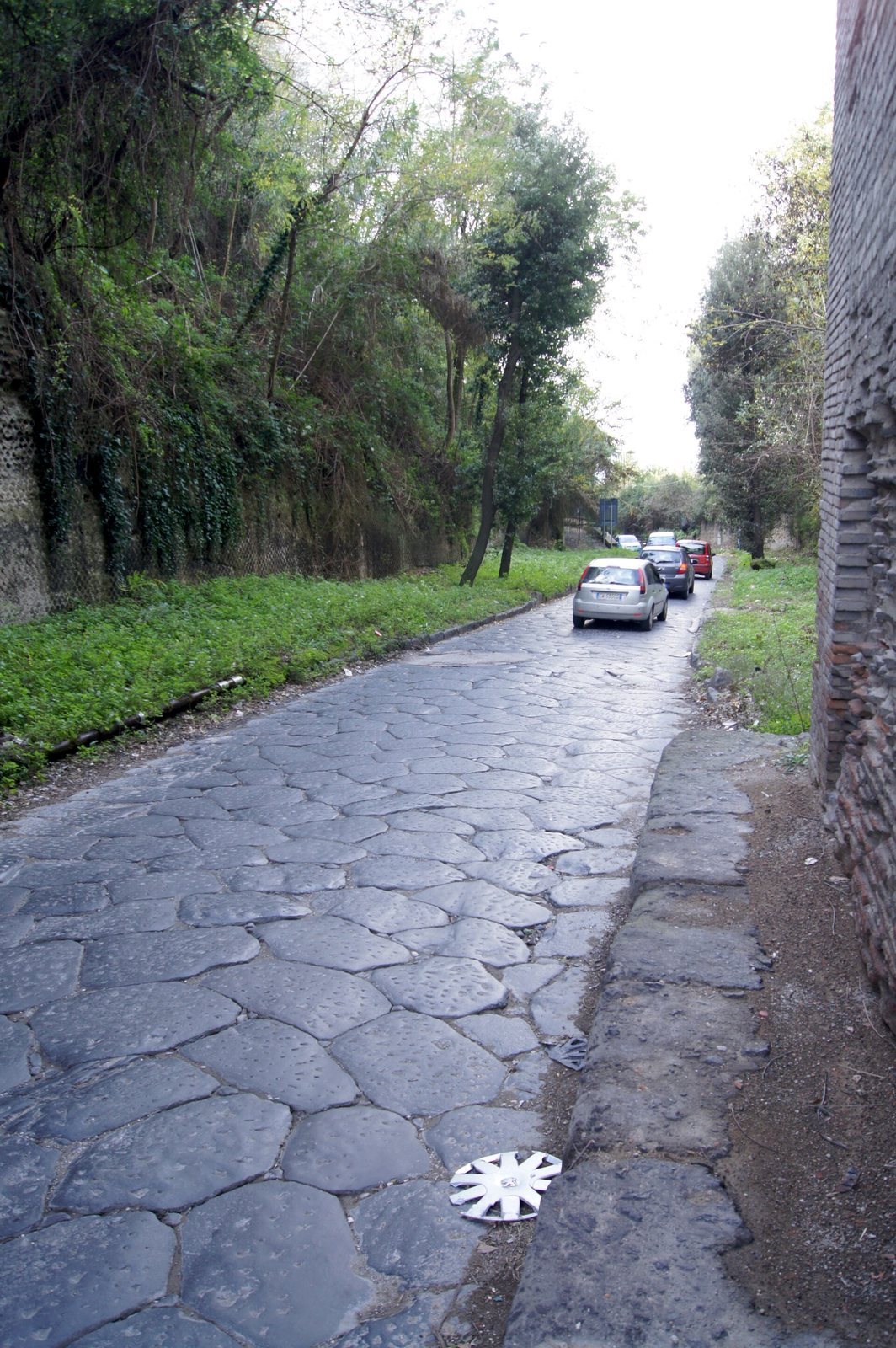
Visible sections
Some sections of the ancient road remain visible.