Macellum of Pozzuoli: Roman Food Market in Italy
Site at a Glance
- Rating
- 4.6
- Popularity
- Medium
- Country
- Italy
- Primary era
- Classical
- External website
- Open
- Eras represented
- Classical
- Civilizations
- Roman
- Site type
- Civic
- Remains
- Market
On this page9 sections
History
The Macellum of Pozzuoli in Italy was the food market of the Roman colony of Puteoli, built by the Romans between the late first and early second century AD in the Flavian period. It stood in the eastern part of the city near the emporium, the commercial harbour district, and served a port that connected Rome with the wider Mediterranean. Puteoli had become a major Roman harbour after the earlier Greek city of Dicaearchia was incorporated into the Roman Republic in 194 BC.
Construction and Severan restoration
The market was probably constructed during the Flavian period, an attribution supported by a dedicatory inscription. Its arrangement followed the typical form of a macellum, a purpose-built Roman food market organized around a courtyard with shops and associated facilities.
During the third century, the complex was restored under the Severan dynasty. Septimius Severus, a Roman emperor of that dynasty, is associated with water pipes found at the site bearing his name. The northern part of the apse and the central tholos, a circular building often covered by a dome, were altered during this restoration.
Rediscovery and reinterpretation
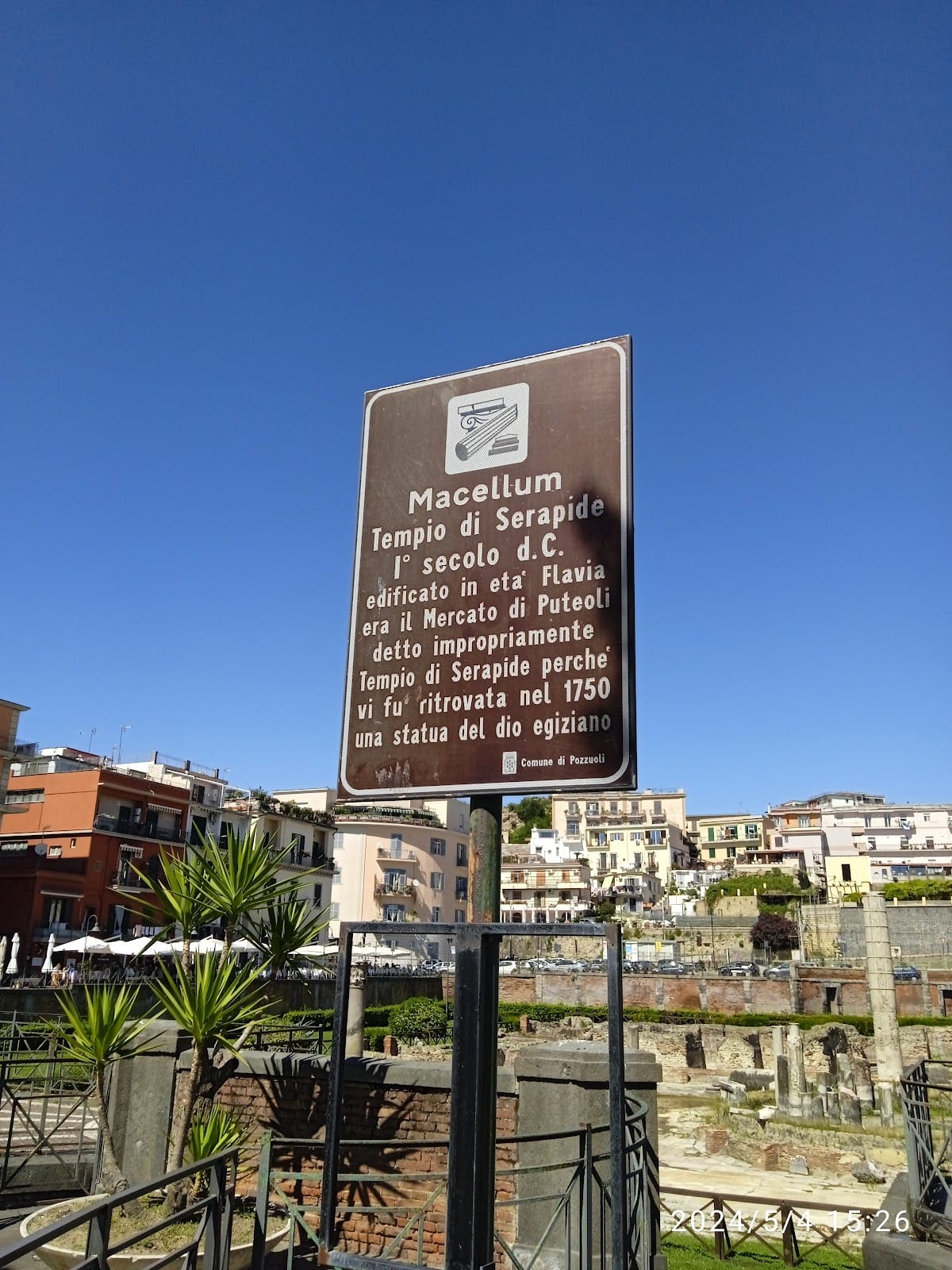
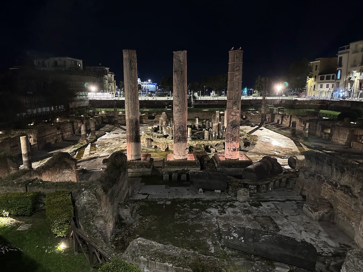
When the ruins were excavated in the eighteenth century, a statue of Serapis led investigators to identify the building incorrectly as the city’s Serapeum, or Temple of Serapis. Excavations ordered by Charles III of Spain, then ruler of Naples, took place between 1750 and 1756. They exposed three large cipollino-marble columns and drew the attention of antiquarians, including William Hamilton and John Soane. Hamilton illustrated the complex in Campi Phlegraei in 1776. Soane visited on 1 January 1779, made sketches, and produced or copied a plan of the ruins.
Further excavations between 1806 and 1818 exposed more of the remains that were still regarded as a Serapeum. These operations destroyed much of the layered archaeological information in the deposits that had buried the building. The marine borings in the standing columns, however, preserved evidence of changes in the relative level of land and sea. Charles Dubois identified the complex as a macellum rather than a temple in his 1907 study of Pozzuoli’s ruins.
Ground movement and geological interpretation
The ruins became an important case study in explanations of changing land and sea levels. Scipione Breislak, John Playfair, James Hutton, Andrea di Jorio, Giovanni Battista Brocchi, Karl Ernst Adolf von Hoff, Johann Wolfgang von Goethe, Charles Daubeny, Charles Lyell, Charles Darwin, and Charles Babbage proposed, discussed, or recorded different interpretations of the site’s submergence and re-emergence.
Andrea di Jorio examined the ruins, published a guide to the Phlegraean Fields in 1817, and issued a study of the supposed Temple of Serapis in 1820. By 1817, seawater had flooded the pavement, indicating that the land had lowered slightly. Babbage surveyed the site in 1828 and considered the salt deposits and marine borings evidence for an initial lowering of the building, the formation of a small lake, and a later subsidence that allowed seawater to enter and marine molluscs to bore into the masonry.
Modern investigations relate these changes to repeated bradyseismic movements near the centre of the Campi Flegrei caldera. Bradyseism is the gradual uplift or subsidence of ground in a volcanic caldera, caused by changing underground magmatic or hydrothermal activity. Long periods of subsidence drowned the ruins, while uplift brought them back above water. After prolonged Roman-period subsidence, uplift occurred around AD 700–800 and again from about 1500 until the 1538 eruption. Following further gradual subsidence, the land rose by about 1.7 metres between 1969 and 1973, followed by slight subsidence and then nearly 2 metres of uplift between 1982 and 1994.
Concern about earthquake damage and a possible eruption led to the temporary evacuation of Pozzuoli. Detailed measurements identified a nearly circular zone of deformation in the caldera centred near Pozzuoli, and several models have been developed to explain this pattern.
Remains
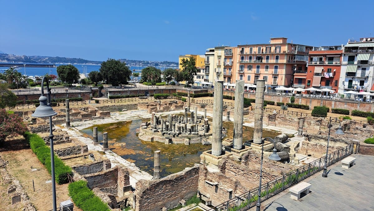
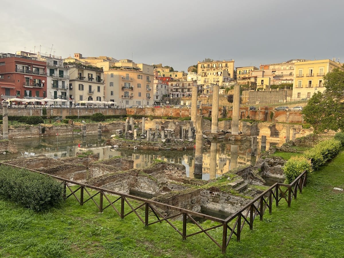
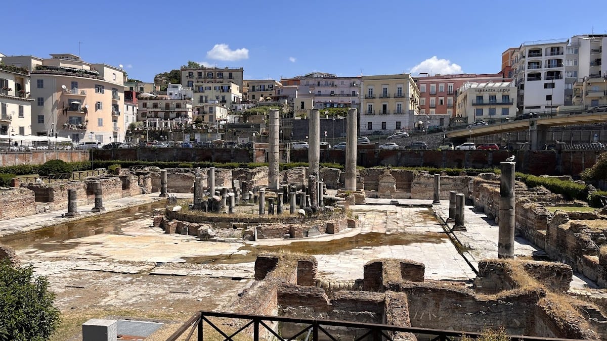
The surviving complex has an approximately square courtyard surrounded by a colonnaded arcade and two-storey buildings containing shops. Its main entrance and vestibule were on the southwest side, facing the ancient harbour, while four secondary entrances opened onto the longer sides of the courtyard. Marble slabs covered both the courtyard and the portico.
Courtyard, arcade, and commercial rooms
The arcade was formed by 34 grey-granite columns, each about 6.11 metres high and 0.80 metres in diameter. Their Corinthian capitals were decorated with shells containing small dolphins. Beside the exedra, a recessed or apsidal architectural space, were service areas and two latrines. The latrines could also be entered from outside. Four probable tabernae, or small commercial units, had entrances from outside as well as access to the arcade.
Central tholos and fountain
At the centre of the courtyard stood a circular tholos on a podium reached by four symmetrically arranged stairways. Sixteen Corinthian columns made of African marble supported its domed vault. The walls used opus latericium, Roman concrete faced with courses of brick, and were covered with marble slabs. Friezes around the base carried images of marine animals.
An octagonal fountain occupied the interior of the tholos. Holes at its centre formed a floral pattern across a channel. Marble platforms for statues and puteals, low circular stone or marble structures often used as wellheads, stood around the tholos, between the columns and on their axes.
Apsidal hall and sculptural decoration
The eastern side contained an apsidal hall opposite the main entrance. Its tetrastyle facade, a front supported by four columns, displayed honorific statues. The entrance had piers faced with cipollino marble, a veined marble used for architectural columns, together with two cipollino-marble columns. Marble screens closed the spaces between the columns.
The hall’s floor used opus sectile, a technique in which cut pieces of stone or marble form geometric designs. Squares containing circles and diamonds were made from red, yellow, green, and violet marble. Niches held statues of Serapis, a Greco-Egyptian deity whose worship spread through the Roman world, as well as groups representing Orestes and Electra from Greek mythology and Dionysus with a Faun. Other statues carried inscriptions honoring Emperor Alexander Severus and his wife, Sallustia Orbiana.
Marine evidence in the columns
Three standing marble columns bear bands of borings known as Gastrochaenolites. These holes were made by Lithophaga, marine bivalves capable of boring into stone, and reached approximately 5.8 metres above the floor. Some rooms also contain dark brown salt encrustation, including a thicker deposit that rises about 2.7 metres above floor level. Together, these physical traces preserve evidence of the water levels that affected the complex after its Roman use.