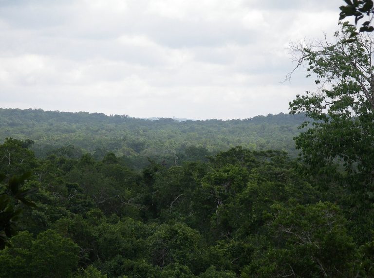
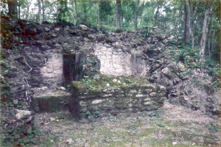
Uaxactún: A Maya Political and Ceremonial Center in Guatemala
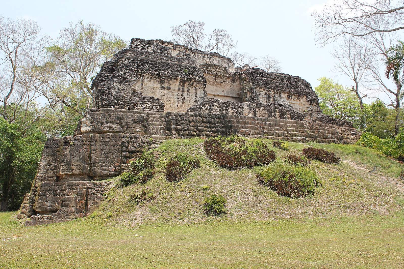
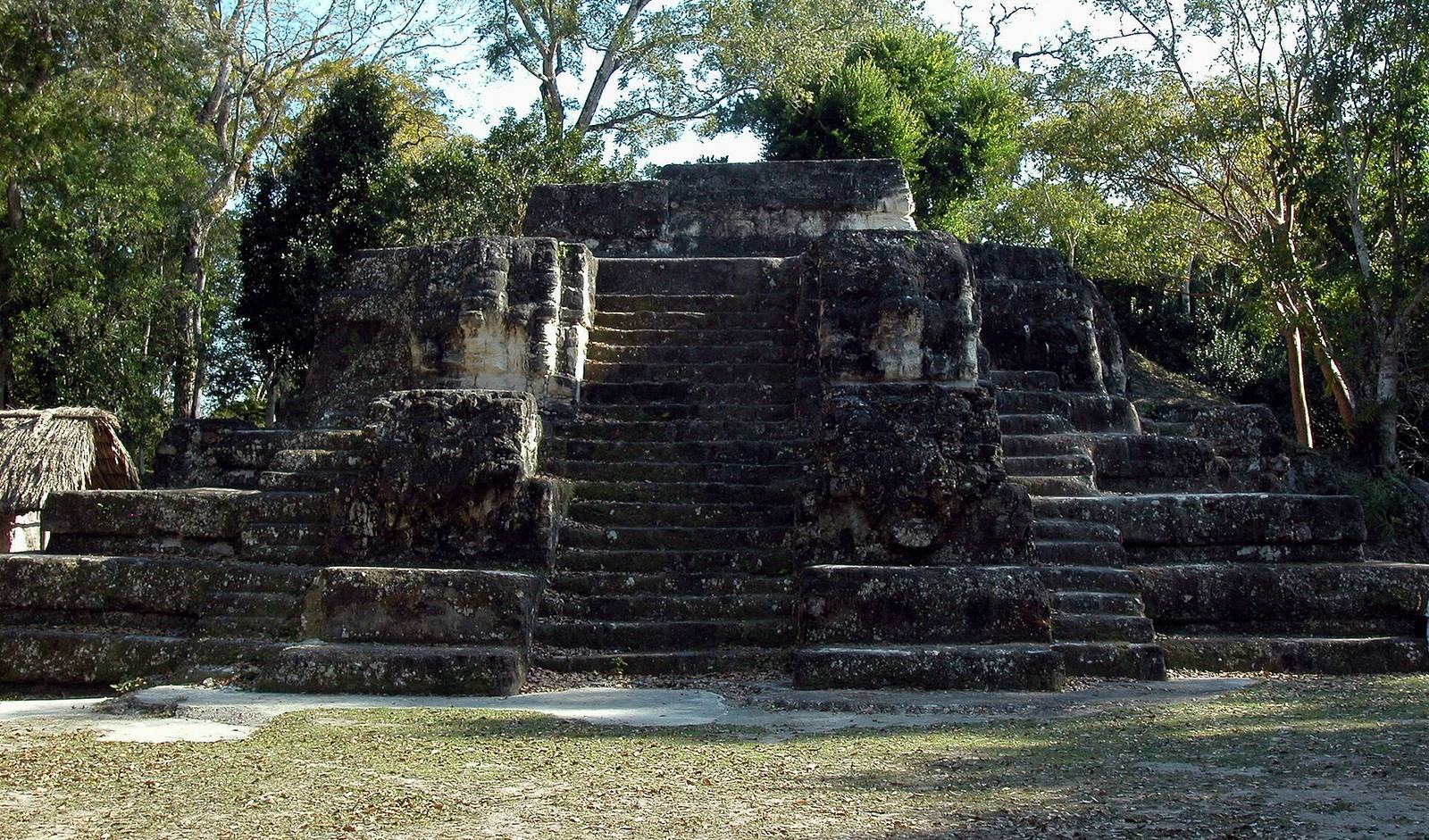
Site at a Glance
- Popularity
- High
- Country
- Guatemala
- Primary era
- Classical
- Eras represented
- Classical, Medieval
- Civilizations
- Maya
- Site type
- City
On this page28 sections
History
Uaxactún is a Maya archaeological site in Guatemala’s Petén Department, about 19 km north of Tikal. Its earliest securely identified construction belongs to the Mamom phase, around 500–350 BCE, although human activity at the site reaches back to about 900 BCE. It became an important political and ceremonial center during the Preclassic and Classic eras of Maya history.
Early settlement and regional power
Uaxactún’s ancient name is uncertain. A royal emblem inscription has been read as referring to a “lord of Siyajchan,” suggesting a kingdom by that name. K’an Witz and K’an Kok have also been proposed as ancient names, but neither identification is secure. The present name means “Eight Stones.” Archaeologist Sylvanus Morley gave it to the site in May 1916, referring to a carved monument bearing the numeral for the eighth baktun, a large cycle in the Maya Long Count calendar. At the time, the monument was regarded as bearing the earliest known Maya date. The name also played on “Washington,” home of the Carnegie Institution, which supported Morley’s work.
From about 600 to 300 BCE, Uaxactún was the seat of a powerful chiefdom. Its influence later extended across central Petén and at times included Tikal, a major Maya city in the region. The local ruling dynasty probably began around 300–225 BCE. Stela 3, an upright stone monument, names its founder as Wak Kab’ Yok’in Ajaw, translated as “Lord of the Sixth Earth,” and places his reign around 275–250 BCE. A ruler who raised the monument in 507 CE claimed to be the founder’s thirty-third successor. Conflict around 100–50 BCE appears to have ended Uaxactún’s regional ascendancy and placed it under Tikal’s political influence.
Group H and changing dynasties
Political and ceremonial authority shifted within the city over time. Group H was a major center of royal power from about 50 BCE to 150 CE. Around 10 BCE, a dynasty associated with the Pacific coast established itself in Group H North. Its founder is known by the nickname “Bloody Head.” An unnamed ruler is said to have raised Stela 28 in connection with the eighth baktun, though the monument’s precise date is uncertain. The dynasty’s power declined around 160 CE.
A woman nicknamed the “Spiny Queen,” probably of royal lineage, was buried around 260 CE and may have helped restore the dynasty’s authority. On 17 or 19 April 323, a ruler conventionally called “Trophy-Skull B’alam” took the throne and marked his accession on Stela 9, which depicts a captive.
Classic-period political realignments
Tz’akbu Usiij became ruler on 27 or 29 February 356. He recorded his accession on Stela 18, erected on 1 February 357 to mark the completion of a 16-katun cycle; a katun is a unit of the Maya Long Count calendar. Stela 19, raised on the same day, depicts a captive whose name is read uncertainly as Way Xok. Tz’akbu Usiij’s reign brought a period of growth. His use of facial paint associated with Teotihuacan, a powerful city in central Mexico, has been taken as evidence of close ties between the two elites.
Around 375, Chak Tok Ich’aak II, ruler of Tikal, captured Tz’akbu Usiij, and Uaxactún became subordinate to Tikal. In 378, the Teotihuacan-linked military leader Siyaj K’ak’ led a political and military intervention at Uaxactún, establishing a new ruling order and possibly using the city as a base for a time. The relationship among Uaxactún, Tikal, and Teotihuacan later shifted. A subsequent ruler, Siyaj-Chan-Ak, is said to have sought greater independence and formed alliances with Waka’ and Pa’chan, a polity associated with El Zotz.
A ruler conventionally called the “Sun Bearer,” whose full name has not been securely read, was crowned on 3 August 391. Stela 4 identifies him as a vassal of the high-ranking lord Siyaj K’ak’ in 396. Stela 5 records Siyaj K’ak’s entry into Tikal and the ruler’s coronation. Its inscription and imagery have been interpreted as evidence for a Teotihuacan-linked military representative at Uaxactún.
Later rulers and abandonment
Markers and monuments preserve a succession of later rulers. Unen Bahlam Noho’l Winkil claimed to be the dynasty’s twenty-eighth successor; a marker from the ballcourt at El Chival-Buena Vista, a nearby site, probably dedicated on 11 December 435, records that claim. Baahte’ K’ihnich supervised a half-katun ceremony in 455. The ruler responsible for Stela 23, raised in 475 to mark the completion of the second katun, is unidentified.
A ruler nicknamed “Bird Head,” probably Tz’akbu Usiij II, ruled around 494–495. His son Kokaaj Witz Winkil took the throne on 18 April 498 and raised Stela 22 in 504 and Stela 3 in 507. Another ruler, associated with burial A-23, reigned around 554. Following Tikal’s defeat in 562, the Kaanul kingdom or ruling dynasty appears to have placed K’ak’ Chapat Wi’ Ohl K’inich on Tikal’s throne. After he was expelled, he may have established a temporary base at Uaxactún; a probable tomb of his was found there. Activity at the city later declined, although building continued in some areas during parts of the Late Classic era.
Rulers in the later sequence include Chaan K’an Ko, active around 702 and 711; Oxlahun Koxba, who ruled in 751; and an unidentified ruler recorded in 771. K’ak’ Hoplaj Chan Yopaat was born on 23 February 771, took the throne on 21 August 792, and ruled at least until 830, when he raised his last known stela. In the 730s, Uaxactún acknowledged the authority of Mutul, an ancient political name associated with Tikal; this relationship is said to have continued into the early ninth century. Jasaw Chan Kawiil, recorded in 889, is the last ruler named in the sequence.
At its fifth-century height, Uaxactún had a population of about 4,000. People cultivated the surrounding land chiefly for maize, with terrace farming widespread. Seasonal monsoon runoff was captured in reservoirs and local catchments to supply the city. Depopulation of the center began gradually in the mid-ninth century. Its last known monument dates to 889, and the center was abandoned around the end of the ninth or beginning of the tenth century. More dispersed settlements on the outskirts continued into the late tenth century.
Rediscovery and archaeological work
Morley’s rediscovery in 1916 was followed by Frans Blom’s survey and map of the structures in 1924. Carnegie Institution excavations led by Oliver Ricketson ran from 1926 to 1937, and A. L. Smith and Ed Shook returned to excavate in 1940. In 1946, Tatiana Proskouriakoff reconstructed the building stages of A-V, helping identify its early triadic arrangement. Shook returned in 1974 to consolidate and restore previously excavated architecture. Surveys by the University of Pennsylvania’s Tikal Project took place in the 1970s; Juan Antonio Valdés directed excavations from 1983 to 1985, followed by rescue work in Group D in 1988–1989. A new archaeological project began in 2009, with investigations continuing through 2014. Work at El Respiradero cave took place from 2010 to 2014, and a later collaboration created photographs, casts, drawings, and a large digital record of the inscriptions.
Uaxactún was included in the protected area of Tikal National Park in 1982 and in the Multiple Use Zone of the Maya Biosphere Reserve when the reserve was established in 1990. The site is also included in a UNESCO World Heritage listing.
Remains
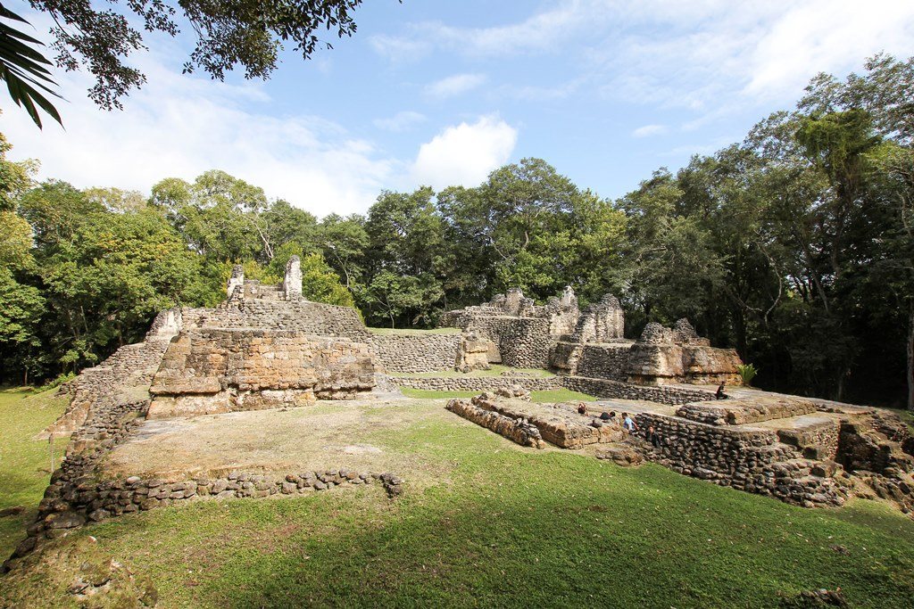
The central area is arranged in eight architectural groups, A through H, set on natural hilltops and ridges separated by ravines and wet lowlands. Builders levelled and reshaped the high ground for construction. Each group was organized around a large rectangular plaza; the larger groups also had one or two smaller plazas and clusters of subsidiary buildings. A stepped stone causeway connected Groups A and B.
Groups A and B
Group A
Group A contains as many as 34 stone buildings divided among three subgroups. Its Main Plaza is bordered on the east by A-V, a large, multiroom palace arranged as a triadic complex, in which three buildings are grouped on a shared platform. Pyramidal temples A-I and A-II have carved stelae at the bases of their stairways. Palace A-XVIII stands at the group’s northeastern edge, while A-XII lies to the west. Stelae also stood within the Main Plaza.
Group B
Group B has 36 buildings in two parts: a principal center around the Main Plaza and a smaller complex on a spur to the east. The multiroom palace B-II occupies the north side of the central plaza. Other palaces include B-I, B-XXV, B-IX, B-XIII, and B-XVII. The high pyramid B-VIII has an interior roof formed by stone courses that project inward from opposing walls. Temples B-IV and B-III and the ballcourt B-V are also among the group’s buildings.
Groups C and D
Group C occupies the western plateau and served both residential and ceremonial purposes. It was continuously occupied during the Tzakol and Tepeu phases, two stages in the archaeological chronology of Uaxactún. Group D includes civic plazas and residential buildings, among them elite residences.
Group E
The E-Group arrangement
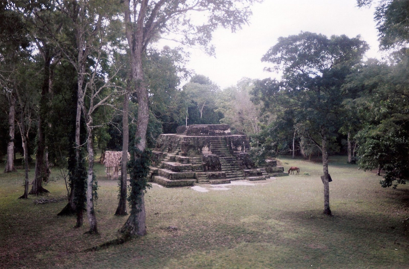
Group E was an early ritual and administrative center. Its characteristic arrangement, known as an E-Group, has a large pyramid on the west side of a plaza or platform and a long, raised building on the east. The layout became a model for identifying similar complexes elsewhere in the Maya lowlands. Platforms in the group align with the equinoxes and solstices. From a pyramid, an observer can see the sun rise through three eastern temples on those dates.
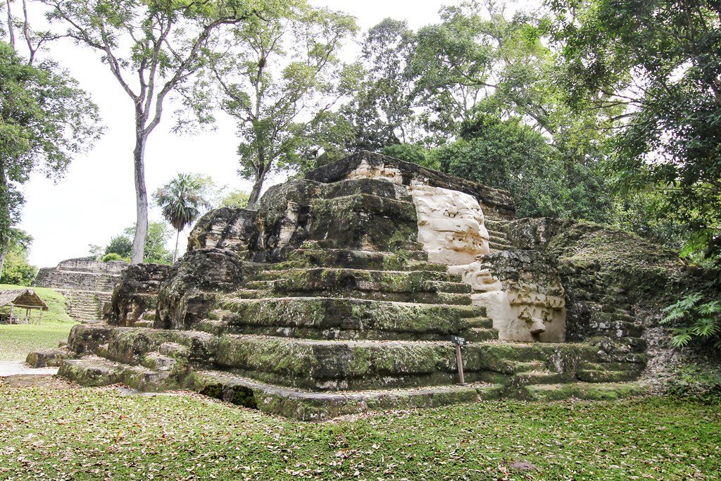
Temple of the Masks
The Temple of the Masks, also identified as E-VII Sub, has stairways on all four sides. Its exterior carries 16 large figures with human and jaguar traits, arranged as four on each side. Holes in the upper platform may have supported a small thatched-roof structure. The pyramid forms part of the solar alignment with the three temples to the east.
Temple E-X and its burial
Temple E-X was rebuilt several times and contained the city’s earliest known burial from the Classic era, that of an elite woman. Her grave goods included an engraved marine shell of the Spondylus genus with zoomorphic decoration, a pendant, and two stingray spines. An offering above the grave held 429 obsidian objects and 17 flint fragments.
Early palaces
Palaces E-IV and E-VI are described as early examples of vaulted construction. Their surviving architectural evidence places them among the group’s early building forms.
El Tiburon complex
El Tiburon, meaning “Shark,” is a monumental, T-shaped structure made from two platforms, one above the other, and topped by triadic groups. It stands 32 m high and has a base measuring 165 by 115 m. The estimated volume of its construction is 355,796 cubic metres. It was the tallest structure at Uaxactún and in Preclassic central Petén. Shark teeth found in the complex gave it its name.
Group H
North Plaza and its temples
Group H is the site’s earliest urban center. Its North Plaza includes a major triadic complex centered on H-I, which served as a royal residence. Huge deity masks were placed on both sides of its façade. Temple H-XV, built in the first century CE, shares features with the central pyramid of Tikal’s Lost World complex. This resemblance has been interpreted as evidence of close ties between the cities around the turn of the era.
H-XVI
H-XVI stands apart from the rest of Group H on the North Plaza and was built in at least three stages. Its first phase dates to around 400–300 BCE and remained intact until about 150 BCE, when later construction covered it as the northern part of Group H was developed. After the complex was abandoned, H-XVI was rebuilt around 300 CE as a temple for ancestor veneration rather than a residence. A niche was added to its front, reached by a stone walkway of large blocks, with a stela above it. Excavators found offering vessels and nearly 50 stone disks.
Homes and later ceremonies
House remains near Group H indicate that most people living there during its florescence occupied huts made of timber and thatch, without foundations. The complex was abandoned during the Classic era but continued to serve as a place of veneration. Ceremonies and sacrifices took place there 600–700 years after its abandonment.
El Respiradero cave
El Respiradero lies near the center of Group A and served as a sacred burial place before Group A became the city’s central complex in the Classic era. Investigations from 2010 to 2014 uncovered burnt human bones, ash from cremated bodies, and grave goods, especially pottery. Radiocarbon dating places the finds between the seventh or sixth century BCE and 150 CE.
Stelae and carved monuments
Monuments and calendar dates
Uaxactún has 28 carved stelae, three carved altars, and 25 plain stelae. Groups A and B together contain 20 of the carved stelae and 19 of the plain ones. The calendar-inscribed carved monuments include Stela 28, assigned to Group H and among the earliest, and extend to Stela 12, dated to 889 CE. Many carvings are heavily weathered. Two monuments mark the ends of ten-year cycles, and eight mark the ends of twenty-year cycles.
Carved scenes and relocated monuments
Surviving carvings include dynastic subjects on Stelae 14, 3, 9, and 20. Stela 5 shows a military figure holding a spear-thrower in one hand and a club edged with sharp flint or obsidian pieces in the other. The figure wears a bird image on a turban-like headdress. Stela 9 was moved to a Late Classic plaza; it originally stood either in front of building A-1 in Group A or in the central plaza of Group E.
Painting and ceramics
The B-XIII mural
Building B-XIII in Group B once had a polychrome mural with historical imagery, apparently showing an act of subjugation. Its naturalistic human figures, gently curving lines, and use of multiple colors have been compared with Preclassic naturalistic polychrome painting at Tikal. The building is now destroyed.
Pottery styles
Ceramics recovered at Uaxactún helped establish a sequence of Maya pottery styles called Mamom, Chicanel, Tzakol, and Tepeu. The sequence was later considered too simple as a general chronology, though it remains useful for Uaxactún. Polychrome vessels in the Uaxactún style include “Siyajchan” vases dated to the transition between Tzakol 3 and Tepeu 1.