Ihuatzio: A Purépecha Ceremonial and Political Center
Site at a Glance
- Rating
- 4.5
- Popularity
- Low
- Country
- Mexico
- Primary era
- Medieval
- Eras represented
- Medieval, Early Modern
- Civilizations
- Purépecha
- Site type
- City
On this page12 sections
History
Ihuatzio is an archaeological site in Michoacán, Mexico, on the southern slopes of Cerro Tariaqueri beside the southeastern shore of Lake Pátzcuaro. Its first occupation, tentatively dated to 900–1200 CE, is associated with Nahua-speaking groups, while the later phase, from 1200 to 1530 CE, belongs to the expansion of Purépecha power in the lake basin and northern Michoacán. Historically also called Tarascans, the Purépecha formed a powerful state centered on the Lake Pátzcuaro region. Ihuatzio became one of its principal settlements, alongside Tzintzuntzan and Pátzcuaro.
Early occupation and Purépecha expansion
The settlement occupied a strategic position at the western end of Lake Pátzcuaro, where it may have controlled part of the basin. The name Ihuatzio comes from the Purépecha word Hihuatsi, meaning “Place of Coyotes.” The site is also traditionally identified with the Nahuatl names Cuyacan or Cuyuacan.
During the later occupation, Ihuatzio served economic, social, ceremonial, and administrative purposes. Its Plaza de Armas hosted rituals, ceremonies, and festivals, and may also have been used for exchange and ball games. The settlement is also identified as a ceremonial center and probably an astronomical observatory, although the exact sequence of construction remains difficult to establish. Construction is placed in the thirteenth century, while radiocarbon dates indicate activity at the site between approximately 1510 and 1575.
Political authority after Tariácuri
The Relación de Michoacán, a sixteenth-century account of Purépecha history, rulers, ceremonies, and political organization, describes the division of authority after the death of Tariácuri. Political and religious power was assigned among three lordships, Ihuatzio, Tzintzuntzan, and Pátzcuaro. Hiripan received Ihuatzio, Tangaxoan received Tzintzuntzan, and Huiquingaje received Pátzcuaro.
Hiripan’s conquests helped concentrate authority at Ihuatzio. He established his residence there, and a house dedicated to Curicaueri, a major Purépecha deity associated with fire, was later built to contain treasures acquired during military campaigns. Ihuatzio consequently became the kingdom’s head for a period. Hiripan was buried at the settlement and succeeded by his son Ticatame.
During Ticatame’s reign, the political center moved to Tzintzuntzan. Zizispandaquare transferred Curicaueri and the royal treasure there, but Ihuatzio continued to hold political authority. Its lord addressed soldiers before military campaigns and participated in the selection of a new cazonci, the supreme Purépecha ruler, who exercised political, judicial, economic, and religious authority.
Abandonment and archaeological investigation
Ihuatzio was abandoned around 1530. The first recorded description of its ruins dates to 1799, when Bravo Ugarte noted the settlement’s large dimensions and its construction system, including the apparent use of neither lime nor sand. In 1855, Pedro Beaumont included Ihuatzio among the principal Purépecha settlements on his map of the Lake Pátzcuaro basin.
Marquina carried out the first surface survey in 1929 and sketched the rectangular structures. Alfonso Caso and Acosta excavated, cleared, and consolidated the rectangular buildings between 1937 and 1938, and the site was opened to the public during that period. Those excavations recovered a chac mool, a pre-Hispanic stone sculpture of a reclining figure holding a tray on its abdomen. Its presence has been interpreted as evidence of contact with Toltec centers such as Tula, a major Mesoamerican cultural center in central Mexico.
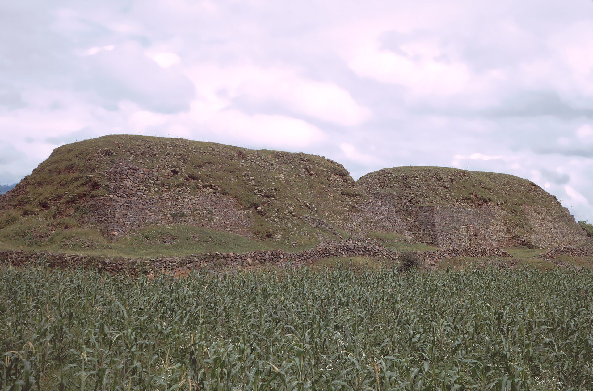
On 29 July 2024, an unusually intense rainstorm heavily damaged one pyramid. Earlier drought and high temperatures had weakened the structure, increasing the effects of the storm. Officials subsequently announced efforts to restore the monument.
Remains
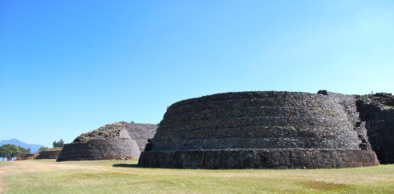
The remains cover approximately 50 hectares on an artificially leveled, low-lying plateau. The settlement extends across the plateau and is enclosed in part by walls and walled roads. The area open to visitors is the Plaza de Armas, while other monumental groups extend beyond it. The architecture combines large platforms, stepped walls, raised roads, pyramidal structures, and distinctive Purépecha yácatas, monumental buildings with rectangular and semicircular plans raised above pyramidal bases.
Platforms and plazas
Northern platform and rectangular structures
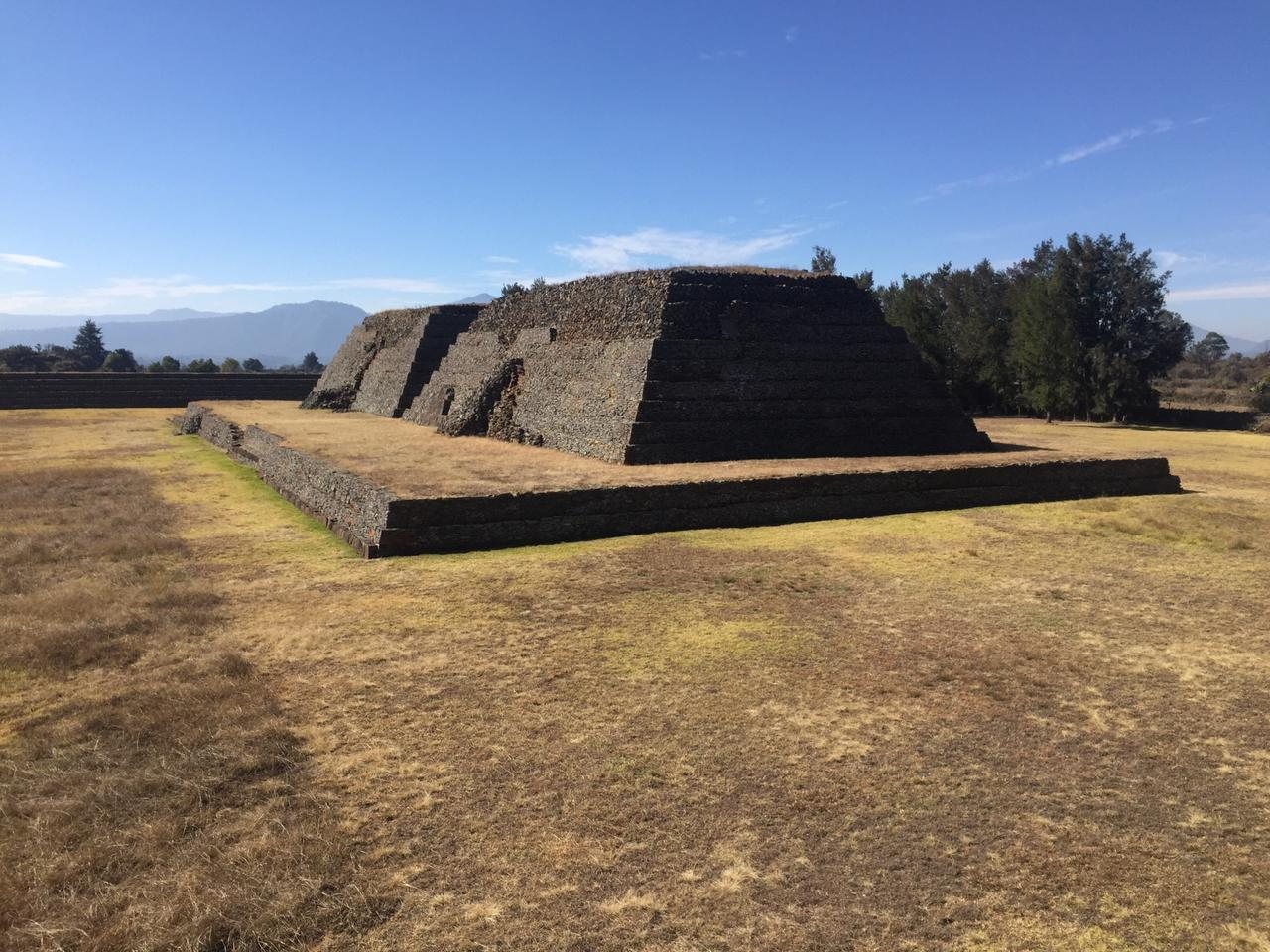
Marquina’s survey identified a northern platform measuring approximately 300 by 180 meters and oriented east–west. Tall stepped walls, about 10 meters wide, bordered its longer sides and enclosed a plaza measuring approximately 223 by 147 meters. Within this area, two rectangular structures stood on a shared platform measuring about 87 by 37.5 meters. They faced east and were built over basalt-stone cores covered by stepped stone-slab walls arranged in eleven levels.
The shared platform had an earth-and-stone core, a facing of stone slabs laid without cement, and finishing blocks of carved janamu, or red volcanic rock used for architectural facing. A passage about 1.65 meters wide ran between the two structures. Excavation there uncovered human skeletons and the chac mool associated with contact between Ihuatzio and Toltec sites. The surviving stairway remains preserve part of the structures’ original access arrangements.
Plaza de Armas
The Plaza de Armas is a large, level rectangular space bordered at its northern and southern ends by wall-causeways. Two broad stepped walls, locally called huatziris, enclose its public area. Stairways built into the walls gave access to their upper surfaces. At the western end, a rectangular platform about 1.5 meters high supported two pedestals.
The huatziris were built with rock-and-earth cores covered by stone slabs, stuccoed upper surfaces, and stepped tiers. Their average height is described as approximately 2 meters, while a related wall is given an average height of 2.5 meters. These raised constructions surrounded much of the settlement, functioned as roads, controlled movement and access, and contributed to the site’s defenses.
Yácatas and monumental circulation
Southern yácatas
South of the Plaza de Armas, a large plaza contains three yácatas. Their foundations combine rectangular and semicircular forms, with central stairways embedded in the rectangular sections. The structures face west, and their semicircular portions stand opposite one of the walled roads.
The yácatas were formed from horizontally laid stone slabs over rock-and-earth cores. Their outer surfaces were originally faced with janamu blocks, a red volcanic stone whose Purépecha name means “rough stone.” Weathering has removed much of this facing, although remnants survive on the eastern side of rectangular Structure 1. Excavations in the yácatas produced idols, ornaments, weapons, and vessels.
Walled roads and the King’s Road
The settlement’s walls and walled roads connected its principal construction groups with access points and internal routes. A well-built road called Queréndaro is described as linking Ihuatzio with Tzintzuntzan to the north.
In the western and southern sectors, the feature known as the “King’s Road” consists of enormous raised constructions approximately 250 meters long, 20 meters wide, and more than 5 meters high. Several superimposed bodies form the structures, whose surfaces were flattened with earth and bordered by low protective walls for pedestrians. Their arrangement and the areas they connect suggest that they served as elevated walkways for transporting the cazonci from the ceremonial center to other parts of the settlement.
Southern sector and distinctive structures
The southern sector contains a cylindrical structure on a circular base. Its function remains uncertain, but its strategic position has led to interpretations of it as a possible observatory or elevated viewpoint. The site also includes pyramids dedicated to Curicaueri and Xaratanga, a tower or fortress traditionally attributed to the city’s founder, additional monumental platforms, and defensive walls.
The southern platform identified by Marquina was oriented north–south and measured approximately 400 by 300 meters. Broad wall remains bounded it, while three yácatas stood at its center. Together with the northern platform, the plazas and raised roads formed a large architectural complex for political authority, ritual activity, movement, and defense.