Bilgroix Gallery Grave: A Neolithic Burial Monument in Arzon, France
Site at a Glance
- Popularity
- Low
- Country
- France
- Primary era
- Stone Age
- Eras represented
- Stone Age
- Civilizations
- Unclassified
- Site type
- Burial
- Remains
- Tomb
On this page15 sections
History
Neolithic origins
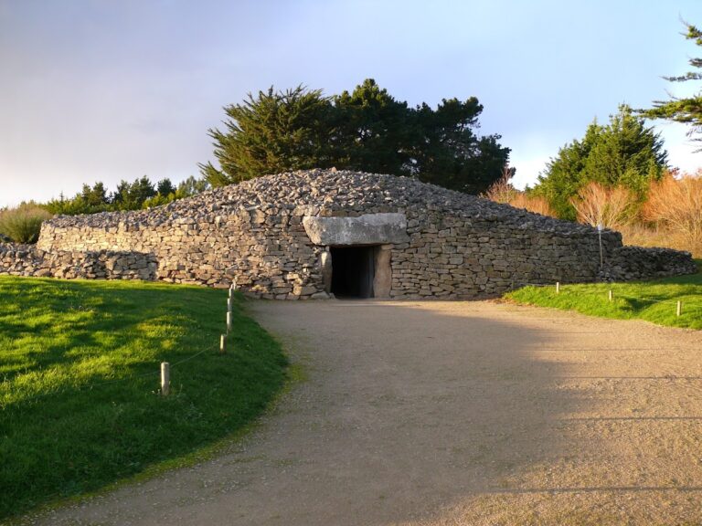
The Bilgroix gallery grave is a Neolithic burial monument at Bilgroix Point in Arzon, France. It is assigned to the Middle and Late Neolithic, the later Stone Age, and broadly dated to around 3000 to 2500 BC. Its pottery is attributed to the Armorican expression of the Seine-Oise-Marne tradition, a Neolithic cultural grouping. Armorica was the historical name for Brittany and adjoining parts of northwestern France.
Four radiocarbon determinations from charcoal in a hearth at bedrock level produced one Middle Neolithic date and three Late Neolithic dates. Together with the pottery, these results place activity at the site across both periods.
Discovery and investigation
G. de Closmadeuc, president of the Polymathic Society of Morbihan, brought the monument to wider notice in 1866. The regional learned society carried out a preliminary excavation, and A. Taslé described the site. In 1912, land clearance by the owner damaged the monument. Zacharie Le Rouzic recorded the work and collected a vessel and flint pieces. Road widening and water-supply works yielded further pottery and flint objects in 1961.
During the 1970s, dumping threatened the site. Its designation as a historic monument on 8 March 1978 helped secure its survival. Joël Lecornec excavated the monument completely between 1989 and 1993, adding extensive evidence about its construction and use.
Remains
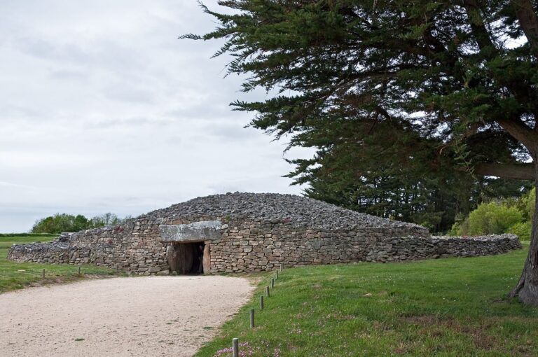
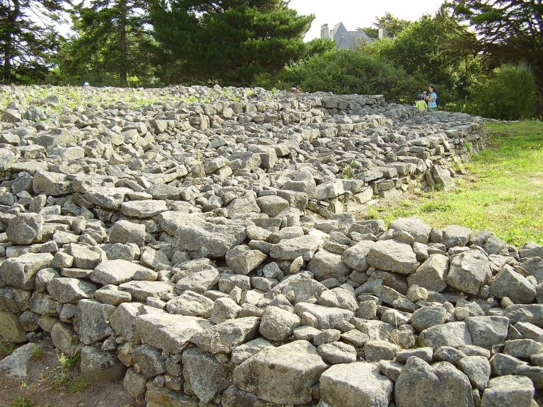
The monument stands 14 m above sea level on the northwestern flank of Bilgroix Point’s summit, near the western end of the Rhuys Peninsula. Its main structure is an elongated, horseshoe-shaped cairn, a mound of stone that also incorporated earth, built around a long dry-stone burial gallery, whose walls were laid without mortar.
Main burial monument
Cairn and facing walls
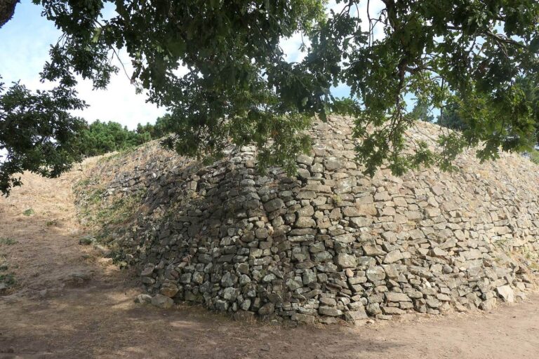
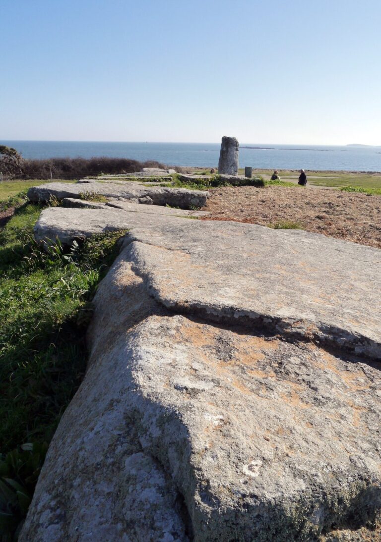
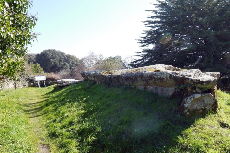
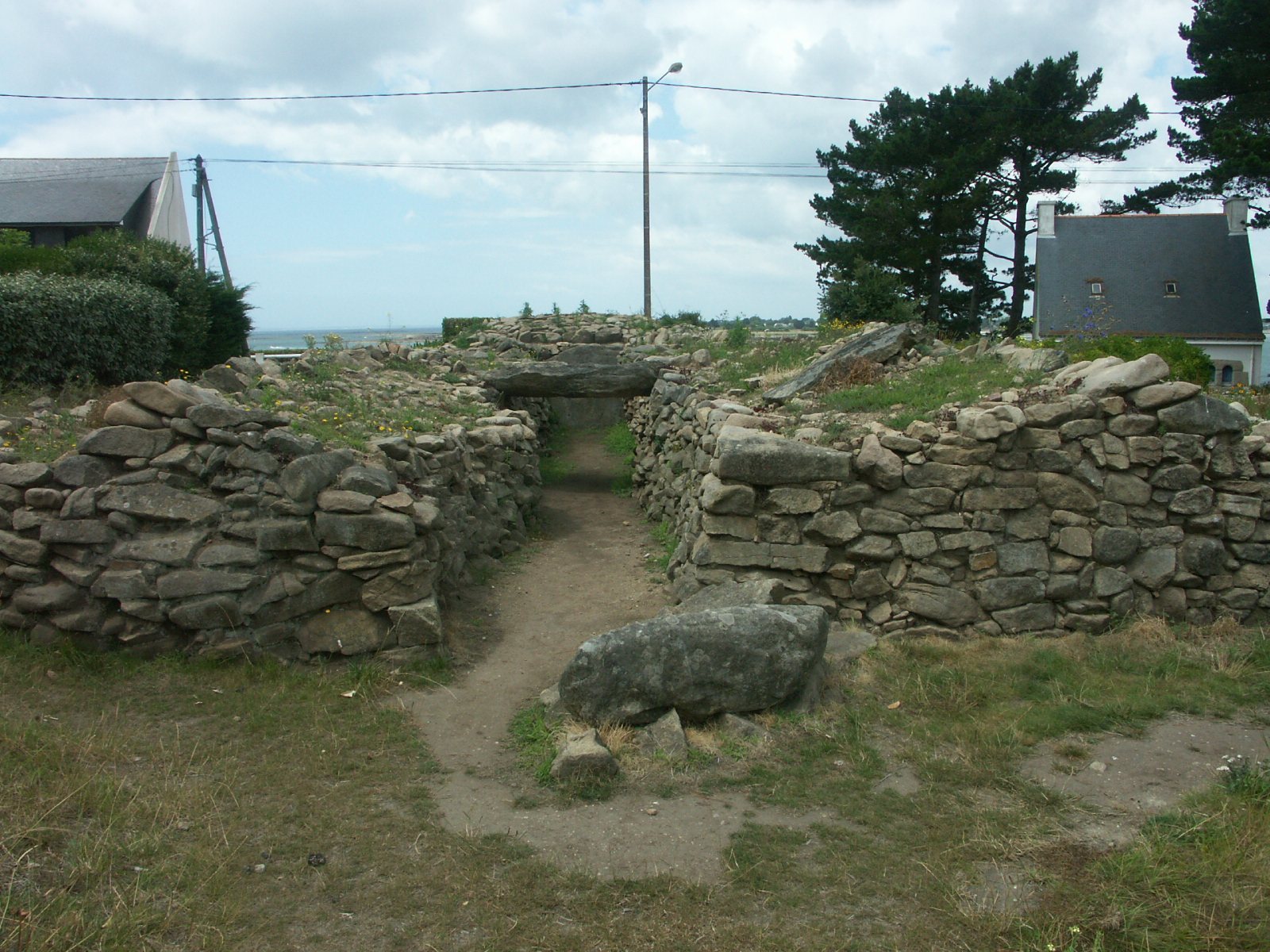
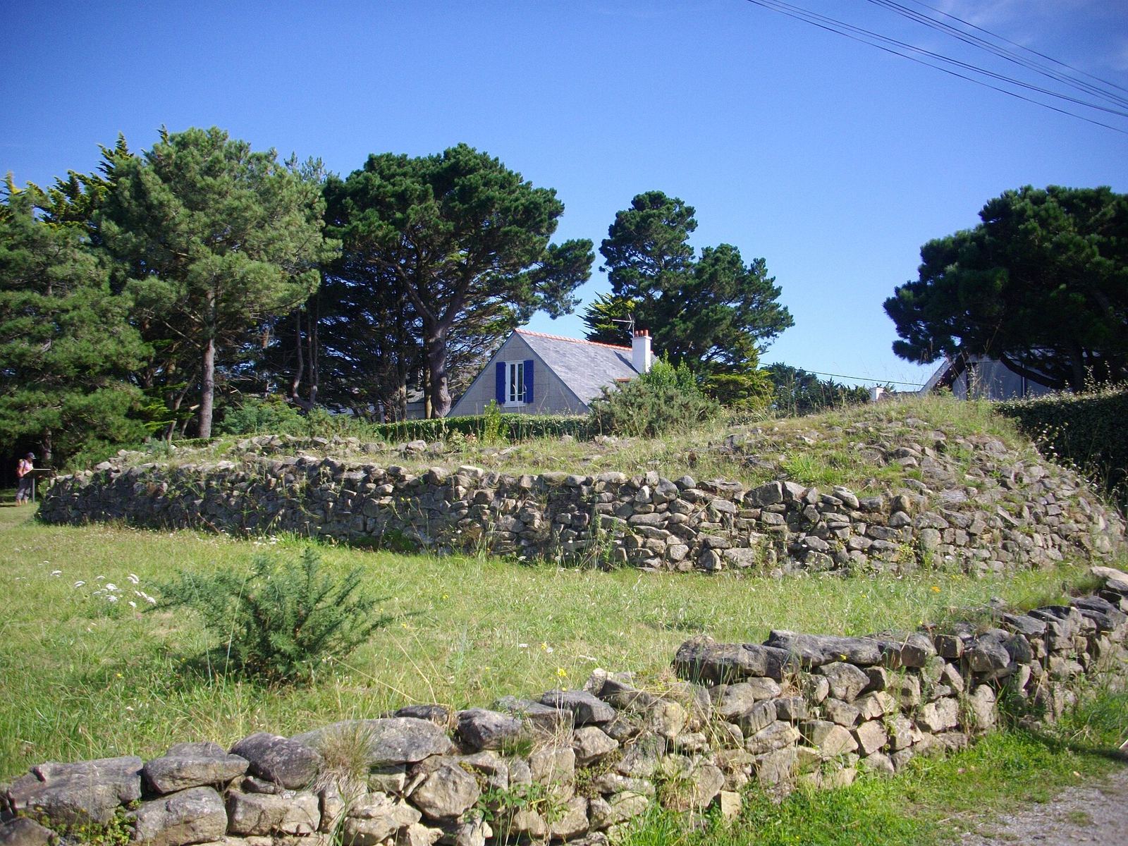
The cairn measures 17 m from east to west and 7.9 m from north to south. Taslé described it as 3 to 4 m high in 1866, but it was leveled during the 1912 clearance, so its present height does not preserve its original profile. A first facing wall survives to 1 m at the southeastern end. A second structure encircles the cairn and has an outer face of large rubble stones and an inner face of smaller rubble. The inner wall reaches 1.5 m, level with the sole surviving covering slab, which measures 3.3 by 2.8 m. Compacted earth mixed with ash filled spaces between the facing walls and between the inner wall and gallery. The blocks are locally quarried leucogranite, a light-colored granite.
Burial gallery
The gallery is about 14 m long and has no separate corridor and chamber. Its first 7.5 m are 1.25 m wide; the remaining 6.5 m widen to 1.8 m. At the far end, an orthostat, or upright stone slab, rises 1.6 m. Its ends are set into the cairn, and the ceiling probably did not rise above its height. Paving covers about 2 m² in the wider section. Only the central roof slab survives, while a small, easily removed slab closed the entrance. A posthole indicates that wooden elements supplemented the stone walls. This dry-stone building method is unusual in Brittany, though it was common in southern France.
Other structures and features
Subsidiary grave
A second grave lay south of the cairn, aligned north to south. Rubble walls bounded it on the east and west, and a small crosswise slab formed its southern end. Its northern side rested against the cairn’s outer facing.
Aligned stone blocks
Three adjoining blocks south of the subsidiary grave form an east-to-west line. The first is a large stationary quern, a stone used for grinding grain. The second bears polishing traces. The third is a broken stele, or upright stone monument, placed upside down in the ground. It measures 0.55 m high, 0.35 m wide and 0.15 m thick, with a convex top and a pecked edge.
S-shaped structure
Excavation to the east and southeast of the cairn revealed an S-shaped dry-stone structure built like the cairn’s double facing. Its condition leaves its function uncertain.
Nearby standing stone
A nearby stone sometimes called the Bilgroix Point Menhir was erected in modern times, rather than in prehistory.
Archaeological finds
Earlier finds
Finds from the 1866 excavation are held in the Polymathic Society’s collections. Pottery includes hemispherical, flat-bottomed bowls with walls of varying thickness, as well as thicker cylindrical or conical vessels with flat bases. Flint finds include blades and blade fragments, three made from Grand Pressigny flint, which comes from the Grand-Pressigny area of France. Le Rouzic’s 1912 collection included a hemispherical vessel, a bladelet and two flakes. A 1958 surface collection produced a notched saw or scraper of Grand Pressigny flint measuring 88 by 54 mm. The 1961 road and water works also yielded a small group of pottery and flint.
Finds from the 1989–1993 excavation
Lecornec’s excavation produced finds from the gallery, north of the cairn and near the unidentified structure to the southeast. Some material gathered around the cairn may have come from spoil left by the 1866 excavation. Pottery fragments numbered about 28,700, including bowls, small bowls and vessels found along the gallery walls. Other finds include about 100 whole or broken quartz hammerstones, mainly flint-knapping debris, a large blade, a blade and a point of Grand Pressigny flint, several dolerite axes made of hard igneous rock, an axe-shaped pendant, a perforated pebble and a rock-crystal fragment. A quern and food-storage containers in the vicinity have prompted the suggestion that the site may also have served as a place of worship.