Roman Road at Alqueidão da Serra: A Roman-Era Regional Route
Site at a Glance
- Popularity
- Very Low
- Country
- Portugal
- Primary era
- Classical
- Eras represented
- Classical
- Civilizations
- Roman
- Site type
- Infrastructure
- Remains
- Road
On this page6 sections
History
The Roman Road at Alqueidão da Serra is a surviving section of a Roman route at Carreirancha in Portugal, built under the Roman Empire, the state governed by Rome and its emperors, between the first century BC and the first century AD. It crossed the Serras de Aire and Candeeiros as a secondary route between the Middle Tagus region and the Estremadura coast.
Roman construction and connections
The road formed part of the Roman network, whose routes first supported army movements during conquest and later helped administer regions and carry tax revenues to provincial and imperial capitals. By the time this road was built, the surrounding region had been pacified, a change indicated by first-century Roman funerary inscriptions.
The route is thought to have linked Scallabis, near modern Santarém, with Collipo, near modern Leiria. Both were important administrative centres in Roman antiquity. Its wider course may also have belonged to a network connecting Sellium, near modern Tomar, with the port of Paredes da Vitória and Conimbriga, near modern Coimbra. The road also helped transport iron ore from the Roman-era mining areas of Figueirinha and Zambujal.
Later use and preservation
The route continued to carry people and goods in the Middle Ages and underwent local repairs. In 1385, when it was known as the Roman road of Carreirancha, it carried the Portuguese nobleman and commander Nuno Álvares Pereira to the military camp at São Jorge on the eve of the Battle of Aljubarrota. The battle was a decisive engagement in the conflict over Portugal’s independence from Castile.
Restoration work included examination of the layers in a partly destroyed section, revealing the road’s successive construction levels. Since 1990, the road has been classified as a Property of Public Interest, Portugal’s legal category for protected cultural heritage.
Remains
The surviving road
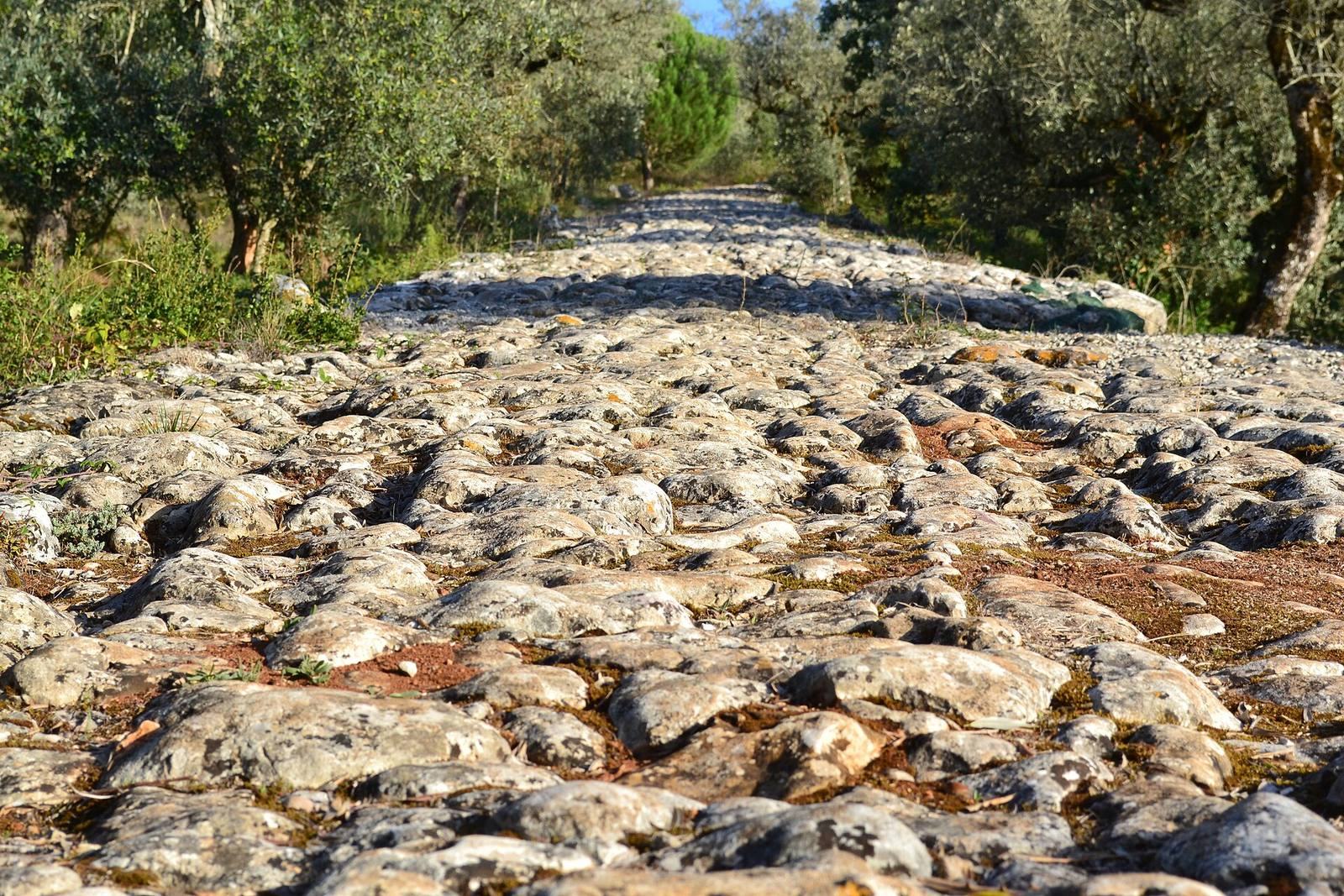
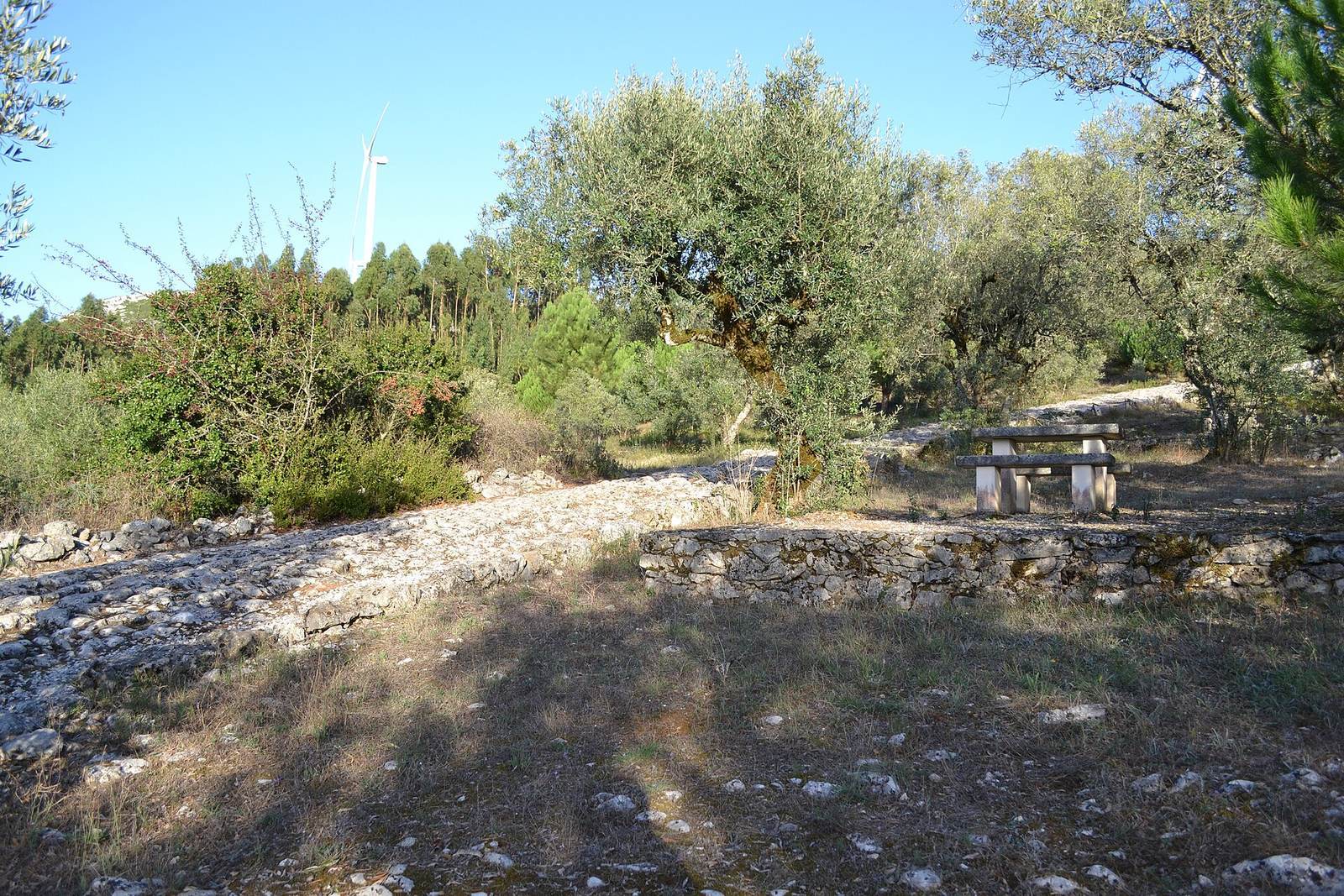
The remains lie at Carreirancha, just under a kilometre from Alqueidão da Serra, within the Serras de Aire and Candeeiros Natural Park. The surviving stretch is no more than 370 metres long, and its first 150 metres are best preserved. It averages about four metres in width, though the road’s width varied with its importance and increased at curves to let vehicles pass. The stretch is among the few Roman roads in Portugal to retain its original character.
The surface consists of closely fitted stones set on edge, with a raised central line and larger slabs along the borders. It rests on clay and fine gravel above a substantial stone foundation enclosed by two thick walls. Larger stones form the foundation’s lowest layer, with smaller stones above. In the better-preserved mountain section, regular stone blocks alternate with smaller ones. Small raised blocks occur at roughly regular intervals along the edges, while retaining walls support the road where the ground is uneven.
Other surviving traces
Isolated remains extend between Alqueidão da Serra and Vales. At Vales, a short section is badly degraded and partly destroyed by a cart road; other brief stretches can be identified as cart tracks and paths. Ironworking slag collected along the route points to metallurgical activity in the area.